Cabot: from Venice to Newfoundland

THE DISCOVERY OF Canada by Europeans is not usually at the forefront of my mind, especially just after an airflight landing in Venice. Yet when we disembarked from the waterbus that carried us from Marco Polo Airport to the city, I noticed a building that surprised me at the south end of the Via Garibaldi (in the Castello ‘sestier’ of Venice). It has one plaque commemorating Giovanni Caboto (c1450-c1500) and his son Sebastiano Caboto (c1450-c1557). Giovanni is better known (to me) as John Cabot. I had no idea that Cabot, the ‘discoverer’ of Newfoundland was from the Italian peninsular. Sebastiano was also a maritime explorer. His most famous work was done in South America.

Cabot(o) lived here in Venice

Giovanni Caboto’s birthplace is unknown, but is likely to have been in the Province of Genoa. By 1476, he had become a Citizen of Venice. He was a trader there. Getting into financial difficulties, he left Venice for Spain in the late 1480s. After seeking financial support for a trans-Atlantic expedition, which never happened, he set off for England in 1495. Cabot, as he became known in England, went to Bristol. From that seaport, he led at least three expeditions to explore the east coast of North America. During these voyages, he set foot on what is now called Newfoundland and probably also on parts of what is now Nova Scotia. One of his later expeditions is believed to have been one of the earliest attempts to discover a Northwest Passage.

Cabot received a reward for his services from England’s King Henry VII. Where John Cabot died is uncertain. It might have been during his last expedition to North America during the period 1498-1501, but no one knows for sure whether he died at sea, or in North America, or after his expedition had returned to England.

A monument on the house in Via Garibaldi, which was placed in 1982 by the Canadian Province of Newfoundland, records that John’s discoveries in 1497 were made with his son Sebastiano. The house that bears this monument (written both in English and French) and another one in Italian, is said to be the house where John Cabot lived in Venice. From many of its windows, the great explorer would have had a good view of the lagoon and the quays, where trading vessels might well have been loaded and unloaded.

Our rented apartment was on a narrow street leading off the Via Garibaldi. I was pleased to see that this is close to a narrow alleyway called Ramo Primo Caboto.

A NEW book about Hampstead in north London

AVAILABLE FROM AMAZON WEBSITES:

e.g.: https://www.amazon.co.uk/dp/B09R2WRK92

Hampstead is one of the highest places in London. There, the heavens are vast
and wide. Beneath this expanse of sky is an area with an eventful past and a
vibrant present. This book takes a fresh look at the locality and shows that
Hampstead is richly imbued with historical memories and has been home to a
multitude of fascinating and noteworthy people. Many books have been written
about Hampstead. Doubtless, there will be more. This one is different. It looks
at Hampstead from unusual as well as familiar viewpoints and gives the reader
a richer appreciation of what makes the place both delightful and intriguing.
This volume explores a wide variety of subjects, familiar and obscure, as well as
some which have never been described in other books about the locality. Here
is a fresh and at times quirky look at this place on a hill, one of London’s
treasures: a district, which is familiar to many people, yet full of surprises.
Although the bulk of this book is about Hampstead, there are also sections
describing some of its environs.

By reading this book, you can find out why John Constable, Samuel Johnson, Boy George, Mohammed Ali Jinnah, Mahatma Gandhi, Peter Sellers, Henry Moore, Maxim Litvinov, General de Gaulle, Stanley Spencer, Thomas Masaryk, Lee Miller, Agatha Christie, Jim Henson, Ian Flemming, Ernő Goldfinger, and many others, both famous and familiar, were all connected with Hampstead.

The book has several sections:
1. a brief survey of Hampstead’s general history and geography.
2. an introduction to Hampstead’s main thoroughfares with some
reminiscences of the area as it was during my youth.
3. the largest section of the book is a collection of chapters about
various aspects of Hampstead’s past and present. Recently, a friend of mine
bemoaned the fact that Hampstead High Street and Heath Street are lined with
branches of shops and cafés that can be found all over London. He is right. So,
if you wish to capture the true character of Hampstead, you need to stray into
the side streets and explore, which is what I hope this book will stimulate you to
do.
4. The last few sections of the book deal with some places of interest near to
Hampstead: Primrose Hill, North End, Go
lders Green, and Highgate.

TABLE OF CONTENTS

PREFACE … 7
INTRODUCTION: OH NO, NOT IN HAMPSTEAD … 7
SOME GEOGRAPHY AND HISTORY … 13
HEATH AND HIGH STREETS WITH SOME MEMORIES … 25
SATURDAY STROLLS … 25
PERRINS LANE, THE EVERYMAN, AND LOUIS … 34
DISCOVERING HAMPSTEAD … 41
A HOUSE ON HEATH STREET AND THE KIT CAT CLUB … 41
A CHURCH ON HEATH STREET … 45
FLASK WALK AND THE HAMPSTEAD SPA … 46
MORE ABOUT THE SPA … 56
THE VALE OF HEALTH … 60
POETS AND THE VALE OF HEALTH … 70
FRENCH CONNECTIONS AND ST MARYS ON HOLLY WALK … 76
ARTISTS IN HAMPSTEAD: ROMNEY, CONSTABLE, AND OTHERS 84
MODERN ARTISTS AND THE ISOKON … 95
BOLSHEVISM AND HEATH STREET … 109
A SINGER AND A PHILOSOPHER ON BRANCH HILL … 114
JUDGES WALK … 118
WHITESTONE POND … 122
EAST HEATH ROAD AND SOUTH END GREEN … 126
SIR HARRY AND ROSSLYN HILL … 137
PILGRIMS LANE AND MORE ON ROSSLYN HILL … 143
NEW END, CHOLERA, AND GROVE PLACE … 150
FITZJOHNS AVENUE AND SWISS COTTAGE … 155
SHEPHERDS WELL … 171
CHURCH ROW … 174
GRACIE FIELDS, FROGNAL WAY, AND FROGNAL … 179
WEST HEATH ROAD AND PLATTS LANE … 187
WEST HAMPSTEAD … 193
SHOOT UP HILL … 198
PRIMROSE HILL … 201
NORTH END AND GOLDERS GREEN … 211
NORTH END AND GOLDERS HILL PARK … 211
POETS AND GOLDERS GREEN … 228
LIFE AND DEATH ON HOOP LANE … 232
HIGHGATE … 241
CODA … 273
SOME BOOKS CONSULTED … 275
ACKNOWLEDGEMENTS … 278
INDEX … 279

Why go abroad?

MANY OF MY FRIENDS AND acquaintances are itching to travel abroad after at least three months of enduring ‘lockdown’ caused by the Corona virus pandemic. Although I fully understand their wanderlust, I would not feel happy travelling abroad for quite a long time despite the easing of restrictions that is on the point of happening in the UK and elsewhere. I am not even happy about travelling on public transport despite the enforcement of wearing face coverings and attempts at separating passengers by so-called ‘social distancing’.


BLOG BLOG

Waterend House

We used to own a car until it decided to give up the ghost in the autumn of 2010. Living in Kensington with access to a rich network of public transport and the fact that we used it no more than twice a month, we felt that replacing it was unnecessary. So, for almost ten years we used buses, trains, minicabs, the occasional rented car, and more recently Uber cars. With the advent of the Corona pandemic, we gave up using public transport and confined our activities to where we could reach comfortably on foot, in our case not much more than two and a half miles from home. As it seems likely that Britain will not be free of risk from infection until eventually there is a vaccine for the infective particles, and that might be a long way off, we decided to travel in ‘splendid isolation’ by buying ourselves a motor car. Recently, we bought a small ‘pre-loved’ motor, and this has allowed us to widen our horizons, to roam around a bit more.

My wife and I are amongst those who prefer to travel to foreign parts and have therefore largely neglected the wonders that are literally on our doorstep: the joys of Britain beyond the boundaries of Greater London. Over the years, it has always struck us how different London is from the rest of Britain. Leaving London and travelling beyond sometimes as exotic to us as crossing international borders.

One part of England that is on London’s doorstep but is completely different is East Anglia (the counties of Cambridgeshire, Suffolk, Essex, Lincolnshire, and Norfolk). Much of Essex contains the eastern spread of the metropolis and is not too attractive, but further away from London the county is full of pleasantly delightful surprises.

Recently, we drove to the tiny village of Tollesbury near the River Blackwater, one of the numerous inlets on the coast of Essex. Nearby, is the estuarine port of Maldon, made famous for its granular salt that is highly regarded by cooks. We spent a couple of hours sitting in Promenade Park next to one of the streams of the River Chelmer. Unlike popular beaches like Brighton and Bournemouth, Malden is enjoyed mainly by the town’s locals.  The small town, which is on a hill overlooking the river contains many old houses and a fine church containing the grave of President George Washington’s great-grandfather.

Another trip, which I have described elsewher, took us to Bury St Edmunds in Suffolk. From there, we visited the Suffolk village of Clare. Dominated by the ruins of a castle and the superb perpendicular style Church of St Peter and St Paul’s, and containing several old pubs and other buildings, this small place was once important in the wool industry. Clare College in Cambridge (founded 1326) was so named in honour of Elizabeth de Clare (1295-1360), an heiress of the Dukes of Clare. She gave the college a handsome endowment. The three red chevrons on the town of Clare’s coat of arms also appear as part of the coat of arms of the Cambridge college. We spent no more than half an hour in Clare, but that was sufficient for us to want to linger there longer on a future visit.   Our route back to London took us through other picturesque villages in Suffolk and Essex, all of which deserve future visits.

Shortly after our trip to Suffolk, we travelled a mere eighteen miles to Hatfield. Our friends took us from that small town deep into the Hertfordshire countryside to a tiny place where Waterend Lane crosses the upper reaches of the River Lea. We parked next to a lovely well-preserved mainly brick building, Waterend House. The historicengland.org.uk website describes it as: “An exceptionally complete example of a mid-C17 medium-sized country house”, and states that one of the fireplaces within it bears an inscription with the date 1692. I would have loved to visit its interior. Instead, we walked around the almost one-mile perimeter of a huge sloping field.

The field and its surroundings were a ‘breath of fresh air’. The upper part of the field was filled with ripening barley, which swayed like waves when the stems were caught by frequent strong gusts of wind. We walked up a steep slope and turned a corner to join the bed of a long since disused railway track. Near the corner of the field an old brick bridge still exists. Long ago, trains used to run below it. While our hosts’ two dogs sniffed their way around the field, M and G pointed out the various wild plants that flanked our path.

The lower half of the field was a sea of daisies. It looked as if the ground was covered with snow. The daisies were not alone. Small patches of blue flowered thistles and red poppies added to the picturesqueness of the scene. Every now and then, we spotted teazels, both green and fresh and, also, dark and drying out, towering high above the daisies. Along the side of the field that runs parallel to the riverbank, there were elderberries and elderflowers as well as many nettles. M pointed out something I had never noticed before. That is, the leaves of nettles are home to numerous ladybirds. In addition to the large numbers of these creatures I spotted many other small beetles, some of which resembled the ladybirds.

I felt that walking around the field, seeing the swaying crops and taking in the details of nature proved very uplifting and therapeutic after our spell of urban ‘lockdown’. It made me pleased that we had taken the decision to buy our own vehicle to explore the countryside on London’s doorstep, and eventually further afield. England outside London feels like ‘another country’ and is well worth exploring. And, in these times of health uncertainties, it provides a worthwhile alternative to the exotic destinations that we have chosen to visit in the past.

Along the canal

THE PADDINGTON ARM of the Grand Union Canal connects Paddington Basin to Bull’s Bridge at Hayes. It was opened in 1801 and was an important transport route before the growth of railway usage in England. Today, it is used mainly for leisure. People enjoy walking, running, and cycling along its well-maintained towpaths. Others keep long canal boats, known as ‘narrow boats, on the water. Some live in these vessels, others use them to move slowly through Britain’s antique but still usable canal network.


BLOG CANAL


During my teens, I used to explore London with three good friends and an excellent guidebook to London’s quirkier sights, “Nairn’s London” written by Ian Nairn. We walked along the banks of the River Thames, which were undeveloped and somewhat sinister in the late 1960s. In those days, there were stretches of riverside that had barely altered since the era of Charles Dickens.  Nowadays, there are few if any stretches of the Thames in London, which have not been made ‘visitor friendly’.

One day, the four of us decided to walk along the Grand Union Canal, starting our exploration at Camden Lock, now a crowded, popular tourist area. We followed the Regents Canal to the point where it enters the Maida Vale Tunnel, and then re-joined it where it emerged. From Little Venice, we continued westward along the Paddington Arm. For most of the way, we saw nobody else on the towpath. As we headed further west, the canal began running through a dreary semi-industrial neighbourhood. Just before we reached the road bridge that carries Ladbroke Grove over the canal, we saw a gang of young men in leather jackets, who looked at us menacingly. They were busy throwing a motorcycle into the canal. We did not like the look of them and decided that we had seen enough of the canal.

Years later, we joined other friends on a boat trip that began at Camden Lock and continued along the canal to Greenford, a suburb in the far west of London. The trip was very picturesque as far as Ladbroke Grove, but the remaining long stretch was less exciting. West of Ladbroke Grove, the canal winds past industrial buildings and the gardens at the back of residential houses. Later, we accompanied the same friends on a boat trip that took us east from Camden Lock. This was a far more interesting ride as its route includes many fascinating built-up urban areas of east London, which have a richer history than the suburbs of west London. It included a visit to the Olympic Games park that was being constructed at the time.

Today, my wife and I re-visited the Paddington Arm, walking the short stretch between the Harrow Road bridge and the point where, long ago, my friends and I saw the young men throwing a motorbike into the water. We did not see anything like that but had to contend with the almost continuous stream of cyclists sharing the towpath. Most of them were courteous, but a few inconsiderate wildly pedalling folk seemed to think that they were taking part in the Tour de France. Given that it was a Sunday afternoon, it was not too busy to make walking along the towpath anything but enjoyable.

Fading with time

SINCE THE IMPOSITION OF ‘LOCKDOWN’ in the UK, use of public transport has been discouraged, as has wandering too far from home when taking exercise. While not exactly ‘confined to barracks’, the distance that we have been allowed to move away from home has been limited, more or less to the amount of distance that we can manage to walk (or, not in my case, cycle) comfortably, without exhausting ourselves. This meant that for many weeks we have been walking around our local area. A friend of ours in Dublin told us, half-jokingly, that during the Irish lockdown, he felt that he had got to know every blade of grass in his neighbourhood. I understood what he was saying.  For me, greater familiarity with our immediate locality has not bred contempt for it, but the opposite. We have been walking along small streets we never knew existed and discovering interesting details in those thoroughfares that we thought we knew so well.

HORNTON 2 BLOG

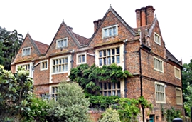
I have been walking along Sheffield Terrace, which leads off Kensington Church Street, two or three times a week for the last 25 years, yet it was only yesterday that I noticed a small square metal plate on the wall of a house in that thoroughfare. It recorded the fact that the author GK Chesterton was born in that house on the 29th of May 1874. A few doors away on the same street, there is a much larger and far more obvious plaque commemorating that the founder of the Church Army, Prebendary Wilson Carlile (1847-1942) had lived there. I had often noticed this memorial, but I had never noticed the far more discreet memorial to Chesterton, which looks like a simple grey wall tile from a distance.

Sheffield Terrace leads to the northern end of Hornton Street, which is marked on 19th century Ordnance Survey maps as ‘Campden House Road’.  Hornton Street leads south and downhill towards High Street Kensington. Once again, this is a street along which I have walked several times a week over a period of at least 25 years. Various roads lead off Hornton Street. The short Pitt Street is one of these. On the corner of Pitt and Hornton Streets, there is a faded rectangular sign that I have always assumed carried the words ‘Hornton Street’. However, I had not looked at it closely enough until yesterday.

I do not know what made me examine the faded sign closely, but I am glad that I did. Some of the letters on it have disappeared. The following are just about visible, and even more so on enhanced digital photographs: H, O, R, N, …, D, G, E. The last three letters are not ‘E, E, T’, which you would expect to see if the sign had read ‘Hornton Street’. I wondered if the sign had originally read ‘Hornton Lodge’. I went home and searched for ‘“Hornton Lodge” Kensington’ on Google.

One of the most useful things that came up amongst the Google search results was an offer on eBay for two pages of the issue of “Country Life” magazine, dated 21st of March 1968. These pages contain an article about Hornton Lodge on Pitt Street. The article bore the title “Serene Vision of a Modern Interior”. It describes the interior of a house built in 1948 on a bomb site and owned by Mr and Mrs James Melvin. The house, a long rectangular building, was called Hornton Lodge. The fading sign is all that remains of the house described in the magazine. Currently, builders are erecting a new building on the part of the plot nearest to the corner where the sign can be found. This new construction is, according to a planning application submitted in December 2019 by Nash Baker Architects, to replace an:

“… early post war semi-detached property … constructed circa 1948-49, on the site of a former villa known as ‘Hornton Lodge’. The architect/owner, James Melvin, was a partner in major architectural firm: Gollins Melvin Ward Partnership. However, at the time it was constructed, the firm was in its infancy, and this project was a modest family home for a young architect and his family; designed with modernist intentions during a time of austerity.”

I found references to a ‘Red House’, also referred to in at least one item, maybe erroneously, as ‘Hornton Lodge’.  The Red House was built by Stephen Bird in 1835. It was also known as ‘Hornton Villa’. This was not the property on Pitt Street demolished by a bomb in WW2 because it stood across Hornton Street opposite the western end of Holland Street, which is south of Pitt Street. A future president of the USA, Herbert Hoover, lived at that address between 1907 and 1918. Hornton Villa, The Red House, was demolished in in the 1970s, and on its site stands the architecturally undistinguished Customer Service Centre of the Royal Borough of Kensington and Chelsea.

There is more evidence of a Hornton Lodge, quite distinct from the Hornton Villa, mentioned above. Joseph Foster’s “Men-at-the-bar : a biographical hand-list of the members of the various Inns of Court, including Her Majesty’s judges, etc.” (published in 1885) published the address of a barrister Richard E Webster (1842-1915; called to the Bar in 1868), Lord Alverstone, as “Hornton Lodge, Pitt Street, Kensington W”. He became Attorney General between 1885 and 1886.  Even earlier than that, “Allens West London Street Directory” (published in 1868) lists a Theodore Aston as living at Hornton Lodge.

Close examination of a sign that I have passed and seen many thousands of times, assuming it bore a simple faded street name, has revealed that I had never looked at it carefully enough before. The constriction of my field of activities to a small part of London has, to my surprise, heightened my powers of observation rather than blunted them, which could have easily happened when visiting the same locality repetitively.

Soon, the faded sign on the corner of Pitt Street will either be removed or become even more illegible. I am glad I noticed its clue to the past before either of those things happen.


A surprising city

AFTER AN EXCITING DAY exploring Gopipura, an old part of Surat where my wife’s father’s family lived until over 100 years ago, we spent the following day seeing some of the better known historic sights of the city.

The castle on the bank of the River Tapi was built by the Muslim Tughlaq dynasty to defend Surat against attacks by the Bhils. It was later modified by the Mughals, the Dutch, and then the British.

Until the River Tapi silted up, Surat was an important international port city with a very active involvement in import/export activity. The silting up and the British acquisition of what became Bombay led to a decline in Surat’s prosperity. Over the years, its castle gradually fell into great disrepair.

Now, the castle is being painstakingly repaired. About half of it is currently open to visitors. The castle is being reconstructed using materials and techniques that archaeologists have discovered whilst investigating what has been left of the original structure. The result is a brand new version of what was most probably how the castle was before it began to disintegrate.

The rooms inside the castle recreate their original appearanc as deduced from archaeological examination. The rooms house a beautifully displayed collection of items portraying the history of Surat. A magnificent job has been done.

A man at the ticket booth of the castle reccomended downloading an app called “Surat Heritage Walk”, which is a very useful and well designed guide to the historical landmarks of the city.

After viewing the castle from a bridge that crosses the Tapi, which is how trading vessels would have seen it in days of yore, we visited the Christ Church (Church of North India) built in 1824. This simply decorated church has memorials to several Victorians, whi died in Surat.

We drove past the Mughal Sarai constructed in the reign of Shah Jehan. This large building was a hostel where pilgrims travelling between Surat and Mecca could be accommodated. Shah Jehan was first to encourage pilgrims going to Mecca to sail from Surat rather than travel overland or to embark on ships from Persian ports.

The Khudawan Khan Rojo, a mausoleum built in the mid 16th century, is newer than most of the medieval mosques that survive in Ahmedabad but, like them, it is rich in features adopted from Hindu and Jain temple design. The mausoleum contains the grave of its builder, Khudawan Khan, a military commander who was killed while fighting the Portuguese in about 1559/60.

The mausoleum described above is beautiful and impressive, but not ‘over the top’. The mausoleums in the Dutch, Armenian, and English cemeteries, which are close to each other and surrounded by crowded Muslim neighbourhoods, have to be seen to be believed. Many of the mausoleums are flamboyant structures with domes and details suggestive of both the art of India and the orient and also the Greek and Roman empires. These fantastic final resting places of Europeans who became rich in Surat are curiously exotic and ridiculous at the same time. The exuberance of the funerary architecture exceeds that which I have seen in European cemeteries in Calcutta and Fort Cochin. These monuments should not be missed by visitors to Surat.

As we drove between the places described above, we passed numerous old buildings, often in bad states of repair but rich in finely crafted decorative features.

After our tour, we lunched at Shukan, a restaurant that serves vegetarian thalis. As a meat eater I am not usually keen on vegetarian food, but what we were served at Shukan was much to my taste. The chef is a Rajasthani ‘mahraj’ (usually a Brahmin chef). His food was light but well flavoured. Unlike chefs cooking in the Surat traditional way, he used garlic, onions, and crushed peanuts. Yet, his dishes were not sugary as we found in other parts of Gujarat, notably in Ahmedabad and Saurashtra.

Although amongst the larger cities I have visited in Gujarat, Surat has fewer major tourist attractions than others (such as Ahmedabad, Baroda, Junagadh, and Bhuj). However, it has a visually exciting urban texture and vibrancy. The two days we allotted to our first visit to Surat was not long enough. We hope to return for longer in the future.

Sighting the high Himalayas

TODAY, WE WERE LUCKY. When we awoke at about 630 am, the sky was almost cloudless. There was no mist. We headed for breakfast at Bakers Café on MG Marg. We took a table by a window with a view of the hills that face Gangtok. To our great delight, we could see the snow covered slopes of Mount Kanchenjunga far beyond the nearer hills. Even though the great peak was partially obscured by clouds, we had managed to see it at last. Until 1853, this mountain was believed to be the highest on the planet. More accurate surveying showed it to be the third highest, K2 also known as Chhogori.

After breakfast, we strolled along MG Marg and then its continuation, New Market. At the far end of the latter, the hitherto fully built up thoroughfare began to be punctuated with greenery, trees and other plants.

After a short ascent, we reached the Ropeway station. It is the halfway point of s cable car service that runs from a much higher station to a far lower one. Currently, the service only runs from the midway station to the lowest one. We boarded one of the two red cable cars to make the descent. Unlike other cable cars I have been on, each cable car has its own cable instead of being on a continuous loop. When the car reaches a station, its driving cable reverses its direction of motion.

The views during the descent are dramatic. The usually tall buildings of Gangtok appear to have been built on step like terraces cut into the sides of the steep slopes of the terrain on which the city is situated. The cable car glides high above a winding road along which an unending stream of small local taxis flows. Looking left and right the tree covered hills surrounding the city offer exciting vistas. The return journey, the ascent, was less dramatic, but enjoyable nevertheless.

We dawdled back the way we had approached the cable car station, enjoying the warm sunshine. Many people were walking around including a significant number of police men and women carrying lathis and short sticks. Wearing berets and dark blue uniforms, they appeared to be milling around casually and without seeming menacing. Every now and then, we saw porters carrying what looked like heavy loads. They wear a thick padded strap over their foreheads. These straps are attached to cords that are tied around what is being carried on the porters’ backs. As they walk, the porters incline their heads slightly forward. This kind of portering looks like a tough way of earning a living.

The shops on MG Mar were open, but those lining the steps leading down to Lal Bazaar were shuttered up, closed. In Gangtok some businesses close on Thursday and others on Saturday. Today, it is Thursday. Fortunately, the excellent, albeit somewhat scruffy, Potala Restaurant in Lal Bazaar was open. I enjoyed a good number of delicately flavoured delicious beef filled steam momos.

After lunch we visited the Organic Market, which is housed in a curved gallery, one of the floors of the so-called Super Market, which is not a supermarket but a multi-storey covered market. Next, we strolled along some of the elevated pedestrian walkways that run above the National Highway, the main thoroughfare of Gangtok.

Before returning to our hotel, we stopped in a small café for beverages. It had a range of breads and pastries that equalled that you would expect to find in large European cities. This was not an isolated example. Gangtok abounds with well stocked bakeries.

The temperature had begun to drop when we reached our hotel, where we sttled down for a siesta.

PS We were fortunate to sight Kanchenjunga on the 28th November, the anniversary of the independence of Albania. Sadly, that country had just experienced a terrible earthquake.

A young explorer

Green signal_500


When I was a child, our local Underground station was Golders Green on the Edgware branch of the Northern Line. It was the first station on the stretch of the line, which remains open air, above ground, between Golders Green and Edgware. As a small child, I yearned to know what lay beyond Golders Green, where we always disembarked, but my parents did not share my yearning.

Long ago in the 1960s,  the trains bound for Edgware stopped at Golders Green on a stretch of line that ran between two platforms. The doors would open on both sides of the train. The platform on the left side of the train gave easy access to the centre of Golders Green and its large bus terminus. The right side, which we always used, led to an entrance that was on the way to Hampstead Garden Suburb, where our family home was located. 

One day, my father and I arrived at Golders Green after having spent some time in central London. As usual, we waited alongside a door on the right side of the train when we stopped in the station. Unusually, the doors on the right side of the train did not open, but those on the left did. By the time we realised that the right side doors were not going to open, the doors on the left side had closed, and we were beginning to travel beyond Golders Green above ground to Brent, the next station. My father was not happy, but I was delighted to be travelling along a stretch of the line that I had always wanted to see.

Since that time, I have always been excited at the prospect of travelling to the ends of the London Underground lines. Yesterday, I travelled to Watford, the terminus of one branch of the Metropolitan Line, and enjoyed it as much as I would have done when aged about ten!

Every day I am a tourist

LONDON PIC

Recently, I was walking along the South Bank close to London’s National Theatre when I saw two friends approaching each other. One said to the other:

“Hello, tourist!”

The other replied:

“I am a tourist everyday.”

This got me thinking that I am also a tourist every day. Since I retired in September 2017, my time is more or less my own. However, I do not sit at home bemoaning the fact that I have no work to do. On the contrary, I love my freedom to do what I wish. 

Almost every day, when not travelling abroad or to some other part of the UK, I visit somewhere in London. It may be local or more distant, it does not matter where. Wherever I go, I discover something new, something that either did not exist before because it is newly built or opened or something that has been around for ages, which I have never noticed before.

London is so rich in experiences and sights that even a person like me, who has lived there for over 60 years, can always find novelty when stepping out of the house. Every time I leave home, I enjoy and appreciate London. Every day, I become a tourist in my own city.

They made Kalashnikovs here…

This  extract from “REDISCOVERING ALBANIA” by Adam Yamey describes a part of Albania where much weaponry was manufactured during the Communist era (1944-91).

OSUMI 2

“We followed the River Osumi upstream [from Berat], passing an isolated working military camp with camouflaged concrete buildings. The road wound up the valley crossing numerous tributaries of the Osumi. Next to many of these small bridges there were construction sites, which were associated with the building of the Trans Adriatic Pipeline. This will carry gas from Kipoi (just east of the Greek city of Alexandropolis) to Seman (a few kilometres north of Vlorë on the Adriatic). From there, it will go under the sea and resurface at the southern Italian coast south east of Lecce. This gas-carrying modern ‘Via Egnatia’ (or maybe it should be called ‘Via Igniter’) will follow the valley of the Osumi, then curve around Berat, before heading westwards towards the sea. It is part of a huge project to transport gas from Azerbaijan to western Europe.

The town of Poliçan was a pleasant surprise. We were expecting to find a drab place because of its industrial heritage. Far from it: Poliçan was a cheerful, vibrant place. We parked at the top end of the sloping triangular piazza named after the large mountain (Tomorr: 2,416 metres), which dominates the area around Berat and Poliçan.  The piazza, is a right-angled triangle in plan. Its two shorter sides were lined with well-restored, freshly painted Communist-era buildings with shops and cafés.  We joined the crowds drinking under colourful umbrellas outside cafés on the Rruga Miqesia, which runs off the piazza towards the town’s cultural centre and Bashkia (both built in the Communist period). It was about 11 am on a working day. There seemed to be many people with sufficient time for sitting leisurely in cafés or just strolling up and down the street. A girl, who ran a mobile ‘phone shop (on her own), sat with friends at a table in a café near to the shop, and only left them if a customer entered her showroom. A long out of date poster on a building advertised a meeting in Tirana for adherents of the Bektashi sect.

Near the upper end of the triangular piazza, there was a new marble monument commemorating Riza Cerova (1896-1935). He was born just south of Poliçan, and became a leading protagonist in the ‘June Revolution’ of 1924, when supporters of Fan Noli forced Ahmed Zogu to flee from Albania. For a brief time, Noli became Albania’s Prime Minister. However, at the end of 1924, aided by the Yugoslavs and Greeks, Zogu made a counter-coup, and then assumed control the country. Soon after this, he had himself crowned ‘King Zog’. Following Noli’s defeat, Cerova joined the German Communist Party, and later returned to Albania where he led anti-Zogist fighters. He died during an encounter with Zog’s forces.

OSUMI 4

Poliçan was important during the Communist period. It was home to an enormous arms and ammunition factory, the KM Poliçan, which was opened in 1962. This produced its own versions (the ASH-72 and ASH-82 series) of the Kalashnikov gun as well as other munitions.  The factory lies amidst cultivated terraced fields on the slopes of a natural amphitheatre away from, and beneath, the southern edge of the town. Workers used to approach the factory from the town by a long staircase. We counted at least twenty-five industrial buildings in the complex, many of them with broken or missing windows. None of the numerous rusting ventilators on these edifices were emitting smoke, and there were no signs of life. The slopes surrounding the factory below were dotted with concrete and metal entrances to underground stores and tunnels. During the unrest of 1997, KM Poliçan was temporarily taken over by criminal gangs while the city was in ‘rebel’ hands. The factory is still used, but mainly to de-activate out-of-date Albanian weaponry. It was difficult to imagine that the peaceful scene, which we observed from a track overlooking it, had such an explosive history.

We travelled southwards through cultivated countryside and past occasional forests, always following the sinuous course of the Osumi. At the edge of Çorovodë, the administrative capital of the Skrapar District, we saw a tourist information poster beside a squat hemispherical Hoxha-era concrete bunker. It portrayed an Ottoman era bridge, which we hoped to see later. In the town’s main square, there was a socialist-realism style monument: a pillar topped by a carved group: one woman with three men. One of them was holding a belt of machine gun ammunition. The base of the monument had ‘1942’ carved in large numerals. On the 5th of September 1942, Skrapar became the first district in Albania to be liberated from the occupying fascist forces. There was a bronze statue of Rizo Cerova in a small park next to the square. Elegantly dressed in a jacket with waistcoat, he is shown holding a rifle in his left hand. His face looked left but his tie was depicted as if it were being swept by wind over his right shoulder.

We ate a satisfying lunch in a large restaurant next to the park, the Hotel Osumi. It backed onto a fast-flowing tributary of the Osumi. After eating, we entered a café a little way upstream to ask for directions to the Ottoman bridge that we had seen on the tourist poster. We were surprised to discover a ‘black’ man at a table, chatting with several Albanians. He spoke perfect English, which was not surprising because he was born in Tennessee (USA). He was teaching English in Çorovodë under the auspices of the Peace Corps.  With pencil and paper to hand, he was compiling his own map of the town. When we told his companions that we were trying to find the old bridge, they advised us that it was only accessible with a rugged four-wheel drive vehicle.

Driving further southwards, we reached the spectacular Canyon of the Osumi (Kanioni i Osumit, in Albanian). It is about twenty-six kilometres long, deep, and narrow. At places where the road came close to the edge of the canyon, we obtained good views. From above, it looked as if the cultivated rolling fields and pastureland had been cracked open. The crack’s walls were steep sided, with dramatic striations of whitish rock. Far beneath us at the bottom of this fissure, the River Osumi flowed around its many bends. Standing at the canyon’s precipitous edge, we could only hear birdsong and water rustling over the river’s stony bed far below us.

OSUMI 3

Retracing our steps to Berat, we passed an abandoned building with a fading circular coloured sign painted on it. It depicted a grey cow standing between a woman in a white dress, who was writing on a clipboard, and a man in a white coat such as doctors wear. In the background, a man in an overcoat holding a shepherd’s crook, was leading a flock of sheep towards the grey animal and its attendants. Around the edge of the picture, we read the words ‘Stacioni Zooteknise’, which literally translates as ‘zoo technical station’. The building with its peeling plaster and patches of exposed brickwork had once been an animal husbandry centre.”

OSUMI 1

Adam Yamey’s book REDISCOVERING ALBANIA is available from Amazon, bookdepository.com, lulu.com, and is on Kindle