ONE OF THE JOYS OF driving a car is that you can go wherever you wish. To get from A to B, you can either take the most direct route or find a more interesting one. We often opted for the latter.
We used to do driving holidays long before ‘satnavs’ and Google mapping were available to ordinary motorists. We relied on maps and atlases, always trying to find the most detailed available.
In Easter 1993, we sailed from Swansea in Wales to Cork in Eire. After a superb breakfast in Cork, which included some of the best black pudding I have ever eaten, we began driving towards Kilshannig near Castlegregory on County Kerry’s Dingle Peninsula.
Armed with a detailed Michelin road map and with a whole day ahead of us, we opted for a picturesque, but less direct, route.
Two interesting features of Irish roads soon became evident. First, there were bifurcations or t junctions where the same destination was on signs pointing in opposite directions. This was not a joke to confuse but simply an indication that both roads eventually met in the same place, maybe, for example, having skirted around different sides of a hill. The other thing is that we would be driving along a road and spotted a sign saying it was ‘5’ to the next village. Soon after that, another sign would inform us that it was ‘7’ to the same place, even though we knew for sure that we were going in the right direction. Ireland was busy converting its road signs from miles to kilometres, but many of the signs failed to include to which unit of measurement they referred.
We turned on our radio and listened to a programme in which someone was describing how to improve one’s skills when playing the game of curling. Every now and then, the presenter would say something like:
“Now, you hold it like this, see?”
The only problem was that there is nothing to be seen during a radio broadcast.
It was a lovely day and we were driving with the roof open. We drove past a golf course when suddenly there was a sharp clunk on the strip of roof between the car’s front windscreen and the open roof window. A poorly skilled golfer had made a poorly aimed shot. His ball had struck the car. Had it struck any where else, there was a good chance that it neither hit one of us nor shattered the windscreen.
Eventually, we reached Kenmare, having passed through Bantry Bay. Our most direct route would have been to go from Kenmare to Killarney via Muckross. However, my wife had discovered an alternative route on the map. It was marked on the map using the thinnest white line, which on Michelin msps denotes the most basic rustic thoroughfare. It was the road across a mountain pass called the Gap of Dunloe.
At first, the picturesque narrow road, not much wider than our Volvo saloon car, was easy to negotiate. We notice no other cars on it, but plenty of walkers and cyclists.
Soon, the track began to ascend, but not in a straight line. It wound up in a series of tight hairpin bends with very few passing places. After a while, we met a car coming down in the opposite direction. It was clear to me that my driving skills were better than the other. So, I had to reverse around several hairpin bends to reach a passing place.
We made it over the summit of the pass, and reached our hosts, Rober and Margaret at their cottage at Kilshannig, on a spit of land almost surrounded by sea and distant mountains: some of the beautiful scenery I have seen in Europe.
After welcome cups of tea, we told our hosts about our journey from Cork to Kilshannig. When we told them that we had driven across the Gap of Dunloe, Margaret exclaimed:
“But, that’s a footpath. We have often thought of visiting it, but we were worried that neither our Land Rover or our car would be able to cope with crossing the Gap.”


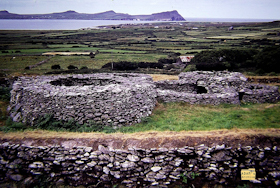
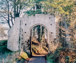 IN DECEMBER 2005, we spent a Saturday night at a bed and breakfast in a remote spot near Winchelsea in East Sussex. In those days we still had our own car and could stop where we wanted on or even off the route.One of our stopping places was Redhill in Surrey. We wanted to visit its contemporary Roman Catholic church of St Joseph and St Paul’s, but not for religious reasons. The architects, who had designed it, knew that my late uncle WS Rindl, an accomplished structural engineer, was a keen amateur sculptor. They asked him to make some decorative features and a crucifix to adorn the exterior of the church. In addition to the concrete crucifix, my uncle designed and constructed concrete gargoyles to run off rainwater from the roof. Each of these gargoyles is decorated in bas-relief with castings of the tools used by builders and engineers. On one of these drainage spouts there is a representation of what looks as if it were an early rather bulky model of a pocket calculator. The church, completed in 1984, is a lovely example of imaginative 20th century architecture, well worth a detour to see.The rurally located bed and breakfast was housed in a building that was at least 300 years old if not older. The accommodation was comfortable but the breakfast was disappointing. The fried eggs served seemed as if they had been made long before breakfast and kept warm; they were not as fresh as the frost that had coated the surrounding countryside overnight. We made a brief visit to Winchelsea, a place that has always fascinated me. Founded as ‘New Winchelsea’ by King Edward the First in the 13th century, the town was a coastal port, complete with city walls. By the 1520s, what had been a thriving centre of trade declined rapidly because of shifting of the coastline resulting from silting up of its harbour. Apart from some of the town’s mediaeval gateways and the large church of St Thomas the Martyr, it is difficult to imagine that Winchelsea was once a bustling metropolis. The decline of Winchelsea is one of many examples all over the world of how environmental changes can affect the ability of civilisations to thrive. In January 2020, we visited Lakhpat in Kutch, a part of Gujarat in western India. This huge walled city, far greater in size than Winchelsea, was a thriving seaport until the early 19th century when an earthquake caused the sea inlet on which it stood to become transformed into a salty desert. Today, the seven kilometres of intact city walls contain not a city but only a few widely separated dwellings and a Sikh Gurdwara. The church, which dates back to the 13th century, looks large. However, what can be seen today is all that is left of what had once been a far larger cathedral-like building.On the Sunday morning when we entered the church, a service was being held. There was the priest and his congregation of less than eight people, looking a little lost in the huge church. Seeing the three of us entering, he welcomed us, and said in a pleading voice: