Adventures in South Africa

HOG 5 Barkly Pass BLOG


In August 2003, we went on a driving holiday in South Africa, concentrating on visiting places connected with my ancestors who began settling in the country during the nineteenth century. We also saw some places unconnected with my family history. Although the main roads in South Africa were excellent. However, some of the minor roads were adventurous to say the least.

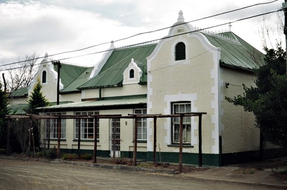
My mother spent the first ten years of her life in a tiny town, Barkly East, in the Eastern Cape. We decided to drive there from Lady Grey, where we had been staying for a couple of nights. My grandfather, my mother’s father, was instrumental in getting the South African government to extend the railway across the mountains from Lady grey to Barkly East. Nelly, a barmaid at the Mountain View Hotel in Lady Grey, told us that the railway no longer ran. About 11 years before we met her, she went on this train along with many other children from Lady Grey on an excursion. Disaster struck. Someone who had had too much to drink took over the running of the train, and it went out of control.  She remembers the train coming to a very sudden halt and being thrown forward. She was lucky only to have received ‘skid-marks’ on her skin: three of her young friends were killed instantly. It would have interesting to have travelled on that line, because like the Darjeeling Himalayan Railway in India’s West Bengal my grandfather’s railway negotiated the steep slopes of the mountains by a series of zig-zags with switchback reverses.

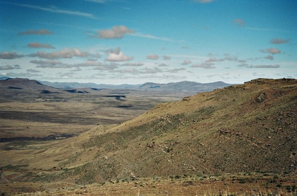
People at the hotel at Lady Grey said that instead of taking a new main road to Barkly East, we should go via the longer but far more picturesque via Joubert’s Pass. This was very scenic but quite hazardous. The road was no wider than our car and covered with loose gravel to which the car’s wheels could hardly grip. I would have enjoyed the spectacular views from the winding road on the way up had I not needed to concentrate so much on keeping the car attached to the road (‘track’ or ‘footpath’ would be a better description of the road). My heart sank when we saw a car approaching us from the opposite direction. The road was so narrow that one of us would have to reverse a long way. Fortunately, the occupants of the approaching car recognised us; they had met us at a barbecue party in Lady Grey on the night before. Kindly, and hazardously, they drove backwards at hair-raising speed along the winding road until they reached a passing place. After the summit of the pass, the road surface improved and we descended into farmland, deserted except for a few sheep and cows. The road wound around following a river, which lay at the bottom of a steep sided canyon. Eventually the road re-joined the main Lady Grey to Barkly East highway.  In a way, this was our ‘baptism of fire’ as far as South African roads are concerned.

Later during our trip, we headed for Hogsback, a quaint place high in the Amathole Mountains about 40 miles northwest of King Williams Town, where my mother and her siblings were born. Some say that Hogsback was the inspiration for his “Lord of the Rings”. However, this is unlikely as Tolkien, who was born far away in Bloemfontein, left South Africa when he was three years old. Whatever the truth of this, we set out for Hogsback from Queenstown in the Eastern Cape. We drove via Whittlesea to the tiny village of Seymour.

My wife, our navigator discovered on the map that there was road – a shortcut, led from Seymour up the side of a mountain to Hogsback. On our detailed map, the thoroughfare was marked as “narrow but with tarmac, not for four-wheel drive vehicles alone”, which we interpreted as meaning that it was suitable for saloon cars such as our hired vehicle. We began driving along it through almost level farmland. We stopped to ask a local whether we were on the road to Hogsback. Somewhat drunkenly, the fellow pointed skywards, and said what sounded like:

Herp, herp, herp.”

This we understood to mean that we had had to go ‘up, up, up’ the hill. Gradually the road began ascending, at first gently. A post-office van passed coming from the opposite direction passed us. This reassured us that the road was motorable. Soon, the road became amazingly steep.

This road, the so-called shortcut, proved to be the worst surface that I have ever driven on. Compared to it, Joubert’s Pass was a motorway. It got progressively worse as we painfully slowly approached Hogsback. The road had everything against it and us. There were potholes, and deep furrows where streams of water had eroded the gravel. Bare rock showed through the road and made steep steps that had to be carefully negotiated. Worst of all were large rounded boulders, which were difficult to drive around as the narrow road was bounded either by ditches or, more often, walls of rock. We were lucky that we neither capsized the car nor grounded it, nor damaged the sump or some other vulnerable part of its under-surface. Negotiating the car safely over some of these boulders reminded me of performing some of my trickiest difficult tooth extractions. In the dental situation, the operator has to avoid cutting the patient’s nerves or large blood vessels. On the way to Hogsback from Seymour, the driver has to avoit severing the fuel line that runs beneath the vehicle. One false move, and we would have been in big trouble, especially as on this lonely road there was neither a mobile telephone signal nor anyone else around.   Hair-raising to say the least: I still shudder when I remember this journey. Things improved at the end of the road. We were amused to see a road sign at the Hogsback end of this road that advised: “Road not recommended for caravans”.

Later, when we returned to Cape Town, I was talking to a cousin about this road. He told me that he had driven along it but managed to ground the car on a rock and sever his car’s fuel line. I have no idea whether this awful road has been improved, but, even if it has, I will not tackle it again.

Hogsback was delightful. However, when we arrived snow began falling in a serious way. The temperature dropped. The cottage we had hired was freezing cold. One tiny heater was provided to try to warm the whole place. It was useless. Hogsback like large parts of India suffers from cold during winter months. Yet, in both places, proper heating seems to be considered unnecessary. Apart from being cold, we enjoyed our brief stay at Hogsback, where we were fed with well-prepared food in a restaurant near our accommodation, run by Dion and Shane.

The two journeys I have described were somewhat risky and adventurous. Writing this reminds me of the parting words of a librarian in, Philippolis (in the Free State), the birth town of Sir Laurence Van Der Post:

Whatever we die of in South Africa, it won’t be boredom.”


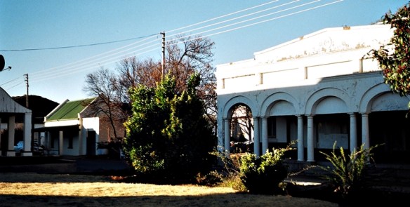
Photo taken in 2003 on the Joubert Pass

Prison cells across the Orange

Z 1 Karoo

The Karoo near Colesberg

In August 2003, Adam Yamey and his family enjoyed a long motor trip, an exploration of his South African ancestry, through rural South Africa. Most of the journey was in the Cape, but a couple of days were spent just over the Orannge River in the Free State (formerly the ‘Orange Free State’)…

Z 2 Colesberg

Octagonal church, Colesberg

…The road from Graaff-Reinet to Colesberg passes through the Karoo just missing Middelburg. Along the roadside near Middelburg, there were many people trying to sell fragile looking models, made in wire, of the ubiquitous Karoo windmills we saw along the way.

Z 5 windmill

Typical windmills seen in the Karoo and the Free State

We ate lunch in Colesburg, which boasts an octagonal church.

Z 3 Colesberg

Jewish inscription, Colesberg museum

We visited the town museum housed in the building that was formerly the Standard Bank.  There is a good collection of Anglo-Boer War memorabilia as well as a display of the history of the Griqua people. Upstairs there were two memorial stones, one in Hebrew and the other in English. The latter lists the founder members of Colesberg’s Congregation, dated 1920. As we were to find in many museums in small South African towns, the one in Colesberg had a selection of second-hand books (often as we discovered later with pages missing!) for sale.  Under the watchful eye of an official of the Standard Bank we inaugurated use of the newest ATM to be installed in Colesberg. It worked well.

Z 4 Orange

Orange River

A road from Colesberg runs north across the rolling hills of the Karoo for 60 kilometres to Philippolis (when spoken, emphasis is on the third syllable). Half way along this road we encountered the wide Orange River over which we crossed, entering the (Orange, formerly) Free State. The countryside along this road was dotted with aloes, creaking windmills, sheep and the occasional rather odd-looking cattle known as Boerebeeste. 

Z 11 Ppolis with a stoep

Philippolis

If Colesberg can be described as a ‘one horse town’, then Philippolis is a ‘one horse village’. It was a village with charm and character. Signposts directed us to the Old Jail House.

Z 6a Jail cells

Old Jail, Philippolis

Until about 46 years ago this was, in fact, the jail for Philippolis. The army then used it for about 20 years before it became a police post.  For two years it remained derelict but largely untouched by vandals as the locals considered the place to be haunted.

Z 6 Jail cells

Cells in the Old Jail, Philippolis

Its most recent owner, Harry, bought the jail and has turned it into a bed and breakfast business. He has preserved as many as possible of the jail’s features and guests may spend the night in the cells. The converted warden’s office is very popular with honeymoon couples.  We stayed in a large bungalow next door to the jail.

Z 13 LVDP born here

Birth place of Laurens Van der Post, Philippolis

Laurens Van Der Post was born in Philippolis. Following his death in 1996 at the age of 96, a very beautiful memorial to him has been laid out at the edge of the ‘white’ part of the village just near to the edge of the ‘black’ part.

Z 7 LVDP


Z 8 LVDP

This picture and the one above it were taken at the Van Der Post Memorial in Philippolis

A series of white concrete pillars, representing the various stages of Van Der Post’s ‘journey through life’, overlook a beautiful sunken garden made up with stones and bricks of many textures, all having various symbolic meanings.  Adjoining this, there is a small guesthouse that is a very good piece of contemporary architecture. The architect of the whole memorial complex is a South African woman.  Jens Friis, a PhD law student at Stellenbosch and travel writer, and his mother Naomi, showed us around. 

Z 12 Ppolis stoep

House with a stoep, Philippolis

We explored Philippolis, which is essentially a fine collection of old single-storied houses with stoeps and often adorned with decorative cast-iron work. There is no restaurant in this town, only a café, the Kokkowitz Café, which closed at 7 in the evening. Harry had arranged for us and, it seemed, all of the other guests at the Old Jail House to have dinner at the home of the Friis family, near the Van Der Post memorial. We enjoyed a bottle of very good red wine, which was produced in the Free State. 

NEXT MORNING:    Harry does not provide breakfast himself, but instead he told us to eat it at the Kokkowitz Café. After a very long wait, we received an excellent fried breakfast. We then walked past the simple flat-roofed house that used to be the residence of Adam Kok (1811-1875), the King of the Griquas, to see the houses that used to be owned by the father of Van Der Post, where the author was born. In Voortrekker Street we visited the Trans Garriep Museum. This museum was icily cold inside. It contains a series of rooms that attempt to reconstruct the kind of house in which white people lived in 19th century Philippolis. There is a small exhibit about the London Missionary Society that set up a mission in the town and also another about the Griqua Kingdom that thrived in the 19th century, and its successful King Adam Kok III. 

Z 14 Ppolis fort

View from Adam Kok’s fortress, Philippolis

The Public Library is next door to the museum and is housed in one of the town’s largest buildings. Formerly this was the home of the Jacobsohn family who owned a shop, still standing but now closed, in the town. The Jacobsohns, the last Jewish family living in the area, now live on a farm and have donated their home to the town.  A very friendly and informative librarian showed us her library. Most of the books were in Afrikaans, also quite a few in English. There were also books in Southern Sotho, Xhosa, and Tswana (only two books in this language – one appearing to be a manual on woodworking). Philippolis is located in an area where several different kinds of Africans live. Many of the ‘black’ people in the area have some Griqua ancestry.

Z 9 Jacobson shop

Colonnaded house belong to the Jacobsohn family, Philippolis

Behind the library, and only accessible through it, there is a pathway that takes one to the summit of a small hillock in the middle of the town from which a good aerial view of Philippolis can be obtained. The remaining three of Adam Kok’s collection of cannon perch here above the town. As we bade farewell to the librarian her parting words to us were, “Even if we all end up killing each other, South Africa is such an interesting country that no one will ever die of boredom”. Philippolis had a curious hold on us; we left with some sadness.

Z 10 Voortrekker Str

Library on Vootrekker Str, Philippolis

We were told that we could make a short cut by taking a dirt road to Donkerspoort, near the Garriep Dam (formerly the Verwoerd Dam, a name by which it is still known by local black African farm workers). A thirty-minute ride would, we were assured, save us much time. An hour and a half later we had completed the so-called ‘short cut’. The surface of the dirt road forced us to drive quite slowly. Our progress was further impeded by a series of closed gates across the road that separated fields through which the road passed. At each gate Lopa had to leave the car to allow us through and then to close the gate behind us. As we proceeded, the frequency of these gates increased. Had we taken the long way around, we would have reached the other end of the ‘short-cut’ in 20 minutes!