SITUATED AT THE northwest corner of Heathrow Airport (and within sight of it), is the former village of Longford. Now in the Borough of Hillingdon, it lies on what was once the main road between London and Bath. Its name derives from a ford which used to cross the River Colne. James Thorne, writing in 1876, noted that there were then three roadside inns and that:
“The fishery here is in good repute among anglers; as is also the Kings Head Inn.”
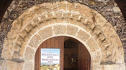
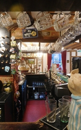
Today, there are only two pubs in Longford, The Kings Arms and The White Horse. The Kings Head, marked on a map surveyed in 1875, no longer exists. It stood just east of the Duke of Northumberland’s River, near the boundary fence of The Thistle Terminal 5 Hotel. Nearby, next to a bus stop (Stop J), stands the now disused Longford Pump. This is almost 10 feet tall and was used to top up the tanks of steam-powered traction engines. Of the two surviving inns, The White Horse looks to be the oldest. According to a notice attached to this picturesque old pub, it was probably built as a smokehouse (for curing meat) in 1534 and became an inn in 1601.

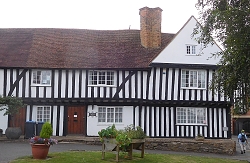
Across the road from The White Horse, there is a magnificent half-timbered building. This Elizabethan (16th century) edifice is Yeomans House. The historian Wendy Tibbits wrote (www.wendytibbitts.info):
“In 1542 Leland in his ‘Itineraries’ describes a building about a mile north of the wooden bridge over the Colne between Longford and Colnbrook, which suggests it could be the building now known as Yeomans. At the time it was the manor house of Colham and owned by the Earl of Derby who died there on 23 May 1521. He had built the Tudor Manor House on the site of a medieval house. At that time the manor of Colham had extensive land extending from Hillingdon southwards … In the mid-eighteenth century this house was owned by Thomas Streeting who died there in 1773. It was inherited by his daughter, Elizabeth, who had married the other prominent Longford farmer, Thomas Weekly. Thomas, his wife, and their nine children were living in the Weekly house, a hundred meters along the Bath Road, and so they decided that the Elizabethan would be divided into three dwellings and rented to their farm labourers’ families …”
Between The White Horse and The Kings Arms, there is a charming, thatched cottage. Almost opposite this, there is a three-storey brick building, now next to the entrance of the Heathrow Medical Aeromedical Centre. According to Ms Tibbits, this is the house built by a wealthy London cloth merchant, Thomas Weekly, about 10 years after the 1666 Great Fire of London. The Weekly family lived here from the late 17th century until 1899. The house had its own farm, which was compulsorily purchased during WW2 to use the land for the construction of an airfield in the neighbouring, now demolished, hamlet of Heathrow.
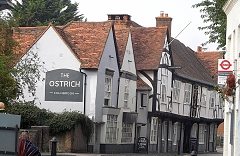
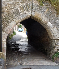
The Kings Arms Pub faces Heathrow Close. Immediately to the east of the hostelry, there is an old long barn with a sagging roof. This is one of the few reminders of the era when Longford was in the midst of agricultural terrain. To the west of this pub, the old road to bath crosses the River Colne over a bridge with elegant cast-iron railings and roundels, each with a crown and beneath it, the following: “WR IV 1834”. This is marked on old maps as “The King’s Bridge”.
Longford contains the remnants of what was once a small country village. Ms Tibbits noted that:
“… its four inns provided travellers with hospitality. Six miles from Windsor Castle the village was the usual stopping place for the Royals to change their horses on the way to and from London and Windsor … Highwaymen prayed on the coach travellers who had to cross the notorious Hounslow Heath to get to Longford, but if any villagers were aware of the culprits they kept it to themselves.”
Sadly, like nearby Harmondsworth, Longford’s future might well be bleak. Should the projected extension of Heathrow Airport finally get the ‘go-ahead’, much of Longford, if not all of it, will be demolished. This would be a great pity as it would involve the displacement of a small community and the loss of several buildings of historical interest.