Where Londoners once had fun

BEFORE THE COVID19 PANDEMIC gripped the world, many Londoners made outings to pleasure grounds such as Legoland, Thorpe Park, and further afield to Disneyland near Paris. During the late 18th century, Londoners seeking entertainment headed for places such as Vauxhall Gardens, Ranelagh (now, the grounds of Royal Hospital Chelsea, site of the Chelsea Flower Show), and Cuper’s (across the Thames opposite Somerset House). These pleasure gardens began to decline, some before and others during the 19th century. However, in their wake, another such place came into existence in Chelsea, Cremorne Gardens.

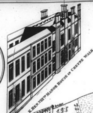
Thomas Dawson, 1st Viscount Cremorne (1725-1813), an Irish landowner, possessed a plot of land on the north side of the Thames, just west of Battersea Bridge. There he had a mansion, Chelsea Farm, which was often visited by King George III, his wife Queen Charlotte, and the future George IV. In 1825, the property came into the possession of Granville Penn (1761-1844), a cousin of Cremorne’s widow.  Penn’s claim to fame is that he was involved in the establishment of what is now The Royal Veterinary College in London (www.rvc.ac.uk/about/the-rvc/history). Penn did much to improve the grounds of the estate, but later sold it. The house and grounds were bought in 1831 by Charles Random De Berenger, Baron De Beaufain (www.rbkc.gov.uk/leisure-and-culture/parks/), who created the Cremorne Pleasure Gardens.

The great beauty of the grounds led it to being opened by De Berenger as a public pleasure ground known at first as ‘The Stadium’. De Berenger was:

“… a sportsman and in the grounds opened Cremorne Stadium. Members who paid their two or three guineas could, under the Baron’s instruction, shoot, box, and practise “manly exercises generally” in the grounds.” (https://www.rbkc.gov.uk/pdf/CRA_Historical_Survey.pdf).

Today, there is a Stadium Street located in what would have once been part of Cremorne’s estate.

The Baron died in 1845 and the estate grounds were sold. They were laid out tastefully and the place, opened as a public pleasure ground that attracted large crowds of people seeking pleasure and entertainment, who were willing to pay modest fees for it. The gardens flourished between 1845 and 1877. In 1850, they came under the ownership of Thomas Bartlett Simpson, who also purchased Ashburnham House (an 18th century edifice) on the west side of the estate, which he used to house some of his visitor attractions. The grounds offered visitors many attractions including dancing; meals; secluded areas; firework displays; theatres for farce and vaudeville; ballets; puppet shows; trapeze artists; tight-rope walkers; a maze; and balloon ascents.

In his 1880’s “Old and New London”, Edward Walford describes some of the exploits with balloons, which were not without excitement. In 1839, whilst the gardens were owned by De Berenger, a Mr Hampton equipped with a parachute ascended two miles above the ground with a balloon and then descended to the ground with his parachute.  Some years later, Vincent De Groof ascended from Cremorne Gardens in a contraption, designed to help him fly, suspended from a balloon. After reaching a high altitude, something went wrong and poor De Groof fell to his death.

By the 1870s, the Cremorne Gardens were becoming disreputable, especially becoming notorious for prostitution. After they closed (for financial reasons), the land became used for building houses and other buildings including the Lots Road Power Station.

In about 1846, the artist JMW Turner (1775-1851) moved into a house by the river on what is now Cremorne Road, close to Cremorne Gardens and to the Cremorne Pier. He constructed a kind of gallery on its roof, from which he could sit and observe the changing light on the river. According to a biography by Peter Ackroyd, Turner was unwell whilst he lived there, suffering from dental problems that caused him to lose all of his teeth, and consequent dietary-related illness. He remained in Cremorne Road until the last year of his life and died there.

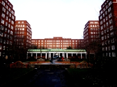
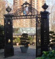
Today, little remains of Cremorne Gardens except a few street names and a small park close named Cremorne Gardens next to the river. This delightful, small open space has a paved section as well as a lawn. It is a tiny fragment of the original Cremorne Gardens but a fitting memorial to a place that provided entertainment for Londoners over many years. A couple of piers project into the river. These were originally landing stages for visitors arriving at the Gardens by river boat. Another souvenir of the heyday of the Gardens is a pair of wrought iron gates that stand in the present plot, but not in their original position, now built over. Small though it is, with its superb views of the Thames, the present Cremorne Gardens is a pleasant place to visit, within a short distance from the fashionable Kings Road.

Where there are dolphins

I HAVE NEVER VISITED MOSCOW, but I imagine that the huge, rather forbidding looking apartment block on Grosvenor Road facing the River Thames, would not look out of place in the Russian city. Covering seven and a half acres of land, built with twelve million bricks and almost seven thousand external window units, and containing at least twelve hundred flats, this mammoth building complex, which has been home to many of the famous and infamous, was completed in late 1936. This enormous residential complex is called Dolphin Square.

Maps surveyed in 1869 and 1913 reveal that the land on which Dolphin Square was built, which is west of St Georges Square, used to be the site of the several long buildings that together made up the Royal Army Clothing Department and its storage depots. Before that, the land was occupied by the work premises of the developer and builder Thomas Cubitt (1788-1855), who built much of Belgravia and Pimlico. A few years after his death, the army leased the site and the depot stood there until 1933, when the lease reverted to the Duke of Westminster (https://en.wikipedia.org/wiki/Royal_Army_Clothing_Depot).

An American firm, Fred F French Companies, bought the freehold of the former army clothing compound, and then, discovering it had insufficient funds to develop it, sold it on to Richard Costain Ltd. Costain commissioned the architect Stanley Gordon Jeeves (1888-1964), whose other works include the now demolished Earls Court Exhibition Centre and the still standing large, art-deco Latimer Court at Hammersmith, to design the residential complex that exists today. Writing soon after it opened, the writer AP Herbert (1890-1971) wrote a book extolling the virtues of Dolphin Square. He wrote that it is:

“…a city of 1,250 flats, each enjoying at the same time most of the advantages of the separate house and the big communal dwelling place …”

Commenting on the fact that the complex included a restaurant, he wrote:

“…fortunate wives will not have enough to do. A little drudgery is good for wives, perhaps. The Dolphin lady may be spoiled.” (quotes from www.theundergroundmap.com/article.html?id=2792)

From outside the building, Dolphin Square looks monolithic and forbidding. However, on entering the huge courtyard within it, this impression changes. For, the courtyard contains a lovely garden, which was designed by Robert Sudell in about 1937 (https://historicengland.org.uk/listing/the-list/list-entry/1455668). Though much modified since then, the formal garden retains much of the original design concept including an axial avenue lined with chestnut trees. Appropriately, the middle of the garden is adorned with a fountain with three sculpted dolphins. Created by the sculptor James Butler (born 1931), this was placed in 1987 to replace an earlier fountain. This pleasant garden would be one good reason to entice me to live in this extraordinarily massive complex. 

As mentioned already, Dolphin Square offers its residents a restaurant. It also contains an arcade of shops, a café, a gymnasium, a swimming pool, a laundrette, underground parking, a bar, a brasserie, a hotel, a tennis court, and more. And all of this is within a short walk of Westminster and the Houses of Parliament. This proximity to the centre of government means that many MPs have made use of Dolphin Square as their London ‘pads’.

Apart from politicians, including Harold Wilson, William Hague, David Steele, and many others, Dolphin Square has been home to people of fame and notoriety. According to an article in Wikipedia, some of these include Oswald Mosley and his wife Diana Mitford; the novelist Radclyffe Hall; Christine Keeler and Mandy Rice-Davies; the comedian Bud Flanagan; the spy John Vassall; and the tennis player Rod Laver. Princess Anne lived in Dolphin Square briefly in 1993, General de Gaulle based his Free French Government in part of the Square in WW2, and Sarah, daughter of Sir Winston Churchill, was:

“…evicted from the square for hurling gin bottles out of her window.” (https://www.bbc.co.uk/news/magazine-33785352).

It seems that a fascinating book about the residents of Dolphin Square is waiting to be written.

I had passed Dolphin Square plenty of times before entering its garden recently, but until now I had no idea that this far from attractive building was home to such a fascinating range of people nor that it contained such a fine garden. Just as one should not judge a book by its cover, it is a mistake to judge Dolphin Square from its exterior.

Honouring a Hindu hero in London

MI5 WORKS TO HELP protect our democracy in the UK. Its architecturally unflattering headquarters stand looming above the southern end of Vauxhall Bridge. A few yards downstream from it, and directly facing the main entrance of the Tate Britain across the river, there is a small grassy triangle close to the river. In the middle of the green space, there is a bust on a pedestal. The bust depicts a man with a moustache, who is wearing two chunky necklaces and what looks like a bejewelled turban. This is a monument to Basaveshvara, who lived between 1134 and 1168 (actually, these dates are not certain: he might have lived c1106-1167). A panel on the side of the pedestal notes that he was:

“Pioneer of Democracy and Social Reform”

Various people and organisations supported the creation of this monument to someone of historical importance but until now unknown to me and, I would guess, to many other people wandering past the bust. As one of the organisations involved in its creation was The Government of Karnataka (in southern India), I reached for my tattered copy of “A History of Karnataka” (edited by PB Desai), which I picked up in the wonderful Aladdin’s cave of a bookshop, Bookworm, in Church Street, Bangalore, a city which I visit often. It has 8 index entries for Basaveshwara, who is also known as ‘Basava’, ‘Basavanna’, and ‘Basavaraja’, all of these being transcripts from various Indian language alphabets.

Basaveshwar was born of Shaivite Brahmin parents at Bagevadi, which is now in the Bijapur district in the northern part of Karnataka. His name is derived from the Sanskrit word ‘Vrishabha’, the divine bull, Nandi, who carries the god Shiva. Early histories (the Puranas) described him as an incarnation of the god Shiva rather than a human being, but it is considered that he was certainly a real person. A devotee of Shiva, Basaveshwara was well-versed in both Kannada and Sanskrit learning. He was brought up in a social milieu in which people blindly adhered to the dogmas and rituals of Vedic Hinduism without bothering to understand the true spirit of religion. Desai wrote:

“Basava’s mind revolted against these ills and he decided to defy the existing order of things.”

After receiving the sacred thread, very roughly speaking a Hindu equivalent of the Jewish Bar-mitzvah or the Christian confirmation, Basaveshwara went to the Kudama Sangama, a temple complex at the confluence of the Rivers Krishna and Malaprabha. In 2011, long before I had ever heard of Basaveshwara, we stopped briefly at the Sangama on our way from Hospet to Bijapur (now named ‘Vijayapura’), both in Karnataka. When we were there, the rivers had dried up and we saw signs advising visitors to beware of crocodiles.  

Basaveshwara remained at the Sangama for about 12 years. In his time, as it is now, the Sangama was much visited by people from all walks of life. There, he met many scholars and learned men from all schools of Hindu belief. Eventually, Basaveshwara travelled to Mangalavada, the headquarters of Bijala II (c1130-c1167), the feudatory governor of the Kalachuri family (of the Chalukya dynasty). Soon, Basaveshwara became the Chief Treasurer of Bijala’s court. It was then that Basaveshwara:

“… started his new movement of religious and social reforms, treating all devotees of Siva [i.e. Shiva] as equal in all respects without the traditional distinctions of castes, communities and sects.” (Desai)

After about 20 years, BASAVESHWARA moved to Kalyana, the capital of Bijala, where his reformist ideas gained a great following. Bijala II, who had become suspicious of Basaveshwara, began crushing the movement inspired by Basaveshwara’s radical ideas that seriously threatened the traditional hierarchy that favoured the Brahmins, as well as advocating some hitherto unknown equality of men and women in spiritual aspects of life. For example, Basaveshwara sanctioned a marriage between the son of an ‘untouchable’ and the daughter of a Brahmin. Upset by this, Bijala sentenced the couple to death. Basaveshwara’s followers then plotted to assassinate Bijala, an act of which Basaveshwara disapproved. Realising that he could not restrain his angry followers, Basaveshwara retreated to Kudama Sangama, where he died. Bijala was murdered soon afterwards. Later, Basaveshwara became venerated as a (Hindu) saint.

Basaveshwara believed:

“…that every human being was equal, irrespective of caste and that all forms of manual labor was equally important.” (https://en.wikipedia.org/wiki/Basava).

These ideas sound familiar to those versed in the history of Mahatma Gandhi, who lived many centuries after Basaveshwara.  Yet, Basaveshwara is relatively unknown compared with Gandhi. Basaveshwara was certainly a reformer as is stated on the base of his bust near Vauxhall Bridge and his radical ideas were undoubtedly democratic when considered in relation to the time when he lived. So, it is quite appropriate that from his bust, there is a clear view of the Houses of Parliament, a home of democracy.

The bust on the embankment was erected by Dr Neeraj Patil, born in Karnataka, a member of the Labour Party and Mayor of the London Borough of Lambeth 2010-2011 and Dr Anagha Patil. It was unveiled in November 2015 by the current Prime Minister of India, Shri Narendra Modi. It is appropriate that Modi inaugurated this memorial as his parents were members of what was officially recognised a socially disadvantaged community, whose emancipation would surely have been approved by the reformer Basaveshwara.  And what is more, Modi is one of the first, if not the very first, of the Indian Prime Ministers, all democratically elected, who was not from a ‘high’ caste or social class such as Brahmin, Kayastha, and Rajput, and has completed at least one term of office. So, I feel that Basaveshwara does deserve a place within sight of the ‘Mother of Parliaments’.

Henry the Eighth and Chelsea

CHEYNE WALK RUNS along the left bank of the River Thames from midway between the Battersea and Albert Bridges to 245 yards downstream of the Albert Bridge. Before 1866, Cheyne Walk ran along the shoreline, but after the construction of Chelsea Embankment it became separated from the waterfront. Today, while walking along this lane east from the Albert Bridge, we spotted the narrow Cheyne Mews. A sign at its entrance intrigued me. It reads:

“King Henry VIII’s manor house stood here until 1753 when it was demolished after the death of its last occupant, Sir Hans Sloane. Nos. 19 to 26 Cheyne Walk were built on its site in 1759-65. The old manor house garden still lies beyond the end wall of Cheyne Mews and contains some mulberry trees said to have been planted by Queen Elizabeth I.”

The manor and village of Chelsea was already in existence in the Anglo-Saxon era (between the departure of the Romans and 1066), when a document records it as ‘Cealchylle’. The 11th century Domesday book names it ‘Cercehede’ and ‘Chelched’. The manor was owned by the Abbey at Westminster until the reign of King Henry VII, when it was in the hands of Sir Reginald Bray (c1440-1503), a highly influential figure during the king’s reign. Next, it changed hands a couple of times before being possessed by William, Lord Sandys (1470-1540), a diplomat, Lord Chamberlain, and a favourite of King Henry VIII (ruled 1509-1547). Sandys, who disapproved of Henry’s marriage to Anne Boleyn (c 1501/07 – 1536), accompanied the unfortunate Anne to the Tower of London, where she was imprisoned.

In 1536, Sandys gave the manor to King Henry VIII. The much-married king gave it to his last spouse, Katherine Parr (1512-1548) as part of her dowry.  She lived in the manor house after the coronation of King Edward VI in January 1547 until she died. After her death, the manor was owned by the soldier and politician John Dudley, Duke of Northumberland (1504-1553). Then the manor passed through many owners until the physician and founder of the British Museum Sir Hans Sloane (1660-1753) bought it in 1712 from the Tory politician Lord William Cheyne (1657-1728).

There were two manor houses in Chelsea, an old one and a new one. The old one, which was given to the Lawrence family by Henry VIII was close to Chelsea Old Church that stands to the west of the Albert Bridge. The New Manor House stood on Cheyne Walk where we saw the sign. It stood near a coffee house that was flourishing when Sloane bought the manor, Don Saltero’s Coffee House, founded in 1695 by James Salter. Saltero’s was originally a barber’s shop until Sloane began donating unwanted specimens to his former servant and travelling companion, the owner of Saltero’s. Salter displayed these specimens (botanical, zoological, and other), collected on Sloane’s travels, in cabinets and gradually the barber shop was transformed into ‘Don Saltero’s Coffee House and Curiosity Museum’. This establishment attracted local men to become its customers, including Sir Isaac Newton.

Sloane’s purchase was a shrewd investment because at the time London was expanding westwards. His biographer James Delbourgo wrote:

“The manor cost the considerable sum of £17,800 and included a total of eleven houses and the Manor House itself … As a suburban equivalent of a country seat, the manor grounded Sloane’s gentlemanly identity. It also bought him about 90 acres of land … as a freeholder, and an unknown number of tenements, on which he began to collect his own rents.”

I have found an engraving of the appearance of the Chelsea manor house that stood on Cheyne Walk in a book published in the 1880s. The image resembles that included on a map of Chelsea surveyed in 1664 by James Hamilton and redrawn in 1717 (www.britishmuseum.org/collection/object/P_1880-1113-1221), but the exact location of the house is not marked on the map.

Apart from the commemorative sign at Cheyne Mews and the garden, to which we were unable to gain access, King Henry VIII’s manor house has completely disappeared. I wondered whether Chelsea’s Kings Road had any links to Henry VIII’s ownership of the manor, but it does not. It began as a private road used by King Charles II, who came to the throne long after Henry VIII, when travelling from London to Kew, and was only made a public thoroughfare in 1830. The site of the former manor house owned by Sloane is but a few minutes’ walk from the Chelsea Physic Garden, some of whose land was leased to the Society of Apothecaries for a small amount by Sloane when he acquired the manor.

Finding small things of great interest like the sign on Cheyne Mews is one of many things that increases my ever-growing fascination with London.

Pond life

WE MADE THE MOST of the shortest day of the year, 21st December 2020, by leaving our house before sunrise, which was supposed to happen at 8.05 am but did not do so visibly because of the grey skies and incessant rain. We drove to South End Green (Hampstead) and parked just above the largest of the Hampstead Ponds (Pond number 1).

Despite the sheets of rain and the sombre sky, the houses across the pond were reflected in the water  where swans and other waterfowl were taking a swim. We splashed along a waterlogged path to the next pond, Pond number 2, which is also overlooked by a few houses, whose inhabitants have an enviable view over the water and the slopes of Hampstead Heath beyond. We stood on a wooden viewing platform and heard a ‘splosh’ near us. It was a cormorant taking a dive. It emerged a few moments later further out in the pond. Several other cormorants could just about be seen through the rain, resting on a tiny island in the pond.

The Hampstead Ponds, three in number, are fed by streams that rise near the Vale of Health, which is about 440 yards northwest of the uppermost pond (number 3), which flows into the second pond and then into the first. These streams, along with those that flow into the Highgate Ponds, are sources of the water that flows in the now subterranean River Fleet, which empties into the Thames under Blackfriars Bridge.  

The idea of damming the streams to make the ponds might have been conceived as early as 1589 (https://guildhallhistoricalassociation.wordpress.com/2016/01/11/the-history-of-the-hampstead-heath-ponds/) but it was only in 1692 that the  Hampstead Water Company  leased the springs that now feed the ponds. The latter, which were used as freshwater reservoirs, were created by damming the streams in the early 18th century. The pond at the Vale of Health was created later, in 1777. Water from these ponds/reservoirs was supplied to users in north London via wooden pipes created by boring holes in elm tree trunks. The Highgate Ponds, which also supply water to the Fleet, were also created by the Hampstead Water Company.

In 1856, the New River Company acquired Hampstead Pond number 1 and the Vale of Health pond, which were by that time becoming less savoury as far as water quality was concerned. Four years later, the Hampstead Junction Railway Company opened what is now Hampstead Heath Overground Station. This was just south of a fourth pond, which was filled in in 1892. In addition, there was another pond in South End Green where a disused 19th century drinking fountain now stands. The pond was filled in in 1835.

Enough of the distant past. Let me tell you how South End Green fits in with my life so far. My mother’s brother, Felix, lived at number 130 Fleet Road. He bought it at an extremely reasonable price because it had a ‘sitting tenant’. Eventually, after the tenant died, my uncle lived on one of the building’s three floors and rented the other two to a couple of Nigerians, who became his close friends. He regarded them as if they were his sons and they looked after Felix as if he was their beloved father.  For a long time, Felix occupied the top flat. He used to visit our flat for dinner regularly and we used to drive him home at the end of the evening. On one occasion, we arrived at his house, and after fumbling in his pockets, he announced that he had left his house keys locked in his home. We asked him what he was going to do. He answered in his South African accent:

“Ag, I do this often. All I need to do is ring my neighbour’s doorbell and they will let me onto their roof. Then, I cross over on to my roof. I keep a stick there so that I can break open my window and climb into my house. So, you don’t need to worry.”

Felix was always creative and inventive. When he grew older and infirm, he moved into the ground floor flat. He began using a stick when out walking. Once, when I was visiting him in a ward in the Royal Free Hospital, which is across the road from his former home, I was present when a physiotherapist visited him. She asked him whether he had a walking stick. He said:

“It’s lying beneath my bed.”

The physiotherapist looked at the stick, and said:

“Well, I have never seen one quite like this before.”

“Ag,” said Felix, “I took a bleddy broomstick and glued an umbrella handle on to it.”

Felix died a few months ago. We miss him greatly.

Sadly, South End Green was  associated with other personal losses. Both my mother, and then many years later, her sister, ended their lives in the Royal Free Hospital.

The rear of Felix’s home once overlooked the LCC Tramway Depot. This was surrounded by the terraced houses on Fleet, Constantine, Agincourt, and Cressy Roads. The entrance to the depot was from the latter. This depot opened for horse-drawn trams in about 1887 and then the system was electrified in 1909. In 1938, trolley buses replaced trams travelling to South End Green and these were replaced by motor buses in about 1960 (www.british-history.ac.uk/vch/middx/vol9/pp3-8). Currently the route 24 bus terminates at South End Green, a route which I used when I was younger.

I used the 24, which passed near University College London where I studied between 1970 and 1982, for two main reasons. One was to visit my uncle Felix and the other to visit some friends, who lived in Constantine Road and others who lived in South Hill Park, part of which was built over the pond that was covered over in 1892.

Today, my wife and I enjoyed our visit to South End Green despite the relentless rain. After buying vegetables at a lovely open-air stall close to the station, we paid a visit to the Matchbox Café next to the cobbled area where the route 24 buses rest before setting off. As we waited for the barrista to prepare our hot drinks, we chatted with him through the hatch through which he serves the take-away drinks and snacks. Mirko was delighted to discover that we had visited his hometown Ptuj in Slovenia, which was once a part of the former Yugoslavia. He told us many things about his native place including that a castle north of the town, Borl (Ankenstein in German), was associated with Parsifal, one of the Knights of King Arthur’s Round Table (more information: https://blogs.bl.uk/european/2018/01/an-arthurian-castle-in-slovenia.html). Incidentally, Mirko prepares good quality coffee and richly flavoured hot chocolate. His café is one of many reasons for visiting South End Green, even on a rainy December day.

The shrinking canal

USUALLY, I LOOK out of the window whenever I am travelling by train. During the 1980s, I often visited London from Kent by train, usually arriving at Victoria Station. The train crosses the River Thames on the Grosvenor Railway Bridge just before it reaches the platforms of Victoria Station. If you are looking out of the left side of the train whilst it is on the bridge, you can spot a building with a curious roof and ornate mansard windows, features that might make you think of nineteenth century Paris (France). For many decades, I have been meaning to investigate this building and today, the 14th of December 2020, whilst walking along the Thames embankment between Chelsea and the Tate Britain, I decided to satisfy my curiosity.

Western Pumping Station

The building with the convex curved roof, which has diagonally shaped tiling, overlapping like fish scales, and mansard windows, is the Western Pumping Station. This sewage pumping station was built in 1875 by William Webster (1819-1888) as part of London’s grand sewage system designed initially by Joseph Bazalgette (1819-1891), which was built mainly between 1865 and 1875. The tall square-based brick chimney next to the pumping station was once an outlet for the steam from the pumps. Now, it serves as a ‘stink pipe’ for exhausting fumes that build up in the sewer. It is 272 feet high. Writing in the 1880s, Edward Walford noted that the pumping station:

“… provides pumping power to lift the sewage and a part of the rainfall contributed by the district, together estimated at 38,000 gallons per minute, a height of eighteen feet in the Low Level Sewer, which extends from Pimlico to the Abbey Mills Pumping Station, near Barking in Essex, The requisite power is obtained from four high-pressure condensing beam-engines of an aggregate of 360-horse power.”

The pumping station and its tall chimney stand between the railway tracks, east of it, and an inlet from the Thames, west of it. A narrow waterway passes from the Thames under Grosvenor Road. Then it moves ‘inland’ via a series of lock gates. This waterway and the dock into which it flows, a watery cul-de-sac surrounded by modern buildings, a rather sterile looking precinct supposed to entice property owners, who want to live in a waterside location, is called ‘Grosvenor Waterside’. The watery appendix sprouting off the Thames is all that remains of the Grosvenor Canal.

The canal was opened in 1824. It was built along the course of a tidal creek that led to a tide mill that pumped water to the Serpentine in Hyde Park and the lake in St James Park. A tide mill works by collecting tide water behind a dam with a sluice, and then allowing the tidal water to escape from it via a watermill as the tide goes out. Modern tidal-barrage electricity generators work that way.

The conversion of the creek to a canal was conceived by Robert Grosvenor (1767-1845), 1st Marquess of Westminster. The short canal, about three quarters of a mile in length, was mainly used for the transportation of coal to the neighbourhood through which it ran. Gradually, the canal was shortened as parts of it were filled in. By 1860, Victoria Station had been built over the Grosvenor Canal Basin.  More of the canal was filled in in about 1899 to build new railways tracks. This halved the remaining length of the canal. In 1925, even more of the waterway was covered over to allow the building of Westminster Council’s Ebury Bridge Estate. What remained of the canal was then used as a dock for loading barges with rubbish. The rump of the canal served this purpose until 1995. Five years later, the construction of the upmarket and rather sterile-looking Grosvenor Waterside housing development, which can bee seen today, began. This includes lock gates, mooring pontoons, and a working swing bridge, but boats are not seen within what remains of the former canal. It is a modern ‘folly’.

Most of the former Grosvenor Canal has disappeared for ever. This is quite unlike many of the so-called ‘Lost Rivers’ of London, which still exist but are hidden from view in underground conduits. One of these, the River Westbourne, flows out of its conduit and into the Thames 270 yards west of the former canal’s entrance, at the southern edge of the Ranelagh Gardens in which Sir Christopher Wren’s magnificent Royal Hospital Chelsea stands.

I hardly ever travel by train to or from Victoria anymore, especially as we now tend to use our car. However, whenever I see the interesting roof of the pumping station and its mansard windows, I remember the days back in the early 1980s when I used to travel between the Medway Towns, where I worked as a dentist, and London, where most of my friends and family resided.

Monkey Island

ROWERS AT THE 2012 Olympics would have become familiar with Dorney Lake. Built at great expense by Prime Minister Boris Johnson’s alma-mater, Eton College, this 1.4-mile-long waterway, a rowing lake, was ready for use by 2006. From the air, it looks like a long, wide airport runway filled with water. Prior to 2012, it was used for several international rowing competitions. In 2012, the lake was the site of both the Olympic and the Summer Paralympics. The lake continues to be used for rowing and members of public are allowed to use the parkland surrounding it when events are not taking place.

Monkey Island

We reached the outer fence of the rowing lake after crossing the elegant Summerleaze footbridge across the River Thames. It allows cyclists and pedestrians to travel between Bray (Berkshire) and Dorney (Buckinghamshire). The bridge takes its name from the company that built it in 1996. It was constructed originally to carry a gravel conveyor belt, which transported gravel from the construction site of the Dorney Lake across the river to the Summerleaze company’s gravel pits next to Monkey Island near to the village of Bray.

The view from the top of the footbridge is magical. The Thames flows briskly beneath it. Upstream the water flows around Monkey Island. Then it travels as a single stream beneath the bridge before being divided into two streams by another island a few yards downstream, Queen’s Eyot. On the chilly Saturday afternoon, when we crossed the bridge, several small cruisers and canoeists passed beneath us.  If you are lucky, and we were, you can see the towers and turrets of Windsor Castle in the distance on the south-eastern horizon.

Looking upstream and through the trees on Monkey Island, you can catch a glimpse of part of the Monkey Island Estate, currently a grand hotel built in and around a house with a fascinating history (www.monkeyislandestate.co.uk/pages/our-story.html).  Many people assume that Monkey Island is so-called because of the paintings of monkeys in one of the buildings on the island, but this is probably erroneous.  The name is most likely derived from the island’s earlier name ‘Monk’s Eyot’. The monks lived in Amersden Bank near Bray Lock on the Buckinghamshire side of the Thames. Their monastery, a cell of Merton Priory, was in existence by 1187, but was dissolved when Henry VIII put an end to such establishments.

The Great Fire of London of 1666 gave the area around Monkey Island a particular importance. For it was from here that Berkshire stone (for details, see: http://hanneyhistory.org.uk/wp-content/uploads/2018/08/Berkshire_Building_Stone_Atlas.pdf) was shipped down river to aid the reconstruction of London. Gravel from the damaged city was brought back upriver and dumped on and around Monkey Island. This resulted in both raising the level of the island to above flood level and providing a solid foundation upon which to construct buildings. Well, getting to know this was alone a good consequence of having crossed the Summerleaze bridge, but wait, there is more to follow.

An ancestor of the wartime Prime Minister, Winston Spencer Churchill, Charles Spencer, the 3rd Duke of Marlborough (1706-1758), purchased the island in about 1723. He had:

“…seen the property whilst attending meetings of the notorious Kit-Kat Club at nearby Down Place in Water Oakley. The Club which met from 1720 purported to be a gathering of ‘men of wit and pleasure about town’ but beneath a facade of joviality had more sinister objectives concerned with the defence of the House of Hanover.” (www.berkshirehistory.com/castles/monkey_island.html).

The Kit Kat Club, about which I have written before (https://adam-yamey-writes.com/2020/11/29/kit-kat-in-hampstead/) also used to meet at the Upper Flask pub in Hampstead Village.

The Duke had two buildings constructed on his recent purchase: a ‘fishing temple’ and a ‘fishing lodge’. The latter, constructed from wooden blocks that were cut to look like stone, still stands and is known as The Pavilion. Lady Hertford (1699-1754), Frances Seymour, later the Duchess of Somerset, writing in 1738, described the Pavilion as follows:

“He has a small house upon it, whose outside represents a farm – the inside what you please: for the parlour, which is the only room in it except the kitchen, is painted upon the ceiling in grotesque, with monkeys fishing, shooting etc., and its sides are hung with paper.”

The Monkey paintings, which still exist, were the work of a French artist Andien de Clermont (died 1783), who worked in England between about 1716 and 1756. Painted before 1738, they decorated the ceiling of what was once a banqueting room. It is now known as the ‘Monkey Room’.

By about 1840, the pavilion had become an inn, which could be reached by ferry from near Bray on the Berkshire side of the Thames. The hostelry became quite popular during the early 20th century, when its regular guests included King Edward VII and his immediate family. The authors HG Wells and Rebecca West enjoyed visiting the place. West makes many references to the island in her novel “The Return of the Soldier” (published in 1918). Here is an excerpt:

“So they went to Monkey Island, the utter difference of which was a healing, and settled down happily in its green silence. All the summer was lovely; quiet, kind people, schoolmasters who fished, men who wrote books, married couples who still loved solitude, used to come and stay in the bright little inn.”

In 1956, a footbridge was built from the Berkshire shore to the island. Additional accommodation was added to the original Pavilion in 1963 and then the inn became known as the ‘Monkey Island Hotel’. After a brief period of decline in the early 1980s, the hotel was restored and has become a successful luxury destination with a fine restaurant, which we have yet to sample.

Our friend who lives in Bray kindly introduced us to the Summerleaze footbridge from where we glimpsed the building on Monkey Island. She suspected that the place had an interesting history, and she was quite right. I will leave you with one more quote from Rebecca West’s novel, one which captured the atmosphere of the place well both when she wrote and today:

“…a private road that followed a line of noble poplars down to the ferry. Between two of them—he described it meticulously, as though it were of immense significance—there stood a white hawthorn. In front were the dark-green, glassy waters of an unvisited back-water, and beyond them a bright lawn set with many walnut-trees and a few great chestnuts, well lighted with their candles, and to the left of that a low, white house with a green dome rising in its middle, and a veranda with a roof of hammered iron that had gone verdigris-color with age and the Thames weather. This was the Monkey Island Inn. The third Duke of Marlborough had built it for a “folly,” and perching there with nothing but a line of walnut-trees and a fringe of lawn between it and the fast, full, shining Thames, it had an eighteenth-century grace and silliness.”

A village by the River Thames

FOR MORE THAN THIRTY YEARS between the mid-1970s and about 2003, I made occasional journeys between Stoke Poges in Buckinghamshire and Eton in Berkshire. On each of these, I passed signs indicating roads to Datchet, yet it was only in November 2020 that we decided to take a look at this village near the River Thames and opposite Windsor.

Writing in 1876 in his “Handbook to the Environs of London”, James Thorne commented that Datchet in Buckinghamshire:

“… is a quiet genteel place of abode, dull and uncharacteristic in appearance; as such places usually are; but the neighbourhood is beautiful and interesting.”

While today Datchet continues to appear genteel, it is not as dull as Thorne made out. Much that Thorne might have seen had he visited it when researching his book can be seen today. For example, the Church of St Mary, which was built in 1860 on the site of an older one, which was demolished in 1857, is attractive despite having been completely rebuilt in Victorian Gothic style.

The church stands beside The Royal Stag pub. Although the front part of the pub facing the village green was added in the 18th century, the rear part that faces the churchyard dates back to 1500 or before (https://datchethistory.org.uk/streetshouses/the-north-greens/the-royal-stag/). Over the centuries, the older parts of this building have undergone modifications, but externally it looks quite old. The pub was visited by the astronomer William Herschel (1738-1822) and his family and is mentioned in “Three Men in a Boat” by Jerome K Jerome.

The pub faces a green in the middle of which there is a memorial to those of Datchet, who fell in both World Wars. A plaque on the memorial relates that the men who fell in WW1 were fighting the combined forces of “Germany, Austria, Turkey, and Bulgaria”. As far as I can recall, this is the first WW1 memorial I have seen that mentions Bulgaria.

Facing both the pub and the church across the green, there is a long half-timbered building with four gables. Thorne describes it as having five gables, but we could only see four. Between two of the gables, there is an area of roof tiling on which a sculpture of a cat appears to be chasing a sculpture of a rat. This building now divided into dwellings is collectively known as ‘Manor House’. Although much modified, this building might have been constructed in the late 16th century. The mock Tudor facing, which we see today, was added in about 1870.

A building named ‘The Old Manor House’ next to the building just described was rebuilt in 1955 on the site of a building constructed first in the 17th century. A row of brick cottages stands on the other side of the gabled building. These attractive old structures are, like their neighbour, timber-framed. They might be older than their larger neighbour. Their brick frontage was added either in the 17th or 18th century.

Another old cottage faces the London Road, which runs along the side of the churchyard. This is ‘Church Cottage’, which was built in about 1500 and has undergone little change since then. It is probably the oldest building still standing in Datchet. James Cottages, neighbouring Church Cottage, are far younger, having been built in 1853 to commemorate James Pearce, who had died in 1851.

I could describe some of the other old buildings that make Datchet a lovely place to linger for a while, but I hope I have written enough to intrigue you. Before concluding, I will tell you a bit about the village’s name, which is strange to my way of thinking. The excellent village website (https://datchethistory.org.uk) provides much interesting information about Datchet and reveals the following about the name. Current thinking links Datchet (‘Decetia’ in Latin) to the French town of Decize, a point in central France where the River Loire could be crossed with ease in Gallic and Roman times. The website observes:

“… Decize and Datchet have more in common than an unusual name; both were originally established on islands of high ground in the low-lying land of a major river route; the remains of Decize’s ancient fort is shown on the map as ‘oppidum’. Settlement sites like this are common, but it may still be significant that these two share such a distinctive name which is not found anywhere else.”

Although we spent less than an hour in Datchet, that was sufficient time to discover that far from being “dull and uncharacteristic in appearance” as claimed by the 19th century writer James Thorne, it is quite attractive even if not in the same league as villages such as Lavenham in Suffolk and Stow-on-the Wold or Bourton in the Cotswolds.

Old Windsor

WINDSOR CASTLE IS well-known to many people and much visited. However, what came before the castle was built is less known. Recently, we visited the place near Windsor which used to be the home of Britain’s royal rulers well before the Normans invaded the British Isles. Our trip began at the car park close to where the Magna Carta was signed in Runnymede in 1215.

Beaumont House

We slithered through the mud and wet leaves on the path running along the bank of the River Thames from Runnymede to Old Windsor. The path runs past the large gardens of homes along the river and provides views of the occasional barges moored on both sides of the stream. We caught glimpses of a couples of swans but remarkably few other forms of bird life. Birds might have been in short supply, but not aeroplanes. Despite the decrease in air travel that has resulted from the covid19 pandemic, there seemed to be a ‘plane flying low over us every one or two minutes because we were walking beneath the flight path along which aircraft descend as they near Heathrow Airport. The low clouds meant that although we could hear them, we could not see all of the ‘planes.

We left the riverside path after having walked about a mile and followed a footpath to the church of Saints Peter and Andrew on the edge of Old Windsor. This lovely church with a sharp pointed steeple and flint walls is set in a graveyard with many picturesque funereal monuments and a tall redwood tree. The present building was constructed in 1218 to replace an earlier wooden church that was burnt down by French mercenaries in 1215 in response to King John’s recent somewhat reluctant signing of Magna Carta at nearby Runnymede (www.oldwindsorchurch.org.uk/history.html). I do not know who was paying these incendiary Frenchmen and wonder if President Donald Trump might not employ some people to create similar mayhem following his election defeat. Since 1218, the church, which was locked when we visited, underwent various modifications over the centuries including an extensive restoration in 1866 by the architect Giles Gilbert Scott (1880-1960).

Most of the present village of Old Windsor is of little interest to the visitor. However, its history is. Old Windsor existed before the formerly named ‘New Windsor’ or ‘Windsor’ as we know it today. The name ‘Windsor’ might be derived from Old English ‘Windles-ore’ or ‘Windlesora’ (meaning ‘winding shore’). The place now known as ‘Old Windsor’ is recorded in the 9th century Anglo-Saxon Chronicle, an early history of the Anglo-Saxons. During that pre-Norman Conquest era, there was a royal palace at Old Windsor. The old palace continued to be used until the castle, the present Windsor Castle, began to be constructed in the reign of William the Conqueror. According to James Thorne in “Handbook to the Environs of London” (published in 1876), the royal residence at Old Windsor continued to be used, maybe occasionally, until the reign of King Henry I, that is until between 1100 and 1135. The old palace has long since disappeared. Some archaeological remains of the palace were discovered in the 1950s and are kept in the Reading Museum.

We walked from the church to a main road (the A308) along a long road (Church Road) through Old Windsor. Apart from a few mildly picturesque old cottages near the church, it was lined with suburban dwellings lacking in architectural merit. The main road along which we walked back towards Runnymede is appropriately named ‘Straight Road’ because it is straight in comparison to the river that runs its sinuous course close by.

When we reached a short thoroughfare named Ousely Road, we noticed what looked like the gatehouse to a large estate at its far end. We walked up to what was definitely once a gatehouse, and which, to prove it, is named ‘Front Lodge’. Beyond it, a vast lawn ascended a slope towards a large house that was barely visible. By walking a short distance from the lodge, we reached the entrance to the Beaumont Estate on Burfield road to which Ousely Road leads. This estate is currently owned by the De Vere hotel group, but in the past, it had a far more celebrated owner.

The estate, which was originally called ‘Remenham’ after Hugo de Remenham, who owned the land in the 14th century, was renamed ‘Beaumont’ in 1751 by the son of the Duke of Roxburghe. In 1705, the then owner, Lord Weymouth, had a mansion built. It was designed by James Gibbs (1682-1764), who also designed St Martin in the Fields in London and the Radcliffe Camera in Oxford. Sadly for us, in the early 19th century, the building was rebuilt and extended for its then owner, an ‘Anglo-Indian’ (i.e. a ‘Brit’ who had lived and worked in India) named Henry Griffiths, by Henry Emlyn (1729-1815), an architect based in Windsor.  The impressive neo-classical portico on the present building was Emlyn’s work.

In 1786, the mansion was acquired (for £12000) by another man who was associated with India, Warren Hastings (1732-1818). Hastings had been the first Governor of the Presidency of Fort William (Bengal) and along with Robert Clive (1725-1774), he was one of the founders of the British Empire in India. When Hastings returned to England in 1785, the House of Commons attempted to impeach him for misdemeanours he was alleged to have perpetrated whilst he was in India. He was eventually acquitted in 1795. During the first three years of his trial, Hastings lived in Beaumont House. In 1789, he sold it to Griffiths, already mentioned.

After several others had owned the estate, in Beaumont became a college, Beaumont College, run by the Society of Jesus and established in 1861. This institution flourished until it was closed in 1967. After becoming a computer training centre and then a conference centre, the estate was acquired by the company that owns the De Vere hotel group. When we wandered into the estate, there seemed to be nothing much happening there.

From Beaumont, it is a short walk to the National Trust Runnymede car park, from which we set off for nearby Datchet, which I will write about separately. If it had not been for the slippery state of riverside footpath, we would have returned along it and thereby would have likely never have come across Beaumont and discovered its interesting connections with British India.

A hero of Chile in Richmond-upon-Thames

BETWEEN OUR FRIENDS’ house in Richmond and Richmond Bridge, which crosses the River Thames, is but a short walk, taking not more than five minutes at a leisurely pace. Yet, during this brief walk that I took yesterday, on the day that my mother would have been one hundred years old, I spotted three old things that were new to me.

The first thing I noticed for the first time is a small single-storeyed building on Church Terrace close to the Wakefield Road bus station. What attracted me to it was a stone plaque set within its stuccoed façade that stated:

“The Bethlehem Chapel built in the year 1797.”

It is still in regular use. I picked up an information leaflet from a plastic container next to its locked door, and this provided me with some information about the place, whose façade looks original but has otherwise been substantially updated.  The interior of this non-Conformist place of worship appears to be similar to what it was when it was first built but considerably restored and modernised a bit (see images of the interior on the video: https://youtu.be/kIYuxaMyZsA).

John Chapman, market gardener of Petersham, where currently the fashionable, upmarket Petersham Nursery flourishes, built the chapel for an independent Calvinist congregation. It was opened by William Huntingdon (1745-1813), a widely known self-educated Calvinist preacher, who began life as a ‘coal heaver’ (https://chestofbooks.com/reference/A-Library-Of-Wonders-And-Curiosities/William-Huntingdon.html). Because of this, the chapel, which is the oldest independent Free Church in the West of London, is also known as the ‘Huntingdon Chapel’. By Free Church, the leaflet explains:

“We do not belong to any denomination. We are an Independent Free Church, which means that we are not affiliated to any organised body like the Church of England, Methodists or Baptists etc.”

More can be discovered about the congregation and its beliefs on the chapel’s informative website (http://bethlehem-chapel.org/index.html).

Between the chapel and the bridge, there is an Odeon cinema with a wonderful art deco façade. This was designed by the architects Julian Leathart (1891-1967) and W F Granger and was opened in 1930. It was originally named the ‘Richmond Kinema’, but this was changed to the ‘Premier Cinema’ on the 29th of June 1940:

“… to enable the removal of the Richmond name on the cinema, in case German parachutists landed nearby.” (http://cinematreasures.org/theaters/6260)

In May 1944, the cinema’s name was changed to the ‘Odeon’. Before it was converted to a triple screen cinema in 1972, its huge auditorium was able to accommodate 1553 seated viewers.

Crossing the main road in front of the cinema, we descend Bridge Street towards Richmond Bridge, but before stepping onto the bridge, we turn left and enter Bridge House Gardens. This open space was the site of the now demolished Bridge House, which was the sometime home of a Jewish family:

“Moses Medina (nephew of Solomon Medina and three times treasurer of Bevis Marks) lived at Bridge House from the 1720s to 1734, having lived previously at Moses Hart’s old house. Abraham Levy lived there from 1737-1753. Levy was a wealthy merchant of Houndsditch.” (www.richmondsociety.org.uk/bridge-house-gardens/).

Solomon Medina (c1650-1730) followed the future William III to England and became “…the leading Jew of his day” according to Albert Hyamson in his “History of The Jews in England” (publ. in 1928), a book I found in the second-hand department of Blossom Book House in Bangalore. Medina became the great army bread contractor in the wars that followed his arrival in England. He was knighted for his services, thus becoming the first professing Jew to receive that honour. His reputation was called into question because it was alleged that he had bribed John Churchill (1650-1722), the First Duke of Marlborough (see “Marlborough” by Richard Holmes, publ. 2008). Moses, his nephew, was a rabbi at the Bevis Marks synagogue in London and thrice its treasurer and also involved in his uncle’s bread contracting, supplying this food to Marlborough’s forces in Flanders (https://forumnews.wordpress.com/about/bank-of-england-nominees/).

Bridge House was demolished in 1930 to create the present area of parkland. Well, I did not know about the Medina connection with Richmond when we visited the Bridge House Gardens. What attracted my attention as soon as I set foot in the small park was the bust of a man looking across a flight of steps and out towards the river below it.

The bust depicts a man wearing a heavily decorated military uniform with tasselled epaulettes. It is a representation of General Bernado O Higgins  (Bernado O’Higgins Riquelme), who was born in Chile in 1778 and died in Peru in 1842. Bernado was an illegitimate son of Ambrosio O’ Higgins (c1720-1801), who was born in Sligo (Ireland) then became a Spanish officer. He became Governor of Chile and later Viceroy of Peru. Bernado’s claim to fame is that he was a Chilean independence leader who freed Chile from Spanish rule after the Chilean War of Independence (1812-1826). He is rightfully regarded as a great national hero in the country he helped ‘liberate’.  But, what, you might be wondering, is his connection with Richmond?

O Higgins studied in Richmond from 1795 to 1798 and while doing so, lived in Clarence House, which is at 2 The Vineyard, Richmond. Whilst in Richmond, he studied history, law, the arts, and music (https://www.davidcpearson.co.uk/blog.cfm?blogID=632) and met  Francisco de Miranda, who was active amongst a London based group of Latin Americans, who opposed the Spanish crown and its rule of colonies in South America. The bust was inaugurated in 1998 to celebrate the 200th anniversary of the departure of O’ Higgins from Richmond. Our friends told us that once a year, a delegation of Chileans arrives by boat at Bridge House Park to celebrate joyously in front of the bust of their national hero. As they arrive, another boatload of people arrives to join the celebration: members of the administration of the Borough of Richmond.

No far from the memorial to the great O’ Higgins, there is another remarkable sight close to the river: a tree with a small notice by its roots. To me, it did not look exceptional, but the notice explains that this example of Platanus x hispanica (aka ‘London plane’):

 “… is the Richmond Riverside Plane, the tallest of its kind in the capital, and is a great tree of London.” First discovered in the 17th century, this hybrid of American sycamore and Oriental plane, was planted a great deal in the 18th century. The plane growing near to the bust of O’ Higgins has a record-breaking height. What I cannot discover is the date on which the notice was placed. So, being the sceptic that I am, I wonder if any other plane trees in London have exceeded the height of this one since the notice was installed.

All of what I have described can be seen in less than ten minutes, but as I hope I have demonstrated, a great deal of history is encapsulated in that tiny part of Richmond.