Lockdown and lunatics

THE GRAND UNION CANAL and its shorter branches link London with Birmingham and other places in the Midlands. For much of its course, it runs vaguely parallel to the route of the M1 motorway, possibly one of the least attractive highways in England. Unlike the motorway, the canal winds its way through picturesque countryside for much of its course. Starting at Brentford (Middlesex) on the River Thames, the canal and the River Brent follow the same course, but they part company at The Fox pub at Hanwell, about two miles (as the crow flies) from the old iron bridge, which carries Brentford High Street over the River Brent. Moving north along the canal from this bifurcation, we soon arrived at something that we did not know about until we walked there with our dear friends from Richmond, who have introduced us to many other fascinating places, which were also new to us.

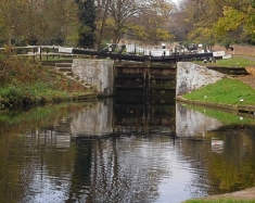
The bifurcation is about 34 feet above sea-level. From that point, the canal’s route curves leftward changing its direction from northwest to southwest, and in so doing it reaches land that is 86 feet above sea level. This curve is about 700 yards in length. To be able to move vessels between these two altitudes, there is a series of six hand-operated locks, known collectively as the Hanwell Lock Flight, an impressive sight. Each of the six locks enables a craft to negotiate about nine feet of the change in altitude.  This is slightly less than the deepest lock on the Grand Union Canal system, which is 11 feet and one inch at Denham Deep Lock.

An old wall, now a protected historical structure, to the east of much of this flight of locks separates the grounds of the former County Lunatic Asylum (‘Hanwell Asylum’) from the canal and its towpath. The wall, formerly that of the Lunatic Asylum, then that of St Bernard’s Hospital, and now that of Ealing Hospital, was probably built in the 1830s (https://historicengland.org.uk/listing/the-list/list-entry/1001963). As for the locks, they must have been constructed at the same time as the canal, that is between 1793, when its construction was authorised and 1805, when the section between Brentford and Braunston (in Oxfordshire) was completed. The work on the canal was supervised by William Jessup (1745-1814), who was the Chief Engineer, and James Barnes (c1740-1819), the Resident Engineer. Each lock is separated by a widened part of the canal, a pool where boats could wait before using the next lock on their journey. The pools have small ramps that were used to lead towing horses from the water if they fell into it accidentally as often happened, when they tripped on the towing ropes of barges awaiting the locks.

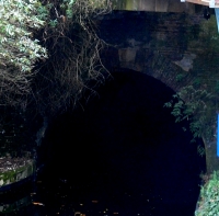
The wall of the former asylum has small blocked up rectangular openings a few inches above the towpath. These were designed to be opened if the asylum caught fire. Water taken from the canal could then be pumped through these holes and into the asylum precincts. Between Locks numbers 94 and 95, the pool widens slightly next to the wall of the former asylum.  The wall has a blocked-up archway, which used to be an entrance to the asylum. Old maps show that this archway led to a small quare dock within the walls of the asylum. The north and east sides of this dock were flanked with the asylum’s mortuary building. To the west of this, there was a burial ground. The dock was used to unload supplies, mainly coal, to the asylum. The asylum grew most of its own food, and any surplus that it produced was loaded on to barges at the dock.

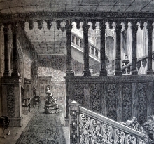
Hanwell Asylum was the first such county establishment to be opened in the county of Middlesex. The second was the better-known one at Colney Hatch (at Friern Barnet), which was opened in 1850. Writing in 1876 in his “Handbook to the Environs of London”, James Thorne describes that the inmates of the asylum were treated in ways far better than they might have been in other such places then and earlier. He wrote that the 1100 women and 650 men confined there ‘enjoyed’ a:

“…a system of entire ‘freedom from restraint on the part of the patients, ample occupation, amusement, and absence of seclusion; with constant kindness of manner and sleepless vigilance on the part of the attendants, and unceasing watchfulness by the superiors’, a system now happily established in all our larger asylums.”

These improvements were introduced under the management of the psychiatrist Dr John Conolly (1794-1866), who qualified in medicine at the University of Edinburgh in 1821. In 1828, he was appointed Professor of medical practice at the recently established University College in London (now ‘UCL’). Two years later, he published a book, “Indications of Insanity”, and in 1839 he became Resident Physician at the Hanwell Asylum. There, he introduced the practice of not restraining patients suffering with what was then known as ‘insanity’. Although he was not the first to do this, his actions ensured that humane methods of treatment including ‘non-restraint’ became accepted practice all over the country. In 1856, Conolly published a book on this subject, “The Treatment of the Insane without Mechanical Restraints”. Despite this, the patients were locked into the asylum beside the locks.

In 1929, the asylum was renamed as ‘St Bernard’s Hospital’, which it remained until the mid-1970s, when the government redeveloped the site to become part of Ealing Hospital. The former Victorian asylum buildings have become the Ealing Hospital, St. Bernard’s Wing, for psychiatric patients.

We walked along the Grand Union Canal/River Brent towpath from Brentford to the Hanwell Lock Flight, just over three miles. At times, the waterway passes so close to the M4 motorway that you can almost touch the traffic roaring past, yet even when this and modern buildings are nearby, the canal runs along a lovely corridor of greenery, where the occasional water fowl such as ducks, coots, cormorants, swans, and heron can be spotted. As you walk along, it is sometimes difficult to believe that you are winding your way through the sea of suburbia that spreads in all directions from the edges of central London. Once again, I am indebted to our friends from Richmond for opening our eyes to yet more of London’s delightful surprises.

We made our walk during the last week of the November 2020 covid19 ‘lockdown’. On reflection, it seems appropriate that our perambulation took us past locks and a place where unfortunates with mental disorders were once locked-up, or should one say ‘locked-down’?

A tunnel and a canal

LITTLE VENICE, near Paddington in London, is a picturesque spot with a large body of water where three waterways meet. The waterways are the part of the Grand Union canal system that links London with Birmingham. Two of the canals that meet at Little Venice are the two sections of the Grand Union Paddington Branch that links Paddington with Brentford. The third is the Regent’s Canal that links Little Venice with Limehouse Basin next to the Thames, 1.6 miles east of Tower Bridge. The body of water where these three waterways meet is triangular with an island in it. The waterways enter the large expanse of water at each of its three corners.

While the area hardly resembles the Italian island of Venice apart from the presence of water, some believe it might have been given its name, Little Venice, by a former local resident, the poet Robert Browning (1812-1889). Others question this, and believe that it was Lord Byron (1788-1824), who associated the name ‘Venice’ with the area (https://hydeparknow.uk/2017/11/11/browning-never-dreamt-up-little-venice/). Apparently, Byron compared the dirtiness of the canals in Venice with those in Paddington:

“There would be nothing to make the canal of Venice more poetical than that of Paddington, were it not for its artificial adjuncts.”

Whatever the origin of its name, Little Venice is now a lovely oasis, favoured by tourists, locals, and waterfowl.

The Regent’s Canal leaves the Little Venice triangle of water by passing beneath the bridge carrying Warwick Road and heads northeast for 475 yards. It is flanked by Blomfield Road, lined with fabulous mansions, on its north side, and Maida Avenue on its south side. Then it enters a 243-yard-long tunnel that begins beneath a café on the Maida Vale section of Edgeware Road, which follows the route of the Roman road, Watling Street. The canal emerges from the tunnel a few yards north east of the eastern end of Aberdeen Street. This street, which has few if any outstanding architectural features, was once the home of the bomber pilot Guy Gibson (1918-1944) who was awarded a Victoria Cross; he was the Leader of the Dambusters Raid in 1943.

The tunnel through which the Regent’s Canal flows is called the ‘Maida Hill Tunnel’. The tunnel was constructed between 1812 and 1816. There are no towpaths in the tunnel, which is narrower than the open-air sections of the canal at either end of it. Therefore, horses could not be used to drag the barges through this subterranean section of the canal. Instead, the barges had to be ‘legged’. Men lay on their backs on planks on top of the barge, and using their raised legs, they pressed their feet against the roof of the tunnel, ‘walked’ them along it, and thus propelled the vessel through the tunnel. This was not without its dangers. For example, in 1825 the planks supporting three men, who were working their way along the roof of the tunnel, accidentally slipped off the top of the barge. One man was seriously injured and the other two were killed.

Much water has flowed through the tunnel since then. Today, pleasure barges, powered by engines, still pass through it. One day, when the pandemic eases up and the weather is better, we hope to take one of the popular cruises from Little Venice to Camden Lock via the Maida Hill Tunnel.

A Jewish academy in north London

WHEN I ENTERED HIGHGATE School at the age of thirteen, daily attendance of religious activity was obligatory. Highgate School was basically a Church of England establishment, but by 1965, 400 years after the school’s founding, it recognised religious diversity to some extent. I was offered the choice of attending ‘chapel’ (Church of England), or ‘Roman Catholic Circle’, or ‘Jewish Circle’. In those, now far-off days, the options of ‘Hindu Circle’ and ‘Islamic Circle’ or even ‘Witches Circle’ were not available.

A few days ago, I received a facsimile edition of “The Northern Heights of London” by the Quaker William Howitt (1792-1879), published in 1869. In a short section on religious communities in Highgate, I read the following:

“Some years ago there was a Jewish academy in Highgate, conducted by Mr Hyman Hurwitz. It was the only thing of the kind in the kingdom, except one on a small scale in Brighton. It had generally about a hundred pupils, sons of the chief families of the Jews; and there was a synagogue for their use. There was also a school for Jewish young ladies, established by Miss Hurwitz, the sister of Mr Hurwitz.”

Seeing this, which was information I had never seen before, I reached for my copy of “A History of the Jews in England” by Albert Montefiore Hyamson (1875-1954), published in 1928. I bought my copy of this book in a second-hand bookshop in Bangalore (India) for a mere 200 Indian Rupees (currently just over £2).  Hyamson, a civil servant and historian, was an ardent advocate of founding a single state for Arabs and Jews in Palestine, an idea that infuriated many Zionists. Regarding Hyman Hurwitz (1770-1844), he wrote in some detail, which I will summarise and add to.

Hurwitz, born in Posen (now ‘Poznan’ in Poland), was a friend of the poet Samuel Taylor Coleridge (1772-1834), who is buried in Highgate, where he died. They lived near each other in Highgate:

“Coleridge and Hurwitz were neighbors and friends living in Highgate, London, England. There are fourteen letters from Coleridge discussing the work of both Hurwitz and Coleridge, including publishing and editing. One letter dated 17 May 1825 from Coleridge encloses a note from his nephew John Taylor Coleridge regarding publication of Hurtwitz’s work through Mr. Murray. A theoretical discussion on the history of language by Coleridge is the subject of the 16 September 1829 letter. The correspondence also includes a recommendation from Coleridge to Leonard Horner regarding Hurwitz’s position as Hebrew professor at the new University College, London, dated 27 November 1827.” (https://franklin.library.upenn.edu/catalog/FRANKLIN_9954204173503681).

 Hurwitz opened The Highgate Academy, a higher school for Jewish boys, in about 1799. Later, on the recommendation of Coleridge, he was appointed the first Professor of Hebrew at University College (London), now UCL, which was founded as a university for Jews, atheists, dissenters, and women, in 1826. Hurwitz’s publications included “Introduction to Hebrew Grammar” (1835), which was the standard grammar for English Jews for many years, and “Hebrew Tales” (1826) as well as “Vindicia Hebraica” (1820).  

The school in Highgate was housed in Church House, which I will discuss soon. In 1821, Hurwitz extended the lease on these premises for another seventeen years. Soon after this, he handed over the direction of his school to his assistant Leopold Neumegen (1787-1875), who moved from Highgate to Kew in 1840, where he lived in Gloucester House, and is buried in a Jewish cemetery in Fulham. In 1821 or 1822, Hurwitz moved his home from Highgate to Grenada Cottage in the Old Kent Road (“Marginalia: Camden to Hutton”, by Samuel Taylor Coleridge, publ. by Princeton University Press: 1980).

Chris Rubinstein wrote (www.friendsofcoleridge.com/MembersOnly/CB24/12%20CB%2024%20Rubinstein.pdf) that Coleridge’s friendship with Hurwitz continued after Hyman left Highgate:

“Coleridge described him as the Luther of Judaism. His eulogies of Hurwitz in his Notebooks and letters were copious from 1816 onwards. The two co-operated in the field of Hebrew learning, each of use to the other as they both well knew. Coleridge relied on Hurwitz for much of his understanding of meanings in the Old Testament, as Hurwitz was authoritative regarding the subtleties of Hebrew, ‘the science of words’ Coleridge’s own phrase. Without his help Coleridge’s vast erudition would have been seriously diminished. And he helped Hurwitz with publication of a least two of his books, one a study of the Hebrew Language, then innovative though ultimately superseded, and the other Hebrew Tales, a best-seller in the 19th century. Coleridge himself contributed three of its many insightful and telling anecdotes. Each of them used the other’s knowledge openly and with attribution.”

So much for the close relationship between a famous poet and a now obscure Jewish scholar. Let us return to Church House in Highgate. Church House is currently number 10 South Grove, next door to the Highgate Literary and Scientific Institution, in the heart of Highgate Village. The land on which it stands was once owned by Sir Roger de Cholmeley (c1485-1565), who founded Highgate School in 1565, which I attended between 1965 and 1970. The present building with its red brick façade was built in the early 18th century.

In 1759, the house came into the possession of Sir John Hawkins (1719-1789), a surveyor and lawyer. Following his death, the house was left to his wife, and then to his son, John Sidney Hawkins, who died in 1842.  It was from this man that Hurwitz leased Church House at first between 1800 and 1820, and then for a further 17 years as already mentioned (https://www.british-history.ac.uk/survey-london/vol17/pt1/pp32-38).

Well, I did not know anything about Hurwitz and his Highgate Jewish school when I was at the older educational establishment not many yards away. I used to pass Church House every Thursday morning when those, including me, who had opted for Chapel rather than Jewish Circle or Roman Catholic Circle, attended a morning service at the Victorian Gothic Church of St Michael not far from it.

Hurwitz was born in what was Prussia a couple of decades before my great-great grandfather Dr Nathan Ginsberg (1814-1890), who was born in the Prussian city of Breslau (now ‘Wrocław’ in Poland). Both men were intellectual giants. Neither of them would have been able to teach in German universities without first converting to Christianity. Both of them founded schools for Jewish children, Hyman in London, and Nathan in the Prussian city of Beuthen (now ‘Bytom’, in Poland). Nathan, my ancestor, started his school because he was unwilling to be baptised in order to be eligible to accept the professorships he was offered in Germany. Hyman established his school in London before Jews were able to teach in English Universities, but fortunately for him the establishment of University College with its willingness to accept Jewish people, allowed him to become a professor. I wonder whether my forefather, Nathan,  ever considered trying to become a university teacher at the university in London that opened when he was only twelve years old and about which he must surely have been aware as he grew older.

Appeasement and leisure in a London park

NEVILLE CHAMBERLAIN (1869-1940) has earned a poor reputation, mainly because of his unfortunate policy of appeasement with Nazi Germany in the late 1930s, which included the Munich Agreement in September 1938, which allowed the Nazis to invade the Sudetenland, the western part of Czechoslovakia. It took the disastrous German invasion of Poland before the then Prime Minister, Chamberlain, finally made Britain declare war on Germany.

Today (24th of November 2020), we revisited Gunnersbury Park, which we ‘discovered’ for the first time a few weeks earlier. The front of the grand house, the Large Mansion, which was acquired by Nathan, a member of the Rothschild family, in 1835, has a terrace running next to its long rear façade. At each end of the terrace, there are two neo-classical archways, which we did not examine carefully on our first visit.

In one of these arches, there are two commemorative tablets inscribed in upper-case lettering. Both note the fact that Gunnersbury Park was opened for use by the public by “The Right Hon. Neville Chamberlain, M.P., Minister of Health”. The rest of the information on the tablets relates to the financing of the purchase of the park (from Lionel Nathan de Rothschild). One tablet commemorates that a quarter of the cost of the park, purchased by the Boroughs of both Acton and Ealing, was provided by Middlesex County Council. The other tablet recalls that in 1927, The Urban District Council of Brentford and Chiswick joined those of Acton and Ealing in the ownership and running of the public park. Thus, for a while, the park was managed by three different district councils. In 1965, Brentford and Chiswick became absorbed into the new Borough of Hounslow. That year, the Borough of Acton became part of the new enlarged Borough of Ealing. So, now the park is managed by two boroughs instead of three. According to a gardener, with whom we spoke, one of these boroughs has spent far more money on the park than the other.

In 1926, when he opened the park at an occasion that has been recorded on film (https://player.bfi.org.uk/free/film/watch-the-official-opening-of-gunnersbury-park-by-the-rt-hon-neville-chamberlain-m-p-1926), Neville Chamberlain was Member of Parliament for Birmingham Ladywood, representing the Unionist party, now part of the Conservative and Unionist party. Two years before he opened Gunnersbury Park, he was appointed Minister of Health by the then Prime Minister Stanley Baldwin.

Although he might have had good reasons for doing so, allowing the Germans to enter Czechoslovakia and overrun the Sudetenland seems unforgivable. However, and this by no means makes his policy of Appeasement more palatable, his opening the gates of Gunnersbury Park to the public has provided joy to visitors from near and far for many decades. I heartily recommend a visit to this lovely place filled with picturesque delights.

Kit Kat in Hampstead

KIT KAT CONFECTIONERY BARS are familiar to many people and I enjoy eating them occasionally. The ‘Kit Kat’ and ‘Kit Cat’ tradenames were registered by the Rowntree’s confectionery company in 1911, but the first chocolates bearing this name only appeared in 1920. Had you wanted to eat a Kit Kat in the early 18th century London, you would not have been served a chocolate item but a type of mutton pie. The Kit Kat mutton pie was the creation of Christopher Catling (aka ‘Katt’ and ‘Cat’), who had a pie house in Shire Lane near Temple Bar, which used to stand near the present-day Royal Courts of Justice on London’s Strand.

When walking in Hampstead Village recently, we saw something I had never noticed before during at least 60 years of visiting the area. It was wording above the doorway of a house on the corner of Heath Street and the much narrower Holly Bush Steps. The words are: “Kit Cat House” and (below them) “A.D. 1745”. Above one of the ground floor windows, that which is nearest to Heath Street but on the wall facing Holly Bush Steps, there are some painted letters, which I will discuss later.

The Kit Cat Club (also sometimes spelled as ‘Kit Kat’) was an 18th century club whose members were of the Whig political persuasion. Members included  literary men such as William Congreve, John Locke, Sir John Vanbrugh, and Joseph Addison; and politicians including Duke of Somerset, the Earl of Burlington, Duke of Newcastle-upon-Tyne, The Earl of Stanhope, Viscount Cobham, Abraham Stanyan and Sir Robert Walpole, who was Prime Minister between 1721 and 1742. The painter Sir Godfrey Kneller (1646-1723) was yet another member. He painted portraits of 48 members of the club, which are now kept in the National portrait Gallery.

The club is commonly believed to be named after Christopher Catling and his mutton pies, but this is not known for certain. The club’s meetings were held at first in Catling’s tavern in Shire Lane (which no longer exists). Then, they were held at the Fountain Tavern on the Strand, which stood where today stands Simpsons on the Strand, and then later at purpose-built premises at Barn Elms (between Barnes and Fulham). In summer, the members met at the Upper Flask in Hampstead.

The Upper Flask, which was demolished long ago, was a pub located on the corner of East Heath Road and Heath Mount, that is on the south corner of East Heath Road and Heath Street, about 190 yards north of the present Kit Cat House on Holly Bush Steps. It was on the site of the now closed Queen Mary’s Maternity Home that received patients between 1919 and 1975.

Edward Walford, writing in his encyclopaedic “Old and New London” (volume 5, published in 1878), noted:

“The ‘Upper Flask’ was at one time called ‘Upper Bowling-green House,’ from its possessing a very good bowling green …  when the Kit-Kat Club was in its glory, its members were accustomed to transfer their meetings in summer time to this tavern, whose walls – if walls have ears – must have listened to some rare and racy conversations … Mr Howitt in his ‘Northern Heights of London’ gives a view of the house as it appeared when that work was published (1869). The author states that the members of the Kit-Kat Club used ‘to sip their ale under the old mulberry tree, which still flourishes, though now bound together by iron bands, and showing signs of great age…’”

During the later year’s of the Club’s existence, in the first quarter of the 18th century, some of those members who sipped ale under this tree included the poets Shelley and Keats, who lived in Hampstead. Another member, who enjoyed meetings at the Upper Flask, the poet and physician Richard Blackmore (1654-1729), penned these lines about them in his poem “The Kit-Kats” (published in 1708):

“Or when, Apollo-like, thou’st pleased to lead

Thy sons to feast on Hampstead’s airy head:

Hampstead, that, towering in superior sky,

Now with Parnassus does in honour vie.”

So, the Kit Cat Club had an association with Hampstead, but was there any connection between the Club and the house on Holly Bush Steps, which bears the date 1745? The house was built in about 1800 (https://historicengland.org.uk/images-books/photos/item/IOE01/15805/21), which is after the period between 1696 and 1720, when the Club was active (https://doi.org/10.1093/ref:odnb/73609). It is also after the date above the door, ‘1745’.

An old postcard, published sometime between 1903 and 1930, reveals that the house was once a shop belonging to ‘Francis’. This was J Francis of number 1 Holly Bush Steps. What J Francis sold is not certain but above the whitewash that covers the wall of the ground floor, the remains of an old painted sign can be seen on the brickwork. It reads:

“Libraries” and also “S ?? D”, the two question marks represent letters that have disappeared.  Other letters below the word ‘libraries’ have also gone. I wonder whether it once read ‘Libraries bought and sold’. Interesting as this is, it does not explain to me why the house is so named or the significance of the date 1745. So far, and this might be purely coincidental, the only connection I have found is that Robert Walpole, a member of the Kit Cat Club, died in 1745. However, I am not at all sure that this is why the date appears below the name above the door of the house on Holly Bush Steps.

I enjoy chance findings like that which I noticed in Hampstead and investigating their histories. I am not sure that I am much the wiser about the naming on the house on Holly Bush Steps, but whilst trying to find out about it, I have learnt a little more about the history of Hampstead, a part of London that was important to me during my childhood and which I continue to enjoy visiting. And as for Kit Kats, I would prefer that you offer me the chocolate version, rather than the mutton one.

William Wordsworth and others in Golders Green

HAD YOU VISITED GOLDERS GREEN in 1876, you would have arrived at:
“… a little outlying cluster of cottages, with an inn, the White Swan, whose garden is in great favour with London holiday makers … from the village there are pleasant walks by lanes and footpaths …” So, wrote James Thorne in his “Handbook to the Environs of London”. Of these lanes, Hoop Lane still exists. The White Swan was in business until recently but has disappeared since I took a photograph of it about three years ago.. I do not think that I would recommend Golders Green as a holiday destination anymore. It is not unpleasant, but it is no longer rural and lacks the atmosphere of a resort. The poet and physician Mark Akenside (1721-1770), a friend of the politician Jeremiah Dyson (1722-1776), who had a house in Golders Green, and a frequent visitor to Dyson’s place, wrote, while recovering from an ailment:

“Thy verdant scenes, O Goulder’s Hill,

Once more I seek a languid guest;

With throbbing temples and with burden’d breast

Once more I climb thy steep aerial way,

O faithful cure of oft-returning ill …”

Another poet, now better known than Akenside, William Wordsworth (1770-1850) wrote:

“I am not unfrequently a visitor on Hampstead Heath, and seldom pass by the entrance of Mr Dyson’s villa, on Golder’s Hill, close by, without thinking of the pleasures which Akenside often had there.”

In those far-off days visitors from London could either reach Golders Green by crossing the range of hills north of Hampstead on a road that follows the path of the present North End Road or, after 1835, when it was completed, by travelling along Finchley Road. The end of Golders Green’s existence as a rural outpost of London and its development as a residential suburb began in June 1907, when the  Charing Cross, Euston & Hampstead Railway (now part of the Underground’s Northern Line) opened the above-ground Golders Green Station.

My family used Golders Green Station on an almost daily basis. During my childhood, there were two ways of entering it. One way, which still exists, is from the large station forecourt, the local bus and coach station. The other way, which was closed at least 35 years ago, was from Finchley Road. An entrance beneath the railway bridge led to a long, covered walkway (see the illustration above) under an elaborate wooden structure, open to the outside air on most of its two sides. The husband of one of my father’s secretaries once remarked that the wooden canopy reminded him of structures he had seen in India. Having visited India myself, I now know what made him think of that.  The walkway led to a ticket office, beyond which there was a corridor from which staircases provided access to the outdoor platforms. Our family favoured using the Finchley Road entrance because it was slightly closer to our home in Hampstead Garden Suburb than the other one next to the bus yard.

In the early 1960s, when I was still a young child, northbound Underground trains coming from the centre of London stopped on one of the two northbound tracks that ran through the station. In those days, the doors on both the left and right sides of the train opened in Golders Green. If the train entered on the left track, that closest to the bus yard side of the station, we used to leave the train by the right hand doors, which led to the platform whose access staircases were closest to the Finchley Road entrance. We did this almost like a reflex action, without thinking about it.

One day, after my father had taken me to spend time in town with him, probably at his workplace, the LSE, we returned to Golders Green by Underground. As usual, since the train had stopped at the platform closest to the bus yard, we waited for the opening of the doors on the right-hand side of the train. Standing facing these doors, we could hear the opening of the doors on the left-hand side. We waited and waited, and then the train began to continue its journey northwards towards the next station, Brent. We were astonished that ‘our’ doors had not opened. My father was mildly upset by this. We behaved like creatures of habit. I was really pleased because I had always wanted to travel beyond Golders Green Station to see what exciting scenery lay beyond it.  It was not, I remember, the rural scenes that visitors in the 19th century and earlier would have enjoyed.

The abolitionist’s country home: Wilberforce in north London

THE RIDGEWAY IN MILL HILL, with spectacular views over north London and the nearby countryside from each side of it, is a pleasant place to wander. St Pauls Church is a simple Gothic revival edifice. It stands across the road from the famous Mill Hill School (established in 1807) and one of a line of three war memorials separated from each other by a few yards. The church has a plaque attached to it that informs the viewer that it was built by the anti-slave trade activist and politician William Wilberforce (1759-1833), consecrated in 1833, and became a parish church in 1926.

While we were looking at the plaque, a man (a cleric) arrived by car, unlocked the church, and invited us inside. We asked him about Wilberforce and his connections with Mill Hill. He told us that the great abolitionist had lived in Mill Hill and was for a short while the neighbour of his friend Sir Stamford Raffles (1781-1826), who is best known for his ‘founding’ of Singapore. Our new acquaintance explained that Raffles’ widow, his second wife, was buried in the churchyard of St Pauls (Mill Hill), but not the great man himself. Raffles, who was an abolitionist, was disliked by Theodor Williams, the Vicar of the parish of Hendon in which Mill Hill lay, who was sympathetic to slavery because his family had profited from slavery in Jamaica. Williams insisted that Raffles be buried outside the parish church rather than within it. Until 1914, the whereabouts of Raffle’s remains were unknown until they were stumbled upon by accident in a vault whilst the ground was being dug up to build an extension to the church. In contrast, his one-time neighbour, Wilberforce was interred in Westminster Abbey.

As an aside, but one which is important for me who has an interest in double-headed eagles, the Raffles coat-of-arms includes one of these imaginary creatures.

Returning to Wilberforce and Raffles, our informant told us that they were neighbours at Highwood Park (on Highwood Hill), 1100 yards northwest of St Pauls. William Hague, politician, and author of a biography of William Wilberforce (first published in 2008), wrote that the abolitionist moved into his new home in Mill Hill on the 16th of June 1826. Wilberforce wrote:

“I shall be a little zemindar, one hundred and forty acres of land, cottages of my own, etc.”

By ‘zemindar’, he was referring to ‘zamindar’, the Hindustani word meaning ‘landowner’. Wilberforce’s neighbour, Raffles, was already installed at Highwood Park when the abolitionist moved next door. Raffles wrote of his home there (quoted in “Handbook to the Environs of London” by James Thorne [publ. 1876]):

“A happy retirement … a house small but compact … Wilberforce takes possession tomorrow of the next-door house so that we be next-door neighbours and divided the hill between us.”

Sadly, Raffles died on the 5th of July 1826, shortly after his friend Wilberforce moved on to Highwood Hill.

Before moving to Mill Hill, Wilberforce had lived for some time in Kensington Gore, which runs along the south side of Kensington Gardens. His home from 1808 to 1821 was Gore House, built in the 1750s and set in three acres of grounds. It had interiors designed by Robert Adam, but sadly it was demolished and eventually replaced by the Royal Albert Hall, which occupies the site of the house and its grounds. Writing in the 1880s, Edward Walford quoted Wilberforce as having written of Gore House:

“We are just one mile from the turnpike at Hyde Park Corner, having about three acres of pleasure-ground around our house, or rather behind it, and several old trees, walnut and mulberry, of thick foliage. I can sit and read under their shade with as much admiration of the beauties of nature as if I were down in Yorkshire, or anywhere else 200 miles from the great city.”

Highwood Hill on the edge of London would have provided the ageing Wilberforce with what he had enjoyed at Gore House but without being so close to the heart of London.

Prior to moving into Mill Hill, Wilberforce had lived in Marden Hall in Surrey and at ‘The Chestnuts’ on Honeycroft Hill in Uxbridge. Unfortunate circumstances led to Wilberforce having to leave Mill Hill prematurely. These included financial difficulties arising from falling income from his land in Yorkshire and losses incurred by his son William. By the end of 1830, Wilberforce and his wife decided that they had to move out of their home on Highfield Hill. They moved to Brighstone on the Isle of Wight, and then later to East Farleigh in Kent.

Wilberforce felt that there was one disadvantage of Mill Hill when he moved there in 1826. The problem was that the nearest church, the parish church at Hendon, was three miles away. William Hague explains what happened next. Here is a summary of what he wrote. In Spring 1828, Wilberforce spent two months in London during which he approached the Church Commissioners regarding establishing a new church near his home in Mill Hill. At first, his plans for the church were welcomed by Theodor Williams, the Vicar of Hendon, who was, as already noted, unfriendly to the anti-slavery movement. However, once the construction of the chapel, the present St Pauls on the Ridgeway, began, Williams reacted vigorously against the idea.  Hague is not certain what caused this change of heart on Williams’ part. One reason might have been that there was an Act of Parliament that allowed the founder of a new church to select and appoint its vicar. Another was that Williams was known not to like the Evangelicals, which included Wilberforce and other promoters of the abolition of slavery.

Despite the difficulties raised by the Vicar of Hendon, the chapel was built, but remained a chapel rather than a parish church until 1926. We liked the simple architecture of the spacious church, but this view was not shared by the architectural historian Nikolaus Pevsner and his co-author Bridget Cherry, who wrote:

“A typical cheap church of its date in the Commissioners’ style…”

The church contains some attractive stained-glass windows. That above the high altar at the eastern edge of the church is a copy, in painted glass, of “Dead Christ and Three Marys” by Annibale Carracci (1557-1602). It was created by Charles Muss (1779-1824) and WG Hodgson and dated 1809. Muss was an enamel painter to King George IV. Three other remarkable windows were created more recently (www.stpaulschurchmillhill.co.uk/jubilee-window.php). One of them, illustrated above, depicts chains and alludes to Wilberforce and slavery; another commemorates the Middlesex Regiment, which used to have some barracks in Mill Hill; and the third celebrates the Diamond Jubilee of Queen Elizabeth II.

We drove to Highwood Hill to see what, if anything, is left of the houses occupied by Raffles and his neighbour Wilberforce. Highwood House, built soon after 1817 and much altered since, was hidden from view behind dense vegetation and by a building close to the road. Just east of this across the narrow Nan Clarks Lane, there is a decaying wooden signboard to which a metal commemorative plaque is affixed, which faces the main road, Highwood Hill (the A5109). The plaque bears the words:

“Site of Hendon Park residence of William Wilberforce from 1826 to 1831.”

Behind the sign, there is a newish wooden fence, the boundary of a small estate of large residential houses. Hendon park was:

“… a substantial brick building in 1756 … was rebuilt and stuccoed in the early 19th century … it had fallen into neglect by 1951 and had been replaced by three houses and Crown Close by 1961 …” (www.british-history.ac.uk/vch/middx/vol5/pp21-23).

We left Mill Hill, having learnt much about two men, whose connection with the place we were previously unaware. There is far more to Mill Hill than this and I hope to write about other aspects of this lovely part of London in the future.

Then and now: Holland House in London before and after the 2nd World War

HOLLAND HOUSE in Holland Park (west London) was built in the early 17th century (about 1604) in the Jacobean style. It was designed by the architect John Thorpe (dates uncertain: c1555-c1655), who is thought to be the creator of Audley End House in Essex. In 1939, King George VI and his wife Queen Elizabeth (the Queen Mother) attended a debutante ball at Holland House. Little did they know that this was to be the last great ball to be held at the house. After the German Luftwaffe began devastating London, Holland House was hit by twenty-two incendiary bombs during a ten-hour raid on the night of the 27th of September 1940. Much of the old house was destroyed apart from the east wing. Fortunately, the library and its valuable contents remained undamaged. A video (www.britishpathe.com/video/holland-house-damaged) made by Pathé News shows the house shortly after it was bombed.

The house remained as a ruin until 1952 when its then owner, Giles Fox-Strangways, 6th Earl of Ilchester (1874-1959), a Member of the Royal Commission on the Historical Monuments of England from 1939–1959, sold the remains of the house and its extensive grounds (now Holland Park) to the London County Council. Eventually in 1986, what was left of the building was transferred to the Royal Borough of Kensington and Chelsea. In normal, non covid19, summers, the now well-preserved remains of the house become the home of a temporary theatre where opera is performed. For many years, but no longer, the relatively intact part of the house was used as a youth hostel by the YHA.

Recently, I have acquired a facsimile edition of “History and Antiquities of Kensington” by Thomas Faulkner, which was published originally in 1820. I have also my own copy of an original edition of Volume 5 of “Old and New London” by Edward Walford, published in 1878. Both books were published when Holland House was still intact, and both contain engravings showing how the house looked both outside and inside.  Faulkner’s book contains a lengthy detailed listing of all the artworks and books that the house contained. These items included several paintings by artists as famous as Teniers, Canaletto, Joshua Reynolds, and Hogarth, to name but a few. Luckily, most of the art treasures in the house were removed for safety before the outbreak of WW2.  The illustrations, some of which I have reproduced, demonstrate how great a tragedy it was that Holland House no longer remains intact.

The illustrations to this article can be viewed at: https://londonadam.travellerspoint.com/60/  

Secret garden

MUCH OF GREATER LONDON is green space, which has not been built on. According to one source of information, Greenspace Information for Greater London CIC (‘GiGL’; http://www.gigl.org.uk):

“Roughly 47% of Greater London is ‘green’; 33% of London is natural habitats within open space according to surveyed habitat information and an additional 14% is estimated to be vegetated private, domestic garden land.”

Of this ‘green space’, much is accessible to the public either free of charge (e.g. Regents Park) or for a fee (e.g. Kew Gardens). This piece is about an example of a type of green space in London that is open to a select few. I am referring to many of the gardens in London squares that are or were surrounded by residential buildings. Some of these (e.g. Gordon Square in Bloomsbury) have been taken over by local councils and are now open to the public in general. However, many of these garden squares contain gardens that may only be entered by people who are eligible to be able to pay a fee for a key to unlock them. Some of the squares confine those eligible for keys to residents in the square or in neighbouring streets. I know of one privately owned garden, that within Princes Square near Bayswater, which is open to anyone who can afford the annual fee. This square garden, being privately owned, is dependent for membership fees to ensure its maintenance. Those eligible to use the gardens within squares, whether privately or partially privately maintained, can be expected to pay something towards the maintenance of these often-beautiful local amenities.

Recently, a friend admitted us to the garden of Norland Square in Kensington. Like many of these limited access gardens, it is surrounded by formidable cast-iron railings. These railings were removed during the Second World War when metals required for war materials were in short supply. They were only replaced in 2007. Like most of these squares, the passer-by cannot see much within the garden beyond the railings because of hedges and other vegetation grown just within them to preserve the privacy of those using the garden. So, being allowed to enter Norland Square provided us a rare opportunity to examine the interior of one of these ‘secret’ gardens.

Norland Square takes its name from the Norland Estate, 52 acres of land bounded to the south by Holland Park Avenue, on the east by roads now named ‘Pottery Lane’ and ‘Portland Road’, on the west  by the boundaries of the parishes of Kensington and Hammersmith (www.british-history.ac.uk/survey-london/vol37/pp276-297). The northern edge of the estate was roughly 200 yards north of the present Wilsham Street. The estate passed through several owners in the 18th century. They lived in a mansion, demolished long ago, which used to stand close to the present number 130 Holland Park Avenue. The name ‘Norland’ was used as early as 1599 to describe the ‘Northlands’, the land in the northern part of the Parish of Kensington (north of the present Holland Park Avenue), which includes the estate (www.rbkc.gov.uk/sites/default/files/atoms/files/Norland%20CAPS.pdf).

Writing in 1878, Edward Walford, author of a series of books called “Old and New London”, noted that during the reign of William IV, the then well-wooded estate belonged to one of the Drummonds, a family of bankers of Charing Cross. Prior to these occupants, the first to live in the former Norland House was Thomas Marquois (died 1802), ‘Professor of Artillery and Fortification’, who used the building as an academy to teach both civil and military subjects to sons of the gentry, who were hoping to join the British Army. According to the website about the Norland Estate mentioned above:

“Board and lodging, plus instruction in Greek, Latin, French, writing and arithmetic could be had for thirty guineas a year, but fortification, mathematics, navigation, drawing, geography, dancing, fencing and riding were all charged as extras. Marquois’ prospectus contains a plan of the academy and its grounds, which were indeed very well suited to his purposes. Besides the house itself there were stables, a manege or riding house, a fives court, a cricket ground, gravelled drives for hack riding, and an artificial ‘mount’ from which the various activities of the pupils could be kept under constant review.”

Marquois relinquished the property after only four years in 1765.

In 1825, fire destroyed Norland House. In 1838, Benjamin Lewis Vulliamy (1780-1854), clockmaker to the Crown, who then owned the Norland Estate, sold it and the ruins of the mansion to a solicitor Charles Richardson, who raised money to develop the estate for building purposes. The layout and design of the southern part of the estate, including Norland Square, was carried out by the architect Robert Cantwell (c1793-1859). The houses on Norland Square were leased to their first occupiers by Charles Richardson in 1842 and 1843.

Except for Norland Square Mansions on the south-west corner of the square, which has a few features slightly suggestive of art-deco style, the other houses surrounding the square are those built in the early 1840s. The mansion block occupies numbers 53 to 57 Norland Square. Interestingly, these plots do not figure in a list of the original lessees of the other plots in the square. Number 52, which neighbours the mansion block was leased to Robert Cantwell in 1842. A detailed map surveyed in 1865 shows that where Norland Square Mansions stands today, there were no houses but instead a garden extending between number 52 and a house, now no longer standing, on the corner of the square and Holland Park Avenue (then named ‘Uxbridge Road’). On a map dated 1913, the position of the mansion block was occupied by a school. This same building, which has a different ground plan to the current block of flats was still present on a detailed map surveyed in 1938. So, it would be reasonable to say that the mansion block was built after 1938.

Getting back to the present, we found that the ‘secret garden’ in the centre of Norland Square is both attractive and well-maintained. In addition to an extensive lawn furnished with occasional wooden benches and a table, there are plenty of shrubs and trees. There is a small well-equipped children’s play area at one end of the garden and tennis courts at the opposite end. While we spent time in the garden, a couple of elderly women were taking their daily walk around it and a young lady was exercising her dog. Areas like this are invaluable during periods of ‘lockdown’ during the current covid19 pandemic, offering lucky city-dwellers a welcome respite from being ‘confined to barracks’ and if they are fortunate to have a garden, they provide a much larger open space to ‘take the air’ than their own smaller patches. We were both grateful and happy to have been able to see and experience what is usually hidden from us by iron railings and curtains of dense vegetation.

Strolling beside a bubbling brook

THE BRENT IS a tributary of the River Thames. When I wrote about it elsewhere (https://londonadam.travellerspoint.com/33/), I mentioned that the two main tributaries of the Brent are Mutton Brook, which has its source in East Finchley and Dollis Brook, the subject of this piece.

On his useful illustrated website (https://www.londonslostrivers.com/dollis-brook.html), Paul Talling describes the course of the Dollis Brook as follows:

“Dollis Brook rises on Moat Mount Open Space in Mill Hill … flows eastwards through Totteridge Fields … then through fields and open spaces to King George V Playing Fields. The brook  then turns southwards and forms the eastern boundary of Totteridge past Totteridge Lane near Totteridge and Whetstone tube station … continues south through Woodside Park (where it merges with Folly Brook) and West Finchley … Dollis Brook then passes under Dollis Road and through Windsor Open Space to the Great North Way (A1). Near Bridge Lane in Hendon it merges with Mutton Brook to form the River Brent.”

One sunny Sunday morning, we joined the footpath that runs alongside the winding Dollis Brook at a bridge crossing it. Halfway across the bridge is the boundary between Laurel Way in the N20 postal district and Laurel View, which is in the N12 postal district. The footpath, which has a well-made surface, free of mud, is part of the Dollis Valley Greenwalk.  By heading north, we entered an area named Whetstone Stray. During the 19th century:

“Whetstone Stray was once part of the Baxendale Estate. Joseph Baxendale had taken over Pickford Brothers, and the area of Whetstone Stray had been used as grazing ground for the 1000 or so horses used in their carrying business. … On the death of Joseph Baxendale in 1872, there were problems over the division of the land.” (https://whetstoneallotments.co.uk/)

The origin of this area’s name is uncertain, but it is likely to have something to do with either grazing horses or with land whose ownership is uncertain or land on which horses could be ‘strayed’. Whatever its meaning, this corridor of meadows and trees along which the Dollis Brook follows its very wiggly course makes for a pleasant place to walk.  Although it was far from crowded, there were plenty of other people enjoying it. What struck us was that the folk that we met were a cosmopolitan bunch. We heard snatches of conversation in a wide variety of languages. This was a complete contrast to the meadows at Runnymede, which we had visited the day before. There, apart from a few tourists from the Indian subcontinent, most people appeared to be of Anglo-Saxon origin.

The northern end of Whetstone Stray is where it meets Totteridge Lane, close to Totteridge and Whetstone Underground Station. The name ‘Totteridge’ is probably derived from the Anglo-Saxon root ‘tot’, meaning an ‘elevation’, and the English word ‘ridge’. An alternative etymology is that the name comes from the name of a Celtic deity ‘Taith’. The Underground Station, which is on the High Barnet branch of the Northern Line, is above ground and a simple building of indifferent architectural merit. It opened as a station on the Great Northern Railway in 1872 and became part of the Underground network in 1940. The Waiting Room Café nearby provided acceptable coffee.

The Dollis Brook continues north after passing beneath bridge carrying Totteridge Lane. The Greenwalk also continues in the same direction. Whereas the Whetstone Stray is a fairly narrow densely vegetated stretch of land, the land through which the path continues is wider and less full of trees. It runs through open fields and parallel to the tracks of the Northern Line, which is almost hidden from view by bushes. However, the roar of passing trains is easily heard and the trains can be seen through gaps in vegetation. The path splits into two soon after leaving Totteridge Lane. One path closer to the Dollis Brook is for cyclists and another further from the still winding stream is reserved for pedestrians. The narrow brook is often hidden by the dense growth of trees and bushes alongside it. However, it can be seen that the riverbed makes many tight U-turns along its course.

After passing Brook Farm Open Space, the brook begins flowing from the west. Brook Farm no longer exists. Next, our path skirted the south edge of a vast open space called Barnet Playing Fields.  We ended our outbound walk at Barnet Table Tennis Centre and then retraced our steps. As we walked towards Totteridge and Whetstone Station, the horizon was dominated by a less than attractive tall building. This was built as the headquarters of British Ever Ready Electrical Company. Then, it became offices for the London Borough of Barnet and was known as ‘Barnet House’. Currently, its future hangs in the balance while developers fight to get permission to get it converted to 256 flats, some of which would be amongst the smallest in London (some as small as 16 square metres). The building was completed in 1966 to the designs of R Seifert and Partners, who designed Centre Point close by Tottenham Court Road Station.

In summary, the walk beside Dollis Brook is yet another example of London’s wealth of pleasant open spaces where city dwellers can enjoy some of the pleasures of the countryside without leaving the metropolis.