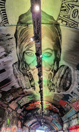
LEAKE STREET RUNS beneath the platforms and tracks of London’s Waterloo Station. It is 300 yards long and its walls and ceiling are covered with colourful graffiti created with cans of paint spray. The artwork creation in this street that runs in a tunnel was inaugurated in May 2008 during the Cans Festival, which was organised by the artist known as Banksy.
Unlike many public places in London, painting the walls in Leake Street is legal. Walking along this highly decorated street is a magnificent experience, which you can repeat often because the images on the wall are frequently changed. If you are lucky, you can watch the artists in action.
IT IS NOT NECESSARY to be able to hold your breath for a long time or to carry a snorkel or even air cylinders to be able to stroll leisurely deep below the surface of London’s River Thames. If you fancy a walk beneath the water, the Greenwich Foot Tunnel is the place to be. It can be entered by stairs or using a wood panel-lined lift from one of its two entrances – the southern one near the Cutty Sark in Greenwich, and the northern one at Island Gardens.
The tunnel, which is circular in cross-section, is 405 yards in length, and 50 feet beneath the river at its deepest point. For most of its length it is 3 yards (9 feet) in diameter, and it slopes downwards at both ends. Its construction began in 1899 and was completed in 1902. Therefore, building the tunnel happened during the entire time that the 2nd Anglo-Boer War was being fought in South Africa. The lifts that are housed beneath domed structures at each end of the tunnel were ready for use in 1904. Judging by the appearance of the wood panelling within the lift carriages, it looks as if these were installed many years ago. Despite their vintage appearance the lifts have been modernised and work without needing an operator.
Although there many notices forbidding cycling in the tunnel, there is no shortage of cyclists disobeying this rule. This makes walking in the tunnel slightly hazardous as the cyclists speed along the narrow walkway in the long, straight tunnel. Using the tunnel is a convenient way of traversing the Thames and gives one the opportunity to walk under water.
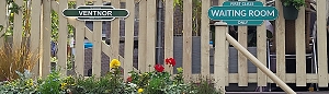
THERE WAS A TIME when one could take a train from London to Portsmouth, cross the Solent by ferry to Ryde on the Isle of Wight, and then take another train from Ryde to Ventnor. This was before 1966 when the station at Ventnor was closed forever. A century earlier, in 1866, this station opened to rail traffic. The closure was part of an extensive plan (devised by Dr Richard Beeching [1913-1985]) to reduce Britain’s railway mileage.
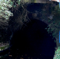
The station, the southern terminus of the isle of Wight Railway, with its associated sidings was located on the site of an old quarry. It was almost completely surrounded by high cliffs. Trains reached it from Shanklin by emerging from a 1312-yard-long tunnel running beneath St Boniface Down. It must have been dramatic emerging from the tunnel to find oneself in the space surrounded by vertiginous rocky walls.
Today, the entrance to the tunnel, through which water pipes now run, is hidden by dense foliage. Nothing remains of the tracks, and only a small part of the former station building (ticket office etc.) remains. The space once occupied by the platforms and railway lines is now occupied by an assortment of buildings, comprising an industrial estate. Trains still run between Ryde and Shanklin, but Ventnor station has all but vanished.
BEFORE THE ADVENT of railways, transportation of goods across England (as well as Wales and Scotland) was heavily dependent on an extensive canal system constructed mostly in the 18th and early 19th centuries. Freight was carried along these canals in the holds of long narrow barges, more correctly known known as ‘narrow boats’. They had to be narrow enough to negotiate some of the narrower canals that formed part of the canal network. Prior to the development of steam and other kinds of engines, and even for some years after these became available, the narrow boats were towed by horses. These creatures walked along paths known as ‘towpaths’ that run along one or other side of a canal, except when a canal passed through a tunnel. In the tunnels there were no towpaths, and the boats were propelled by the feet of men lying either above the load on the boat or sometimes on planks projecting from the sides of the vessel, a process known as ‘legging’. The boatmen’s feet literally walked along the tunnel walls, thus moving the boat. Meanwhile, the towing horses walked over the hill through which the tunnel passed. All of this interesting but becomes even more so if you can experience a trip on a canal in a narrow boat.
Several companies offer canal trips between Little Venice (near London’s Paddington) and Camden Lock, east of it. We chose to travel on “Jason”, a narrow boat built in 1906 and one of the last of its era, which is still in use. “Jason” has been little modified compared to others that ply the route along the Regents Canal, a branch of the Grand Union Canal system. “Jason”, which was originally horse-drawn, has been fitted with a diesel engine that occupies part of the small rear located cabin that was once the home to a boatman and his family. Passengers sit in the long, narrow freight hold of the boat under an awning that was added when “Jason” was converted from a freight carrier to a tourist vessel, which has been doing the tours since 1951. Unlike most of the other tourist boats, there are no windows separating passengers from the exterior. This provides for great viewing along the route without the hindrance of sometimes not too clean glass, which might be encountered in other vessels.
The tour starts from a landing stage next to Blomfield Road, close to the cast-iron bridge that carries Westbourne Terrace Road over the Paddington Arm of the Grand Union Canal. At the other end of the trip, passengers disembark or embark next to the popular (not with me) and rather ‘tacky’ Camden Lock Market. The cruise between the two landing stages takes 45 minutes and is highly enjoyable. Travelling eastwards from Little Venice, we were given an extremely clear and intelligent commentary by a lady called Sarah. Various things she told us made a strong impression on me.
The Regents Canal that links Paddington Basin to Limehouse Basin in east London, where it leads to other canals, used to carry a wide range of goods, from coal to cocoa. The waterway passes under both rail and road bridges. Many of the latter have curved arches over the canal; are made of stone; and look older than the rail bridges, most of which have rectangular arches with roofs consisting of metal plates screwed together. Over the years, the tow ropes drawing the narrow boats have cut grooves or notches in the corners of the bridges next to the towpath. Some of the bridges have been protected from this damage by iron brackets placed so that the ropes passed over these instead of the masonry of the bridge. These metal protectors, which were easily replaceable, can now be seen to be notched where the ropes have abraded them.
“Jason”, like most other narrow boats, has a flat bottom and a shallow draught. This is because the water most of the canal system is quite shallow, usually not more than 6 feet deep. The bottom of “Jason” is made of wood (probably elm) and iron, a combination known as a ‘composite’ construction. Few narrow boats with this kind of construction exist today.
The most fascinating thing that Sarah told us related to the history of Lord’s Cricket Ground. In 1787, Thomas Lord (1755-1832), a professional cricket player, opened his first cricket ground in what is now Dorset Square (close to Baker Street Underground station). In 1809, Lord shifted his cricket ground to another location because the rent at his Dorset Square site became too high. The new location was on some disused ground just south of the present Lord’s Cricket Ground. It was where today the Regents Canal emerges from the eastern end of the 272-yard-long Maida Hill Tunnel. Let me explain.
In 1813, Parliament altered the route of the proposed Regents Canal so that it passed right through Mr Lord’s recently relocated cricket ground (www.lords.org/lords/our-history/timeline). Mr Lord was unhappy about this and was not prepared to give up his ground without first going to court. According to our guide, Lord struck a deal with the government. He agreed to move to a new site providing he was given all the earth that was excavated during the construction of the Maida Hill Tunnel. He used the vast amount of excavated earth to lay out the ground on which the present Lord’s Cricket pitches are now located.
Concerning construction, Sarah told us that not only had the tunnels been dug by hand, but also the entire canal system. Most of the manual workers were Irish and were known as ‘navigational engineers’, or ‘navvies’ for short. The base of the Regents Canal is lined with compressed clay to make it watertight, a difficult process when the canal was built.
The cruise between Little Venice and Camden passes through a variety of landscapes, ranging from disused industrial to almost bucolic. The canal passes through the northern edge of Regents Park, where it is lined with trees and parkland. In this stretch of the canal, it is difficult to believe one is in the middle of a huge metropolis and not in the deep countryside. The waterway also passes through the London Zoo. On one side, if you are lucky, you can catch glimpses of African hunting dogs and the occasional warthog in their cages overlooking the canal. Opposite them on the northern bank of the canal is Lord Snowdon’s aviary, now devoid of birds and awaiting a new purpose.
The 45-minute cruise provides an enchanting view of several districts of London. The commentary provided by Sarah and what she pointed out along the route helps recreate in one’s mind the golden age of canal transport. We enjoyed the cruise in both directions and hope that many others will take advantage of the special experience that it provides. For booking details and other practical information, consult “Jason’s” website: www.jasons.co.uk/the-tour
IF THE RAILWAY authorities did not prevent people from wandering along the track as many people do in India (for example), taking a photograph of an amazing construction at the base of London’s Primrose Hill would be simple. But, wisely, they do not encourage people to risk their lives on tracks that carry high speed trains from London’s Euston station to places north of it. The remarkable edifice to which I am referring is the eastern entrance to the Primrose Hill Tunnels that originally carried lines of the London and Birmingham Railway (‘L&BR’) underground between Primrose Hill Road in the east and Finchley Road in the west. Short of trespassing on the tracks, the best place to see the entrance is through the railings on the north side of King Henrys Road a few feet east of Primrose Hill Road.
The Roundhouse
The Primrose Hill tunnels were the first railway tunnels dug in London and some of the first in the United Kingdom (https://historicengland.org.uk/listing/the-list/list-entry/1329904). The tunnels had to be built strong enough to withstand the weight of houses that were to be built above them. The land beneath which the trains pass is part of the Eton Estate (owned by Eton College). When the railway was being laid in the early 19th century, the Estate raised objections initially, worrying that running a railway through a deep cutting would reduce the saleability of the land, the Chalcot Estate owned by Eton, through which it ran. However:
“The L&BR bought off any possible College obstruction by agreeing to put the line in a tunnel through the Chalcots Estate. From an engineering viewpoint this was unnecessary as the rails were never more than 50 ft below the ground surface, and side slopes of 1 on 2 were specified initially. A tunnel had the merit of using no land, the surface being preserved for building …” (http://www.crht1837.org/history/tunnel).
Digging the tunnels was not without danger. Workmen got killed. When this happened, their bodies were taken at first to be laid out in a local hostelry, The Chalk Farm Tavern. This place in Regents Park Road was rebuilt in 1853-54 and its new building is now home to Lemonia, a popular Greek restaurant. So, next time you are enjoying a plate of tzatziki or a souvlaki, just remember that years ago there was a mortuary for railway navvies near your table.
Today, there are two tunnels commencing at Primrose Hill Road. The northern one, nearest Adelaide Road, was the first to be built, in 1837. The southern one, nearest King Henrys Road, was built about 40 years later. Part of Eton College Estate’s requirements of the L&BR was:
“… the mouth of the Tunnel at the eastern end shall be made good and finished with a substantial and ornamental facing of brickwork or masonry to the satisfaction of the Provost and College…” (http://www.crht1837.org/history/tunnel).
The portals at this end of the tunnel, which can just about be seen from King Henrys Road, are grand and impressive examples of neo-classical Italianate masonry. The northern portal, the first to be constructed, was designed by William H Budden, who was appointed as an office assistant to the L&BR in May 1834 (https://etheses.whiterose.ac.uk/16826/1/Railway%20tunnels%20recovered%203.pdf). The newer southern portal is a replica of the earlier one.
The graffiti-covered iron railway bridge that is 530 yards east of the tunnel, quite close to the house on King Henrys Road once occupied by the Indian politician and lawyer Dr Bhimrao Ramji Ambedkar (1891-1956), is easy to see, but far less attractive than the tunnels’ magnificent portals. Now a pedestrian and cycle bridge, it carries the northern section of Regents Park Road across the tracks. The present bridge, made of iron, was constructed in 1846 to replace an earlier one built in brick in 1839 (http://primrosehillhistory.org/?p=388). Until 1992, passengers could board and disembark from trains at a station at the northern end of the bridge. Opened in 1859, this station was named ‘Hampstead Road’, then ‘Chalk Farm’, and finally ‘Primrose Hill’.
Whereas the Primrose Hill Tunnel portals can only be glimpsed with great difficulty, the largely brick-built Roundhouse, a few yards south of Chalk Farm Underground Station, is impossible to miss. Located close to the railway tracks a few yards east of the Regents Park Road footbridge, this circular building was built as a railway locomotive shed in 1846-47. It was designed by Robert Benson Dockray (1811-1871), who had been an Assistant Engineer during the construction of the pioneering Stockton and Darlington Railway in 1835 (https://www.locallocalhistory.co.uk/ctown/p001/pages39-42.htm). The building was made circular because in its centre there was a turntable for moving the locomotives that were stored on tracks radiating out from it.
In 1967, the then disused Roundhouse was converted into a huge theatre. From the 1970s onwards, I used to attend occasional performances there. Amongst these, I particularly recall a somewhat raunchy show put on by the Grande Magic Circus, a French company, and many years later, an incomprehensible performance of Shakespeare’s “A Midsummers Night Dream”, which was performed in a variety of Indian languages by a troupe of acrobatic gymnasts. In recent years, a sculpture by Antony Gormley has been placed on the roof of a modern annex of the Roundhouse.
Private functions are also held in the Roundhouse. On one occasion, we were invited to a bat-mitzvah held there. Drinks and canapés were served in the circular upper floor gallery that runs around the circular auditorium. I was extremely surprised when one of the other guests came up to me and after looking me up and down, said:
“You must be in the fashion business.”
For a moment I was flattered, then I wondered whether he had had one too many or was visually impaired.
LITTLE VENICE, near Paddington in London, is a picturesque spot with a large body of water where three waterways meet. The waterways are the part of the Grand Union canal system that links London with Birmingham. Two of the canals that meet at Little Venice are the two sections of the Grand Union Paddington Branch that links Paddington with Brentford. The third is the Regent’s Canal that links Little Venice with Limehouse Basin next to the Thames, 1.6 miles east of Tower Bridge. The body of water where these three waterways meet is triangular with an island in it. The waterways enter the large expanse of water at each of its three corners.
While the area hardly resembles the Italian island of Venice apart from the presence of water, some believe it might have been given its name, Little Venice, by a former local resident, the poet Robert Browning (1812-1889). Others question this, and believe that it was Lord Byron (1788-1824), who associated the name ‘Venice’ with the area (https://hydeparknow.uk/2017/11/11/browning-never-dreamt-up-little-venice/). Apparently, Byron compared the dirtiness of the canals in Venice with those in Paddington:
“There would be nothing to make the canal of Venice more poetical than that of Paddington, were it not for its artificial adjuncts.”
Whatever the origin of its name, Little Venice is now a lovely oasis, favoured by tourists, locals, and waterfowl.
The Regent’s Canal leaves the Little Venice triangle of water by passing beneath the bridge carrying Warwick Road and heads northeast for 475 yards. It is flanked by Blomfield Road, lined with fabulous mansions, on its north side, and Maida Avenue on its south side. Then it enters a 243-yard-long tunnel that begins beneath a café on the Maida Vale section of Edgeware Road, which follows the route of the Roman road, Watling Street. The canal emerges from the tunnel a few yards north east of the eastern end of Aberdeen Street. This street, which has few if any outstanding architectural features, was once the home of the bomber pilot Guy Gibson (1918-1944) who was awarded a Victoria Cross; he was the Leader of the Dambusters Raid in 1943.
The tunnel through which the Regent’s Canal flows is called the ‘Maida Hill Tunnel’. The tunnel was constructed between 1812 and 1816. There are no towpaths in the tunnel, which is narrower than the open-air sections of the canal at either end of it. Therefore, horses could not be used to drag the barges through this subterranean section of the canal. Instead, the barges had to be ‘legged’. Men lay on their backs on planks on top of the barge, and using their raised legs, they pressed their feet against the roof of the tunnel, ‘walked’ them along it, and thus propelled the vessel through the tunnel. This was not without its dangers. For example, in 1825 the planks supporting three men, who were working their way along the roof of the tunnel, accidentally slipped off the top of the barge. One man was seriously injured and the other two were killed.
Much water has flowed through the tunnel since then. Today, pleasure barges, powered by engines, still pass through it. One day, when the pandemic eases up and the weather is better, we hope to take one of the popular cruises from Little Venice to Camden Lock via the Maida Hill Tunnel.