KENSINGTON GARDENS CONTAINS numerous works of art, one of which is a large piece by Henry Moore (1898-1986), a sculptor who is highly regarded by many people. It is a large irregularly shaped arch made of travertine, which stands overlooking the Long Water, the part of the Serpentine lake within the confines of Kensington Gardens. Presented by the artist to the park in 1980, its shape is based on that of an animal bone. I am not wild about Moore’s works, but this piece looks wonderful in its setting on the eastern bank of the Long Water.
Today, 19th of May 2021, whilst walking in Kensington Gardens I saw a heron standing on the western bank of the Long Water almost framed by the Moore arch. After circumnavigating the lake, we reached the point on the eastern shore where the sculpture stands. Through the archway you can see the eastern façade of Kensington Palace. Along the line that connects the palace and the sculpture, you can see another sculpture, “Physical Energy” by George Frederick Watts (1817-1904). The three items on this axis form a kind of timeline: the 18th century palace, the 19th century sculpture by Watts, and the 20th century sculpture by Moore.
I have walked past the Moore sculpture too many times to count, but it was only today that I saw a heron perched on top of it. I have seen geese and pigeons perched on it in the past, but this was the first time I saw a heron using it as a doubtless superb vantage point to survey its surroundings. Apart from the fact that I find herons beautiful, its close association with the sculpture struck a certain curious chord in my mind. Maybe, it was something to do with the fact that the words ‘heron’ and ‘henry’ share so many letters in common (3 out of 5). Whatever the reason, it was pleasing to see nature and art intimately in touch with each other.
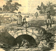
BEFORE THE ADVENT of railways, transportation of goods across England (as well as Wales and Scotland) was heavily dependent on an extensive canal system constructed mostly in the 18th and early 19th centuries. Freight was carried along these canals in the holds of long narrow barges, more correctly known known as ‘narrow boats’. They had to be narrow enough to negotiate some of the narrower canals that formed part of the canal network. Prior to the development of steam and other kinds of engines, and even for some years after these became available, the narrow boats were towed by horses. These creatures walked along paths known as ‘towpaths’ that run along one or other side of a canal, except when a canal passed through a tunnel. In the tunnels there were no towpaths, and the boats were propelled by the feet of men lying either above the load on the boat or sometimes on planks projecting from the sides of the vessel, a process known as ‘legging’. The boatmen’s feet literally walked along the tunnel walls, thus moving the boat. Meanwhile, the towing horses walked over the hill through which the tunnel passed. All of this interesting but becomes even more so if you can experience a trip on a canal in a narrow boat.
Several companies offer canal trips between Little Venice (near London’s Paddington) and Camden Lock, east of it. We chose to travel on “Jason”, a narrow boat built in 1906 and one of the last of its era, which is still in use. “Jason” has been little modified compared to others that ply the route along the Regents Canal, a branch of the Grand Union Canal system. “Jason”, which was originally horse-drawn, has been fitted with a diesel engine that occupies part of the small rear located cabin that was once the home to a boatman and his family. Passengers sit in the long, narrow freight hold of the boat under an awning that was added when “Jason” was converted from a freight carrier to a tourist vessel, which has been doing the tours since 1951. Unlike most of the other tourist boats, there are no windows separating passengers from the exterior. This provides for great viewing along the route without the hindrance of sometimes not too clean glass, which might be encountered in other vessels.
The tour starts from a landing stage next to Blomfield Road, close to the cast-iron bridge that carries Westbourne Terrace Road over the Paddington Arm of the Grand Union Canal. At the other end of the trip, passengers disembark or embark next to the popular (not with me) and rather ‘tacky’ Camden Lock Market. The cruise between the two landing stages takes 45 minutes and is highly enjoyable. Travelling eastwards from Little Venice, we were given an extremely clear and intelligent commentary by a lady called Sarah. Various things she told us made a strong impression on me.
The Regents Canal that links Paddington Basin to Limehouse Basin in east London, where it leads to other canals, used to carry a wide range of goods, from coal to cocoa. The waterway passes under both rail and road bridges. Many of the latter have curved arches over the canal; are made of stone; and look older than the rail bridges, most of which have rectangular arches with roofs consisting of metal plates screwed together. Over the years, the tow ropes drawing the narrow boats have cut grooves or notches in the corners of the bridges next to the towpath. Some of the bridges have been protected from this damage by iron brackets placed so that the ropes passed over these instead of the masonry of the bridge. These metal protectors, which were easily replaceable, can now be seen to be notched where the ropes have abraded them.
“Jason”, like most other narrow boats, has a flat bottom and a shallow draught. This is because the water most of the canal system is quite shallow, usually not more than 6 feet deep. The bottom of “Jason” is made of wood (probably elm) and iron, a combination known as a ‘composite’ construction. Few narrow boats with this kind of construction exist today.
The most fascinating thing that Sarah told us related to the history of Lord’s Cricket Ground. In 1787, Thomas Lord (1755-1832), a professional cricket player, opened his first cricket ground in what is now Dorset Square (close to Baker Street Underground station). In 1809, Lord shifted his cricket ground to another location because the rent at his Dorset Square site became too high. The new location was on some disused ground just south of the present Lord’s Cricket Ground. It was where today the Regents Canal emerges from the eastern end of the 272-yard-long Maida Hill Tunnel. Let me explain.
In 1813, Parliament altered the route of the proposed Regents Canal so that it passed right through Mr Lord’s recently relocated cricket ground (www.lords.org/lords/our-history/timeline). Mr Lord was unhappy about this and was not prepared to give up his ground without first going to court. According to our guide, Lord struck a deal with the government. He agreed to move to a new site providing he was given all the earth that was excavated during the construction of the Maida Hill Tunnel. He used the vast amount of excavated earth to lay out the ground on which the present Lord’s Cricket pitches are now located.
Concerning construction, Sarah told us that not only had the tunnels been dug by hand, but also the entire canal system. Most of the manual workers were Irish and were known as ‘navigational engineers’, or ‘navvies’ for short. The base of the Regents Canal is lined with compressed clay to make it watertight, a difficult process when the canal was built.
The cruise between Little Venice and Camden passes through a variety of landscapes, ranging from disused industrial to almost bucolic. The canal passes through the northern edge of Regents Park, where it is lined with trees and parkland. In this stretch of the canal, it is difficult to believe one is in the middle of a huge metropolis and not in the deep countryside. The waterway also passes through the London Zoo. On one side, if you are lucky, you can catch glimpses of African hunting dogs and the occasional warthog in their cages overlooking the canal. Opposite them on the northern bank of the canal is Lord Snowdon’s aviary, now devoid of birds and awaiting a new purpose.
The 45-minute cruise provides an enchanting view of several districts of London. The commentary provided by Sarah and what she pointed out along the route helps recreate in one’s mind the golden age of canal transport. We enjoyed the cruise in both directions and hope that many others will take advantage of the special experience that it provides. For booking details and other practical information, consult “Jason’s” website: www.jasons.co.uk/the-tour
MANY PEOPLE ENJOY eating watercress. I quite like it, but it is not my favourite. I prefer eating its close and more piquant relatives: mustard and wasabi. As its name suggests, watercress is an aquatic plant that lives in a watery environment. It could almost be considered an edible water weed. This April (2021) we visited Ewelme, a small village in Oxfordshire, where watercress is cultivated in the river that runs through it. We had come to Ewelme to see its alms-houses and school, which were built in about 1437 and are still being used for their original purposes. I will relate more about these in the future.
On our way to the village, we met some cyclists, who told us about the watercress cultivation in Ewelme and recommended that we took a look at the set-up. I was interested to see it as I had never (knowingly) seen watercress growing. Also, I was curious because I have often walked past Willow Cottages on Willow Road in Hampstead. It was in this row of dwellings that Hampstead’s watercress pickers lived many years ago. They gathered the crop from streams flowing on nearby Hampstead Heath.
The name Ewelme is derived from the Old English ‘Ae-whylme’ meaning ‘waters whelming’ or ‘source of a stream or river’. In the early 13th century, the place was known as ‘Eawelma’. The spring after which the village is named is just north of Ewelme. Water from the spring that flows through the village is in Ewelme Brook, which is a short tributary of the nearby River Thames. It meets the Thames 1.2 miles upstream from Wallingford Bridge. Watercress grows best in alkaline water such as flows in Ewelme Brook, which rises in the chalky Chiltern Hills.
The watercress beds can be found in Ewelme near the northern end of the High Street, northwest of the attractive village pond that forms a part of the Brook. They were established in the 19th century. Watercress from Ewelme was taken to Wallingford from where it was carried further afield by train. In 1881, the idea of a rail link between Ewelme and Wallingford was mooted, but the line was never built. It was in that year that:
“…Smiths of Lewknor and South Weston, who were established at Brownings by 1881, and created cress beds along the roadside stream probably in stages. The business continued until 1988, with cress initially transported from Watlington station for sale in the Midlands, Covent Garden, and Oxford.” (www.british-history.ac.uk/vch/oxon/vol18/pp192-234)
The watercress beds at Ewelme are a series of rectangular enclosures in a widened part of the stream. The cress grows, floating on the water in the enclosures. Pairs of enclosures are arranged sequentially like shallow steps in a staircase. The shallow water flows rapidly from one enclosure to the next through small gaps in the stone barriers that demarcate them. Swarms of watercress leaves on their stems almost fill each of the enclosures, deriving nutrients and water from the continuously changing water flowing through their roots. I imagine that picking the crop involves wading in the watery watercress beds.
Although Oxfordshire is no longer one of the major counties for watercress cultivation, what can be seen at Ewelme is pleasing to the eye. The counties where most of this plant is now grown include Hampshire, Dorset, Wiltshire, and Hertfordshire (https://en.wikipedia.org/wiki/Watercress). Alresford in Hampshire, near Winchester, is known as the UK’s watercress capital.
Although I am not keen on raw watercress, I prefer it served in a soup. My late aunt used to make a superb watercress soup using fresh watercress added at the last minute to a homemade vegetable stock. We have tried making it with meat stock, but this was not nearly as nice because the fresh taste of the almost uncooked watercress gets masked by the flavour of the stock. With this small bit of culinary advice, I will leave the watercress beds of Ewelme and wish you “bon appetit”.
LIFE DEPENDS ON WATER. A few days ago, at the end of March 2021, we drove to a village in Oxfordshire to see two old wells. They are no ordinary wells: they were gifts from India while it was still part of the British Empire.
Maharajah’s Well at Stoke Row
Edward Anderton Reade (1807-1886) was a British civil servant in India between 1826 and 1860. Brother of the novelist Charles Read (author of “The Cloister and the Hearth”), Edward was born in Ipsden, a village in Oxfordshire (www.oxforddnb.com/). He entered the East India Company in 1823. In 1832, he was transferred to Kanpur (Cawnpore), where he introduced opium cultivation to the district. In 1846, he became Commissioner to the Benares Division, a position he held until 1853 when he was moved to Agra.
Edward encouraged genial relations with the local Indian gentry and aristocracy. One of his Indian acquaintances, who became his good friend, was Ishri Prasad Narayan Singh (1822-1889), the Maharajah of Benares, who reigned from 1835 to 1889. During the years before the Indian Rebellion of 1857 (aka ‘First War of Independence’ or ‘The Indian Mutiny’), Reade and the Maharajah discussed much about England including the shortage of water that existed in Ipsden, the part of Oxfordshire where his family lived. Apparently, the villagers in this part of the Chiltern Hills had little or no access to clean drinking water, much as must have been the case for many villagers in India.
During the Rebellion of 1857, the Maharajah remained loyal to the British. In June 1857, the town of Kanpur was besieged by Nana Sahib and his forces. After 3 weeks, the British garrison surrendered under condition that the British inhabitants would be given safe passage out of the town. However, Nana Sahib decided to hold about 120 women and children and kept them housed in a house known as the ‘Bibighar’. This ended badly when some of the hostages were killed. Some of them tried to escape their grizzly end by jumping into a well at the Bibighar. This well became one of the most powerful images of the Rebellion in the minds of those who lived in Britain.
I do not know whether or not it was the tragedy at Bibighar that brought the conversations he had with Reade to the forefront of the mind of the Maharajah of Benares after the Rebellion was over, but in 1862, after his loyalty to the British had been formally recognised, he consulted Reade as to making a charitable gift to the poor people of Ipsden, whose plight he recalled. The Maharajah financed the construction of a well at Stoke Row, not far from Ipsden. It is also possible that the Maharajah remembered the help that Reade had given him when constructing a well in Azamgarh (now in Uttar Pradesh) back in 1831.
Work commenced on the well in March 1863. The well shaft was dug by hand, a perilous job for the labourers as they removed earth from the depths of an unlit and unventilated shaft, bucket by bucket. The shaft, 4 feet in diameter, was 368 feet in depth, greater than the height of St Pauls Cathedral in London, for this is depth of the water table at Stoke Row. Special winding machinery constructed by Wilder, an engineering firm in Wallingford, was installed. It is topped with a model elephant. The mechanism and the well stand beneath an octagonal canopy topped with a magnificent metal dome with circular glazed windows to allow better illumination. It resembles a ‘chhatri’ or architectural umbrella such as can be seen at war memorials on London’s Constitution Hill and on the South Downs near Hove. The structure, restored in recent times, looks almost new today. Reade, who helped plan the Maharajah’s well, planted a cherry orchard nearby; dug a fish-shaped pond (the fish was part of the Maharajah’s coat-of-arms); and constructed an octagonal well-keeper’s bungalow next to the well. The profits from the cherries harvested from the orchard were supposed to help to finance the well, for whose water the villagers were not charged anything. The Maharajah’s well at Stoke Row was the first of many such gifts given by wealthy Indians to Britain. Other examples include the Readymoney drinking fountain in Regents Park and a now demolished drinking fountain in Hyde Park, close to Marble Arch. According to the Dictionary of National Biography:
“Reade was wryly amused that an Indian prince should thus give a lesson in charity to the English gentry.”
The well at Stoke Row provided the locals with fresh water until the beginning of WW2, when, eventually, piped water reached the area. It provided 600 to 700 gallons of water every day. The Maharajah’s Well at Stoke Row is relatively well-known compared to another Indian-financed well next to the parish church at Ipsden, where Reade’s grave is located. The well, whose winding mechanism is similar to that installed at Stoke Row, is not covered by a canopy. It stands by a cottage next to the entrance to the churchyard. It was presented to Ipsden in 1865 by ‘Rajah Sir Deon Narayun Singh of Seidpor Bittree’ (I am not sure where this is: these are the words on the well), who had, like the Maharajah of Benares, remained loyal to the British during the 1857 Rebellion.
The Ipsden well is deep but not nearly as deep as that at Stoke Row. A lady, who lives in the cottage beside the well, told us that she had tasted water from the well and it was ice cold, deliciously clean, and tasted pure, having been filtered by many feet of chalk through which it has seeped. She said that once a year, the local water board opens the well and takes a sample of its water to check its purity.
Both wells are worth visiting. We parked in Benares Road in Stoke Row close to the Maharajah’s gift. After viewing the well head and its surroundings, we bought hot drinks at the village’s shop-cum-café, which his run by a couple of friendly people from Zimbabwe. I am grateful to Dr Peter U for bringing the existence of this unusual well to my attention.
THE NAME ‘TYBURN’ evokes thoughts of executions in many people’s minds. For, amongst the trees growing by the River Tyburn, there were many executions carried out in mediaeval and later times. Eventually, the place where these fatal punishments were performed was moved westwards to near where Marble Arch stands today. Amongst those who lost their lives, there were many unfortunate Roman Catholics, who were regarded as traitors because they wished to adhere to their religion. Today, the Tyburn Convent and Church stands at the eastern end of Bayswater close to the ‘Tyburn Tree’ the site of the executions (https://www.tyburnconvent.org.uk/tyburn-tree).
Shepherd’s Well, Hampstead; as it was during the early 19th century
The River Tyburn, now no longer visible, was one of several of the so-called ‘lost rivers’, tributaries of the River Thames that have been buried beneath the city of London. The Tyburn crossed what is now Oxford Street somewhere west of Marylebone Lane and east of Marble Arch, and then flowed southwards towards Green Park and then to the River Thames. Its exact course from Green Park to the Thames has been long forgotten because no reliable early map of the stream exists. It is also believed that the course of the river might have been altered several times.
According to Nicholas Barton in his informative “The Lost Rivers of London”, the Tyburn has or had one source at Shepherds Well in Hampstead and another in the grounds of the former Belsize Manor (on the present Haverstock Hill). Then it flowed south through Swiss Cottage towards the present Regents Park. There, it is carried in a pipe across the Regents Canal towards Marylebone Lane.
Various footpaths lead from the east side Fitzjohns Avenue that runs from Hampstead to Swiss Cottage. These paths bear the names Spring Path, Spring Walk, and Shepherd’s Path. They are all just north of Lyndhurst Road. Near the corner of Lyndhurst Road and Akenside Road, which runs south from it, there is a circular stone plaque bearing the words:
“For the good of the public this fountain is erected near to the site of an ancient conduit known as The Sheperd’s Well”
The drinking fountain, which was placed by the Metropolitan Drinking Fountain and Cattle Trough Association has been removed, leaving only the metal plate placed by the Association affixed to the pavement. The drinking fountain is said to have been near the conduit known as Shepherd’s Well, but I wondered where exactly was it located.
A glorious Victorian Gothic building called Old Conduit House stands between the site of the circular plaque and the corner of Lyndhurst Road and Lyndhurst Terrace (formerly known as ‘Windsor Terrace’). This building might possibly have been named in memory of the Shepherd’s Well water conduit. This house was built in about 1864 (https://historicengland.org.uk/listing/the-list/list-entry/1379406). A detailed map surveyed in 1866 marks the building and, more interestingly, a spot labelled ‘Conduit Wells’, which is in what was then open country a few yards west of Old Conduit House, near where Fitzjohns Avenue (not yet built in 1866) meets Lyndhurst Road.
Edward Walford writing in his “Old and New London” published in the 1880s reveals:
“Down till very recently, Hampstead was separated from Belsize Park, Kilburn, Portland Town etc. by a broad belt of meadows, known as Shepherds’ or Conduit Fields, across which ran a pleasant pathway sloping up to the south-western corner of the village, and terminating near Church Row.”
This pathway ran along the course of what has become Fitzjohns Avenue. Walford continued:
“On the eastern side of these fields is an old well or conduit, called the Shepherd’s Well, where visitors, in former times used to be supplied with a glass of the clearest and purest water. The spring served not only visitors but also the dwellers of Hampstead with water, and poor people used to fetch it and sell it by the bucket.”
From this description, it seems likely that what was marked on the 1866 map as ‘Conduit Wells’ was, in fact, the Shepherd’s Well. A map dated 1860 (www.theundergroundmap.com/article.html?id=3&zoom=13&annum=1860) shows ‘Shepherd’s Well’ in the same spot as the Conduit Wells on the 1866 map. Walford added that unlike other springs around Hampstead (e.g. The Chalybeate Well in Well Walk), the water of the Shepherd’s Well did not have a high mineral content. The probable location of the Shepherd’s Well is close to the Junction of Lyndhurst Road and Fitzjohns Avenue, probably a short distance south west of the end of Shepherd’s Path.
Having traced the probable location of one of the sources of the Tyburn, where it gained life in Hampstead, we can reflect that it was beside the elm trees that used to grow along its banks near Oxford Street that the lives of many people, both innocent and guilty, came to an end. That was before the site of execution was moved westwards to where Marble Arch stands today. The
A GROUP OF AGITATED SWANS were on a stream beneath an iron bridge. A wire mesh stretched from one bank of the waterway to the other was the cause of their frustration because some of the birds were on one side of the barrier and the rest on the other, and they had not yet discovered a way to pass the obstruction. It was distressing to watch a swan on one side pecking at the mesh trying to reach the beak of another doing the same thing on its side. The purpose of the mesh was not clear to me.
The water beneath this bridge at the northwest corner of the Waterhouse Plantation in London’s Bushy Park is flowing along the man-made Longford River. It runs from the River Colne at Longford, which is on the western edge of Heathrow Airport, to the River Thames. After being diverted into several separate channels, its waters flow into the Thames at three points near Hampton Court and Bushy Park. On reaching the northern edge of Bushy Park it flows under the bridge where I saw the frustrated swans and then through woodland until it reaches a large triangular pool, the Waterhouse Pond. From there, its waters flow through outlets controlled by sluices into a maze of streams, which water the grounds of parts of Bushy Park. The river and the Waterhouse Pond are elevated several feet above the surrounding terrain. This allows water to escape from the river via small channels and from the pond through the sluices, which have mechanical devices with taps to control the flow. Near the Waterhouse Pond there is a tall wooden totem pole, which was designed by Norman Tait and constructed in 1992. The pole was:
“Installed to mark the connection between Canada and Bushy Park, which housed a large Canadian camp during World War l.” (www.royalparks.org.uk/media-centre/factsheets-on-the-royal-parks/monuments/monuments-in-bushy-park)
The Waterhouse Pond was a noisy place when we visited it early one morning recently. Most of the noise was being made by pairs of Canada Geese, which was rather appropriate given that they were in sight of the totem pole. The geese were craning their long necks forward and cackling loudly, their reddish tongues very visible. Nearby, occasional Egyptian Geese with their characteristic ‘eye make-up’ colouring, were furiously proclaiming something that seemed most important to them. Elsewhere in the vicinity, there was a veritable symphony of bird calls including plenty produced by green parakeets which were perched on camellia bushes, some of them pecking away at the flowers, dislodging petals one by one as they searched for something tasty. It was pleasant to be in a place that humans were completely outnumbered by birds … and squirrels.
The Longford River that supplies the water lovely features in Bushy Park did not exist prior to 1638. In that year, in accordance with the wishes of the ill-fated King Charles I, the river (really, a canal) was constructed to bring water to Hampton Court and its neighbour Bushy Park. Twelve miles in length, it took only nine months to complete. Before the twentieth century, when it acquired its present name, the waterway was known variously as: the ‘New River’, the ‘King’s River’, the ‘Queen’s River’, the ‘Cardinal’s River’, the ‘Hampton Court Cut’, and the ‘Hampton Court Canal’ (https://en.wikipedia.org/wiki/Longford_River). There is another New River in Greater London, which, like the Longford, is man-made. The other New River, which retains its original name, was built in 1613 to carry drinking water from the River Lea at Ware in Hertfordshire to reservoirs in Islington.
The part of the Longford River, which I have been describing, runs through and irrigates the Waterhouse Plantation. This and its neighbour, another plantation, the Woodland Garden, where swamp cypresses with their curious aerial outcrops may be seen, were originally planted in the early 19th century (https://historicengland.org.uk/listing/the-list/list-entry/1000281). Both areas are surrounded by fences to prevent the ingress of deer that reside in Bushy Park. They were redeveloped extensively between 1948 and 1949, and now look well-established.
After having been introduced to it by friends, who live not far away from it in Richmond, we have visited Bushy Park several times and enjoyed its variety and wildlife every time. If you are planning a visit – something I recommend highly – try to reach it early, prefer well before 10am so that you will have no difficulty parking and because at that early hour the park is reasonably empty of other visitors, many of them are dogs, which are excluded from the plantations, with their owners; joggers in expensive gear; and ‘yummy mummies’ with infants in tow or in and out of upmarket push chairs.
It was unfortunate that Charles the First lost his head, but fortunate for us that he created a waterway that makes Bushy Park so delightful today.
WE OFTEN CIRCUMNAVIGATE the Serpentine. Usually, when we stroll around this large body of water shared between London’s Hyde Park and Kensington Gardens, we tend to look mainly towards the water with its busy groups of waterfowl, rather than inland away from the water. Today, in the last week of February 2021, we walked around the Serpentine yet again but this time as we rounded its westernmost end and began heading back along the northern shore, we noticed for the first time a clump of trees within which there is a group of buildings.
Sheep trough in Hyde Park
A wide path leads north from the water towards these buildings, first passing the small single storey Serpentine Lodge, which being close to the lakeshore footpath, I had noticed many times before. It was built in 1839 and was home to various officials connected with the park including the Head Park Constable Joseph Smith (1811-late 1880s), who was living there by 1871 and remained there until his death (https://ifthosewallscouldtalk.wordpress.com/2016/05/31/hidden-histories-serpentine-lodge-hyde-park-london/). The lodge is now a private residence.
Moving inland past the lodge, we soon reach an elegant brick-built two storey house with a triple bay on each side of the centrally located front door. This is the Ranger’s Lodge, which was built in 1831/2. It houses the park’s administrative offices. Attractive because of its age and lovely setting, it is not distinguished architecturally. It stands next to a newer and far more elegant building, The Old Police Station. When I saw the chimney stacks which are built with layers of brick alternating with layers of white stone and the windows framed with white masonry, I was immediately reminded of the former police station and courthouse that stands on Rosslyn Hill in Hampstead. Both police stations, the one in the park (built 1900-02) and that in Hampstead (1912), were designed by the same architect, John Dixon Butler (1860-1920), who designed almost 200 police stations. Two police officers on horses told us that in the yard behind the station, there are stables for the horses of the Park Police. The police station bears a memorial to Jack William Avery (1911-1940), a war reserve Metropolitan Police Constable, who was murdered near the station on the 5th of July 1940. He was stabbed to death by a homeless labourer named Frank Cobbett (https://en.wikipedia.org/wiki/Death_of_Jack_Avery). It was only in 2007 that the memorial plaque was placed in the park.
New Lodge, a large Victorian villa with at least three storeys, built in 1876, now a private residence, stands a few yards north of the police station. This lodge as well as others in the park, like Serpentine Lodge, can be leased from the Royal Parks as dwellings by private individuals and their families. A footpath leads northwest from between the police station and New Lodge and soon passes a disused water pump enclosed within a square area delineated by iron railings. A few feet north of the pump, there is what looks like a large bath next to a vertical pipe that might have once provided water. The map of the park describes these two items as “old sheep trough and water pump”. The bath-like object was the trough and is marked as such on a detailed map surveyed in 1862-6. This map also marks a small “fire engine house”, which no longer exists.
Another structure that no longer stands is a few yards west of Serpentine Lodge. It is commemorated by a stone lying in the grass. The stone bears an inscription that says that it marks the spot where there once stood the ‘Receiving House of the Royal Humane Society’. It had been erected on land granted by The Crown in 1774 and was severely damaged by a bomb during WW2. Its story and that of other receiving houses is related in an interesting article I found on the Internet (https://ifthosewallscouldtalk.wordpress.com/2016/05/31/hidden-histories-serpentine-lodge-hyde-park-london/):
“In 1774 two London doctors, William Hawes and Thomas Cogan, formed the ‘Society for the Recovery of Persons Apparently Drowned’ which later grew into The Royal Humane Society. The society was founded based on the doctors’ fears that people could be mistakenly taken for dead and thereby accidentally buried alive.
To combat this, a number of Receiving Houses were built along waterways in Westminster in the early nineteenth century. The Receiving Houses were designed as places where people could be taken into if they had gotten into difficulty in the water. A Receiving House was built in 1794 on the edge of the Serpentine…”
Judging by what is marked on a detailed map surveyed in 1914, the receiving house covered a considerably larger area than its neighbour, Serpentine Lodge.
Near to the marker for the former receiving house, there is an ugly black metal drinking fountain, marked on the park map as “Lutyens drinking fountain”. This was one of several similar fountains designed in 1950 by “Messrs Lutyens & Greenwood” (http://mdfcta.co.uk/fountains_lutyens.html). As the architect of New Delhi and Hampstead Garden Suburb, Edwin Lutyens, died in 1944, I imagine that the Lutyens who designed this ugly object might well have been his son Robert Lutyens (1901-1972), who published a book with his co-author Harold Greenwood in 1948.
The ugly drinking fountain no longer works. So, if you are thirsty having searched the hidden items that were new to us as described above, help is at hand a little further west, where there is an attractive modern wood-clad café kiosk, one of several of these designed trecently by the Mizzi Studio’s architects (www.floornature.com/).
THE ONLY MINERAL WATER you can get in London’s Hampstead today is bottled water from a shop or supermarket. In the 18th century, people came to Hampstead to imbibe the allegedly curative iron-rich chalybeate waters available from the spring in Well Walk or at the elegant spa rooms established on that street. Walking along that thoroughfare where once people flocked to take the water, which rivalled that which is still available at Tunbridge Wells in Kent, I remembered an experience in the Slovakian part of Czechoslovakia, before that country split into the separate Czech and Slovak republics in 1993.
With a friend, I drove to what was then Czechoslovakia in about 1992. The objects of my trip were to visit a country I had never been to before and to collect information about music in Czechoslovakia to help my friend, the late Michael Jacobs, who was writing a new edition of “The Blue Guide to Czechoslovakia”.
Bardejov, Slovakia
The furthest east place in which we stayed was the small town of Bardejov in north-eastern Slovakia. We did venture a bit further towards the edge of the country, to the Dukla Pass where there was a Soviet Russian victory over the Germans during WW2, but only as a day excursion.
At Bardejov, we booked into a hotel just outside the centre of the old, picturesque town. The accommodation was part of a spa complex, where people came to take the curative spring waters that issued from beneath the ground. My friend and I were keen to sample these, not because we were unwell, but out of curiosity.
The waters were dispensed in a building a few yards away from the hotel. It was late afternoon when we entered the tap room. A tubby woman in white uniform indicated that she was just about to close up for the day, but somehow, we communicated to her that we only wanted to taste one or two of the different spring waters. She was happy to oblige. She picked up a small porcelain beaker, and before filling it with some water from one of the springs, she rubbed the inside of the vessel with her (un-gloved) middle and index fingers. Seeing this, my travelling companion decided to give a miss to tasting, but I took a swig of the metallic tasting water.
I handed the beaker back to the attendant, who wiped it again with her two fingers, before filling it with water from another spring. I cannot remember that there was much difference between the tastes of the two waters I sampled. After thanking her for letting me try the waters, we returned to the hotel. At the back of my mind, I had two thoughts. One was that I hoped that I did not get ill after drinking from a glass that had been ‘wiped’ with fingers that had probably wiped many peoples’ beakers during the day. The other thought was that perhaps it was something in the lady’s fingers that gave the healing powers, rather than the spring waters themselves. I did not get ill but will probably never get to know whether my wild idea that it was the lady’s fingers that had curative properties, rather than the spring water, held even a grain (or drop) of truth.
A long time has passed since that visit to Czechoslovakia, but that brief experience at the spa near Bardejov lingers in my memory. Thinking about it makes me wonder about the hygiene of the conditions prevailing when people came to Hampstead to take the waters in the 18th century, when not much was known about the role of microbes in the transmission of diseases.
This brings me back to the present, when in the UK cafés can only serve hot drinks in disposable cups. Often these are covered with special lids with orifices through which the drinks can be sipped without removing them. I always remove these lids for two reasons. First, I do not like sipping through a tiny hole and, second, I wonder about the cleanliness of the server’s fingers, which place the lid on the cup. I will leave you with that worrying thought.