
THE NAME ‘TYBURN’ evokes thoughts of executions in many people’s minds. For, amongst the trees growing by the River Tyburn, there were many executions carried out in mediaeval and later times. Eventually, the place where these fatal punishments were performed was moved westwards to near where Marble Arch stands today. Amongst those who lost their lives, there were many unfortunate Roman Catholics, who were regarded as traitors because they wished to adhere to their religion. Today, the Tyburn Convent and Church stands at the eastern end of Bayswater close to the ‘Tyburn Tree’ the site of the executions (https://www.tyburnconvent.org.uk/tyburn-tree).
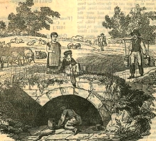
The River Tyburn, now no longer visible, was one of several of the so-called ‘lost rivers’, tributaries of the River Thames that have been buried beneath the city of London. The Tyburn crossed what is now Oxford Street somewhere west of Marylebone Lane and east of Marble Arch, and then flowed southwards towards Green Park and then to the River Thames. Its exact course from Green Park to the Thames has been long forgotten because no reliable early map of the stream exists. It is also believed that the course of the river might have been altered several times.
According to Nicholas Barton in his informative “The Lost Rivers of London”, the Tyburn has or had one source at Shepherds Well in Hampstead and another in the grounds of the former Belsize Manor (on the present Haverstock Hill). Then it flowed south through Swiss Cottage towards the present Regents Park. There, it is carried in a pipe across the Regents Canal towards Marylebone Lane.
Various footpaths lead from the east side Fitzjohns Avenue that runs from Hampstead to Swiss Cottage. These paths bear the names Spring Path, Spring Walk, and Shepherd’s Path. They are all just north of Lyndhurst Road. Near the corner of Lyndhurst Road and Akenside Road, which runs south from it, there is a circular stone plaque bearing the words:
“For the good of the public this fountain is erected near to the site of an ancient conduit known as The Sheperd’s Well”
The drinking fountain, which was placed by the Metropolitan Drinking Fountain and Cattle Trough Association has been removed, leaving only the metal plate placed by the Association affixed to the pavement. The drinking fountain is said to have been near the conduit known as Shepherd’s Well, but I wondered where exactly was it located.
A glorious Victorian Gothic building called Old Conduit House stands between the site of the circular plaque and the corner of Lyndhurst Road and Lyndhurst Terrace (formerly known as ‘Windsor Terrace’). This building might possibly have been named in memory of the Shepherd’s Well water conduit. This house was built in about 1864 (https://historicengland.org.uk/listing/the-list/list-entry/1379406). A detailed map surveyed in 1866 marks the building and, more interestingly, a spot labelled ‘Conduit Wells’, which is in what was then open country a few yards west of Old Conduit House, near where Fitzjohns Avenue (not yet built in 1866) meets Lyndhurst Road.
Edward Walford writing in his “Old and New London” published in the 1880s reveals:
“Down till very recently, Hampstead was separated from Belsize Park, Kilburn, Portland Town etc. by a broad belt of meadows, known as Shepherds’ or Conduit Fields, across which ran a pleasant pathway sloping up to the south-western corner of the village, and terminating near Church Row.”
This pathway ran along the course of what has become Fitzjohns Avenue. Walford continued:
“On the eastern side of these fields is an old well or conduit, called the Shepherd’s Well, where visitors, in former times used to be supplied with a glass of the clearest and purest water. The spring served not only visitors but also the dwellers of Hampstead with water, and poor people used to fetch it and sell it by the bucket.”
From this description, it seems likely that what was marked on the 1866 map as ‘Conduit Wells’ was, in fact, the Shepherd’s Well. A map dated 1860 (www.theundergroundmap.com/article.html?id=3&zoom=13&annum=1860) shows ‘Shepherd’s Well’ in the same spot as the Conduit Wells on the 1866 map. Walford added that unlike other springs around Hampstead (e.g. The Chalybeate Well in Well Walk), the water of the Shepherd’s Well did not have a high mineral content. The probable location of the Shepherd’s Well is close to the Junction of Lyndhurst Road and Fitzjohns Avenue, probably a short distance south west of the end of Shepherd’s Path.
Having traced the probable location of one of the sources of the Tyburn, where it gained life in Hampstead, we can reflect that it was beside the elm trees that used to grow along its banks near Oxford Street that the lives of many people, both innocent and guilty, came to an end. That was before the site of execution was moved westwards to where Marble Arch stands today. The
