NEVILLE CHAMBERLAIN (1869-1940) has earned a poor reputation, mainly because of his unfortunate policy of appeasement with Nazi Germany in the late 1930s, which included the Munich Agreement in September 1938, which allowed the Nazis to invade the Sudetenland, the western part of Czechoslovakia. It took the disastrous German invasion of Poland before the then Prime Minister, Chamberlain, finally made Britain declare war on Germany.
Today (24th of November 2020), we revisited Gunnersbury Park, which we ‘discovered’ for the first time a few weeks earlier. The front of the grand house, the Large Mansion, which was acquired by Nathan, a member of the Rothschild family, in 1835, has a terrace running next to its long rear façade. At each end of the terrace, there are two neo-classical archways, which we did not examine carefully on our first visit.
In one of these arches, there are two commemorative tablets inscribed in upper-case lettering. Both note the fact that Gunnersbury Park was opened for use by the public by “The Right Hon. Neville Chamberlain, M.P., Minister of Health”. The rest of the information on the tablets relates to the financing of the purchase of the park (from Lionel Nathan de Rothschild). One tablet commemorates that a quarter of the cost of the park, purchased by the Boroughs of both Acton and Ealing, was provided by Middlesex County Council. The other tablet recalls that in 1927, The Urban District Council of Brentford and Chiswick joined those of Acton and Ealing in the ownership and running of the public park. Thus, for a while, the park was managed by three different district councils. In 1965, Brentford and Chiswick became absorbed into the new Borough of Hounslow. That year, the Borough of Acton became part of the new enlarged Borough of Ealing. So, now the park is managed by two boroughs instead of three. According to a gardener, with whom we spoke, one of these boroughs has spent far more money on the park than the other.
Although he might have had good reasons for doing so, allowing the Germans to enter Czechoslovakia and overrun the Sudetenland seems unforgivable. However, and this by no means makes his policy of Appeasement more palatable, his opening the gates of Gunnersbury Park to the public has provided joy to visitors from near and far for many decades. I heartily recommend a visit to this lovely place filled with picturesque delights.
KIT KAT CONFECTIONERY BARS are familiar to many people and I enjoy eating them occasionally. The ‘Kit Kat’ and ‘Kit Cat’ tradenames were registered by the Rowntree’s confectionery company in 1911, but the first chocolates bearing this name only appeared in 1920. Had you wanted to eat a Kit Kat in the early 18th century London, you would not have been served a chocolate item but a type of mutton pie. The Kit Kat mutton pie was the creation of Christopher Catling (aka ‘Katt’ and ‘Cat’), who had a pie house in Shire Lane near Temple Bar, which used to stand near the present-day Royal Courts of Justice on London’s Strand.
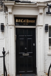
When walking in Hampstead Village recently, we saw something I had never noticed before during at least 60 years of visiting the area. It was wording above the doorway of a house on the corner of Heath Street and the much narrower Holly Bush Steps. The words are: “Kit Cat House” and (below them) “A.D. 1745”. Above one of the ground floor windows, that which is nearest to Heath Street but on the wall facing Holly Bush Steps, there are some painted letters, which I will discuss later.
The Kit Cat Club (also sometimes spelled as ‘Kit Kat’) was an 18th century club whose members were of the Whig political persuasion. Members included literary men such as William Congreve, John Locke, Sir John Vanbrugh, and Joseph Addison; and politicians including Duke of Somerset, the Earl of Burlington, Duke of Newcastle-upon-Tyne, The Earl of Stanhope, Viscount Cobham, Abraham Stanyan and Sir Robert Walpole, who was Prime Minister between 1721 and 1742. The painter Sir Godfrey Kneller (1646-1723) was yet another member. He painted portraits of 48 members of the club, which are now kept in the National portrait Gallery.
The club is commonly believed to be named after Christopher Catling and his mutton pies, but this is not known for certain. The club’s meetings were held at first in Catling’s tavern in Shire Lane (which no longer exists). Then, they were held at the Fountain Tavern on the Strand, which stood where today stands Simpsons on the Strand, and then later at purpose-built premises at Barn Elms (between Barnes and Fulham). In summer, the members met at the Upper Flask in Hampstead.
The Upper Flask, which was demolished long ago, was a pub located on the corner of East Heath Road and Heath Mount, that is on the south corner of East Heath Road and Heath Street, about 190 yards north of the present Kit Cat House on Holly Bush Steps. It was on the site of the now closed Queen Mary’s Maternity Home that received patients between 1919 and 1975.
Edward Walford, writing in his encyclopaedic “Old and New London” (volume 5, published in 1878), noted:
“The ‘Upper Flask’ was at one time called ‘Upper Bowling-green House,’ from its possessing a very good bowling green … when the Kit-Kat Club was in its glory, its members were accustomed to transfer their meetings in summer time to this tavern, whose walls – if walls have ears – must have listened to some rare and racy conversations … Mr Howitt in his ‘Northern Heights of London’ gives a view of the house as it appeared when that work was published (1869). The author states that the members of the Kit-Kat Club used ‘to sip their ale under the old mulberry tree, which still flourishes, though now bound together by iron bands, and showing signs of great age…’”
During the later year’s of the Club’s existence, in the first quarter of the 18th century, some of those members who sipped ale under this tree included the poets Shelley and Keats, who lived in Hampstead. Another member, who enjoyed meetings at the Upper Flask, the poet and physician Richard Blackmore (1654-1729), penned these lines about them in his poem “The Kit-Kats” (published in 1708):
“Or when, Apollo-like, thou’st pleased to lead
Thy sons to feast on Hampstead’s airy head:
Hampstead, that, towering in superior sky,
Now with Parnassus does in honour vie.”
So, the Kit Cat Club had an association with Hampstead, but was there any connection between the Club and the house on Holly Bush Steps, which bears the date 1745? The house was built in about 1800 (https://historicengland.org.uk/images-books/photos/item/IOE01/15805/21), which is after the period between 1696 and 1720, when the Club was active (https://doi.org/10.1093/ref:odnb/73609). It is also after the date above the door, ‘1745’.
An old postcard, published sometime between 1903 and 1930, reveals that the house was once a shop belonging to ‘Francis’. This was J Francis of number 1 Holly Bush Steps. What J Francis sold is not certain but above the whitewash that covers the wall of the ground floor, the remains of an old painted sign can be seen on the brickwork. It reads:
“Libraries” and also “S ?? D”, the two question marks represent letters that have disappeared. Other letters below the word ‘libraries’ have also gone. I wonder whether it once read ‘Libraries bought and sold’. Interesting as this is, it does not explain to me why the house is so named or the significance of the date 1745. So far, and this might be purely coincidental, the only connection I have found is that Robert Walpole, a member of the Kit Cat Club, died in 1745. However, I am not at all sure that this is why the date appears below the name above the door of the house on Holly Bush Steps.
I enjoy chance findings like that which I noticed in Hampstead and investigating their histories. I am not sure that I am much the wiser about the naming on the house on Holly Bush Steps, but whilst trying to find out about it, I have learnt a little more about the history of Hampstead, a part of London that was important to me during my childhood and which I continue to enjoy visiting. And as for Kit Kats, I would prefer that you offer me the chocolate version, rather than the mutton one.
HAD YOU VISITED GOLDERS GREEN in 1876, you would have arrived at: “… a little outlying cluster of cottages, with an inn, the White Swan, whose garden is in great favour with London holiday makers … from the village there are pleasant walks by lanes and footpaths …” So, wrote James Thorne in his “Handbook to the Environs of London”. Of these lanes, Hoop Lane still exists. The White Swan was in business until recently but has disappeared since I took a photograph of it about three years ago.. I do not think that I would recommend Golders Green as a holiday destination anymore. It is not unpleasant, but it is no longer rural and lacks the atmosphere of a resort. The poet and physician Mark Akenside (1721-1770), a friend of the politician Jeremiah Dyson (1722-1776), who had a house in Golders Green, and a frequent visitor to Dyson’s place, wrote, while recovering from an ailment:
“Thy verdant scenes, O Goulder’s Hill,
Once more I seek a languid guest;
With throbbing temples and with burden’d breast
Once more I climb thy steep aerial way,
O faithful cure of oft-returning ill …”
Another poet, now better known than Akenside, William Wordsworth (1770-1850) wrote:
“I am not unfrequently a visitor on Hampstead Heath, and seldom pass by the entrance of Mr Dyson’s villa, on Golder’s Hill, close by, without thinking of the pleasures which Akenside often had there.”
In those far-off days visitors from London could either reach Golders Green by crossing the range of hills north of Hampstead on a road that follows the path of the present North End Road or, after 1835, when it was completed, by travelling along Finchley Road. The end of Golders Green’s existence as a rural outpost of London and its development as a residential suburb began in June 1907, when the Charing Cross, Euston & Hampstead Railway (now part of the Underground’s Northern Line) opened the above-ground Golders Green Station.
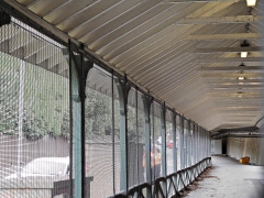
My family used Golders Green Station on an almost daily basis. During my childhood, there were two ways of entering it. One way, which still exists, is from the large station forecourt, the local bus and coach station. The other way, which was closed at least 35 years ago, was from Finchley Road. An entrance beneath the railway bridge led to a long, covered walkway (see the illustration above) under an elaborate wooden structure, open to the outside air on most of its two sides. The husband of one of my father’s secretaries once remarked that the wooden canopy reminded him of structures he had seen in India. Having visited India myself, I now know what made him think of that. The walkway led to a ticket office, beyond which there was a corridor from which staircases provided access to the outdoor platforms. Our family favoured using the Finchley Road entrance because it was slightly closer to our home in Hampstead Garden Suburb than the other one next to the bus yard.
In the early 1960s, when I was still a young child, northbound Underground trains coming from the centre of London stopped on one of the two northbound tracks that ran through the station. In those days, the doors on both the left and right sides of the train opened in Golders Green. If the train entered on the left track, that closest to the bus yard side of the station, we used to leave the train by the right hand doors, which led to the platform whose access staircases were closest to the Finchley Road entrance. We did this almost like a reflex action, without thinking about it.
One day, after my father had taken me to spend time in town with him, probably at his workplace, the LSE, we returned to Golders Green by Underground. As usual, since the train had stopped at the platform closest to the bus yard, we waited for the opening of the doors on the right-hand side of the train. Standing facing these doors, we could hear the opening of the doors on the left-hand side. We waited and waited, and then the train began to continue its journey northwards towards the next station, Brent. We were astonished that ‘our’ doors had not opened. My father was mildly upset by this. We behaved like creatures of habit. I was really pleased because I had always wanted to travel beyond Golders Green Station to see what exciting scenery lay beyond it. It was not, I remember, the rural scenes that visitors in the 19th century and earlier would have enjoyed.
THE RIDGEWAY IN MILL HILL, with spectacular views over north London and the nearby countryside from each side of it, is a pleasant place to wander. St Pauls Church is a simple Gothic revival edifice. It stands across the road from the famous Mill Hill School (established in 1807) and one of a line of three war memorials separated from each other by a few yards. The church has a plaque attached to it that informs the viewer that it was built by the anti-slave trade activist and politician William Wilberforce (1759-1833), consecrated in 1833, and became a parish church in 1926.
While we were looking at the plaque, a man (a cleric) arrived by car, unlocked the church, and invited us inside. We asked him about Wilberforce and his connections with Mill Hill. He told us that the great abolitionist had lived in Mill Hill and was for a short while the neighbour of his friend Sir Stamford Raffles (1781-1826), who is best known for his ‘founding’ of Singapore. Our new acquaintance explained that Raffles’ widow, his second wife, was buried in the churchyard of St Pauls (Mill Hill), but not the great man himself. Raffles, who was an abolitionist, was disliked by Theodor Williams, the Vicar of the parish of Hendon in which Mill Hill lay, who was sympathetic to slavery because his family had profited from slavery in Jamaica. Williams insisted that Raffles be buried outside the parish church rather than within it. Until 1914, the whereabouts of Raffle’s remains were unknown until they were stumbled upon by accident in a vault whilst the ground was being dug up to build an extension to the church. In contrast, his one-time neighbour, Wilberforce was interred in Westminster Abbey.
As an aside, but one which is important for me who has an interest in double-headed eagles, the Raffles coat-of-arms includes one of these imaginary creatures.
Returning to Wilberforce and Raffles, our informant told us that they were neighbours at Highwood Park (on Highwood Hill), 1100 yards northwest of St Pauls. William Hague, politician, and author of a biography of William Wilberforce (first published in 2008), wrote that the abolitionist moved into his new home in Mill Hill on the 16th of June 1826. Wilberforce wrote:
“I shall be a little zemindar, one hundred and forty acres of land, cottages of my own, etc.”
By ‘zemindar’, he was referring to ‘zamindar’, the Hindustani word meaning ‘landowner’. Wilberforce’s neighbour, Raffles, was already installed at Highwood Park when the abolitionist moved next door. Raffles wrote of his home there (quoted in “Handbook to the Environs of London” by James Thorne [publ. 1876]):
“A happy retirement … a house small but compact … Wilberforce takes possession tomorrow of the next-door house so that we be next-door neighbours and divided the hill between us.”
Sadly, Raffles died on the 5th of July 1826, shortly after his friend Wilberforce moved on to Highwood Hill.
Before moving to Mill Hill, Wilberforce had lived for some time in Kensington Gore, which runs along the south side of Kensington Gardens. His home from 1808 to 1821 was Gore House, built in the 1750s and set in three acres of grounds. It had interiors designed by Robert Adam, but sadly it was demolished and eventually replaced by the Royal Albert Hall, which occupies the site of the house and its grounds. Writing in the 1880s, Edward Walford quoted Wilberforce as having written of Gore House:
“We are just one mile from the turnpike at Hyde Park Corner, having about three acres of pleasure-ground around our house, or rather behind it, and several old trees, walnut and mulberry, of thick foliage. I can sit and read under their shade with as much admiration of the beauties of nature as if I were down in Yorkshire, or anywhere else 200 miles from the great city.”
Highwood Hill on the edge of London would have provided the ageing Wilberforce with what he had enjoyed at Gore House but without being so close to the heart of London.
Prior to moving into Mill Hill, Wilberforce had lived in Marden Hall in Surrey and at ‘The Chestnuts’ on Honeycroft Hill in Uxbridge. Unfortunate circumstances led to Wilberforce having to leave Mill Hill prematurely. These included financial difficulties arising from falling income from his land in Yorkshire and losses incurred by his son William. By the end of 1830, Wilberforce and his wife decided that they had to move out of their home on Highfield Hill. They moved to Brighstone on the Isle of Wight, and then later to East Farleigh in Kent.
Wilberforce felt that there was one disadvantage of Mill Hill when he moved there in 1826. The problem was that the nearest church, the parish church at Hendon, was three miles away. William Hague explains what happened next. Here is a summary of what he wrote. In Spring 1828, Wilberforce spent two months in London during which he approached the Church Commissioners regarding establishing a new church near his home in Mill Hill. At first, his plans for the church were welcomed by Theodor Williams, the Vicar of Hendon, who was, as already noted, unfriendly to the anti-slavery movement. However, once the construction of the chapel, the present St Pauls on the Ridgeway, began, Williams reacted vigorously against the idea. Hague is not certain what caused this change of heart on Williams’ part. One reason might have been that there was an Act of Parliament that allowed the founder of a new church to select and appoint its vicar. Another was that Williams was known not to like the Evangelicals, which included Wilberforce and other promoters of the abolition of slavery.
Despite the difficulties raised by the Vicar of Hendon, the chapel was built, but remained a chapel rather than a parish church until 1926. We liked the simple architecture of the spacious church, but this view was not shared by the architectural historian Nikolaus Pevsner and his co-author Bridget Cherry, who wrote:
“A typical cheap church of its date in the Commissioners’ style…”
The church contains some attractive stained-glass windows. That above the high altar at the eastern edge of the church is a copy, in painted glass, of “Dead Christ and Three Marys” by Annibale Carracci (1557-1602). It was created by Charles Muss (1779-1824) and WG Hodgson and dated 1809. Muss was an enamel painter to King George IV. Three other remarkable windows were created more recently (www.stpaulschurchmillhill.co.uk/jubilee-window.php). One of them, illustrated above, depicts chains and alludes to Wilberforce and slavery; another commemorates the Middlesex Regiment, which used to have some barracks in Mill Hill; and the third celebrates the Diamond Jubilee of Queen Elizabeth II.
We drove to Highwood Hill to see what, if anything, is left of the houses occupied by Raffles and his neighbour Wilberforce. Highwood House, built soon after 1817 and much altered since, was hidden from view behind dense vegetation and by a building close to the road. Just east of this across the narrow Nan Clarks Lane, there is a decaying wooden signboard to which a metal commemorative plaque is affixed, which faces the main road, Highwood Hill (the A5109). The plaque bears the words:
“Site of Hendon Park residence of William Wilberforce from 1826 to 1831.”
Behind the sign, there is a newish wooden fence, the boundary of a small estate of large residential houses. Hendon park was:
“… a substantial brick building in 1756 … was rebuilt and stuccoed in the early 19th century … it had fallen into neglect by 1951 and had been replaced by three houses and Crown Close by 1961 …” (www.british-history.ac.uk/vch/middx/vol5/pp21-23).
We left Mill Hill, having learnt much about two men, whose connection with the place we were previously unaware. There is far more to Mill Hill than this and I hope to write about other aspects of this lovely part of London in the future.
HOLLAND HOUSE in Holland Park (west London) was built in the early 17th century (about 1604) in the Jacobean style. It was designed by the architect John Thorpe (dates uncertain: c1555-c1655), who is thought to be the creator of Audley End House in Essex. In 1939, King George VI and his wife Queen Elizabeth (the Queen Mother) attended a debutante ball at Holland House. Little did they know that this was to be the last great ball to be held at the house. After the German Luftwaffe began devastating London, Holland House was hit by twenty-two incendiary bombs during a ten-hour raid on the night of the 27th of September 1940. Much of the old house was destroyed apart from the east wing. Fortunately, the library and its valuable contents remained undamaged. A video (www.britishpathe.com/video/holland-house-damaged) made by Pathé News shows the house shortly after it was bombed.
The house remained as a ruin until 1952 when its then owner, Giles Fox-Strangways, 6th Earl of Ilchester (1874-1959), a Member of the Royal Commission on the Historical Monuments of England from 1939–1959, sold the remains of the house and its extensive grounds (now Holland Park) to the London County Council. Eventually in 1986, what was left of the building was transferred to the Royal Borough of Kensington and Chelsea. In normal, non covid19, summers, the now well-preserved remains of the house become the home of a temporary theatre where opera is performed. For many years, but no longer, the relatively intact part of the house was used as a youth hostel by the YHA.
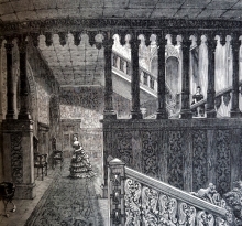
Recently, I have acquired a facsimile edition of “History and Antiquities of Kensington” by Thomas Faulkner, which was published originally in 1820. I have also my own copy of an original edition of Volume 5 of “Old and New London” by Edward Walford, published in 1878. Both books were published when Holland House was still intact, and both contain engravings showing how the house looked both outside and inside. Faulkner’s book contains a lengthy detailed listing of all the artworks and books that the house contained. These items included several paintings by artists as famous as Teniers, Canaletto, Joshua Reynolds, and Hogarth, to name but a few. Luckily, most of the art treasures in the house were removed for safety before the outbreak of WW2. The illustrations, some of which I have reproduced, demonstrate how great a tragedy it was that Holland House no longer remains intact.
MUCH OF GREATER LONDON is green space, which has not been built on. According to one source of information, Greenspace Information for Greater London CIC (‘GiGL’; http://www.gigl.org.uk):
“Roughly 47% of Greater London is ‘green’; 33% of London is natural habitats within open space according to surveyed habitat information and an additional 14% is estimated to be vegetated private, domestic garden land.”
Of this ‘green space’, much is accessible to the public either free of charge (e.g. Regents Park) or for a fee (e.g. Kew Gardens). This piece is about an example of a type of green space in London that is open to a select few. I am referring to many of the gardens in London squares that are or were surrounded by residential buildings. Some of these (e.g. Gordon Square in Bloomsbury) have been taken over by local councils and are now open to the public in general. However, many of these garden squares contain gardens that may only be entered by people who are eligible to be able to pay a fee for a key to unlock them. Some of the squares confine those eligible for keys to residents in the square or in neighbouring streets. I know of one privately owned garden, that within Princes Square near Bayswater, which is open to anyone who can afford the annual fee. This square garden, being privately owned, is dependent for membership fees to ensure its maintenance. Those eligible to use the gardens within squares, whether privately or partially privately maintained, can be expected to pay something towards the maintenance of these often-beautiful local amenities.
Recently, a friend admitted us to the garden of Norland Square in Kensington. Like many of these limited access gardens, it is surrounded by formidable cast-iron railings. These railings were removed during the Second World War when metals required for war materials were in short supply. They were only replaced in 2007. Like most of these squares, the passer-by cannot see much within the garden beyond the railings because of hedges and other vegetation grown just within them to preserve the privacy of those using the garden. So, being allowed to enter Norland Square provided us a rare opportunity to examine the interior of one of these ‘secret’ gardens.
Norland Square takes its name from the Norland Estate, 52 acres of land bounded to the south by Holland Park Avenue, on the east by roads now named ‘Pottery Lane’ and ‘Portland Road’, on the west by the boundaries of the parishes of Kensington and Hammersmith (www.british-history.ac.uk/survey-london/vol37/pp276-297). The northern edge of the estate was roughly 200 yards north of the present Wilsham Street. The estate passed through several owners in the 18th century. They lived in a mansion, demolished long ago, which used to stand close to the present number 130 Holland Park Avenue. The name ‘Norland’ was used as early as 1599 to describe the ‘Northlands’, the land in the northern part of the Parish of Kensington (north of the present Holland Park Avenue), which includes the estate (www.rbkc.gov.uk/sites/default/files/atoms/files/Norland%20CAPS.pdf).
Writing in 1878, Edward Walford, author of a series of books called “Old and New London”, noted that during the reign of William IV, the then well-wooded estate belonged to one of the Drummonds, a family of bankers of Charing Cross. Prior to these occupants, the first to live in the former Norland House was Thomas Marquois (died 1802), ‘Professor of Artillery and Fortification’, who used the building as an academy to teach both civil and military subjects to sons of the gentry, who were hoping to join the British Army. According to the website about the Norland Estate mentioned above:
“Board and lodging, plus instruction in Greek, Latin, French, writing and arithmetic could be had for thirty guineas a year, but fortification, mathematics, navigation, drawing, geography, dancing, fencing and riding were all charged as extras. Marquois’ prospectus contains a plan of the academy and its grounds, which were indeed very well suited to his purposes. Besides the house itself there were stables, a manege or riding house, a fives court, a cricket ground, gravelled drives for hack riding, and an artificial ‘mount’ from which the various activities of the pupils could be kept under constant review.”
Marquois relinquished the property after only four years in 1765.
In 1825, fire destroyed Norland House. In 1838, Benjamin Lewis Vulliamy (1780-1854), clockmaker to the Crown, who then owned the Norland Estate, sold it and the ruins of the mansion to a solicitor Charles Richardson, who raised money to develop the estate for building purposes. The layout and design of the southern part of the estate, including Norland Square, was carried out by the architect Robert Cantwell (c1793-1859). The houses on Norland Square were leased to their first occupiers by Charles Richardson in 1842 and 1843.
Except for Norland Square Mansions on the south-west corner of the square, which has a few features slightly suggestive of art-deco style, the other houses surrounding the square are those built in the early 1840s. The mansion block occupies numbers 53 to 57 Norland Square. Interestingly, these plots do not figure in a list of the original lessees of the other plots in the square. Number 52, which neighbours the mansion block was leased to Robert Cantwell in 1842. A detailed map surveyed in 1865 shows that where Norland Square Mansions stands today, there were no houses but instead a garden extending between number 52 and a house, now no longer standing, on the corner of the square and Holland Park Avenue (then named ‘Uxbridge Road’). On a map dated 1913, the position of the mansion block was occupied by a school. This same building, which has a different ground plan to the current block of flats was still present on a detailed map surveyed in 1938. So, it would be reasonable to say that the mansion block was built after 1938.
Getting back to the present, we found that the ‘secret garden’ in the centre of Norland Square is both attractive and well-maintained. In addition to an extensive lawn furnished with occasional wooden benches and a table, there are plenty of shrubs and trees. There is a small well-equipped children’s play area at one end of the garden and tennis courts at the opposite end. While we spent time in the garden, a couple of elderly women were taking their daily walk around it and a young lady was exercising her dog. Areas like this are invaluable during periods of ‘lockdown’ during the current covid19 pandemic, offering lucky city-dwellers a welcome respite from being ‘confined to barracks’ and if they are fortunate to have a garden, they provide a much larger open space to ‘take the air’ than their own smaller patches. We were both grateful and happy to have been able to see and experience what is usually hidden from us by iron railings and curtains of dense vegetation.
THE BRENT IS a tributary of the River Thames. When I wrote about it elsewhere (https://londonadam.travellerspoint.com/33/), I mentioned that the two main tributaries of the Brent are Mutton Brook, which has its source in East Finchley and Dollis Brook, the subject of this piece.
“Dollis Brook rises on Moat Mount Open Space in Mill Hill … flows eastwards through Totteridge Fields … then through fields and open spaces to King George V Playing Fields. The brook then turns southwards and forms the eastern boundary of Totteridge past Totteridge Lane near Totteridge and Whetstone tube station … continues south through Woodside Park (where it merges with Folly Brook) and West Finchley … Dollis Brook then passes under Dollis Road and through Windsor Open Space to the Great North Way (A1). Near Bridge Lane in Hendon it merges with Mutton Brook to form the River Brent.”
One sunny Sunday morning, we joined the footpath that runs alongside the winding Dollis Brook at a bridge crossing it. Halfway across the bridge is the boundary between Laurel Way in the N20 postal district and Laurel View, which is in the N12 postal district. The footpath, which has a well-made surface, free of mud, is part of the Dollis Valley Greenwalk. By heading north, we entered an area named Whetstone Stray. During the 19th century:
“Whetstone Stray was once part of the Baxendale Estate. Joseph Baxendale had taken over Pickford Brothers, and the area of Whetstone Stray had been used as grazing ground for the 1000 or so horses used in their carrying business. … On the death of Joseph Baxendale in 1872, there were problems over the division of the land.” (https://whetstoneallotments.co.uk/)
The origin of this area’s name is uncertain, but it is likely to have something to do with either grazing horses or with land whose ownership is uncertain or land on which horses could be ‘strayed’. Whatever its meaning, this corridor of meadows and trees along which the Dollis Brook follows its very wiggly course makes for a pleasant place to walk. Although it was far from crowded, there were plenty of other people enjoying it. What struck us was that the folk that we met were a cosmopolitan bunch. We heard snatches of conversation in a wide variety of languages. This was a complete contrast to the meadows at Runnymede, which we had visited the day before. There, apart from a few tourists from the Indian subcontinent, most people appeared to be of Anglo-Saxon origin.
The northern end of Whetstone Stray is where it meets Totteridge Lane, close to Totteridge and Whetstone Underground Station. The name ‘Totteridge’ is probably derived from the Anglo-Saxon root ‘tot’, meaning an ‘elevation’, and the English word ‘ridge’. An alternative etymology is that the name comes from the name of a Celtic deity ‘Taith’. The Underground Station, which is on the High Barnet branch of the Northern Line, is above ground and a simple building of indifferent architectural merit. It opened as a station on the Great Northern Railway in 1872 and became part of the Underground network in 1940. The Waiting Room Café nearby provided acceptable coffee.
The Dollis Brook continues north after passing beneath bridge carrying Totteridge Lane. The Greenwalk also continues in the same direction. Whereas the Whetstone Stray is a fairly narrow densely vegetated stretch of land, the land through which the path continues is wider and less full of trees. It runs through open fields and parallel to the tracks of the Northern Line, which is almost hidden from view by bushes. However, the roar of passing trains is easily heard and the trains can be seen through gaps in vegetation. The path splits into two soon after leaving Totteridge Lane. One path closer to the Dollis Brook is for cyclists and another further from the still winding stream is reserved for pedestrians. The narrow brook is often hidden by the dense growth of trees and bushes alongside it. However, it can be seen that the riverbed makes many tight U-turns along its course.
After passing Brook Farm Open Space, the brook begins flowing from the west. Brook Farm no longer exists. Next, our path skirted the south edge of a vast open space called Barnet Playing Fields. We ended our outbound walk at Barnet Table Tennis Centre and then retraced our steps. As we walked towards Totteridge and Whetstone Station, the horizon was dominated by a less than attractive tall building. This was built as the headquarters of British Ever Ready Electrical Company. Then, it became offices for the London Borough of Barnet and was known as ‘Barnet House’. Currently, its future hangs in the balance while developers fight to get permission to get it converted to 256 flats, some of which would be amongst the smallest in London (some as small as 16 square metres). The building was completed in 1966 to the designs of R Seifert and Partners, who designed Centre Point close by Tottenham Court Road Station.
In summary, the walk beside Dollis Brook is yet another example of London’s wealth of pleasant open spaces where city dwellers can enjoy some of the pleasures of the countryside without leaving the metropolis.
LONDON IS BLESSED with an abundance of open spaces where one can exercise and enjoy reasonably fresh air. In addition to parks, woods, the banks of the Thames, and squares with gardens, the towpaths alongside canals provide visually fascinating places to walk, run, or cycle. These canals used to be important routes along which freight could be transported right across England before they were rendered practically redundant by the advent of the railways. Despite this, they have been maintained and give great pleasure to many people including my wife and me.
Today, the 6th of November 2020, we walked along a branch of the Grand Union Canal from Golborne Road (near Portobello Road), where I practised dentistry from 1994 until about 2001, to Paddington Basin, which only became accessible to casual visitors in about 2000, when it was redeveloped. We began our walk in Meanwhile Park at the base of Trellick Tower, a tall block of flats designed in brutalist style by Ernő Goldfinger and opened in 1972. The pleasant community park, created in 1976, runs alongside a short stretch of the Paddington Arm of the Grand Union Canal, which was opened for use in 1801. We walked across the narrow park and onto the towpath. Although we have walked along this often, what attracted me this time in addition to the variety of barges and waterfowl was the variety of bridges that cross the canal and its towpath. I shall concentrate on these in this essay.
The first bridge we walked beneath is that carrying the Great Western Road over the canal. This is a cast-iron, single-arched bridge with the Union Tavern at its northern end. It looks like a Victorian design. Heading east, after walking beneath the sweeping curve of the Westway, an elevated motorway (the A40), the first bridge we encountered was that which carries the Harrow Road over the canal. This iron bridge with brick abutments is shorter than the previous one because the canal narrows temporarily as it passes beneath it. A few yards east of this, there is another bridge that crosses the canal to reach an old, derelict building that must have been a factory in the past. The bridge, known as the ‘Pipe Bridge’, has a roof and is completely enclosed with translucent panelling. It looks as if it was built in the last few decades and leads from the factory to a solid brick wall which serves as its abutment on the south bank of the canal.
Four hundred yards east of the Pipe Bridge, after passing the green space around the Church of St Mary Magdalene, we pass beneath a concrete footbridge with iron railings and decorative lamp posts that links Delamere Terrace and Lords Hill Road with Blomfield Road across the canal. The approach to the bridge from Delamere Terrace is an elegant helical ramp. This fairly modern crossing is known as the ‘Ha’Penny Bridge’ (i.e. half penny).
The towpath runs south east and alongside Delamere Terrace and reaches the building that houses the Canal and River Trust, the former Toll House. This is next to another bridge, a delicate-looking cast-iron structure with masonry abutments topped with distinctive lamp stands. This carries Westbourne Terrace Road (laid out in the early 1850s) over a constricted section of the canal. East of this the canal enters a vast triangular expanse of water, the junction of three waterways: the Paddington Branch from west London, its continuation towards Paddington Station, and the Regents Canal that leads to Camden Town and further east.
The poet Robert Browning, who lived near to this junction area, or possibly Lord Byron, is credited with christening this district as ‘Little Venice’, the name by which it is known today (https://londoncanals.uk/2010/01/17/the-history-of-the-place-name-known-as-little-venice-and-the-facts-that-are-ignored/). With its willow trees, colourful barges, a wealth of waterfowl, and some floating refreshment outlets, Little Venice is a popular place for tourists both local and from further afield. The small island in the middle of the watery space, inhabited only by birdlife, is called Browning’s Island.
We leave Little Venice by walking south east along the next section of the Paddington Branch canal. Soon, we reach another bridge, an undistinguished structure that carries the Harrow Road over us and another short, constricted section of the canal. The next 450 yards of the towpath on the west side of the canal has been redeveloped recently and is lined with eateries both on the shore and on boats moored alongside the shore.
After walking beneath a concrete bridge, the Westway Viaduct, carrying the Westway high above us, we soon reach a fascinating footbridge over the canal. The span across the water is approached by both curving staircases and spiral ramps. This suspension bridge is supported by cables fanning out from a tall pole on the eastern side of the canal. It is known as the ‘Harrow Road’ footbridge. Despite an extensive search of the Internet, I have not yet discovered who designed this structure, which is a visual delight in comparison with the next bridge we reach, an inelegant concrete span, which carries Bishops Bridge Road.
Shortly before the direction of the canal turns from south east to due east, we need to cross it over a curious looking modern footbridge that runs beneath what looks like a double wall of glass panels. This, the Station Bridge (Paddington Basin), leads from the east side of Paddington Station to a footpath leading to North Wharf Road. It was completed in 2004 by the Langlands and Bell partnership (www.langlandsandbell.com/work/).
Having crossed this distinctive bridge, we are now on the final stretch of this blind ending branch of the Paddington Arm of the canal. Next, we encounter another suspension footbridge with perforated metal panels along both sides of its footway over the water. This bridge leads to a car park next to a twentieth century block, part of St Mary’s Hospital. This is the Paddington Basin Footbridge designed by Sidell Gibson Architects.
A few yards further east, we cross a short blind-ended inlet by means of a short bridge known as The Rolling Bridge. Designed by the Thomas Heatherwick Studio and completed in 2005, this bridge curls up into a circle to allow boats to enter or leave the inlet. Routinely, this pointlessly complex yet interesting bridge is opened briefly at noon on Wednesdays and Fridays and at 2pm on Saturdays.
On Fridays at noon, or when necessary, the last bridge over the Paddington Arm, a few feet away from its eastern terminus, can be seen in action. At rest, the Fan Bridge (aka Merchant Square Bridge) looks unexceptional. However, when it is raised to allow passage of vessels it is extraordinary. As the bridge rises, it splits into sections resembling five blades of a pen knife when they are all opened, or a lady’s fan. The bridge is twenty feet long, was designed by Knight Architects, and completed in 2014. We were lucky enough to see this bridge open and then to watch it closing. You can watch this happening on my video at https://youtu.be/UGQERbGo_jU .
Beyond the Fan Bridge, the canal ends abruptly. Trellick Tower, where we began our perambulation was a landmark in modern architecture when it was built. The Fan Bridge, constructed 42 years later, is another exciting development in design. In between the tower block and the unusual bridge, we passed beneath or over several canal crossings representing various points in the history of bridge design, many of them adding beauty to a lovely waterway that provides pleasure for many people.
DRIVING ALONG THE NORTH Circular Road, I noticed a long wall over the top of which I could see what looked like the pinnacles of a Gothic revival garden folly. We were driving past Gunnersbury Park in West London and did not have time to stop. So, the next day, we drove back to the park and spent some time exploring it. What we found was a fascinating estate consisting of beautiful park land and a series of architectural delights. This is hardly far from where we live, but it was the first time that we had visited it. Had I not noticed what I did when on the North Circular Road, I am not sure that we would not have considered making a trip to find out what lies behind the wall next to which queues of slow moving traffic can often be seen.
The first impression one gets on entering Gunnersbury Park with its wealth of trees including many Cedars of Lebanon is that you are inside the grounds of a great house such as you can find at, for example, Ham House and Osterley Park. That impression is justified because Gunnersbury Park is basically what is left of the grounds of a mansion built in the Palladian style for the lawyer and politician Sir John Maynard (1604-1690) between 1658 and 1663. It was designed by the architect John Webb (1611-1672). Maynard died at Gunnersbury Park.
Between 1762 and 1786, Gunnersbury Park was used as a summer residence by Princess Amelia (1711-1786), who was King George III’s aunt (https://historicengland.org.uk/listing/the-list/list-entry/1000808). In 1761, she had bought the estate from George Furness (after 1688-1756). His father had been a ‘factor’ in the East India Company. George was a British merchant and politician as well as being an art collector. He was a Member of Parliament between 1720 and 1756 and had bought the property in 1739 from John Hobart (1693-1756), 1st Earl of Buckinghamshire, a British politician. Furness improved the grounds by employing the famous gardener William Kent (1685-1748). I am not sure how much of his original design has survived the passage of time.
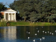
Princess Amelia, the second daughter of King George II, did much to improve the grounds, by landscaping, arranging planting, and by adding ornamental buildings, which still add to the charm of the place. These buildings include the bath house and a neo-classical temple, which overlooks a circular pond.
The princess held fabulous parties at Gunnersbury. In “Handbook to The Environs of London” by James Thorne, which was published in 1876, the politician and intellectual Horace Walpole (1717-1797), author of the Gothick novel “The Castle of Otranto”, who attended some of these parties, is quoted thus:
“Ever since the late king’s death, I have made Princess Amelia’s parties once or twice a week … I was sent for again to dine at Gunnersbury on Friday, and forced to send to town for a dress-coat and a sword. There were the Prince of Wales, the Prince of Mecklenburg, the Duke of Portland, Lord Clanbrassil … The Princess, Lady Barrymore, and the rest of us, played three pools at Commerce till ten … While we were at the Dairy, the Princess insisted on my making some verses on Gunnersbury. I pleaded being superannuated. She would not excuse me. I promised she should have an Ode on her next birthday, which diverted the Prince; but all would not do.”
The next morning, Walpole composed three verses for the Princess. One of them (quoted in a letter from Walpole to HS Conway dated 18th of June 1786) reads as follows:
“Oh! Why is Flaccus not alive,
Your favourite scene to sing?
To Gunnersbury’s charms could give
His lyre immortal spring.”
Walpole admitted in his letter to Conway that his poem was not one of his best. He wrote:
“If they are but poor verses, consider I am sixty-nine, and was half asleep, and made them ex-tempore – and by command!”
Following the death of the Princess, the Palladian mansion was demolished in 1801. Its contents were sold by auction and the 205 acres of its grounds were divided into lots and sold at the same time. Most of their area was bought by Alexander Copland (1774-1834), who built a new house, which forms the basis for the present building, which now houses a museum, which is currently closed because of the covid19 pandemic. Copland, a builder and business partner of the architect Henry Holland (1745-1806), was a son of Alexander Copland and his wife Barbara (née Smirke). The Alexander, who bought Gunnersbury was a cousin of the architect Robert Smirke (1780-1867), whose brother, also an architect, Sydney Smirke (1797-1877) designed the Orangery, which was built at Gunnersbury Park in 1836, and has been restored beautifully.
Copland built The Large Mansion (now the museum). Either Stephen Cosser or Major Alexander Morrison, a retired East India Company officer who bought the plot from him, built the so-called ‘Small Mansion’ to the east of the Large Mansion, which is currently in a poor state of repair. A gardener explained to us that it was supposed to be cared for by one London borough whereas the Large Mansion was under the care of another. In 1828, the part of the estate with the Small Mansion was bought by Thomas Farmer, who lived there as Copland’s neighbour until 1835.
In 1835, Copland’s Large Mansion was bought by the banker Nathan Mayer Rothschild (1777-1836). After his death a year later, his widow Hannah (née Barent-Cohen; 1783-1850) used Gunnersbury Park as her second home and employed the architect Sidney Smirke to make alterations to it (https://family.rothschildarchive.org/estates/37-gunnersbury). Following Hannah’s death, her oldest son Lionel Rothschild (1808-1879), the first ever practising Jew to become a Member of Parliament, took over the property and enlarged its park as well as improving the house’s facilities. After his death and that of his widow Charlotte, the estate moved into the possession of their youngest son Leopold de Rothschild (1845-1917).
In 1889, Leopold purchased the Small Mansion and thereby reunited the two parts of the original Gunnersbury estate. Under the ownership of the Rothschild family, many improvements were made to the grounds, some of which I will mention soon. After Leopold died in 1917, the estate was broken up and parts were sold off. In 1925, both mansions and about 185 acres of attached grounds were purchased for public use by the then Boroughs of Acton and Ealing. Now, the park and its mansions are maintained by the boroughs of Ealing and Hounslow.
The Large Mansion is elegant but not as attractive as the one which was demolished long ago and can be seen in old drawings. Nearby, the temple that overlooks a pond is delightful and reminded me of some of the garden architecture at Stourhead (in Wiltshire). Wandering around the garden, you will come across the Gothic revival architectural features I saw when driving past Gunnersbury Park on the North Circular Road. These are built around ‘Princess Amelia’s Bath House’, a garden folly built in the 1780s. Not far from this, there are very picturesque ‘Gothick’ ruins near to the estate’s farm buildings. These might be the remains of the dairy mentioned above in the quote from Horace Walpole or possibly later additions to the grounds constructed by an owner who bought the Princess’s estate. One source (https://brentfordandchiswicklhs.org.uk/publications/the-journal/journal-10-2000/princess-amelias-bath-house/) suggests that what is now called the ‘Bath House’ might have been the dairy in Amelia’s time at Gunnersbury. Whatever its history, lovers of romantic Gothic revival ruins will get great pleasure from what can be seen at Gunnersbury Park.
The Orangery stands next to a large pond. This structure was built whilst the Rothschilds owned the estate. It was constructed in 1836, designed by Sidney Smirke. The family were responsible for another water feature on their estate. It has a name that intrigued us: the Potomac Pond. This almost circular water body is surrounded by a fence and almost hidden by the trees and other vegetation growing around its perimeter. It is only accessible to members of a local angling club. The Rothschilds had purchased a former clay pit and converted it into the pond. One of the claypit’s kilns was rebuilt to create a Gothic revival tower on its shore. This lovely folly, which would look at home in a painting by the German Caspar David Friedrich (1774-1840), might have once been used as a boathouse.
I have described a few of the features that make it well worthwhile to visit Gunnersbury Park, whose history is not exactly simple. The place is so near to London and the M4 motorway, yet it feels so far away. If it were not the background roar of the traffic and the low flying aeroplanes descending towards Heathrow Airport, fewer than usual these days, it would be hard to believe you were not deep in the countryside.
THE RIVER WESTBOURNE may be known by few, but seen by many, living in, or visiting, London. Much of this tributary of the River Thames is hidden from view; it runs underground. The river rises in West Hampstead, passes through Kilburn and beneath Bayswater Road, flows through Kensington Gardens and Hyde Park, then runs into the Thames near the gardens of The Royal Hospital Chelsea, home of the annual Chelsea Flower Show, (close to the Bull Ring Gate bus stop).
Italian Gardens with 3 arched pump house and behind it on the right, the Queen Anne Alcove
What I will refer to as ‘The Serpentine’ is really the combination of the Long Water (in Kensington Gardens) and the contiguous Serpentine (in Hyde Park). It occupies part of the valley of the River Westbourne and is thus the only part of this river that most people can see. The Serpentine was created between 1730 and 1733 for Queen Caroline (1683-1737), wife of King George II. The body of water was formed by linking several existing ponds fed by the River Westbourne and by water pumped from the Thames. Today, some of the water is supplied from borewells in Hyde Park. Prior to the creation of the Serpentine, two of the ponds were separated by a building called ‘Price’s Lodge’. The “Daily Post” dated 20th of April 1733 reported that:
“The old Lodge in Hyde Park, together with part of the grove, is to be taken down in order to compleat the Serpentine River.”
Price’s Lodge, formerly known as ‘the Cheesecake House’ was a place where the nobility riding around Hyde Park could purchase refreshments (https://georgianera.wordpress.com/tag/prices-lodge/). The newspaper quoted above refers to ‘The old Lodge’, which might possibly been a separate building from Price’s Lodge, which might have still been in existence and being used as a boat house in 1801, but it was no longer standing later that century.
We begin our stroll at the end of the Serpentine just across Bayswater Road close to Lancaster Gate Underground Station. It was here that after flowing beneath Bayswater Road that the River Westbourne flowed into the Long Water section of the Serpentine. The so-called Italian Gardens consists of four large basins or reservoirs, each with eight sides. There is a fountain in the centre of each of them and another in the middle of them. The reservoirs are set on a platform adorned with sculptures and a statue of Edward Jenner, of vaccination fame. The platform is about eight feet above the water level of the rest of the Serpentine. At the north end of the platform with the reservoirs and fountains, there is a decorative building with a central single chimney and roofed with Italianate tiles. Facing the fountains, the building has a loggia, a convenient shelter during a rain shower. Behind the loggia there is a large room housing machinery to pump the water that shoots out of the fountains.
Between the Italian Gardens and Bayswater Road, there is a relatively new café, The Italian Gardens Café, which overlooks the fountains. The café is next to a neo-classical structure which contains a concavity lined with wood panelling. Made in 1705, designed by Christopher Wren (of St Pauls Cathedral fame) and bearing the crest of Queen Anne (reigned 1702-1714), this is the Queen Anne Alcove. This decorative building was moved to its present site from near Kensington Palace in 1868.
The four reservoirs, which make the Italian Gardens delightful, were built in 1861 and were intended to act as filter beds for the Serpentine. The loggia-cum-engine house was designed by Robert Richardson Banks (1812-1872) and Charles Barry (1823-1900). The sculptural features, including urns and nymphs, through which water flows from the Gardens into the Serpentine, were designed by John Thomas (1813-1862).
Moving on from the Italian Gardens southwards along the east side of the Long Water, you can, if you are lucky, spot birds such as herons and cormorants standing in the water near the opposite shore. After a short stretch along which the lake is well hidden from the path by vegetation you reach an open space in the centre of which there is a huge sculpture made of travertine stone, “The Arch”, presented to the park by its creator, Henry Moore (1898-1986), in 1980. Looking through the arch and across the Serpentine you can see the equestrian sculpture “Physical Energy” by the Victorian sculptor GF Watts. The two sculptures are in line with Kensington Palace, of which there is an unobstructed view from the Moore artwork. “The Arch” is irregularly shaped because it is based on the for of an animal bone that the sculptor had in his possession. A path leads away from the Serpentine to the Serpentine Sackler art gallery, which is often worth visiting. However, we will ignore that and continue to follow the Long Water in a south easterly direction.
Soon, we reach an elegant masonry bridge with five arches spanning the water. This was built in the 1820s to the designs of John Rennie junior (1794-1874), son of John Rennie, who designed the first Waterloo Bridge. The foot path around the Serpentine passes under each end of the bridge through semi-circular stone lined tunnels. The bridge marks the boundary not only between Kensington Gardens and Hyde Park but also between the Long Water and the Serpentine.
Walking along what has become the north shore of the water because of the bend in the Serpentine, you will pass numerous waterfowl of various shapes and sizes, including swans, gulls, ducks, coots, moorhens, geese, and cormorants. Step carefully to avoid their squidgy droppings along the footway. As you approach the modernistic Serpentine Bar and Kitchen (designed as ‘The Dell’ by Patrick Gwynne [1913-2003] and built in 1964) at the eastern end of the lake, you will pass two boat houses and a shed where in normal times, small pedal-operated boats may be hired by visitors. Look away from these boat houses towards the parkland north of the water and you will spot a roughly hewn monumental stone, a granite boulder. This is the Norwegian War Memorial, presented by the Norwegian Navy and Merchant Fleet in 1978. On one side it bears the words:
“You gave us a safe haven in our common struggle for freedom and peace”,
and on another:
“Worked and shaped by forces of nature for thousands of years”, which refers to the stone itself.
The Serpentine Bar and Kitchen is at one end of the Serpentine. Walking around the back of it, you will notice a small monument that marks the spot from which a supply of water to the Abbey of Westminster was granted by King Edward the Confessor (reigned 1042-1066). Further along the path, heading south, we cross a balustraded bridge with arches facing the Serpentine. Water from the lake flows under the path and emerges from beneath it just before it falls over a cascade (made in 1820) into the luxuriantly vegetated ‘Dingley Dell’. South of the bridge, there is an ornamental urn, the Queen Caroline Memorial, beneath which there is the following inscription:
“To the memory of Queen Caroline wife of George II for whom the Long Water and the Serpentine were created between 1727 . 1731.”
The path around the Serpentine begins heading west along the south shore of the lake. It is flanked by many trees including weeping willows. Eventually, we reach the Lido. The Lido includes a café and an outdoor bathing area, where bold swimmers, who are not averse to pondweed and sharing the water with waterfowl, can swim in the unheated water of the Serpentine. The front of the café is supported by a row of pillars with Doric capitals. A plaque attached to the wall facing the water commemorates the once leader of the Labour Party George Lansbury (1859-1940), who created the bathing area in about 1930. When the situation is normal, when there is no covid19 pandemic, swimmers use the bathing area throughout the year whatever the temperature of the water.
After enjoying a refreshment at the Lido, we move towards Rennie’s mighty bridge, passing first the Diana Memorial Fountain, opened by the Princess’s mother-in-law, Queen Elizabeth II, in 2004. This curiously designed water feature consists of two streams of water that flow down curved slopes and meet each other at the lower end of the fountain closest to the Serpentine. Near this, there is a huge, rather unattractive, sculpture of a bird with a long beak. Titled “Isis”, this artwork was created by Simon Gudgeon in 2009. Its circular base has bands of metal inscribed with the names of supporters of the Look Out Hyde Park appeal.
A short stretch of foot path takes one from Isis to the beautiful bridge across the Serpentine. After emerging from the tunnel under the bridge, we find ourselves back in Kensington Gardens and alongside the Long Water section of the Serpentine, walking in a north-westerly direction. Looking away from the water, you will spot a single storey building with three arches each topped with triangular pediments. Built in 1734-35, this is Queen Caroline’s Temple, which might have been designed by William Kent (1685-1748). Opposite it and across the water you get a fine view of Henry Moore’s sculptural arch.
Further on, the pathway runs alongside the water, affording a good view of the distant Italian Gardens and many waterfowl perched on a series of wooden posts crossing the water. Looking away from the water, you will see a statue of Peter Pan standing above a collection of children and animals. Peter Pan is a character created by the author James Barrie (1860-1937), who lived on Bayswater. The statue was created in 1912 by the artist George Frampton (1860-1928).
A few yards further, and we come alongside the western edge of the Italian Gardens. Looking west, you can see a distant obelisk, a memorial to the explorer John Hanning Speke (1827-1864). Near the north west corner of the Gardens, there is a cute sculpture of two bears embracing each other. This metal artwork is placed upon a disused stone drinking fountain. A plaque attached to it notes that it commemorates the 80th anniversary of The Metropolitan Drinking Fountain & Cattle Trough Association, which was founded in 1859. If you get thirsty reading this plaque, then help is close at hand at the lovely Italian Gardens Café.
Finally, one more brief note about Queen Caroline, for whom the Serpentine was created, and which now provides much joy to many Londoners and others. When she inquired of Sir Robert Walpole (1676-1745) the cost of enclosing the publicly owned St James Park to secure it for her exclusive use, he replied:
“Only three crowns”
By this, Walpole, the Prime Minister, meant the Crowns of England, Scotland, and Ireland because what she was asking was politically impossible.