Lola lived here briefly

ACTON IS NOT usually given high priority on the list of places that visitors to London might compile. However, this district in west London, once a borough in its own right between 1865 and 1965, now part of the Borough of Ealing, is not devoid of interest. After a visit to our dentist, whose surgery is close to Acton’s High Street, we took a look around the area. Churchfield Street, filled with small shops and various eateries, leads east to Acton Central Overground Station.

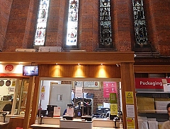
Opened in 1853 as ‘Acton’ station, it was first a stop on the North and South Western Junction Railway. In 1925, it was renamed ‘Acton Central’. The original 19th century railway building built in about 1876, a rather too grand edifice for such a humble station, has now been converted into a pub/restaurant, whose menu looks appetising. Crossing the tracks, we reach Acton Park, about which I will say more later.

The name ‘Acton’ might derive from Old English words meaning ‘oak town’. At the beginning of the 19th century, the parish of Acton was mostly agricultural land with a small population of about 1400 souls. Between 1861 and 1871, the population increased from about 4000 to about 8300, reflecting the urbanisation of the area. By the mid-1880s, it had reached about 12000. No doubt the accessibility of London via the railway helped increase the area’s attractiveness for people wishing to live in leafy suburbs within easy reach of their workplaces in the centre of the metropolis. Many of the streets near the station are lined with substantial, well built houses.

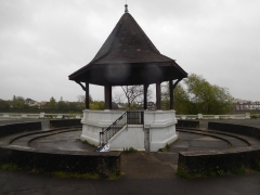
Acton Park is an attractive, municipal recreation area with lawns, trees, bushes, a café, a putting green, and other facilities including a ‘skate park’ and a children’s nursery. At the northern edge of the park opposite Goldsmiths Buildings, there stands a fine stone obelisk. This was moved to its present position in January 1904 from its original sight in the grounds of the now demolished Derwentwater House on Acton’s Horn Lane. It commemorates James Radcliffe, 3rd Earl of Derwentwater (1679-1816). The date of his death is significant, as I will explain.

James was the son of the 2nd Earl (1655-1705) and Lady Mary Tudor (1673-1726), whose parents were King Charles II and one of his mistresses, the actress Mary ‘Moll’ Davis (c1648-1708). James was brought up in France in the court of the exiled James Francis Edward Stuart (1688-1766), ‘The Old Pretender’, son of the Roman Catholic King James II of England, who was forced to leave England by the Protestant William of Orange. James Stuart, encouraged both by a desire to re-establish the line of James II on the English Throne and by the French monarchy, made various attempts to gain the Throne of England. One of these was in 1715, a year after the Protestant Hanoverian King George I had become crowned King of England.  In December 1715, The Old Pretender landed in Scotland, having sailed from France.

In 1709, James Radcliffe, whose memorial stands in Acton Park, sailed to England to visit his recently inherited estates in Cumberland and Northumberland.  In 1715, he joined the conspiracy to put his companion since childhood, The Old Pretender, on the Throne of England. A warrant for his arrest was issued, but at first he evaded capture by going into hiding. At the Battle of Preston (9th to 14th November 1715), when the Jacobite forces fighting for The Old Pretender were defeated, Radcliffe was arrested and taken to The Tower of London. After various attempts to reprieve him, he was executed in February 1716. His heart was taken to a convent in Paris, where it remains. The monument was erected by Radcliffe’s widow, Lady Derwentwater, who was living in Acton at the time of his execution. Her home, Derwentwater House, which can be seen marked on a detailed map produced in the early 1890s but not on one published in 1914, stood where Churchfield Road East meets Horn Lane, where today the newish shopping centre, ‘The Oaks’, now stands. Edward Walford, writing in 1883, noted in connection with the house:

“It is said that the iron gates at the end of the garden have never been opened since the day her lord last passed through them on his way to the Tower.”

Acton Park was created in 1888, mostly on land that had been owned by The Worshipful Company of Goldsmiths. Across the road from the park and opposite the obelisk, you will see the elegant Goldsmiths Almshouses. This building was erected in 1811 and enlarged in 1838. They were built on land left to the Goldsmiths Company by John Perryn, in whose memory one of Acton’s residential roads is named.

Tree-lined Goldsmiths Avenue is just 360 yards north of Acton Central Station. Number 78 used to be named ‘Tilak House’ in honour of the Indian freedom fighter Bal Gangadhar Tilak (1856-1920). In early May 1907, Vinayak Damodar Savarkar (1883-1966), a freedom fighter and father of the idea of ‘Hindutva’, an expression of Indian nationalism which underlies the political philosophy of India’s currently ruling BJP party, held a celebration of the fiftieth anniversary of the Indian Rebellion of 1857 at this house. The house was then the home of Nitin Sen Dwarkadas, brother-in-law of another Indian patriot who lived in London, Shyamaji Krishnavarma (1850-1930). Today, there is no memorial to this event.

Other attractions that caught my eye in Acton include St Marys Church (established by 1228, but the current building dates from 1865-67) and its nearby peaceful rectangular cemetery on West Churchfield Road. The Old Town Hall with its accompanying municipal offices was built on the site of the former Berrymede Priory. Designed by the architects Raffles and Gridley, the town hall was built in 1908-10, and extended in 1939. Berrymead Priory, a dwelling, is commemorated by a thoroughfare named Berrymead Avenue, where our dentist practises. It was built on the grounds formerly occupied by William Savile, 2nd Marquess of Halifax (1665-1700), who died here. The priory must have been lovely. Walford noted that it was:

“… a picturesque Gothic edifice of the Strawberry Hill type, and occupied the centre of several acres of ground, which are planted with fine trees and evergreens.”

One of the priory’s better-known inhabitants was the novelist and politician Edward Bulmer (1803-1873), Lord Lytton, who lived there between 1835 and 1836. In 1849, the place was purchased by the wealthy cavalry officer George Drafford Heald, who lived here briefly with his wife, the glamorous Irish born actress and courtesan Lola Montez (1821-1861), one time mistress of King Ludwig I of Bavaria and also of the composer Franz Liszt, whom he had married in 1848. The Healds had to flee to France soon after their marriage, which contravened the terms of her divorce with a previous spouse. Lola and George’s marriage did not last long. However, the building named ‘Berrymead Priory’ lasted longer, until 1982 when it was demolished.

Our Lady of Lourdes, a small Roman Catholic Church built in 1902 in the Romanesque style, was designed by Edward Goldie (1856-1921), who built many other Catholic churches. This church is on the High Street close to another decorative public building, The Passmore Edwards Library, built in 1898-99 and designed by Maurice Bingham Adams (1849-1933) in what Nikolaus Pevsner describes as:

“… his typical rather bulging Baroque paraphrase of the accepted Tudor of the late Victorian decades.”

Adams also designed the Passmore Edwards Library in Shepherds Bush. There is more to Acton than I have described, but maybe what I have written might whet your appetite to explore a part of London that is somewhat off the tourist’s beaten track.

An actress on the village green

SHE SITS THERE MOTIONLESS, day after day and year after year, watching the traffic on Westway either rushing past or crawling along in a traffic jam. In her heyday, before being captured in stone, instead of the noise of motor vehicles, she would have enjoyed the sound of the applause given by audiences in dimly lit theatres. She was the actress Mrs Sarah Siddons (1755-1831), and her carved stone statue stands facing the elevated Westway in Paddington Green, just west of the Edgware Road.

Mrs Siddons

Paddington Green used to be part of an expanse of ancient wasteland located in an area now bounded by the Regents Canal, the Paddington Arm of the Grand Union Canal, and Edgware Road, but now much of this wasteland has been built upon. Writing in 1867, John Timbs noted:

“Paddington Green, now inclosed and iron-bound, was the green of the villagers, shown in all its rural beauty in prints of 1750 and 1783. Upon a portion of it were built the Almshouses, in 1714; their neat little flower-gardens have disappeared. South of the green is the new Vestry -hall. At Dudley Grove was modelled and cast, by Matthew Cotes Wyatt, the colossal bronze statue of the Duke of Wellington … it is thirty feet high, and was conveyed from the foundry, upon a car, drawn by 29 horses, Sept. 29, 1846, to Hyde Park Corner.”

Dudley Grove was in Paddington. What is now left of the wasteland consists of St Mary’s churchyard and next to it a small grassy area, still known as ‘Paddington Green’, and marked as such on a map drawn in 1815. It contains the statue of Mrs Siddons. The first written record of the Green is dated 1549. The Green contained a mediaeval chapel, now long-since gone. It has been replaced by St Mary’s Church, which was built in the Georgian style, in 1788. It was designed by John Plaw (1745-1820), who emigrated from London to the North American Colony of Prince Edward Island in 1807. His church in Paddington was later modified in the 19th century but restored to its original shape (a Greek Cross in plan) in 1970 under the guidance of the architect Raymond Erith (1904-1973), amongst whose other creations was the current form of the Jack Straws Castle pub in Hampstead.

The present church is the third in the area, which was halfway between the ancient villages of Paddington and Lilestone. The old Manor of Lilestone (or ‘Lilystone’) included the present Lisson Grove and extended as far as Hampstead. The earliest church was taken down in about 1678. The second church, which replaced it, can be seen in old drawings. It was a simple edifice with a single aisle and a small bell tower at one end. Edward Walford, writing in the 1880s, described it as:

“… not unlike the type of country churches in Sussex…”

The poet and preacher John Donne (1572-1631) preached his first sermon in the first church in 1615 and the painter William Hogarth (1697-1764) was married to Jane Thornhill (c1709-1789) in the second in 1729 without her parents’ knowledge.

Next to the western end of the church there is a single-storied rectangular, brick building decorated with trompe-l’oeil grisailles, one of which depicts Mrs Siddons. Today, this houses the Phileas Fox Nursery School. Built on the site of the old, now demolished, vestry hall (parish council meeting place), this building, the  church hall,  in a late Georgian style was designed by John Quinlan Terry (born 1937), an architect of the ‘New Classical’ style favoured by Prince Charles, and built in 1978-81.

Apart from the statue of Mrs Siddons on Paddington Green, most of it is surrounded by buildings or roads built either at the end of the 19th century or long after. At the eastern side of the Green there is what looks like a pair of either early 19th or possibly 18th century houses. The reason Mrs Siddons is commemorated on the Green is that she is buried in the adjoining St Mary’s Churchyard. Her gravestone is contained within a cast-iron enclosure that looks like a small cage. For some time, the actress lived in Paddington in a house which used to stand in the area around Westbourne Green, which is near the current Westbourne Park Underground station.  

Mrs Siddons was highly acclaimed as an actress by many. The critic James Henry Leigh Hunt (1784-1859) had reservations as he remarked in his autobiography:

“Want of genius could not be imputed to his sister, Mrs Siddons. I did not see her, I believe, in her best days; but she must always have been a somewhat masculine beauty; and she had no love in her, apart from other passions. She was a mistress, however, of lofty, of queenly, and of appalling tragic effect. Nevertheless, I could not but think that something of too much art was apparent even in Mrs Siddons; and she failed in the highest points of refinement.”

Although the poet and playwright Joanna Baillie (1762-1851), shared Hunt’s opinion about her, others held her in higher regard.

The statue of Mrs Siddon in Paddington Green was sculpted by the French sculptor Léon-Joseph Chavalliaud (1858-1919). In the 1880s, he moved to London from France and lived south of the Thames in Brixton. His Mrs Siddons, based on a portrait by Sir Joshua Reynolds, was unveiled by the actor Sir Henry Irving (1838-1905) in 1897. It was the first statue of a woman, who was not royal, to be put up in London.

Paddington Green, like its close neighbour Paddington Station, figures in the history of London’s transportation. For, it was from here that the coachbuilder George Shillibeer (1797-1866) ran London’s first omnibus service to The Bank of England in 1829. He had got the idea from Paris, where he had been asked to design carriages that could carry up to 24 passengers at any one time.

The Paddington Green police station building stands a few yards east of Paddington Green. Constructed in 1971, this used to provide local policing services as well as an interrogation centre for terrorist suspects. Suspects accused of terrorist activities were brought here for questioning from all over the UK. Although it was refurbished in 2009, the station was closed in 2018. The building’s future is in the hands of property developers, who plan to build new housing on its site.  

Until the beginning of the 19th century, Paddington Green was a bucolic environment on the edge of what was then London. Now, surrounded by buildings and highways, it is a green but noisy oasis in a highly urbanised area.

A post office in a church

WEST HAMPSTEAD, FORMERLY known as ‘West End’ in the time, before the 20th century, that Hampstead was a small town separated from London. Now, yet another of London’s numerous suburbs, West Hampstead has several churches as well as a synagogue. One of these places of worship, St James Church, is worth entering because it is not what it seems from its external appearance.

The large Parish Church of St James, built mainly with red bricks, was erected in about 1887 (www.lwmfhs.org.uk/parishes/6-middlesex/28-hampstead). It was designed by Sir Arthur William Blomfield (1829-1899), the fourth son of CJ Blomfield, Anglican Bishop of London between 1828 and 1856, who encouraged much new church building during the 19th century. This large church could seat 1000 people (www.british-history.ac.uk/vch/middx/vol9/pp145-152#h3-0007) and has some fine 19th century stained-glass windows.

On entering the church through its electrically operated glass sliding doors, you will be surprised by what you find beneath its fine hammer beam timber ceiling. The west end of the nave is occupied by a post office, the first main-branch of a UK post office ever to be housed within a church. The north aisle of the church contains a children’s ‘soft play’ area, appropriately named ‘Hullabaloo’. The floor of the nave is filled with tables and chairs occupied by people of all ages, some enjoying refreshments from the church’s Sanctuary Café. All these things that you would not normally expect to find inside a church are part of The Sherriff Centre, a community organisation that began operating in 2014 (https://thesherriffcentre.co.uk/). The Centre’s activities also include a stationery store, a free food bank, live music as well as other events, free wi-fi, debt advice, and more.

Jesus is said to have thrown the moneychangers and others involved in commercial activity from the Temple in Jerusalem (“The Holy Bible”, John, Ch 2, v 13-16). However, he might have approved of the commercial activities within St James because profits from the sales outlets in the Centre are used to help finance charitable work. In addition to everything that I have already described about what goes on within St James, there is one more thing to mention. Despite the activities that you might not expect to find inside a church, regular religious Church of England services are held there. It is wonderful that St James, instead of becoming yet one more barely used Victorian church in London, has become a vibrant and beneficial part of a local community, catering to more than only just its by now small congregation.

Wrecked, then recovered

Running track at Paddington Recreation Ground

PADDINGTON RECREATION GROUND, located between West Kilburn and St John’s Wood, was formally established in 1893. It was London’s first public athletic ground. From 1860 to 1893, it was a parish cricket ground. In 1888, a cricket pavilion was constructed. It is now named after Richard Beachcroft who was Secretary of the cricket club in the 1880s. Also in 1888, the grounds were opened to public access and a cycle track was laid out, which remained in existence until 1987 when the position of the cricket pitch was moved. In 1893, the Paddington Recreation Act was passed, authorising:

“…the formal acquisition of lands in the Parish of Paddington to “provide the residents with a public recreational ground.” (https://en.wikipedia.org/wiki/Paddington_Recreation_Ground).

In 2006, the grounds were completely refurbished by Westminster City Council. The centrally located cricket pitch and its Victorian pavilion are now surrounded by a children’s playground; tennis courts; an outdoor gymnasium; a running track; hockey pitches; a bandstand; a bowling green; and various fenced off enclosures containing gardens and an ‘environmental area’. The pleasant park with its café and other facilities covers 27 acres and is well used by locals.

The Paddington Recreation Ground was a place where two world famous sportsmen trained. One was the professional road and track cyclist Sir Bradley Marc Wiggins (born 1980), who won the Tour de France in 2009. He learned to ride a bicycle in the grounds. He attended the St Augustines Church of England School nearby. The other sportsman was a medical student at the nearby St Marys Hospital when he trained on a running track at the Recreation Grounds, and on the 6th of May 1954, he became the first man to run a mile in under 4 minutes. This man was Sir Roger Bannister (1929-2018).

The Recreation Ground has several entrances. One of these is a short path leading from Carlton Vale. It runs past a pub called ‘The Carlton Tavern’, which has a curious recent history. In 1918, a German bomb destroyed a pub that stood on this site. In 1921, this was replaced for the Charrington Brewery by a newer building designed by Frank J Potter (1871-1948), who also designed the observatory in Hampstead. During WW2, the pub was the only building in the street not to have been destroyed during The Blitz. This plucky little pub’s luck ran out in 2015.

In 2015, developers bought the Tavern with a view to demolishing it to create space to build luxury flats. A week before the pub was due to become a protected historical edifice, the developers, no doubt having learned what was in the offing, reduced it to rubble. They hoped that they would get away with being fined an amount, which they could easily recoup when they sold the luxury accommodation they were planning to build. Things did not work out in their favour. Local action groups fought for the pub’s reconstruction and won. The courts ordered the developers to reconstruct the pub brick-by-brick (www.standard.co.uk/news/london/developer-told-to-rebuild-maida-vale-pub-brick-by-brick-after-site-torn-down-without-notice-10211892.html). They did a good job, and today it looks much as it did before it was hurriedly demolished.

Both the pub and the Recreation Ground stand in the shadow of the tall tower of the Anglo-Catholic Church of St Augustin. Known as ‘the cathedral of north London’, the church was designed in the gothic revival style by John Loughborough Pearson (1817-1897), who also designed Truro Cathedral in Cornwall. St Augustin was consecrated in 1880, but the tower and spire were not completed until 1897-98. I have never been inside this building, but I have seen photographs of its interior, which looks superb.

The places described above are almost all that remains of an area which has been subject to much rebuilding since WW2. Visiting these places can make an interesting detour when walking near Little Venice along the Paddington Arm (branch) of The Grand Union Canal. I doubt that I would have visited the Recreation Grounds had I not been alerted to it and encouraged to pay it a visit by two sets of friends, to whom I am grateful.

Perched on a sculpture

KENSINGTON GARDENS CONTAINS numerous works of art, one of which is a large piece by Henry Moore (1898-1986), a sculptor who is highly regarded by many people. It is a large irregularly shaped arch made of travertine, which stands overlooking the Long Water, the part of the Serpentine lake within the confines of Kensington Gardens. Presented by the artist to the park in 1980, its shape is based on that of an animal bone. I am not wild about Moore’s works, but this piece looks wonderful in its setting on the eastern bank of the Long Water.

Today, 19th of May 2021, whilst walking in Kensington Gardens I saw a heron standing on the western bank of the Long Water almost framed by the Moore arch. After circumnavigating the lake, we reached the point on the eastern shore where the sculpture stands. Through the archway you can see the eastern façade of Kensington Palace. Along the line that connects the palace and the sculpture, you can see another sculpture, “Physical Energy” by George Frederick Watts (1817-1904). The three items on this axis form a kind of timeline: the 18th century palace, the 19th century sculpture by Watts, and the 20th century sculpture by Moore.

I have walked past the Moore sculpture too many times to count, but it was only today that I saw a heron perched on top of it. I have seen geese and pigeons perched on it in the past, but this was the first time I saw a heron using it as a doubtless superb vantage point to survey its surroundings. Apart from the fact that I find herons beautiful, its close association with the sculpture struck a certain curious chord in my mind. Maybe, it was something to do with the fact that the words ‘heron’ and ‘henry’ share so many letters in common (3 out of 5). Whatever the reason, it was pleasing to see nature and art intimately in touch with each other.

A floral fireworks display

SOME OF LIFE’S PLEASURES are seasonal. Such is the case for the explosion of colour that can be seen in the Isabella Plantation in London’s Richmond Park. During late April and most of May, the azaleas and rhododendrons in the Isabella burst into flower. These alongside many other flowering plants, including seas of bluebells, provide a sumptuous banquet of colour for the visitors’ eyes. It is not so much the immense number of flowers that provides so much joy but the way the shrubs and other plants have been planted that creates a visual experience that easily rivals the best of fireworks displays. Even if I were able to express myself better in writing, words cannot possibly recreate the experience of seeing the Isabella Plantation in full bloom. Although I am keen on photography, I feel that even good photographs of the place can only hint at the impact of seeing the flora in real life. In brief, if you can, you must try to visit the plantation when the blooms are at their most magnificent.

The Plantation is in the southwest part of Richmond Park, not far from both the Robin Hood and Kingston Gates. The latter is open to motor traffic currently (May 2021). Richmond Park was a royal deer park, a hunting ground, established by the 14th century when it was part of the Manor of Sheen (https://historicengland.org.uk/listing/the-list/list-entry/1000828).  King Henry VII was particularly fond of the park, which he named ‘Richmond’ after his earldom in Yorkshire (Richmond is a town in that county). He also had a palace built there, of which precious little remains because by the Restoration of the Monarchy in 1660, it was already dilapidated and was never rebuilt. In its heyday, it was one of the few places fitted with a flushing lavatory. This was installed by Queen Elizabeth I’s godson, Sir John Harington (baptised 1560- died 1612; https://en.wikipedia.org/wiki/John_Harington_(writer)).

The history of public access to the park is of interest (www.trpg.org.uk/perch/resources/newsletter-005.pdf). Between 1637 when King Charles I enclosed the park and the 1730s when Robert Walpole forbade it, there was pedestrian access to the park. In 1758, a certain John Lewis (1713-1792) won a court case that re-established the right of some public access to the paths and roadways within the park. By the mid-19th century, the public could drive their carriages through it. Today, its roadways are popular both with cyclists and motorists.

The history of the Isabella Plantation is detailed on the website of The Royal Parks (www.royalparks.org.uk/), from which I obtained the following information. By the 17th century, the waterlogged area in the south west corner of Richmond Park was known as ‘The Sleyt’, a sleyt being a word for boggy ground or an open space between woods and banks.  The area where the Plantation is today was marked as ‘Isabella Slade’ on maps published by 1771. The name Isabella either referred to a lady with that name, or, more likely, it was a corruption of the word ‘isabel’, which as far back as the 15th century meant ‘dingy’ or ‘greyish yellow’, which is the colour of the soil in the area of the park where the Plantation is located.

A Deputy Park Ranger, Henry Addington, Lord Sidmouth (1757-1844), fenced off an area of 42 acres of the Isabella Slade in 1831, planted various kinds of trees for timber, and gave the land its present name, ‘Isabella Plantation’. Sidmouth, a Tory politician, was briefly Prime Minister at the beginning of the 19th century, lived in the White Lodge of Richmond Park from 1801 until his death (https://whitelodgetimeline.royalballetschool.org.uk/1800/item/161/). He had been given it as a residence by King George III, who appointed himself the park’s Ranger and Sidmouth his Deputy. Currently, the White Lodge houses The Royal Ballet school.

Getting back to the Plantation as we see it today, it was created chiefly by the work of the Park Superintendent, George Thomson, done between 1951 and 1971. The Royal Parks website explains that:

“The present garden of clearings, ponds and streams was established from the 1950s onwards. It is largely the work of George Thomson, the park superintendent from 1951-1971. Along with his head gardener, Wally Miller, he removed Rhododendron ponticum from large areas and replaced it with other rhododendron species. They established evergreen Kurume Azaleas around the Still Pond and planted other exotic shrub and tree species.”

The Plantation has three ponds, of which the Still Pond is the most spectacular. Surrounded by azaleas and Rhododendrons, its waters are still, that is they are mirror-like. The flowers of the shrubs surrounding the water are reflected in the water, producing a delightful and dramatic visual effect. The other ponds, Peg’s Pond, and one named after Thomson, have their own charms but lack the drama of the Still Pond. Streams and rivulets lined with ferns and other plants flows across the Plantation. The longest stream was dug in 1960 and includes Peg’s Pond.

So far, we have visited the Isabella Plantation three times. Twice, we saw it in its full floral glory and once a few months before the flowering began. Timing is important if you want to enjoy the full floral impact. So, get there in late April or during the first few weeks of May in order to best experience the forms, colours, and fragrances of this beautiful collection of flowering shrubs.

Dining in a church

A FRIEND INVITED us to dine one evening at the exclusive Mosimann’s Club in West Halkin Street in London’s elegant Belgravia district. As it was dark when we arrived and I was too busy chatting with our host, I failed to notice the exterior of the establishment. Years later, I noticed that the narrow façade of this fancy eatery, named ‘The Belfry’, is that of a Victorian gothic church with a slender spire.

The church was being used by the Presbyterians in 1866, so wrote Edward Walford in the 1880s. The website of The London Metropolitan Archives catalogue reveals more:

“…a chapel was built on Lower George Street, called the Ranelagh Chapel. In 1845, on the death of the Methodist minister, the church joined the English Presbyterian Church and was renamed Ranelagh Presbyterian Church. The lease on the Lower George Street chapel expired in 1866 and the church merged with a Presbyterian Mission in West Halkin Street, Belgrave Square. The name Belgrave Presbyterian Church was adopted. The church was rebuilt in 1881. In 1923 the church moved to premises in Emperor’s Gate, Kensington.”

The former church is an unusual structure in that the end facing the entrance is considerably wider than the façade. As to when it was originally built, I am uncertain. Nikolaus Pevsner, the architectural historian, does not give it a mention in his extremely detailed guide to the buildings of the City of Westminster in which it is located. However, he does mention the chapel’s neighbour, to the left of it as you face the façade. Far more attractive than the chapel is the façade of its neighbour which is decorated in a neoclassical style. It has two porticos supported by pillars with Doric capitals. This building was built in about 1830.

Today, the Doric pillars flank entrances to a branch of Waitrose food stores. This shop also has an entrance on the street parallel to West Halkin Street, Motcombe Street. Thus, two temples of food stand side by side. If you cannot afford to dine in the former church, then you can console yourself and appease your appetite by acquiring something edible in Waitrose by stepping between the Doric pillars. In case you are wondering what we ate at Mosimann’s, I am afraid I cannot recall as it was so long ago, but I do remember enjoying it.

A canal cruise and a cricket ground

BEFORE THE ADVENT of railways, transportation of goods across England (as well as Wales and Scotland) was heavily dependent on an extensive canal system constructed mostly in the 18th  and early 19th centuries. Freight was carried along these canals in the holds of long narrow barges, more correctly known known as ‘narrow boats’. They had to be narrow enough to negotiate some of the narrower canals that formed part of the canal network.  Prior to the development of steam and other kinds of engines, and even for some years after these became available, the narrow boats were towed by horses. These creatures walked along paths known as ‘towpaths’ that run along one or other side of a canal, except when a canal passed through a tunnel. In the tunnels there were no towpaths, and the boats were propelled by the feet of men lying either above the load on the boat or sometimes on planks projecting from the sides of the vessel, a process known as ‘legging’. The boatmen’s feet literally walked along the tunnel walls, thus moving the boat. Meanwhile, the towing horses walked over the hill through which the tunnel passed. All of this interesting but becomes even more so if you can experience a trip on a canal in a narrow boat.

Several companies offer canal trips between Little Venice (near London’s Paddington) and Camden Lock, east of it. We chose to travel on “Jason”, a narrow boat built in 1906 and one of the last of its era, which is still in use. “Jason” has been little modified compared to others that ply the route along the Regents Canal, a branch of the Grand Union Canal system. “Jason”, which was originally horse-drawn, has been fitted with a diesel engine that occupies part of the small rear located cabin that was once the home to a boatman and his family. Passengers sit in the long, narrow freight hold of the boat under an awning that was added when “Jason” was converted from a freight carrier to a tourist vessel, which has been doing the tours since 1951. Unlike most of the other tourist boats, there are no windows separating passengers from the exterior. This provides for great viewing along the route without the hindrance of sometimes not too clean glass, which might be encountered in other vessels.

The tour starts from a landing stage next to Blomfield Road, close to the cast-iron bridge that carries Westbourne Terrace Road over the Paddington Arm of the Grand Union Canal. At the other end of the trip, passengers disembark or embark next to the popular (not with me) and rather ‘tacky’ Camden Lock Market. The cruise between the two landing stages takes 45 minutes and is highly enjoyable. Travelling eastwards from Little Venice, we were given an extremely clear and intelligent commentary by a lady called Sarah. Various things she told us made a strong impression on me.

The Regents Canal that links Paddington Basin to Limehouse Basin in east London, where it leads to other canals, used to carry a wide range of goods, from coal to cocoa. The waterway passes under both rail and road bridges. Many of the latter have curved arches over the canal; are made of stone; and look older than the rail bridges, most of which have rectangular arches with roofs consisting of metal plates screwed together. Over the years, the tow ropes drawing the narrow boats have cut grooves or notches in the corners of the bridges next to the towpath. Some of the bridges have been protected from this damage by iron brackets placed so that the ropes passed over these instead of the masonry of the bridge. These metal protectors, which were easily replaceable, can now be seen to be notched where the ropes have abraded them.

“Jason”, like most other narrow boats, has a flat bottom and a shallow draught. This is because the water most of the canal system is quite shallow, usually not more than 6 feet deep. The bottom of “Jason” is made of wood (probably elm) and iron, a combination known as a ‘composite’ construction. Few narrow boats with this kind of construction exist today.

The most fascinating thing that Sarah told us related to the history of Lord’s Cricket Ground. In 1787, Thomas Lord (1755-1832), a professional cricket player, opened his first cricket ground in what is now Dorset Square (close to Baker Street Underground station). In 1809, Lord shifted his cricket ground to another location because the rent at his Dorset Square site became too high. The new location was on some disused ground just south of the present Lord’s Cricket Ground. It was where today the Regents Canal emerges from the eastern end of the 272-yard-long Maida Hill Tunnel. Let me explain.

In 1813, Parliament altered the route of the proposed Regents Canal so that it passed right through Mr Lord’s recently relocated cricket ground (www.lords.org/lords/our-history/timeline). Mr Lord was unhappy about this and was not prepared to give up his ground without first going to court. According to our guide, Lord struck a deal with the government. He agreed to move to a new site providing he was given all the earth that was excavated during the construction of the Maida Hill Tunnel. He used the vast amount of excavated earth to lay out the ground on which the present Lord’s Cricket pitches are now located.

Concerning construction, Sarah told us that not only had the tunnels been dug by hand, but also the entire canal system. Most of the manual workers were Irish and were known as ‘navigational engineers’, or ‘navvies’ for short. The base of the Regents Canal is lined with compressed clay to make it watertight, a difficult process when the canal was built.

The cruise between Little Venice and Camden passes through a variety of landscapes, ranging from disused industrial to almost bucolic. The canal passes through the northern edge of Regents Park, where it is lined with trees and parkland. In this stretch of the canal, it is difficult to believe one is in the middle of a huge metropolis and not in the deep countryside.  The waterway also passes through the London Zoo. On one side, if you are lucky, you can catch glimpses of African hunting dogs and the occasional warthog in their cages overlooking the canal. Opposite them on the northern bank of the canal is Lord Snowdon’s aviary, now devoid of birds and awaiting a new purpose.

The 45-minute cruise provides an enchanting view of several districts of London. The commentary provided by Sarah and what she pointed out along the route helps recreate in one’s mind the golden age of canal transport. We enjoyed the cruise in both directions and hope that many others will take advantage of the special experience that it provides. For booking details and other practical information, consult “Jason’s” website: www.jasons.co.uk/the-tour

The Duke, his meadows, and the developers

DESPITE THE RAIN, we decided to walk along the path by the River Thames, proceeding upstream from Hammersmith. I had done this before, but never ventured beyond (i.e., upstream) the attractive church of St Nicholas, Chiswick, in whose graveyard you can find the funerary monument to the painter, William Hogarth (1697-1764), whose former home is nearby, and another to the Italian patriot, Ugo Foscolo (1778-1827). After walking along a riverside pathway that passes several recent, moderately attractive, but probably immoderately priced, housing estates, we reached Chiswick Pier at Corney Reach, whose name commemorates the now demolished Corney House, where Queen Elizabeth I was once entertained by the Earl of Bedford, who owned the place (www.chiswickw4.com/default.asp?section=info&page=conhistory29.htm).

Several lovely old houseboats are moored next to the pier. Near the jetty there is a noticeboard explaining the history of each of these vessels. Soon after this, the riverside path enters Dukes Meadow. Up to Barnes Bridge, which is a combined rail and pedestrian crossing over the river, the meadows form a grassy promenade running parallel to the Thames.  Beyond the bridge, the meadows widen out and extend to Great Chertsey Road that crosses Chiswick Bridge.

The bandstand at Dukes Meadow

The history of Dukes Meadow is recorded in a detailed essay by Gillian Clegg (https://brentfordandchiswicklhs.org.uk/dukes-meadows-the-threats-to-its-rural-survival/), from which I have extracted most of the following. In the past, the Meadow were low lying farmland and orchards prone to occasional flooding. The land was owned by the Dukes of Devonshire and cultivated by the Jessop family, then later farmed by John Smith of Grove Farm. Incidentally, one of  the Dukes, William, the 5th Duke of Devonshire (1748-1811), who had owned nearby Chiswick House in the 18th century. He had both enlarged the house (in 1788) and extended its grounds. At one time, the grounds of Chiswick House must have neighboured the Dukes Meadow. Ms Clegg noted that it was miraculous that the meadows survived as such considering the plans that were proposed for making use of it during the early 20th century.

Two plans were conceived for the ‘development’ of Dukes Meadow. The first was a housing scheme that was to be named ‘Burlingwick’. Clegg wrote:

“On 19 April 1902 The Times newspaper reported that ‘an influential body of capitalists’ had negotiated successfully with the Duke of Devonshire for 330 acres of land for a building plan to be called Burlingwick. The promoter, manager and developer of this scheme was Jonathan Carr, the developer of Bedford Park.”

Had this gone ahead, it would have created housing for up to 400,000 people and 330 acres of green land would have been lost to bricks and mortar. Fortunately, for reasons that are not now too clear the scheme was abandoned in about 1906.

1914 saw the next threat to the Meadows. The Brentford Gas Company planned to cover 80 acres of the Meadow with a huge gasworks. The people of Chiswick and other areas raised strong objections. The London “Times” of 6th February 1914 published its doubts about the scheme, which it said went against all the principles of good town planning, suggesting:

“…that land ripe for building – such as the Chiswick orchard farm – near the heart of the metropolis should be utilized for parks and garden settlement.”

The plan was scrapped, but what the “Times” had alluded to was later realised, but in a then novel way.

In 1923, the local council bought 200 acres of land from the then Duke of Devonshire. The land was to be used as a public recreation area complete with a riverside promenade, a bandstand, and a children’s area with paddling pools. All of this cost the council much money. To recoup some of what they had spent, they made an agreement with the Riverside Sand and Ballast Group. As Ms Clegg explained, the company:

“…was allowed to extract at least five acres every year in exchange for £1,500 an acre.”

The extraction of gravel proceeded from 1924 until 1937 and caused considerable damage to the area. Ms Clegg explained that when the land was finally returned to the council in 1948:

“The gravel pits were filled in, mainly with rubbish brought from inner London, and the area re-landscaped. Dukes Meadows has been described as one of the earliest and most impressive examples of restoration.”

Today, the promenade remains but I saw neither a children’s play area nor paddling pools, which still exist. The bandstand, which stands within a sunken circle lined with steps on which the audience can sit has a hexagonal tiled roof supported by six plain pillars. It is flanked on two sides by spacious shelters, also with tiled roofs. All their roofs are designed so that the angle (or degree) of pitch reduces noticeably about two thirds of the way from the top. Judging by their appearance, I would guess that these structures were built back in the early 1920s. This is confirmed by their appearance in a photograph taken during those years. Also visible in this picture are the unusual, twisted railings, looking like sugar-candy, running alongside the water, and supported by concrete posts with rounded tops. These are still in place today as are their concrete supports which bear simple decorative patterns. Some balustrading can be seen lining the waterfront near the bandstand (see quote below).

Part of the promenade leading towards Barnes Bridge from the Chiswick end of the Meadow is arranged in the form of two long steps. I have no idea why, but maybe they were once used by spectators watching boat races on the river. An article written in 1924 describes the popularity the Meadow with people watching the annual university boat race (http://dmtrust.dukesmeadowspark.com/newriversidepleasaunce.html):

“…in fact so many thousands of people availed themselves of this vantage point last Saturday week at the small admission fee charged by the Council, that over £1,000 net was raised towards the promenade project.”

 However, currently a line of bushes obscures sight of the river and the suburb of Barnes across it from these steps. A planning document produced in November 1923 (http://dmtrust.dukesmeadowspark.com/ariversideboulevard.html) sheds a little light on these steps:

“The Scheme, which received the first prize and was submitted by MR A. V. Elliot, of Chiswick, is reproduced on this page. It shows a series of terraces with a plateau of turf, showing seats and rustic shrubberies at intervals, and with a central feature of a bandstand and stone balustrading including a flight of steps and a causeway admitting to the river at all states of the tide.”

We enjoyed our stroll along the Dukes Meadow promenade even though the sky was grey, trees were dripping, and raindrops were falling intermittently. On our way back along the Thames Path to Hammersmith, we stopped at a charming Italian eatery and delicatessen on Chiswick Mall. The place, which is run by Sicilians, is called Mari Deli & Dining, and merits a visit to enjoy a good espresso, at the very least.

May the 8th

SIXTY-NINE YEARS ago on the 8th of May 1952, a lecturer in economics at the London School of Economics was sitting anxiously in the ante-chamber of an operating theatre in the Royal Free Hospital, which was at that time in London’s Grays Inn Road. It is now part of the Eastman Dental Hospital, the post-graduate dental school of University College London, where I have attended courses.

The lecturer looked up from what he was trying to read to distract himself when the gloved surgeon came out of the operating theatre, and talking to himself, but loud enough to be heard, said:

“Shall I use the Simpsons or the Kiellands?”

He was referring to forceps used to deliver babies. My father, who thought that the question had been addressed to him, replied:

“I am sorry I can’t help you with that. I am only an economist.”

The surgeon gave him a withering look, and returned to the operating theatre, where the economist’s wife was lying, deeply anaesthetised. In the end, the surgeon decided to deliver the baby with a Caesarian section.

That baby was me. The economist was my father. That I am writing this today is at the very least a minor miracle, as I will explain.

Back in the early 1950s, one did not argue with medical practitioners; they always knew best. My mother had informed her physician when I had been conceived, but he did not believe what she had said. I can imagine the doctor thinking: “what would she know? Only a woman.” So, when my mother did not give birth when she expected, at about nine months after conception, the doctor told her to be patient as he thought she had another month to go

After I had been ‘in utero’ for ten months, my mother began getting worryingly ill. Eventually, those who claimed to know best admitted her to hospital and I was delivered. Both my mother and me had developed symptoms of toxaemia. It was touch and go as to whether we would both survive, but we did.

Because I had been inside the womb for a month longer than I should have, I was born with several problems. One of these was a cerebral haematoma, which I hope has resolved itself by now. Years later, my mother told the school that I should not play rugby for fear of disturbing this. The other thing was that my neck was bent over to one side; I had a torticollis. The medics told my mother that it was incurable and that she should get used to the idea that I would just have to live with the distortion.

If I am not misrepresenting my late mother, I am certain that she would not have been happy living with a distorted child. She was a sculptor and decided that the doctors were wrong about being certain that my neck condition was incurable. Every day, she stretched my neck gently and gradually it began to grow in the normal way. I am incredibly grateful that she did this.

Getting back to my first days on earth, I had to spend the first fortnight in an incubator. In those far-off days, visiting babies in incubators was limited if it was allowed at all. My mother was exhausted after the traumatic birth and, given that she would not have been able to see me much whilst I was in the incubator, she and my father took a holiday in Cornwall. I only learnt about this a few years ago, Had I known about it when I was younger, who knows but I might have had a rejection complex. My behaviour might be considered unusual at times, but I feel it would be unfair to blame that on my spell in the incubator in London while my parents relaxed in Cornwall.

Well, there you have it: the story of the first few days of my life. Of course, I cannot remember any of it, but what I have told you was related to me by people who were around at the time.