SOMETIMES SUBMERGED DURING high tide, a causeway connects mainland Essex with the island of Mersea in the Colne and Blackwater estuaries. Markers with measurements are posted along the causeway so that people wishing to cross it when water covers it can tell how deep the water is. Road signs on both sides of the causeway advise drivers to test their brakes, especially if the road to and from the island is wet.
I first heard of Mersea Island in the mid-1970s when a friend of mine, with whom I have lost contact, married someone who farmed sheep on Mersea Island. However, it was only in 2021 that I first set foot on the island. The largest settlement on Mersea is the small town of West Mersea. We visited on the 12th of April, which was the first day (since the latest ‘lockdown began in December last year) that people were allowed to have drinks at pubs and eat meals at restaurants, but only in the open air. Fortunately, the sun was out and the waterfront mostly south facing.
In 895 AD, the island was known as ‘Meresig’; by 995 as ‘Myresig’; and in the Domesday Book as ‘Meresai’. The Old English word ‘mere’ usually refers to a lake (e.g., Windermere) but in the case of Mersea (and Margate) it refers to the sea. Thus, Mersea comes from words meaning ‘the island in the sea’. During the Celtic era (before the Roman conquest), the island was populated mainly with folk who fished and farmed. After the Romans established their capital at nearby Colchester, they built a causeway to Mersea Island and improved an already existing Celtic track (see: “The Shell Book of the Islands of Britain”, by D Booth and D Perrott). The Romans called the island ‘Maris Insula’ and archaeological remains of their presence there have been discovered and are now in Colchester Museum. There is a museum in West Mersea (www.merseamuseum.org.uk/) but this was closed on account of covid19 regulations. It plans to re-open in June.
The Normans also visited the island. The Domesday book recorded that in about 1086 there about 100 persons living on the island along with 300 sheep. The construction of the Church of St Peter and St Paul, which occupies the highest spot in West Mersea, began in 1046. Some of the original structure forms part of the fabric of the present church, which, sadly, was closed when we visited.
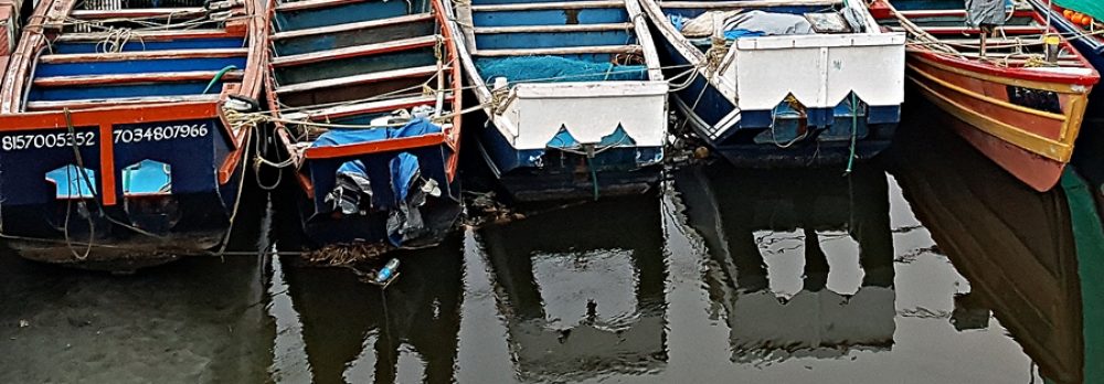
West Mersea is a holiday resort. Many fine homes, mostly modern, line the road that runs parallel to the waterfront, but which is separated from it by mudflats and salt marshes. Twenty or so large houseboats are moored at the water’s edge. Each of them has its own, often rickety-looking, boardwalk leading to it from the road. There are several pubs and eateries from which views of the boats moored by the town may be viewed. The town is famous for its oysters. We watched workmen hosing down crates filled with oysters, which look like large knobbly stones. Apparently, the Mersea oysters are highly prized internationally. Interspersed between boatyards for pleasure craft, there are yards where fishing vessels are maintained. At low tide, which is when we visited, the muddy shore is dotted with small boats of all types, some of them gently rotting away.
As it was late afternoon and we had to drive back to London and we had recently been well-fed, we spent no more than an hour in West Mersea. We hope to return when the weather warms up and then we will sample some of the local refreshment outlets. Although Mersea Island is only about 60 miles (and a lot of heavy traffic) from London’s Hyde Park Corner, it feels as if it is much further away: far away from anywhere.
TOLLESBURY IS A TINY village on the estuary of the River Blackwater in the English county of Essex, famed for its oysters, nature reserve, and sailing facilities. It is not far from Colchester and the smaller Tiptree famed for its jam manufacture. Tiny though it is, Tollesbury appears in the Domesday Book, with the name ‘Tolesberia’ and in 1218 as ‘Tolesbir’. It is possible that the ‘Toll’ part of the name refers to a person who lived many centuries ago. The Church of St Mary the Virgin that stands at one end of the central village square was built in about 1090, possibly incorporating material from an earlier Saxon Church.
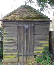
At the southern edge of the square, close to the northern boundary of the churchyard there stands a small wooden hut with a pyramidical tiled roof and one door with a small, barred window. It looks a bit like a garden shed but it was not built for storing tools and so on. For, this was the village lockup or ‘cage’. Built in 1700, it seems in remarkably good condition. The lockup, as its name suggests, was where local miscreants were locked up. It was a tiny prison. The reason that it is in a good state despite its age is that it has:
Essex is home to plenty of village lockups. Apart the lockup from at Tollesbury, you can see village lockups at, for example, Great Bardfield, Thaxted, Canewdon, Great Dunmow, Orsett, Braintree, Roydon, and Steeple Bumpstead (hwww.essex.police.uk/SysSiteAssets/media/downloads/essex/about-us/museum/research/history-notebooks/66.pdf).
These miniature jails were:
“… used in the eighteenth and nineteenth centuries to house criminals who were apprehended on suspicion of committing petty crime … Lock-ups were only temporary forms of imprisonment, usually for one or two people, before the local authorities of the day decided how to deal with the offender. Criminals could be released or sent to the closest large town for trial.” (www.essexlive.news/news/essex-news/historic-jails-essex-you-can-3227277)
Our friend, who lives in Tollesbury, suggested that probably the lockup was often used to house people who had drunk too much and needed to sober up. This not an unreasonable idea considering that at one time the village had six pubs.
Although there is much more that could be written about Tollesbury, I hope to do this after a future visit to this charming little place.
LIFE DEPENDS ON WATER. A few days ago, at the end of March 2021, we drove to a village in Oxfordshire to see two old wells. They are no ordinary wells: they were gifts from India while it was still part of the British Empire.
Maharajah’s Well at Stoke Row
Edward Anderton Reade (1807-1886) was a British civil servant in India between 1826 and 1860. Brother of the novelist Charles Read (author of “The Cloister and the Hearth”), Edward was born in Ipsden, a village in Oxfordshire (www.oxforddnb.com/). He entered the East India Company in 1823. In 1832, he was transferred to Kanpur (Cawnpore), where he introduced opium cultivation to the district. In 1846, he became Commissioner to the Benares Division, a position he held until 1853 when he was moved to Agra.
Edward encouraged genial relations with the local Indian gentry and aristocracy. One of his Indian acquaintances, who became his good friend, was Ishri Prasad Narayan Singh (1822-1889), the Maharajah of Benares, who reigned from 1835 to 1889. During the years before the Indian Rebellion of 1857 (aka ‘First War of Independence’ or ‘The Indian Mutiny’), Reade and the Maharajah discussed much about England including the shortage of water that existed in Ipsden, the part of Oxfordshire where his family lived. Apparently, the villagers in this part of the Chiltern Hills had little or no access to clean drinking water, much as must have been the case for many villagers in India.
During the Rebellion of 1857, the Maharajah remained loyal to the British. In June 1857, the town of Kanpur was besieged by Nana Sahib and his forces. After 3 weeks, the British garrison surrendered under condition that the British inhabitants would be given safe passage out of the town. However, Nana Sahib decided to hold about 120 women and children and kept them housed in a house known as the ‘Bibighar’. This ended badly when some of the hostages were killed. Some of them tried to escape their grizzly end by jumping into a well at the Bibighar. This well became one of the most powerful images of the Rebellion in the minds of those who lived in Britain.
I do not know whether or not it was the tragedy at Bibighar that brought the conversations he had with Reade to the forefront of the mind of the Maharajah of Benares after the Rebellion was over, but in 1862, after his loyalty to the British had been formally recognised, he consulted Reade as to making a charitable gift to the poor people of Ipsden, whose plight he recalled. The Maharajah financed the construction of a well at Stoke Row, not far from Ipsden. It is also possible that the Maharajah remembered the help that Reade had given him when constructing a well in Azamgarh (now in Uttar Pradesh) back in 1831.
Work commenced on the well in March 1863. The well shaft was dug by hand, a perilous job for the labourers as they removed earth from the depths of an unlit and unventilated shaft, bucket by bucket. The shaft, 4 feet in diameter, was 368 feet in depth, greater than the height of St Pauls Cathedral in London, for this is depth of the water table at Stoke Row. Special winding machinery constructed by Wilder, an engineering firm in Wallingford, was installed. It is topped with a model elephant. The mechanism and the well stand beneath an octagonal canopy topped with a magnificent metal dome with circular glazed windows to allow better illumination. It resembles a ‘chhatri’ or architectural umbrella such as can be seen at war memorials on London’s Constitution Hill and on the South Downs near Hove. The structure, restored in recent times, looks almost new today. Reade, who helped plan the Maharajah’s well, planted a cherry orchard nearby; dug a fish-shaped pond (the fish was part of the Maharajah’s coat-of-arms); and constructed an octagonal well-keeper’s bungalow next to the well. The profits from the cherries harvested from the orchard were supposed to help to finance the well, for whose water the villagers were not charged anything. The Maharajah’s well at Stoke Row was the first of many such gifts given by wealthy Indians to Britain. Other examples include the Readymoney drinking fountain in Regents Park and a now demolished drinking fountain in Hyde Park, close to Marble Arch. According to the Dictionary of National Biography:
“Reade was wryly amused that an Indian prince should thus give a lesson in charity to the English gentry.”
The well at Stoke Row provided the locals with fresh water until the beginning of WW2, when, eventually, piped water reached the area. It provided 600 to 700 gallons of water every day. The Maharajah’s Well at Stoke Row is relatively well-known compared to another Indian-financed well next to the parish church at Ipsden, where Reade’s grave is located. The well, whose winding mechanism is similar to that installed at Stoke Row, is not covered by a canopy. It stands by a cottage next to the entrance to the churchyard. It was presented to Ipsden in 1865 by ‘Rajah Sir Deon Narayun Singh of Seidpor Bittree’ (I am not sure where this is: these are the words on the well), who had, like the Maharajah of Benares, remained loyal to the British during the 1857 Rebellion.
The Ipsden well is deep but not nearly as deep as that at Stoke Row. A lady, who lives in the cottage beside the well, told us that she had tasted water from the well and it was ice cold, deliciously clean, and tasted pure, having been filtered by many feet of chalk through which it has seeped. She said that once a year, the local water board opens the well and takes a sample of its water to check its purity.
Both wells are worth visiting. We parked in Benares Road in Stoke Row close to the Maharajah’s gift. After viewing the well head and its surroundings, we bought hot drinks at the village’s shop-cum-café, which his run by a couple of friendly people from Zimbabwe. I am grateful to Dr Peter U for bringing the existence of this unusual well to my attention.
RIVER CROSSINGS HAVE often had great historical significance. The small town of Wallingford in Oxfordshire has been a place for crossing the River Thames since Roman times or maybe even before. According to “The Concise Oxford Dictionary of English Place-names” by someone with an interesting name: Eilert Ekwall, a fascinating book that I picked up for next to nothing at a local charity shop, the town was known as ‘Waelingaford’ in 821 AD, as ‘Welengaford’ in c893 AD, and ‘Walingeford’ in the Domesday Book. The meaning of the name is ‘The ford of Wealh’s people’, clearly referring to a river crossing place. It is said the William the Conqueror used the ford. Today, a fine bridge with many arches crosses the river.
Wallingford Castle
There has been a bridge at Wallingford since 1141, or before. The construction of the first stone bridge was probably constructed for Richard, the first Earl of Cornwall (1209-1272), a son of King John, who became King of Germany (Holy Roman Empire) in 1256, a title he held until his death. Some of the arches of the bridge may contain stonework from the 13th century structure. Much of the present bridge dates from a rebuilding done between 1810 and 1812 to the designs of John Treacher (1760-1836). During the Civil War (1642-1651), four arches were removed and replaced by a drawbridge to help defend the besieged Wallingford Castle.
The huge castle was built on a hill overlooking the town; the river – an artery for water transport in the past; and, more importantly, the bridge, which was an important crossing place on the road leading from London to Oxford via Henley-on-Thames. Between the 11th and the 16th centuries, the castle was used a great deal, being used as a royal residence until Henry VIII abandoned it. During the Civil War, the castle was restored and re-fortified and used as a stronghold by the Royalists. It was of great importance to them as their headquarters were at nearby Oxford. To simplify matters, the Parliamentarians began laying siege to Wallingford Castle in 1645. This initial attempt was unsuccessful because the besiegers had underestimated the strength of the castle’s fortifications. After the Royalists were defeated at the Battle of Naseby (14th June 1645), Wallingford was one of only three strongholds in Berkshire (now in Oxfordshire) still loyal to King Charles I. A second siege of Wallingford commenced on the 14th of May 1646, shortly after the Parliamentarians had laid siege to Oxford. The latter fell on the 24th of June 1646, but Wallingford held out until the 22nd of July 1646 (https://en.wikipedia.org/wiki/Wallingford,_Oxfordshire). The castle was demolished in November 1652.
The castle grounds are open to the public. Here and there, few and far between, there are ruins of what must have once been a spectacular castle. Within the grounds of the former castle, there are several informative notices that give the visitor some idea of which part of the castle used to stand near the signs. From the grassy areas that formed the motte and bailey of the castle, there are fine views of the river below and some of the town.
Although our first visit to Wallingford was brief, I learnt that the judge Sir William Blackstone (1723-1780) had presided as the Recorder at Wallingford from 1749 to 1770. “So, what?”, I hear you asking. At first, I hoped that he was something to do with the road, where we lived in Chicago (Illinois) in 1963: South Blackstone Avenue (number 5608). But I think that thoroughfare was more likely named after the American politician and railway entrepreneur Timothy Blackstone (1829-1900). The Wallingford Blackstone, who lived in the 18th century, was most probably a distant cousin of Timothy’s father (https://en.wikipedia.org/wiki/Timothy_Blackstone). Related or not, Sir William Blackstone had an extremely important influence the legal affairs of the USA.
Having studied at the University of Oxford and the Middle Temple, where he was called to the Bar, Sir William taught law at Oxford for a few years. Just before resigning his prestigious academic position in 1766, he published the first volume of what was to become a best-seller, a real money-spinner, “Commentaries on the Laws of England”. Eventually, this work was completed in four volumes. They contain:
“… first methodical treatise on the common law suitable for a lay readership since at least the Middle Ages. The common law of England has relied on precedent more than statute and codifications and has been far less amenable than the civil law, developed from the Roman law, to the needs of a treatise. The Commentaries were influential largely because they were in fact readable, and because they met a need.” (https://en.wikipedia.org/wiki/Commentaries_on_the_Laws_of_England)
The “Commentaries” are widely regarded as being the definitive sources of common law in America before the American Revolution. Blackstone’s writings were influential in the formulation of the American Constitution. His words embodied his vision of English law as a method of protecting people, their possessions, and their freedom. Blackstone’s ideas are well exemplified by this quotation from the “Commentaries”:
“It is better that ten guilty persons escape than that one innocent suffer.”
This is known as ‘Blackstone’s Ratio’.
Leaders of the American Revolution recycled the idea with words such as:
“It is of more importance to the community that innocence should be protected, than it is, that guilt should be punished; for guilt and crimes are so frequent in this world, that all of them cannot be punished…” (John Adams; 1735-1826), and:
“…it is better 100 guilty Persons should escape than that one innocent Person should suffer…” (Benjamin Franklin; 1706-1790)
As already mentioned, Sir William presided in the court in Wallingford from 1749 onwards, three years after being called to the Bar. During his career, he served as a Tory Member of Parliament a couple of times: for Hindon (1761-68) and for Westbury (1768-70). In the House of Commons, he was:
“…an infrequent and ‘an indifferent speaker’: during the seven years 1761-8 only 14 speeches by him are recorded, mostly on subjects of secondary importance. Very learned and original, over-subtle and ingenious, in major debates he showed a lack of political common sense.” (www.historyofparliamentonline.org/volume/1754-1790/member/blackstone-william-1723-80)
The Blackstone family owned a large estate at Wallingford including 120 acres of land by the River Thames. He died in Wallingford and was buried inside St Peter’s Church, which is close to the bridge over the river.
What little we saw of Wallingford, its castle, its riverside including the Thames towpath, its attractive market square, and streets rich in historic buildings, during our brief visit recently, we saw enough to whet our appetites for a future and lengthier visit.
WE ARRIVED BACK IN LONDON from several months in India on the 27th of February 2020. Since we retired, we have taken to spending a few of the winter months in my wife’s native land, India.
We have often spent Christmas in the south Indian city of Bangalore, where we stay at the long-established ex-colonial Bangalore Club, where the young Winston S Churchill once stayed and then left without settling an outstanding bill. To date, we have settled all our Club bills, you will be pleased to know. However, maybe this is one reason why none of us has ever been elected as Prime Minister of the UK or any other nation.
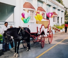
Christmas is celebrated in style at the Club. Strings of tiny lightbulbs are draped all over the establishment’s buildings and the many lovely trees in the Club’s extensive grounds. Shortly before Christmas, there is an outdoor evening carol singing concert that ends with the lighting of a huge bonfire. There is also a lively Christmas party for the members’ children that culminates with the arrival of Father Christmas on a horse-drawn carriage. I always feel a bit sorry for him as he must dress not only in a bushy white beard but also in clothing that is far too warm for the December temperatures in Bangalore, which can be in the high twenties Celsius. On Christmas Day, members and their families, who are not vegetarian as many are in India, queue up for servings of roast Turkey and a wealth of other foods available at a luncheon buffet. There is plenty available for those who prefer not to eat meat. Well, we will be missing all of this in 2020, and a lot more.
Usually, a day or so after we return to London, we visit our travel agent to book tickets for our next ‘Winterreise’ to borrow a title from the composer Franz Peter Schubert. Air tickets become available eleven months before a flight’s departure date. When we were seated at our travel agent’s desk, we told him the dates of our proposed trip. He looked on his system and told us that we could book the outbound flight, but the return flight tickets would not be available for purchase until early April. He advised us to return in April and then book both outward and inbound tickets together. That turned out to be extremely sound advice.
In the middle of March, the UK went into a total ‘lockdown’. It was no longer possible to return to our travel agent or to do much else. In addition, things were deteriorating all over the world as a result of the spreading of covid19 infections. As the weeks went past, it looked increasingly unlikely that we would be making a trip to India at the end of 2020. We were fortunate that we had been advised not to buy our outbound air tickets. Now, having reached December, travel abroad is not advised and currently travel from the UK is being curtailed. Many countries, including India, are banning travel from the UK.
In August, when restrictions on movement were being relaxed, we spent a pleasant week in a rented cottage in Kingsbridge, Devon. We liked the cottage so much that we asked its owner whether we could reserve it over the Christmas/New Year holiday period. She was happy with the idea providing that future ‘lockdown’ rules did not find her trapped there. A couple of months ago, she informed us that the cottage would not be available after all. This was not because of travel restrictions, but because a friend of hers needed temporary accommodation for a few months in winter.
Undismayed, we managed to find another self-catering cottage in the West Country to rent during the Festive Season. Then, London was cast into Tier 3 covid19 preventive measures, which discourage travel outside the Tier 3 restrictions area except between the 23rd and 28th of December. We rang our landlady in the West Country to explain that we would rather not drive so far to spend such a short time and she agreed to rebook us in March 2021.
With the West Country shelved, we decided to stay in a hotel near Cambridge and to spend some ‘socially distanced’ time with one of my cousins, who lives in the area. As the 23rd of December grew nearer, we began planning our festive feasting programme and buying mouth-watering supplies for it. Then, we all learned that the coronavirus had become highly creative and managed to mutate in more ways that most of these bugs can usually manage. This new viral creation is far more efficient at spreading from person to person than its awful ancestors. As a result, and surprisingly sensibly for our strange government, London and much of southeast England was put under stricter restrictions, Tier 4, which include a travel prohibition that forbids travel out of Tier 4 and no relaxation of restrictions during the period that we had planned to spend near Cambridge. So, that was Cambridge ‘out of the window’.
Soon after London was made subject to Tier 4 regulations, we learned that even with the arrival of new vaccines it was likely that the severe restrictions on travel might continue until Easter. So, we reached for the ‘phone and asked our future landlady in the West Country to shift our booking until May 2021. Now, we will make the most of Christmas and New Year without leaving London for any kind of winter journey, let alone India. I hope that all of this does not sound too depressing to you, because we subscribe to the idea that ‘all’s well that ends well’, and we hope that by following the rules, as ad hoc as they might be, we will all keep well.
While we munch our way through all of the festive ‘goodies’ we have accumulated, we will think of you, our friends all over the world, and wish you a prosperous and healthy future.
IT SEEMED APPROPRIATE to visit Runnymede, the so-called birthplace of democracy on a day (7th November 2020) when Donald Trump, the current president of the USA, appears to be losing faith in it and might be about to attempt to undermine it.
Runnymede, a water meadow of the Thames close to Windsor, is close to a former Roman river crossing near the town of Staines. The name is probably derived from the Anglo-Saxon words ‘runieg’, meaning ‘meeting place’, and ‘mede’, meaning ‘meadow’. The ‘Witangemot’, a council of Anglo-Saxon kings, used to meet at Runnymede between the 7th and 11th centuries (AD). This pre-Norman Conquest meeting place was used again on the 15th day of June in 1215, when King John reluctantly signed the Magna Carta in the presence of a group of barons who had met a few months earlier in the Suffolk city of Bury St Edmunds (www.visit-burystedmunds.co.uk/blog/2018/discover-bury-st-edmunds-historic-role-in-the-creation-of-the-magna-carta). Runnymede is the most probable location of the signing, as this is what is written at the end of its text (translation from www.bl.uk/magna-carta/articles/magna-carta-english-translation):
“Given by our hand in the meadow that is called Runnymede, between Windsor and Staines, on the fifteenth day of June in the seventeenth year of our reign.”
The Magna Carta, whose evolution is too detailed to be described here, was, and still, is of great importance because it aims to ensure a fair relationship between the rights of ruler and those of his or her then powerful subjects, his barons, but nowadays its principles have extended to cover all subjects of the realm, It contains chapters such as:
“In future no official shall place a man on trial upon his own unsupported statement, without producing credible witnesses to the truth of it.” (chapt. 38)
“No free man shall be seized or imprisoned, or stripped of his rights or possessions, or outlawed or exiled, or deprived of his standing in any way, nor will we proceed with force against him, or send others to do so, except by the lawful judgment of his equals or by the law of the land.” (chapt. 39)
“In future it shall be lawful for any man to leave and return to our kingdom unharmed and without fear, by land or water, preserving his allegiance to us, except in time of war, for some short period, for the common benefit of the realm. People that have been imprisoned or outlawed in accordance with the law of the land, people from a country that is at war with us, and merchants – who shall be dealt with as stated above – are excepted from this provision.” (chapt. 42)
“We will appoint as justices, constables, sheriffs, or other officials, only men that know the law of the realm and are minded to keep it well.” (chapt. 45)
The Magna Carta includes a number of items that are hardly relevant in the modern world, but those such as I have quoted above are deeply relevant and extremely important. However, the document signed by King John has some elements that illustrate attitudes that we would consider unacceptable today, notably antagonism to Jewish people as can be seen in chapter 10:
“If anyone who has borrowed a sum of money from Jews dies before the debt has been repaid, his heir shall pay no interest on the debt for so long as he remains under age, irrespective of whom he holds his lands …”, and in chapter 11:
“If a man dies owing money to Jews, his wife may have her dower and pay nothing towards the debt from it. If he leaves children that are under age, their needs may also be provided for on a scale appropriate to the size of his holding of lands…”
Seventy-five years after the signing at Runnymede, King Edward I issued an edict expelling all Jews from the Kingdom of England, thus throwing into question whether or not everyone in England was protected by the mostly virtuous intentions of Magna Carta.
In brief, Runnymede was the site of the signing a far-reaching document of great importance to the rights of citizens. Several centuries later, the Magna Carta influenced the formulation of the Constitution of the USA in the late 18th century. The area of Runnymede is now maintained by the National Trust. It contains several monuments and artworks relating to the historic significance of the place.
On arrival at the parking place, we passed a sign that reads:
“Runnymede. A home to politics and picnics for over 1000 years.”
The car park is next to one of a pair of lodges designed by Edwin Lutyens (1869-1944), son-in-law of Edward Robert Lytton Bulwer-Lytton (1831-1891) the Viceroy of India from 1876-1880, and the architect of some of the government buildings in New Delhi. The lodges were built between 1930 and 1932. They are not the only connection between Runnymede and India as I will explain soon.
During our visit to Runnymede on a crisp sunny morning, we walked across the muddy ground to four features of interest in its meadows dotted with lovely trees, many of them oaks. The first place we reached is a cylindrical stone monument standing within a ring of eight square pillars that support a circular ring whose centre is open to the sky. It is approached via a staircase with names carved in its steps. These are the names of lawyers from the USA. The cylindrical stone bears the words:
“To commemorate Magna Carta, symbol of freedom under law”
This monument was designed by the English architect Sir Edward Maufe (1883-1974) and erected by the American Bar Association in 1957.
The American monument stands a few feet above the base of an oak tree, which is growing beside a square marble stone that bears the words:
“Quercus robur, planted by PV Narasimha Rao, Prime Minister of the Republic of India, as a tribute to the historic Magna Carta, a source of inspiration throughout the world, and as an affirmation of the values of Freedom, Democracy, and the Rule of Law, which the people of India cherish and have enshrined in their constitution. March 16 1994”
‘Quercus robur’ is a type of oak tree and Rao (1921-2004), a member of the Indian National Congress Party, was Prime Minister of India from 1991 to 1996.
Twelve bronze chairs are placed in the midst of the meadow closest to the raised wooded area containing the American and Indian monuments. They are arranged in two rows of five facing each other with another two chairs at the two ends of what is effectively a rectangular dining table with the table removed. Each chair back’s two surfaces are decorated with bas-reliefs, one facing the chair opposite it and the other away from it. The bas-reliefs depict the various people, events, and ideas resulting from the ideas expressed in the Magna Carta. One of them depicts Cornelia Sorabji (1866-1954), a Parsi, the first Indian woman to practise law in India. Another depicts Mahatma Gandhi’s portable spinning wheel, his symbol of resistance to the importation of British goods to India. Other motifs are described in an informative website, https://www.nationaltrust.org.uk/runnymede/features/what-does-the-jurors-represent . Seeing the empty chairs set out so formally in the field made me feel as though someone had put them there in readiness for King John’s famous meeting with the barons in June 1215. This effective and moving artwork was created by Hew Locke (born 1959) for the 800th anniversary of the signing of the charter. It is quite likely that the sun would have been shining as brightly on that significant day as it did when we visited Runnymede.
Dramatic as is Locke’s work at Runnymede, it is rivalled, or, better, complemented, by another fantastic creation not far away. From the outside, it looks like a recently constructed circular military bunker with a tall entrance in its wall. Step inside and you find yourself in a dark passageway that runs parallel with the outer wall and another inner circular wall. Soon, you reach an opening in the inner concentric wall. This leads into a circular chamber lit by daylight coming through a circular orifice in its ceiling. The inner circular chamber contains a circular pool of water surrounded by a metal band in which words are written as a mirror image, just like the way that Leonardo da Vinci used to write. The words are reflected in the water, where they appear the right way round. They spell out the words of chapter 39 of the Magna Carta (translated into English). The effect is both dramatic and very moving. The artwork is called “Writ in Water”, the words coming from the inscription on the gravestone of the poet John Keats, which are:
“Here lies one whose name was writ in water”.
This spectacular piece of art was designed by Mark Wallinger (born 1959) as a place to reflect on the principles of democracy that were born at Runnymede in 1215. It was completed in 2018 and it alone is a good reason to visit Runnymede.
While I was writing this, news began arriving from the USA. It suggested that barring any devious surprises from the current president of the USA, the democratic process in the USA might well have a chance of remaining guided by the noble principles enshrined in Magna Carta under a new president, Mr Joseph Biden.
DRIVING ALONG THE NORTH Circular Road, I noticed a long wall over the top of which I could see what looked like the pinnacles of a Gothic revival garden folly. We were driving past Gunnersbury Park in West London and did not have time to stop. So, the next day, we drove back to the park and spent some time exploring it. What we found was a fascinating estate consisting of beautiful park land and a series of architectural delights. This is hardly far from where we live, but it was the first time that we had visited it. Had I not noticed what I did when on the North Circular Road, I am not sure that we would not have considered making a trip to find out what lies behind the wall next to which queues of slow moving traffic can often be seen.
The first impression one gets on entering Gunnersbury Park with its wealth of trees including many Cedars of Lebanon is that you are inside the grounds of a great house such as you can find at, for example, Ham House and Osterley Park. That impression is justified because Gunnersbury Park is basically what is left of the grounds of a mansion built in the Palladian style for the lawyer and politician Sir John Maynard (1604-1690) between 1658 and 1663. It was designed by the architect John Webb (1611-1672). Maynard died at Gunnersbury Park.
Between 1762 and 1786, Gunnersbury Park was used as a summer residence by Princess Amelia (1711-1786), who was King George III’s aunt (https://historicengland.org.uk/listing/the-list/list-entry/1000808). In 1761, she had bought the estate from George Furness (after 1688-1756). His father had been a ‘factor’ in the East India Company. George was a British merchant and politician as well as being an art collector. He was a Member of Parliament between 1720 and 1756 and had bought the property in 1739 from John Hobart (1693-1756), 1st Earl of Buckinghamshire, a British politician. Furness improved the grounds by employing the famous gardener William Kent (1685-1748). I am not sure how much of his original design has survived the passage of time.
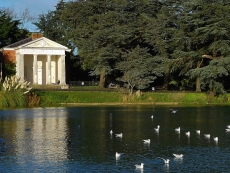
Princess Amelia, the second daughter of King George II, did much to improve the grounds, by landscaping, arranging planting, and by adding ornamental buildings, which still add to the charm of the place. These buildings include the bath house and a neo-classical temple, which overlooks a circular pond.
The princess held fabulous parties at Gunnersbury. In “Handbook to The Environs of London” by James Thorne, which was published in 1876, the politician and intellectual Horace Walpole (1717-1797), author of the Gothick novel “The Castle of Otranto”, who attended some of these parties, is quoted thus:
“Ever since the late king’s death, I have made Princess Amelia’s parties once or twice a week … I was sent for again to dine at Gunnersbury on Friday, and forced to send to town for a dress-coat and a sword. There were the Prince of Wales, the Prince of Mecklenburg, the Duke of Portland, Lord Clanbrassil … The Princess, Lady Barrymore, and the rest of us, played three pools at Commerce till ten … While we were at the Dairy, the Princess insisted on my making some verses on Gunnersbury. I pleaded being superannuated. She would not excuse me. I promised she should have an Ode on her next birthday, which diverted the Prince; but all would not do.”
The next morning, Walpole composed three verses for the Princess. One of them (quoted in a letter from Walpole to HS Conway dated 18th of June 1786) reads as follows:
“Oh! Why is Flaccus not alive,
Your favourite scene to sing?
To Gunnersbury’s charms could give
His lyre immortal spring.”
Walpole admitted in his letter to Conway that his poem was not one of his best. He wrote:
“If they are but poor verses, consider I am sixty-nine, and was half asleep, and made them ex-tempore – and by command!”
Following the death of the Princess, the Palladian mansion was demolished in 1801. Its contents were sold by auction and the 205 acres of its grounds were divided into lots and sold at the same time. Most of their area was bought by Alexander Copland (1774-1834), who built a new house, which forms the basis for the present building, which now houses a museum, which is currently closed because of the covid19 pandemic. Copland, a builder and business partner of the architect Henry Holland (1745-1806), was a son of Alexander Copland and his wife Barbara (née Smirke). The Alexander, who bought Gunnersbury was a cousin of the architect Robert Smirke (1780-1867), whose brother, also an architect, Sydney Smirke (1797-1877) designed the Orangery, which was built at Gunnersbury Park in 1836, and has been restored beautifully.
Copland built The Large Mansion (now the museum). Either Stephen Cosser or Major Alexander Morrison, a retired East India Company officer who bought the plot from him, built the so-called ‘Small Mansion’ to the east of the Large Mansion, which is currently in a poor state of repair. A gardener explained to us that it was supposed to be cared for by one London borough whereas the Large Mansion was under the care of another. In 1828, the part of the estate with the Small Mansion was bought by Thomas Farmer, who lived there as Copland’s neighbour until 1835.
In 1835, Copland’s Large Mansion was bought by the banker Nathan Mayer Rothschild (1777-1836). After his death a year later, his widow Hannah (née Barent-Cohen; 1783-1850) used Gunnersbury Park as her second home and employed the architect Sidney Smirke to make alterations to it (https://family.rothschildarchive.org/estates/37-gunnersbury). Following Hannah’s death, her oldest son Lionel Rothschild (1808-1879), the first ever practising Jew to become a Member of Parliament, took over the property and enlarged its park as well as improving the house’s facilities. After his death and that of his widow Charlotte, the estate moved into the possession of their youngest son Leopold de Rothschild (1845-1917).
In 1889, Leopold purchased the Small Mansion and thereby reunited the two parts of the original Gunnersbury estate. Under the ownership of the Rothschild family, many improvements were made to the grounds, some of which I will mention soon. After Leopold died in 1917, the estate was broken up and parts were sold off. In 1925, both mansions and about 185 acres of attached grounds were purchased for public use by the then Boroughs of Acton and Ealing. Now, the park and its mansions are maintained by the boroughs of Ealing and Hounslow.
The Large Mansion is elegant but not as attractive as the one which was demolished long ago and can be seen in old drawings. Nearby, the temple that overlooks a pond is delightful and reminded me of some of the garden architecture at Stourhead (in Wiltshire). Wandering around the garden, you will come across the Gothic revival architectural features I saw when driving past Gunnersbury Park on the North Circular Road. These are built around ‘Princess Amelia’s Bath House’, a garden folly built in the 1780s. Not far from this, there are very picturesque ‘Gothick’ ruins near to the estate’s farm buildings. These might be the remains of the dairy mentioned above in the quote from Horace Walpole or possibly later additions to the grounds constructed by an owner who bought the Princess’s estate. One source (https://brentfordandchiswicklhs.org.uk/publications/the-journal/journal-10-2000/princess-amelias-bath-house/) suggests that what is now called the ‘Bath House’ might have been the dairy in Amelia’s time at Gunnersbury. Whatever its history, lovers of romantic Gothic revival ruins will get great pleasure from what can be seen at Gunnersbury Park.
The Orangery stands next to a large pond. This structure was built whilst the Rothschilds owned the estate. It was constructed in 1836, designed by Sidney Smirke. The family were responsible for another water feature on their estate. It has a name that intrigued us: the Potomac Pond. This almost circular water body is surrounded by a fence and almost hidden by the trees and other vegetation growing around its perimeter. It is only accessible to members of a local angling club. The Rothschilds had purchased a former clay pit and converted it into the pond. One of the claypit’s kilns was rebuilt to create a Gothic revival tower on its shore. This lovely folly, which would look at home in a painting by the German Caspar David Friedrich (1774-1840), might have once been used as a boathouse.
I have described a few of the features that make it well worthwhile to visit Gunnersbury Park, whose history is not exactly simple. The place is so near to London and the M4 motorway, yet it feels so far away. If it were not the background roar of the traffic and the low flying aeroplanes descending towards Heathrow Airport, fewer than usual these days, it would be hard to believe you were not deep in the countryside.
SINCE THE FOURTH OF JULY 2020, the anniversary of the day Britain lost a large American colony and when our worldly wise Prime Minister deemed it safe for all of us to be liberated from the constraints of ‘lockdown’ and encouraged us to ‘eat out to help out’, a policy that appears to have helped to spread the covid19 virus as well as restaurant owners, we have been roaming around the countryside, discovering what a beautiful country we inhabit. What has struck me when driving from A to B is the number of exceptionally attractive, yet not well-known, villages we have passed through. The village of Comberton in Cambridgeshire was one of these, which we nearly drove past without examining it. However, as time was on our side and it looked so lovely, we stopped there for a few minutes and took a stroll around.
We parked next to an oddly shaped small village pond in which clumps of reeds were growing. A small family of ducks wound its way between the vegetation, occasionally disappearing from view. At the far end of the pond, there is an old low brick wall. Behind it, there is a long two-storey house with a brick roof and decorative chimney stacks. Before describing some of the other lovely buildings in the village, let me give you a flavour of its history.
Sometime between 4000 BC and 2500 BC, someone dropped a polished Neolithic stone axe near where the village stands today. Somewhat later, the Romans built a villa near Comberton. Even later, the village’s name began to evolve, as is described on the village’s website (http://www.comberton.org/home/about-comberton/history-of-comberton/):
“A lot is said about the name of the village and its origins. It is believed that the name is of Celtic origin, possibly named after a landowner by the name of Cumbra. The Domesday Book (1086) has it recorded as Cumbertone. According to William Kip’s map of the area in 1607 Comberton is spelt as it is today and interestingly Barton is spelt Berton”
The village has several churches, which we will visit in the future. One of these is St Mary’s, is in the Early English style with later modifications. Another still extant place of worship is used by non-Conformists. There have been associations between non-Conformism and Comberton since as early as the 17th century. The Puritan William Dowsing (1596-1668), an iconoclast, visited the village in March 1643, and recorded:
“‘We brake downe a crucifix and 69 superstitious pictures we brake downe, and gave order to take downe 36 cherubims, and the steps to be taken down by March 25.’”
Prior to 1772, when a new road, a turnpike (now the A228), was built, Comberton was on the road connecting Oxford with Cambridge. Apart from the usual activities found in villages, such as butchery, bakery, saddlery, harness-making, inn keeping, blacksmithing, and so on, the place had one industry for a while. That was in the 19th century when Comberton became a small centre for mining coprolite, fossilised dung. This material used to be ground in a mill to produce a powder that made a good crop fertiliser. Judging by the good state of the houses and the high-quality cars parked near them, the inhabitants of Comberton appear make their living in reasonably well-paid jobs. Were I to have had a profitable career in or near Cambridge, this village might have been a good place to live.
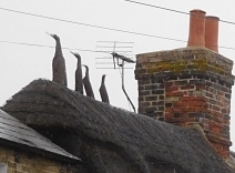
Every village is unique, but many share the same features. In Comberton, we saw several houses with well-maintained thatched roofs. However, we also saw something I had never noticed before. Some of the houses had what you might describe as ‘hybrid’ roofs: partly thatched and partly tiled. One house near the village pond had something we have seen on thatched roofs in many other villages. That is, the ridge of the thatch is decorated with animals made of thatch. Here in Comberton, this one roof was adorned with thatch sculptures of four birds with long necks, that made me think they are supposed to be depicting geese rather than ducks or swans.
The village pond, which is across the road from a dental surgery and ‘Millionhairz’, a hairdresser’s salon, is encircled by an attractive low, neatly built stone wall that curves around the water in a visually pleasant way. On the green next to the pond, there is a timber post that supports a sign (erected 1977) with the name of the village and a two-sided picture above it. On one side, a priest is depicted handing fishes to three people with outstretched arms. This refers to years long past when herrings were handed out to the poor in the village soon before Easter. The other side of the picture above the village name depicts a farmer ploughing his field with a plough drawn by a horse. Behind the farmer high on a hill, there is a white coloured wooden windmill. This reminds us that once Comberton had two working mills.
Our visit to Comberton lasted no more than ten minutes partly because we had to reach somewhere to meet my cousin and because the weather was miserable: grey, cold, and wet. However, what little we saw of this delightful place made us realise that it was well worth stopping en-route to our destination. We have already driven through so many intriguing villages on our excursions through the English countryside. I would have liked to spend time in all of these, and hope to return to some of them in the future. I would rather spend time wandering around picturesque villages than sitting for hours in traffic jams, as happens so often these days.
THERE IS A LOVELY STRETCH of the railway from London Paddington to Devon and Cornwall. It is between Exeter and Newton Abbot. The train runs from Exeter along the western shore of the wide estuary of the River Exe, then along the seashore between Dawlish Warren and Teignmouth (often between the base of cliffs and the sea), and finally turns inland to run along the shore of the broad River Teign to reach Newton Abbot. This scenic stretch of track helps make the trip to the far southwest extremely pleasant.
In August 2020, our friends in Torquay took us by car to Teignmouth and other points along this scenic rail route. It was fun to stand near the track and watch trains rushing past. One of the places we visited on that trip was the small village of Starcross, where a small passenger ferry crosses the Exe, carrying pedestrians, cyclists, the crew and their small dog to and from Exmouth. Near the Ferry embarkation point which is reached by crossing the railway via a footbridge, I spotted something quite surprising for this day and age of concerns about health and safety. A small gate (‘kissing gate’ variety) for pedestrians allows people to cross the tracks to reach the beach beyond them. This crossing is unguarded and permits folk to walk across two lines of track along which trains hurtle every few minutes. A sign exhorts those foolhardy enough to make use of this crossing to “Stop, Look, and Listen”.
Near the pier where one boards the ferry at Starcross, there is a brick building with white stone facings and a tall square brick tower. This edifice that has an industrial appearance stands close to the railway lines. In days gone by, it was a pumping station for a railway whose trains were propelled by compressed air, the so-called ‘Atmospheric Railway’.
The South Devon Atmospheric Railway, which followed the route taken by trains today, ran between Exeter and Plymouth. The construction of the westbound line from Exeter, The South Devon Railway, gained Parliamentary authorisation in mid-1844. Isambard Kingdom Brunel (1806-1859) was the engineer in charge of constructing the South Devon Railway. Given the then current power of steam locomotives, he decided that they would not have sufficient strength to deal with some of the gradients along the route. He opted to use propulsion generated by gases under pressure – the atmospheric system. One of the pioneers of atmospheric railways was the English engineer and politician Joseph d’Aguilar Samuda (1813 –1885), whose ideas influenced Brunel.
Trying to put it as simply as possible, here is how I understand that the atmospheric railway system worked. A cylindrical metal traction pipe was laid between the railway tracks. This pipe had a longitudinal slit facing upwards. The slit was sealed shut by leather flaps that kept the pipe airtight when it was filled with compressed air provided by a series of pumping stations along the line. The building we saw at Starcross was one of these units, whose engines could generate between 45 and 82 horsepower.
The pumps injected air into the slitted longitudinal iron pipes (20 inches in diameter), whose leather flaps prevented escape of the gas. The trains using the atmospheric system were pulled by specially designed traction cars. Each of these cars was attached to a piston that fitted snugly within the air pipes running along the track. The attachment of the piston to the traction car was fitted with a mechanism that opened the short section leather flap immediately beneath it. The compressed air exerted pressure on the end of the piston, causing it to move along the pipe. Being attached to the traction car, the motion of the piston caused the car to move along the tracks. As the traction car was attached to the carriages, they were pulled along by the air-propelled traction car. As soon as the traction car moved along the track, the part of the flap that had been open momentarily, then closed, and the next short section opened briefly. What I have described is an oversimplification that ignores how the system dealt with points, level crossings, etc. More detail is available for those interested on various websites (e.g. https://railwaywondersoftheworld.com/atmospheric-railway.html and on Wikipedia).
This system of propulsion was able to propel trains at speeds up to 70 miles per hour, although this speed was rarely attained. It also allowed trains in the late 1840s to overcome gradients that would have been too challenging for the steam engines at that time. The system was abandoned in about 1848. The leather valves caused numerous problems. Air leakage was one of these. Throughout the year, the leather dried out and became too stiff for use. In winter, frost also damaged their flexibility. Throughout the year, they provided food for rats, whose activities were detrimental to their efficient functioning. The rat story is oft quoted but WG Hoskins, author of the much-respected book “Devon” notes that the atmospheric railway:
“… was a complete failure mainly because of the decomposing action of water and iron on the vital leather component of the valves … In September 1848 the line was worked by locomotives and the ‘Atmospheric Caper’ was abandoned for good, after more than £400,000 of the company’s money had been wasted. Brunel had made a tremendous mistake …”
I wonder whether with today’s synthetic rubber the experiment could be repeated, thus creating a railway system that makes little use of diesel engines. I suppose that electrification of the line might be a more practical solution.
Today, the largest relics of the short-lived Atmospheric Railway are the well-built pumping stations such as the one next to Starcross Station and the ferry embarkation point. It was built in 1845 and designed by Brunel. It consists of two blocks and the tall, solid looking chimney (https://historicengland.org.uk/listing/the-list/list-entry/1097684). In 1869, the east block, which used to house the boilers, was converted for use as a Wesleyan chapel, and served this purpose until 1950. The west block used to house the beam engine that used to compress air. This block was later converted to an engine shed for housing steam locomotives until 1981, when it became home to a museum related to the Atmospheric Railway. In its heyday, the Atmospheric Railway was powered by 11 pumping stations, of which only four remain standing (Starcross, Totnes, Dawlish [not much left to see], and Torquay). There is one other souvenir of the ill-fated system at Starcross. This is a pub opposite the station. It is called ‘The Atmospheric Railway Inn’. Sadly, the covid19 pandemic has resulted in it deciding to remain closed for the foreseeable future.
I had never heard of the Atmospheric Railway until we visited our friends in Torquay. Had it not been for their suggestion that we took a trip across the River Exe on the ferry, I might never have noticed the former pumping station at Starcross and remained in ignorance of Brunel’s adventurous experiment in railway technology.