Drowned in India

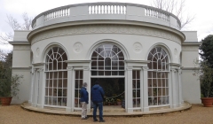
ON OUR THIRD VISIT to the delightful grounds of Compton Verney House in Warwickshire, we took a close look at the chapel that stands close to the main house. Constructed between 1776 and 1779 in Palladian style, it was designed by someone who was far better known for his skill in landscape planning than for his architectural ability, Lancelot (‘Capability’) Brown (c1715-1783).

The chapel was constructed to replace another older mediaeval one that Brown demolished in order to improve the view of the garden’s lake from the main house. A slender obelisk stands close to the lake, marking the former position of the older chapel. A carved stone notice below it explains:

“This obelisk is an exact model of the Lateran obelisk at Rome. The marble was given by Joseph Thomas Jeffrey Esq of Place in Cornwall”

A man with the same name ordered the building of the Treffry Viaduct in Cornwall in 1839, using granite from his own quarries (https://explorecornwall.org/a-walk-around-luxulyan-valley/). Maybe this is the same person who supplied the granite on which the Compton Verney obelisk stands. Place in Cornwall is near to Fowey, where Jeffrey was based.

 Close to this monument, there are a couple of gravestones lying in the grass. When the old chapel was demolished in 1772, most of its funerary monuments were saved and then transferred to Brown’s new chapel, where they can be seen today.

A fenced off area near the obelisk contains a brick structure from which spring water issues. This is fed to a rectangular stone bath next to the lakeside. This pool is currently being used to grow watercress.

On entering Capability Brown’s chapel, the visitor cannot help immediately noticing the splendid carved monument in the centre of the eastern half of the nave. Carved in 1631 by Nicholas Stone (c1586-1647), sculptor and architect as well as Master Mason to both James I and Charles I, its top bears the carved almost life-sized effigies of Richard (1563-1630) and Margaret Verney (née Margaret Greville, 6th Baroness Willoughby de Broke; c1561-1631) . Various large gravestones form the floor of the raised step where an altar should normally stand. Some of these have been placed so that the heads of the stone slabs face east rather than the usual west. The oldest memorial that we could find in the chapel is dated 1574. It is the gravestone of George Verney (c1543-1574), son of Sir Richard Verney (c1516-1549) and his wife Frances (née Raleigh; c1521-1544).

While I was looking at the stones set in the floor, our friend, who was accompanying us and knows of my interest in India and its history, pointed to a commemorative plaque on the north wall of the chapel. It informs:

“In memory of Henry Verney 2nd Lieutenant VII Hussars. Born June 19th 1870, drowned at Poonah with two of his brother officers June 25th 1893, and of Katharine Verney born July 3rd 1874, died July 28th 1897.”

Henry’s full name was ‘Henry Peyto Verney’. He was the son of Henry Verney, 18th Baron Willoughby de Broke (1844-1902) and Geraldine (née Smith-Barry). Katharine was Henry’s sister.  ‘Poonah’ is an old name for the city of Pune (modern name) in the current State of Maharashtra in India.

The VII Hussars were originally ‘7th Queen’s Own Light Dragoons’. They took on their new name in 1807. This British army unit, which Henry Verney joined, was in existence from 1805 until 1958. The unit served all over the place: in the Peninsular Wars (1808-1809); in England to help quell the Corn Law Riots (1815); at the Battle of Waterloo (1815); in Canada, quelling riots (1838-1842); in India suppressing the Revolt that began in 1857 (1857-1859); South Africa (1881-1882) during the First Anglo-Boer conflict; the Sudan (1884-1885); and again in India (1886-1895)

Henry Verney joined the VII Hussars and went out to India at the age of twenty. According to a history of the VII Hussars (https://www.britishempire.co.uk/forces/armyunits/britishcavalry/7thhussarsverney.htm) :

“Preparations for embarkation to India began in September 1886 when the 7th left Hounslow to go to Shorncliffe. Horses were handed over to the Mounted Infantry and to the 14th Hussars who were returning from India. Extra men were drafted into the regiment from other hussar units so that the strength was now 21 officers, 587 NCOs and privates. They, with 50 women and 47 children proceeded by rail to Portsmouth where they sailed on the ‘Euphrates’ troopship on 26th Nov 1886. They arrived at Bombay on 23rd Dec, taking less than a month, so must have sailed through the Suez Canal. They were stationed at Secunderabad … In Oct 1891 they moved to Mhow…”

They arrived at Mhow (renamed ‘Dr. Ambedkar Nagar’  in Madhya Pradesh State) in the year following that in which Henry Verney joined them:

“He joined the 7th Hussars on 8th Oct 1890 and served with them in India but he was unfortunately drowned in a boating accident at Poona on 25th June 1893. He and two other young officers, Lt Sutton and Lt Crawley were on leave and hired a sailing boat to go on the river, but they lost control of it in the current and were swept over a waterfall. The three of them were seen clinging to the upturned boat in the swirling waters but they succumbed and went under, one of them was last seen swimming towards a bridge but he never made it. Verney’s body was found on 27th and the other two on the next day. They were buried on 28th June with military honours. A firing party was provided by 2nd Yorks LI and a gun carriage by L Battery RHA. The commanding officer Lt-Col J L Hunt attended with 9 officers and 3 warrant officers.”

This plaque in Capability Brown’s chapel is not the only one recalling the drowning of Henry Verney. Another one can be seen in the church at Lighthorne, a village close to Compton Verney. The trapezoid plaque, which I have yet to see, reads:

“TO THE GLORY OF GOD/ AND IN THE MEMORY OF HENRY PEYTO VERNEY/ LIEUT 7TH HUSSARS DROWNED AT POONAH/ IN INDIA 25 JUNE 1893 AGED 23 YEARS” (www.iwm.org.uk/memorials/item/memorial/83855).

Had Henry not been killed so young, he might have become involved in the Second Anglo-Boer War (1899-1902) or even WW1, by which time he would have been 44 years old. During that war, the VII Hussars lost 224 of their members in Mesopotamia during 1917.  They had been sent to the Middle East from Bangalore (India), where they had been stationed since 1911.

Even if your interest in India is minimal or non-existent, it is well worth making a visit  to Compton Verney to see its art collections, house, chapel, its lake with fine stone bridges, its wonderful trees, and its beautifully landscaped grounds.

A hero of Chile in Richmond-upon-Thames

BETWEEN OUR FRIENDS’ house in Richmond and Richmond Bridge, which crosses the River Thames, is but a short walk, taking not more than five minutes at a leisurely pace. Yet, during this brief walk that I took yesterday, on the day that my mother would have been one hundred years old, I spotted three old things that were new to me.

The first thing I noticed for the first time is a small single-storeyed building on Church Terrace close to the Wakefield Road bus station. What attracted me to it was a stone plaque set within its stuccoed façade that stated:

“The Bethlehem Chapel built in the year 1797.”

It is still in regular use. I picked up an information leaflet from a plastic container next to its locked door, and this provided me with some information about the place, whose façade looks original but has otherwise been substantially updated.  The interior of this non-Conformist place of worship appears to be similar to what it was when it was first built but considerably restored and modernised a bit (see images of the interior on the video: https://youtu.be/kIYuxaMyZsA).

John Chapman, market gardener of Petersham, where currently the fashionable, upmarket Petersham Nursery flourishes, built the chapel for an independent Calvinist congregation. It was opened by William Huntingdon (1745-1813), a widely known self-educated Calvinist preacher, who began life as a ‘coal heaver’ (https://chestofbooks.com/reference/A-Library-Of-Wonders-And-Curiosities/William-Huntingdon.html). Because of this, the chapel, which is the oldest independent Free Church in the West of London, is also known as the ‘Huntingdon Chapel’. By Free Church, the leaflet explains:

“We do not belong to any denomination. We are an Independent Free Church, which means that we are not affiliated to any organised body like the Church of England, Methodists or Baptists etc.”

More can be discovered about the congregation and its beliefs on the chapel’s informative website (http://bethlehem-chapel.org/index.html).

Between the chapel and the bridge, there is an Odeon cinema with a wonderful art deco façade. This was designed by the architects Julian Leathart (1891-1967) and W F Granger and was opened in 1930. It was originally named the ‘Richmond Kinema’, but this was changed to the ‘Premier Cinema’ on the 29th of June 1940:

“… to enable the removal of the Richmond name on the cinema, in case German parachutists landed nearby.” (http://cinematreasures.org/theaters/6260)

In May 1944, the cinema’s name was changed to the ‘Odeon’. Before it was converted to a triple screen cinema in 1972, its huge auditorium was able to accommodate 1553 seated viewers.

Crossing the main road in front of the cinema, we descend Bridge Street towards Richmond Bridge, but before stepping onto the bridge, we turn left and enter Bridge House Gardens. This open space was the site of the now demolished Bridge House, which was the sometime home of a Jewish family:

“Moses Medina (nephew of Solomon Medina and three times treasurer of Bevis Marks) lived at Bridge House from the 1720s to 1734, having lived previously at Moses Hart’s old house. Abraham Levy lived there from 1737-1753. Levy was a wealthy merchant of Houndsditch.” (www.richmondsociety.org.uk/bridge-house-gardens/).

Solomon Medina (c1650-1730) followed the future William III to England and became “…the leading Jew of his day” according to Albert Hyamson in his “History of The Jews in England” (publ. in 1928), a book I found in the second-hand department of Blossom Book House in Bangalore. Medina became the great army bread contractor in the wars that followed his arrival in England. He was knighted for his services, thus becoming the first professing Jew to receive that honour. His reputation was called into question because it was alleged that he had bribed John Churchill (1650-1722), the First Duke of Marlborough (see “Marlborough” by Richard Holmes, publ. 2008). Moses, his nephew, was a rabbi at the Bevis Marks synagogue in London and thrice its treasurer and also involved in his uncle’s bread contracting, supplying this food to Marlborough’s forces in Flanders (https://forumnews.wordpress.com/about/bank-of-england-nominees/).

Bridge House was demolished in 1930 to create the present area of parkland. Well, I did not know about the Medina connection with Richmond when we visited the Bridge House Gardens. What attracted my attention as soon as I set foot in the small park was the bust of a man looking across a flight of steps and out towards the river below it.

The bust depicts a man wearing a heavily decorated military uniform with tasselled epaulettes. It is a representation of General Bernado O Higgins  (Bernado O’Higgins Riquelme), who was born in Chile in 1778 and died in Peru in 1842. Bernado was an illegitimate son of Ambrosio O’ Higgins (c1720-1801), who was born in Sligo (Ireland) then became a Spanish officer. He became Governor of Chile and later Viceroy of Peru. Bernado’s claim to fame is that he was a Chilean independence leader who freed Chile from Spanish rule after the Chilean War of Independence (1812-1826). He is rightfully regarded as a great national hero in the country he helped ‘liberate’.  But, what, you might be wondering, is his connection with Richmond?

O Higgins studied in Richmond from 1795 to 1798 and while doing so, lived in Clarence House, which is at 2 The Vineyard, Richmond. Whilst in Richmond, he studied history, law, the arts, and music (https://www.davidcpearson.co.uk/blog.cfm?blogID=632) and met  Francisco de Miranda, who was active amongst a London based group of Latin Americans, who opposed the Spanish crown and its rule of colonies in South America. The bust was inaugurated in 1998 to celebrate the 200th anniversary of the departure of O’ Higgins from Richmond. Our friends told us that once a year, a delegation of Chileans arrives by boat at Bridge House Park to celebrate joyously in front of the bust of their national hero. As they arrive, another boatload of people arrives to join the celebration: members of the administration of the Borough of Richmond.

No far from the memorial to the great O’ Higgins, there is another remarkable sight close to the river: a tree with a small notice by its roots. To me, it did not look exceptional, but the notice explains that this example of Platanus x hispanica (aka ‘London plane’):

 “… is the Richmond Riverside Plane, the tallest of its kind in the capital, and is a great tree of London.” First discovered in the 17th century, this hybrid of American sycamore and Oriental plane, was planted a great deal in the 18th century. The plane growing near to the bust of O’ Higgins has a record-breaking height. What I cannot discover is the date on which the notice was placed. So, being the sceptic that I am, I wonder if any other plane trees in London have exceeded the height of this one since the notice was installed.

All of what I have described can be seen in less than ten minutes, but as I hope I have demonstrated, a great deal of history is encapsulated in that tiny part of Richmond.

Ham and Highgate

LAUDERDALE IS A NAME, which until a few days ago I used to associate solely with Highgate in north London. Lauderdale House sits on Highgate Hill close to Waterlow Park. What you see of it today is a highly restored 18th century building that dates to 1760. Prior to that date, a finer looking timber framed house built in 1582 stood on the site. Built for the goldsmith Richard Martin (died 1617), who was Mayor of London in 1589, it was one of the finest country houses in Highgate. The present version, although acceptable aesthetically, is unremarkable. In 1645, the house became the property of John Maitland, 1st Duke of Lauderdale (1616-1682), a Scot.

Originally a supporter of Oliver Cromwell’s regime, he later became a supporter of King Charles II in 1660 soon before his restoration to the throne. During the reign of Charles II, Lauderdale held several of the highest offices in the land including Secretary of State and Lord High Commissioner. He was also involved in the Company of Royal Adventurers of England trading with Africa (founded 1663), which dealt much in slaves and gold.  

Lauderdale was first married to Lady Anne Home (1612-1671), a Scottish aristocrat. A year after Anne died, Lauderdale married Elizabeth Murray, Countess of Dysart (1626-1698), who had been an active and important supporter of Charles II during and after his exile. Evelyn Pritchard in her book “Ham House and its owners through five centuries 1610-2006” reports that it was rumoured that she had been having an affair with Lauderdale while she was still married to her first husband, Sir Lionel Tollemache (1624-1669). Lauderdale’s second marriage brings us across London from Highgate to the River Thames at Ham near Richmond.

Elizabeth Murray was the first born of the four daughters of William Murray, 1st Earl of Dysart (c 1600-1655) and his wife Catharine (née Bruce). Being the eldest, Elizabeth inherited her father’s title and the home he owned at Ham, Ham House.  Her father, William, acquired Ham House in 1626. During the Civil War, Elizabeth Dysart maintained good relations with both Oliver Cromwell and the exiled King Charles II and thus preserved her ownership of Ham House, where she and Tollemache produced eleven children.

The house that William took over had been built between 1608 and 1610 by Sir Thomas Vavasour (1560-1620), a naval captain who had fought the Spanish at sea in the late 16th century. He had been awarded his knighthood at sea in 1597. The basic structure of Ham House, an ‘H plan’ typical of the Jacobean style, has survived although over the years newer parts have been added to it particularly at the rear. Seen from the front, Ham House has retained its original attractive Jacobean appearance. The rear of the house (the south facing garden side) has lost two of the original arms of the ‘H’ because the space between them was filled with an extension created by the Lauderdales in the 1670s. Thus, the north (front) façade is Jacobean, the southern one is in the later baroque style with sash windows, which make it look much newer than it is actually.

Because of the restrictions caused by the covid19 pandemic we were only allowed to view the ground floor rooms. However, this was sufficient to see what a splendidly decorated and furnished place the Lauderdales created. Every room we saw from the grand Great Hall and the fine carved wooden staircase to the smallest closets is a wonder to behold. A couple of rooms had beautiful ceilings with paintings, one by the German Franz Cleyn (c1582-1658) born in Rostock (Germany) and died in London, and another by the Italian Antonio Verrio (c1636-1707), born in Lecce (Italy) and died at Hampton Court.

Ham House has wonderful gardens, which we explored briefly before walking back to Richmond via the water meadows that flank the Thames. For me, the highlight of the grounds of Ham House was the geometrically perfect, formal garden to the east of the house. This was originally ‘the Cherry Garden’ where cherries are known to have been grown in 1653, when it was leased to one Samuel Purnell. The National Trust website (https://www.nationaltrust.org.uk/ham-house-and-garden/features/the-garden-at-ham-house) informs us that:

“… the garden re-creates what historically ‘might have been’, following work in the 1970s to reinstate 17th century character previously lost.”

A statue of Bacchus, the only original piece of garden sculpture to have survived at Ham, stands in the heart of this perfectly manicured example of man’s influence on nature.

The National Trust received Ham House from Sir Lyonel Tollemache (born 1931) and his son Cecil Lyonel Newcomen Tollemache in 1948. The 9th Earl of Dysart (1859-1935), a descendant of William Murray, inherited Ham House in 1884 but died childless in 1935. The Dysart title passed on to his niece Wynefrede (1889-1973) whilst Ham House was passed on to his second cousin Sir Lyonel.

We left Ham House, thoroughly intrigued, and satisfied by what we had seen and hope to return a few more times. From now on, when the name ‘Lauderdale, springs to mind, I will not automatically think of my old ‘stomping ground’, Highgate, but also Ham will spring to mind. There is a local north London newspaper “The Ham and High” that covers what happens in Hampstead and neighbouring Highgate. Now. that paper’s name has assumed a new meaning for me having learned of Lauderdale’s connection with both Ham and HIGHgate.

A short stroll in Kensington

BEDFORD GARDENS IN Kensington is a short street connecting Kensington Church Street at its eastern end and Campden Hill Road up the hill at its western end. The facades of many of the buildings along this thoroughfare are at least partly hidden behind foliage that can be very luxuriant in the warmer seasons of the year. We have walked along this street frequently, but it was only recently that we noticed two commemorative blue plaques, which record that someone famous lived in the buildings to which they are affixed.  Also, we looked at one building, which has no commemorative plaque, but does merit at least one.

77 Bedford Gardens

A rich network of leafy wisteria branches covers the façade of number 4 Bedford Gardens on the north side of the road. Partly hidden by this vegetation, there is a circular blue commemorative plaque that informs the viewer that the composer Frank Bridge (1879-1941) lived there. He did so for many years in this house that was built in the late 1830s (www.rbkc.gov.uk/virtualmuseum/general/default.asp). What little I have heard of his compositions has not appealed to me.

Further along the road and on its south side, there is a blue plaque on number 27. It tells us that William Beveridge (1879-1963), “architect of the Welfare State”, lived in this elegant brick house from 1914 to 1921. During this period of his life, this Liberal politician left the Board of Trade in 1919 to become Director of the London School of Economics, a post he held until 1937, a year or so before my father arrived at that institution as a post-graduate student from Cape Town.

Many years ago, if my memory serves me correctly, a friend of mine, who was studying history of art at the Courtauld Institute, spent several weeks as a lodger in the home of the art historian John Pope-Hennessy (1913-1994). I remember visiting my friend there once back in the 1970s. The famous art historian, whom I did not meet, lived for some years in Bedford Gardens (www.kensingtonsociety.org/wp-content/uploads/Annual-Report-1994.pdf) at number 41 ( according to a letter published in the “Times Literary Supplement” of October 29 1976). If there is a commemorative plaque for Pope-Hennessy on Bedford Gardens, I have not yet found it.

One house in Bedford Gardens that deserves a commemorative indication is a tall brick building with large studio windows on several of its five storeys. Built in 1882, it bears the numbers 77 and 79.  A sculpted head, looking like a classical Greek or Roman carving, is mounted centrally in the façade above the first-floor windows. This building was once used as artists’ studios; it might still be used by artists. According to an incomplete list (https://en.wikipedia.org/wiki/Bedford_Gardens,_London) of notable people who resided in Bedford Gardens, number 77 was used by the artists Robert Colquhoun (1914-1962), Robert MacBryde (1913–1966), Jankel Adler (1895–1949), and John Minton (1917-1957). Ronald Searle (1920-2011) also had a studio there but lived in nearby Bayswater and then Notting Hill (http://ronaldsearle.blogspot.com/2012/07/at-home-with-searles.html).

Minton lived at number 77 from 1943 to 1946 along with Colquhoun and his partner MacBryde (https://artuk.org/discover/artists/minton-john-19171957#). Colquhoun served as an ambulance driver in the Royal Army Medical Corps during WW2, but after suffering injuries in 1941, he moved to London where he shared studio space and his life with MacBride. The pair, who met at Glasgow School of Art in the 1930s, where their lifelong romantic relationship began, shared a house with Minton and after 1943 also with Jankel Adler ( http://www.blondesfineart.com/robert-colquhoun-artist). The parties these artists held at 77 Bedford Gardens were well-known in the artistic circles of London in the 1940s.

Kensington became a popular place with artists from all over Britain from the end of the nineteenth century onwards as this quote from a website (https://historicengland.org.uk/listing/the-list/list-entry/1442898) illustrates:

“The late C19 saw a sharp rise in the number of artists’ studios in London, particularly in Camden, Hampstead, St Johns Wood and Kensington and Chelsea … Speculative studio development … started in the late 1860s in Camden, moving to Kensington in the 1870s, with the Avenue, Fulham Road built by Charles Freake (Grade II), and reaching a peak in the 1880s and 90s. By 1914, when the market virtually dried up, there were some 150 properties of this type in London ranging from pairs to groups of as many as thirty. Of these, approximately sixty multiple studios in Kensington and Chelsea contained 293 individual units. Consequently the number of artists recorded in these studios is extraordinarily high, counting many artists of great merit.”

77 Bedford Gardens was one of these developments. Today, few artists apart from the most successful of them could either afford a studio in this street or to live there. The accommodation in this short thoroughfare is now at the higher end of the property market. However, it costs nothing to stroll along this attractive little road, along which quite a few famous people have lived, and it is a pleasant thing to do.

Smoking drums

A DENTIST NEEDS manual dexterity and good powers of observation (amongst many other skills). My PhD supervisor, Robert Harkness, used to teach physiology to the first year (pre-clinical) dental students at University College London. He not only encouraged them to learn the rudiments of the subject but also how to improve their dexterity and skill in observation.

While the students were under Robert’s care, he tried to instil in them something of his spirit of scientific curiosity. Each student had to carry out an investigative project as part of the physiology course. This had to make use of the students’ powers of observation. He felt, quite correctly, that a good physician must be very observant. He had students, with their pencils, watches, and notepads at the ready, measuring, for example, the blink rates of people travelling on the Underground, or how many times a minute peoples’ jaws moved whilst chewing gum, or how often and for how long people scratched their heads. Projects like these, simple though they sound, honed the students’ ability to observe carefully. These projects also helped to instil something else in some of the students: many of them went on to have academic dental careers.

Robert had great manual dexterity and knew that development of this in his students was of great importance to those aspiring to practise dentistry. When he or his wife Margaret was interviewing prospective students, they always enquired whether a candidate played a musical instrument or enjoyed making models or sewing/knitting/embroidery. If they did, then there was a good chance that the candidate’s manual dexterity would be sufficient to perform dental procedures. Robert encouraged this in the practical physiology classes that he arranged for his pre-clinical students. Typical of this was his insistence on the use of the archaic smoked drum kymograph.

Most students doing experiments in physiology would record results from their experimental set-ups, be it a contracting muscle or a stretch of live nerve, on an electrically operated pen and ink tracing that produced a graph on a piece of paper tape. All that was necessary was to plug the measurement transducer out-put lead into the electronic moving chart recorder and wait for the results.

Robert insisted on his dental students using a kymograph with smoked paper, a mechanical predecessor of the modern electronic equipment. A sheet of white paper had to be attached around the outside of a metal cylinder (drum). This had to be rotated carefully above a smoky flame until the entire surface of the paper had been uniformly blackened by a thin layer of charcoal particles. Without disturbing this fragile black layer with a stray finger or thumb, the smoked drum had to be carefully attached to the vertical spindle that emerged from a cylindrical motor. The experimental tissue – often the students measured the contraction rates and strengths of lengths of rodent gut – was attached via a thin cord to a delicate lever which had a sharp point (stylus) at one end of it. This point was then placed against the smoked paper and then the motor was activated, causing the drum to rotate at a known speed. As the gut contracted, it moved the lever up and down which in turn caused the sharp point to displace carbon particles beneath the stylus point to leave a white tracing on the slowly moving blackened paper covering the metal cylinder. When the tracing had been made, it had to be removed from the drum without smudging it, and then immersed in some liquid, a smelly lacquer, that fixed the image to the paper. This procedure, I can assure you, is no less demanding on one’s manual skills than, say, preparing a tooth for an inlay or a bridge abutment or placing an implant.

Many generations of Robert’s dental students remember him fondly. Recently, someone with whom I studied dentistry at University College reminded me about his curious laboratory coats. He did not wear the long white coats that most scientists and many medics normally use. Instead, he wore a long coat coloured brown or ochre. Why he wore a lab coat that looked more like the work wear of an old fashioned grocer I have no idea – I never thought to ask him – but Robert did many things in his own inimitable style. Often his approach to things seemed eccentric at first sight, but usually after reflection you would realise that there was a lot of sense in what he did and how he did it.

Ulysses and the underground

THE IRISH AUTHOR James Joyce (1882-1941), author of “Ulysses”, “The Dubliners” etc., lived at number 28B Campden Grove in Kensington in 1931. While living in this flat, he worked on his novel “Finnegans Wake” (published in 1939) and married his long-term companion and muse Nora Barnacle (1884-1951). A blue plaque, which I had never noticed before during the 28 years I have lived in the area, on the house records his stay in Kensington. Joyce was not keen on this dwelling. In 1932, he wrote to Harriet Weaver Shaw:

“’I never liked the flat much though I liked the gardens nearby. That grove is inhabited by mummies. Campden Grave, it should be called. London is not made for divided houses. The little sooty dwellings with their backs to the railway line etc etc are genuine; so is Portland Place. But houses like that were never built to be run on the continental system and as flats they are fakes.” (quoted in http://peterchrisp.blogspot.com/2019/05/campden-grave-james-joyce-in-london.html

A few yards further west of Joyce’s temporary home, I spotted something else that I had not seen before and is relevant to what Joyce wrote.

The rear outer wall of number 1 Gordon Place is best viewed from near the end of Campden Grove just before it meets the northern end of Gordon Place. That rear wall is unusually shaped. Its windows are set into a concavely curved brickwork wall rather than the normal flat wall.

Today Gordon Place extends southwards, then briefly joins Pitt Street to run east for a few feet before making a right angle to continue southwards, crossing Holland Street and then ending in a picturesque cul-de-sac lined with luxuriant gardens. This has not always been its course. A map surveyed in 1865 shows Gordon Place as running between Campden Grove and Pitt Street. The section of today’s Gordon Place that runs south from Pitt Street to Holland Street was called ‘Vicarage Street’ and the cul-de-sac running south from Holland Street was then called ‘Orchard Street’. A map complied in 1896 reveals that Gordon Place was by then running along its present course. Vicarage Street had become renamed as part of ‘Gordon Place’.

Aerial views of the curved building, number 1 Gordon Place, show that its curved rear wall forms part of a deep opening that extends below the ground. Maps compiled from 1865 onwards show the presence of this hole and within it short stretches of railway tracks. The hole is a ventilation shaft for the Underground tracks, currently the Circle and District lines, that run just below the surface. Standing on Campden Grove close to the back of number 1 Gordon Place, one can hear trains clearly as they travel below the hole in the ground. How deep is the hole? The corner of Gordon Place and Campden Grove is 86 feet above sea level and High Street Kensington Station is at 43 feet above sea level.  The railway lines do not slope too much between the ventilation shaft and the station. According to Transport for London, between Notting Hill Gate and High Street Kensington, they descend by 12 feet (www.whatdotheyknow.com/request/70389/response/179967/attach/html/2/Station%20depths.xlsx.html). Using the information that we have, we can estimate the depth of the shaft to be at least 43 feet (i.e. 86-43 plus a little more because the rails are several feet below the surface).

The Metropolitan Railway that included the stretch of track between Notting Hill Gate and High Street Kensington stations was laid before 1868, and from the 1865 map, it was already present before the date when the map was surveyed. According to a detailed history of the area (https://www.british-history.ac.uk/survey-london/vol37/pp49-57), houses near the corner of Camden Grove and Gordon Place (and in other locations nearby) had to be rebuilt after the railway was constructed between 1865 and 1868.  The 1865 map shows no house at the site of the present number 1 Gordon Place. This building with its concave curved rear wall appears on a map surveyed in 1896. It would seem that the developer who constructed number 1 did not want to waste any of his valuable plot; he constructed the rear of the building right up to the circular edge of the ventilation shaft.

So, now we have an explanation for the curiously curved wall and for Joyce’s comments about houses with their backs to railway lines. Some friends of ours own a house with an outer wall that forms part of another ventilation hole on the District and Circle lines. They told us that should they need to make repairs to the outside of the wall that overlooks the tracks, they would need to get special permission from the company that runs the Underground and that many precautions would be needed to protect the workmen and the trains running beneath them.

Life is often far from straightforward, but London is endlessly fascinating. James Joyce preferred Paris to London, where most of his books were published. I hope that it was not his experience with trains running close to where he lived in Campden Grove that influenced his preference.

A brief video that I made gives another view of the ventilation shaft described above: https://youtu.be/js87XIWn1gU

Under pressure

THERE IS A LOVELY STRETCH of the railway from London Paddington to Devon and Cornwall. It is between Exeter and Newton Abbot. The train runs from Exeter along the western shore of the wide estuary of the River Exe, then along the seashore between Dawlish Warren and Teignmouth (often between the base of cliffs and the sea), and finally turns inland to run along the shore of the broad River Teign to reach Newton Abbot. This scenic stretch of track helps make the trip to the far southwest extremely pleasant.

In August 2020, our friends in Torquay took us by car to Teignmouth and other points along this scenic rail route. It was fun to stand near the track and watch trains rushing past. One of the places we visited on that trip was the small village of Starcross, where a small passenger ferry crosses the Exe, carrying pedestrians, cyclists, the crew and their small dog to and from Exmouth. Near the Ferry embarkation point which is reached by crossing the railway via a footbridge, I spotted something quite surprising for this day and age of concerns about health and safety. A small gate (‘kissing gate’ variety) for pedestrians allows people to cross the tracks to reach the beach beyond them. This crossing is unguarded and permits folk to walk across two lines of track along which trains hurtle every few minutes. A sign exhorts those foolhardy enough to make use of this crossing to “Stop, Look, and Listen”.

Near the pier where one boards the ferry at Starcross, there is a brick building with white stone facings and a tall square brick tower. This edifice that has an industrial appearance stands close to the railway lines. In days gone by, it was a pumping station for a railway whose trains were propelled by compressed air, the so-called ‘Atmospheric Railway’.

The South Devon Atmospheric Railway, which followed the route taken by trains today, ran between Exeter and Plymouth. The construction of the westbound line from Exeter, The South Devon Railway, gained Parliamentary authorisation in mid-1844. Isambard Kingdom Brunel (1806-1859) was the engineer in charge of constructing the South Devon Railway. Given the then current power of steam locomotives, he decided that they would not have sufficient strength to deal with some of the gradients along the route. He opted to use propulsion generated by gases under pressure – the atmospheric system.  One of the pioneers of atmospheric railways was the English engineer and politician Joseph d’Aguilar Samuda (1813 –1885), whose ideas influenced Brunel.

Trying to put it as simply as possible, here is how I understand that the atmospheric railway system worked. A cylindrical metal traction pipe was laid between the railway tracks. This pipe had a longitudinal slit facing upwards. The slit was sealed shut by leather flaps that kept the pipe airtight when it was filled with compressed air provided by a series of pumping stations along the line. The building we saw at Starcross was one of these units, whose engines could generate between 45 and 82 horsepower.

The pumps injected air into the slitted longitudinal iron pipes (20 inches in diameter), whose leather flaps prevented escape of the gas. The trains using the atmospheric system were pulled by specially designed traction cars. Each of these cars was attached to a piston that fitted snugly within the air pipes running along the track. The attachment of the piston to the traction car was fitted with a mechanism that opened the short section leather flap immediately beneath it. The compressed air exerted pressure on the end of the piston, causing it to move along the pipe. Being attached to the traction car, the motion of the piston caused the car to move along the tracks. As the traction car was attached to the carriages, they were pulled along by the air-propelled traction car. As soon as the traction car moved along the track, the part of the flap that had been open momentarily, then closed, and the next short section opened briefly. What I have described is an oversimplification that ignores how the system dealt with points, level crossings, etc.  More detail is available for those interested on various websites (e.g. https://railwaywondersoftheworld.com/atmospheric-railway.html and on Wikipedia).

This system of propulsion was able to propel trains at speeds up to 70 miles per hour, although this speed was rarely attained. It also allowed trains in the late 1840s to overcome gradients that would have been too challenging for the steam engines at that time. The system was abandoned in about 1848. The leather valves caused numerous problems. Air leakage was one of these. Throughout the year, the leather dried out and became too stiff for use.  In winter, frost also damaged their flexibility. Throughout the year, they provided food for rats, whose activities were detrimental to their efficient functioning. The rat story is oft quoted but WG Hoskins, author of the much-respected book “Devon” notes that the atmospheric railway:

“… was a complete failure mainly because of the decomposing action of water and iron on the vital leather component of the valves … In September 1848 the line was worked by locomotives and the ‘Atmospheric Caper’ was abandoned for good, after more than £400,000 of the company’s money had been wasted. Brunel had made a tremendous mistake …”

I wonder whether with today’s synthetic rubber the experiment could be repeated, thus creating a railway system that makes little use of diesel engines. I suppose that electrification of the line might be a more practical solution.

Today, the largest relics of the short-lived Atmospheric Railway are the well-built pumping stations such as the one next to Starcross Station and the ferry embarkation point. It was built in 1845 and designed by Brunel. It consists of two blocks and the tall, solid looking chimney (https://historicengland.org.uk/listing/the-list/list-entry/1097684). In 1869, the east block, which used to house the boilers, was converted for use as a Wesleyan chapel, and served this purpose until 1950.  The west block used to house the beam engine that used to compress air. This block was later converted to an engine shed for housing steam locomotives until 1981, when it became home to a museum related to the Atmospheric Railway. In its heyday, the Atmospheric Railway was powered by 11 pumping stations, of which only four remain standing (Starcross, Totnes, Dawlish [not much left to see], and Torquay). There is one other souvenir of the ill-fated system at Starcross. This is a pub opposite the station. It is called ‘The Atmospheric Railway Inn’. Sadly, the covid19 pandemic has resulted in it deciding to remain closed for the foreseeable future.

I had never heard of the Atmospheric Railway until we visited our friends in Torquay. Had it not been for their suggestion that we took a trip across the River Exe on the ferry, I might never have noticed the former pumping station at Starcross and remained in ignorance of Brunel’s adventurous experiment in railway technology.

Pelicans in the park

I HAVE BEEN FORTUNATE to have lived in parts of London close to large green open spaces. When I was at secondary school in Highgate (north London), I could walk there from my home in Hampstead Garden Suburb, hardly needing to walk along streets. It was a short distance from my house to the grassy Hampstead Heath Extension. From there, I crossed a road to enter the wooded part of Hampstead Heath through which I walked to the Spaniards Inn. Then a few hundred yards of pavement followed before I entered the pleasant landscaped grounds of Kenwood House. Walking through this lovely park brought me to within a few hundred yards of my senior school.

When I was a student at University College London (‘UCL’), I was able to walk there through green areas most of the way from my family home. By walking the length of Hampstead Heath Extension, and then strolling southwards across the eastern part of Hampstead Heath, I reached South End Green. From there, I had to tramp the streets towards Primrose Hill, where once again my feet were on grass instead of paving stones. Primrose Hill led straight to Regents Park and from that splendid open space, it was a short walk along pavements to UCL.

Since marrying over 27 years ago, we have lived close to the northwest corner of Kensington Gardens. We are about three to four minutes’ walk away from the gardens depending on whether the pedestrian traffic lights are in our favour or not. We can traverse Kensington Gardens, passing close to the so-called Round Pond and then reaching The Serpentine Lake, where maybe one might stop for a coffee at the café by the Lido on the Serpentine. From there, it is not a long distance to the southeast corner of Hyde Park, which is next to Hyde Park Corner, a small green space ringed by busy roads. After crossing Hyde Park Corner, maybe having walked beneath Wellington Arch, which is surmounted by a metal quadriga, one road needs traversing before entering Green Park, which lives up to its name with its expanses of lawn and rows of mature trees. If you wish, you can walk along the northern fringe of Green Park to reach the eastern third of Piccadilly, and then you have arrived in the heart of the West End hardly having stepped upon the pavements lining busy streets.

After walking east through Green Park, one reaches the Mall and the front of Buckingham Palace. Cross the Mall and then you are in St James Park. By crossing this beautiful green space, you will soon reach Parliament Square and beyond it the Thames and the South Bank area.

Let us linger awhile in St James Park. The feature that endears me to this London Park is the St James Park Lake and its rich assortment of waterfowl. The park was established by King Henry VII on marshland watered by the now no longer visible Tyburn River, which runs in underground conduits. The lake, probably designed by the French landscape designer André Mollet (d. before 16 June 1665), began life as a canal dug for King Charles II. The king used it for swimming in the summer and for skating when it froze in the winter (a rare occurrence nowadays, thanks to the so-called ‘global warming’ that many believe is occurring).

There is a pedestrian bridge across the water, two islands, and a fountain, in the lake. A wide variety of ducks, swans, geese, herons, cormorants (or shags), and other birds congregate in and around the water. This is nothing peculiar. You can see the same in The Round Pond, the Serpentine Lake, and many other water bodies that are dotted liberally across Greater London. However, St James Park offers one kind of bird that you will not find anywhere else in London except at the Zoo. The park is home to a small population of pelicans. These creatures are often hard to see as they usually perch on the islands in the lake, but yesterday, the 11th of October 2020, at least three of them were walking fearlessly (it seemed) along the edge of the lake close to admiring visitors including my wife and me.

In 1664, during the reign (1660-1685) of King Charles II of England, Scotland and Ireland, pelicans were first introduced into St James Park. These distinctive long billed birds, which symbolise the Passion of Jesus and the Eucharist in Christian symbolism, were gifts of the Russian Ambassador, who knew that the king appreciated exotic waterfowl. Charles was presented with two grey or Dalmatian pelicans (Pelicanus crispus). Sadly, they did not breed successfully, and the park needed to be replenished with new specimens occasionally. An article in the online version of “Country Life” (www.countrylife.co.uk/out-and-about/dogs/st-jamess-park-pelicans-sparked-cold-war-stand-off-russia-usa-171954), published in January 2018, reveals:

“The Russian Embassy’s custom of occasionally presenting new pelicans continued during and after the Soviet era and other organisations – such as the City of Prague in 2013 – have also added to the birds’ numbers.”

However, a diplomatic incident erupted in the 1960s, when:

“… London’s Royal Parks accepted some American pelicans for the lake in St James’s Park … According to Foreign Office tradition, the presence of the American pelicans resulted from a Cold War rivalry between the American and Soviet Embassies. One day, a newly accredited US Ambassador called on the Foreign Secretary, whose office overlooks the lake. He noticed the pelicans and was informed about their history and origin.

Determined not to be upstaged by the Soviet Ambassador, his opposite number announced that he, too, would be presenting some pelicans – American ones – to grace the lake, an offer that the Royal Parks management accepted gratefully.

When the American pelicans duly arrived, they were, predictably, not friendly to their Russian counterparts. Indeed, rather mysteriously, they failed to flourish and seemed miserable. The US Embassy suspected the Soviet Embassy of harming the American pelicans – which the Russians denied – and relations between the embassies became glacial.”

That incident is something that we did not see recorded on any of the numerous informative signs placed near the perimeter of the lake.

Londoners are most fortunate to have so many green spaces often within easy walking distance from their homes. Many other great cities of the world do have significantly large public green spaces, for example Central Park in New York, Cubbon Park in Bangalore, the Bois de Boulogne in Paris, and Kalemegdan in Belgrade, but few have so many as liberally distributed across their areas as does London. Being within walking distance of both Kensington Gardens and Holland Park during our recent severe month’s long ‘lockdown’ helped raise our spirits during this bleak period. Not only was the walking we did good for our spirits, but it gradually increased the distance that we can walk comfortably before becoming physically fatigued. Even when eventually the pandemic of covid19 dies down, we might well think twice about taking public transport now that we know how pleasant it is to walk instead.

PS: If you wish, you can watch the pelicans feeding in the lake on:  http://www.ipernity.com/doc/adam/50409682

The story of a bookshop

THE BIOGRAPHY OF STANLEY Spencer, which I ordered online, was too large to fit through the letter flap on our front door. So, as is usual in such situations, the postman left a red and white postcard informing me that I could collect my oversized parcel from the local post office. Until October 2019, undelivered packages could be collected from a busy post office in Queensway. Since then, and throughout the 2020 ‘lockdown’, post can be collected from a new and much improved centre on nearby Westbourne Grove.

Much of the architecture on the stretch of Westbourne Grove between Chepstow Road and Queensway is unremarkable. An exception is number 26, which houses the Al Saqi bookstore. This elegant establishment specialises in selling (and publishing) books about the Middle East and North Africa. In 1978, two friends, André Gaspard and Mai Ghoussoub, left war-torn Lebanon to settle in London. They founded the Al Saqi book shop because:

“They yearned to recreate something of the heady intellectual freedom of pre-war Beirut, and to supply a then-untapped market for English and Arabic books on the Middle East and North Africa.” (https://saqibooks.com/about/history/).

They began publishing as ‘Al Saqi’ in 1983 and have been selling books, including some banned in certain countries, for well over thirty years.

Interesting as the bookshop might well be, its premises catch the eye and intrigue the passer-by. As the “Arab Weekly” wrote in December 2015 (https://thearabweekly.com/al-saqi-not-your-average-london-bookstore), the shop is;

“Not your average London Bookstore … London – Al-Saqi bookshop is housed in a conspicuous building in London’s Bayswater district. With colonnades and arches topped by 11 staring busts, its architecture recalls ruins that are found across Europe, North Africa and the Middle East.”

It was the shop’s exuberant and unusual façade that has often caught my attention.

It was not Al Saqi who designed the façade of the building housing it. After he had spoken with a customer in Arabic, I asked a learned looking man, who was working in the shop, about the history of the building in which it is housed. He had no idea.

The architectural historian and his co-author Bridget Cherry mention the building in “The Buildings of England, London 3: North West”. They wrote that the highlights of Westbourne Grove include:

“… No. 26 built as an ‘Athenaeum’, 1861, by A Billing, stuccoed with columns and a good deal of sculpture (musical angels, busts of Milton, Shakespeare, etc.)”

A Billing was Arthur Billing (1824-1896), whose career included construction of, and restoration of, many churches in London and south-east England. Most dictionaries define an Athenaeum as an institution for the promotion of literary or scientific learning. a library or reading room.

Another source (https://historicengland.org.uk/listing/the-list/list-entry/1066120) describes Saqi’s home as having once been a “… Theatre … built as a Shakespearean theatre”, but does not refer to it as an Athenaeum.  Just as I was beginning to despair of discovering whether number 26 was originally an Athenaeum or a theatre, or both, I stumbled across an informative website (https://archiseek.com/2013/vestbourne-athenom-westbourne-grove-b-wswater/). It describes the building as having been originally named ‘Westbourne Hall’ and quotes an article published in an issue of “The Building News” dated 31st of May 1861.

From the article, we learn that the newly built Westbourne Hall was attached to the Bayswater Athenaeum, which was on nearby Havelock Terrace (which, strangely, does not appear on a detailed map published in the late 1860s). From the detailed description of the façade of Westbourne Hall, it is certain that the premises of the bookshop are in the former Westbourne Hall, not the Athenaeum. The gaslit auditorium, equipped with lights installed by Mr G Reed, “the eminent gasfitter of Westbourne Grove”, had raked seats with “carved ends”. There was a gallery above the entrance end of the hall. The hall was equipped with what was then a “new patented system” of heating and cooling designed to keep the audience comfortable. The article added:

“When the new reading rooms, refreshment and committee rooms, and other offices are completed, the business of the Athenaeum will be removed into them, and look out upon Westbourne-Grove.”

So, it appears that The Athenaeum moved into Westbourne Hall. The article also gives an idea of the place’s original intention. It was to provide a place where the “respectable population” of the area could hear worthy events such as Shakespeare being read by:

“… a silver voiced popular preacher …Lectures on the Holy Land, Revelations, and Negro Slavery, an evening with amatory Thomas Moore …”

Another issue of “The Building News” (see  https://archiseek.com/2013/vestbourne-athenom-westbourne-grove-b-wswater/) gives a very full description of the building’s remarkable exuberant façade.

The subsequent history of the Westbourne Hall is found on an informative website (www.british-history.ac.uk/vch/middx/vol9/pp221-226). Here, slightly edited by me, is what is written:

“Westbourne hall in Westbourne Grove could hold 400 people for lectures and entertainments in 1860, when its lessee opened adjoining premises in Havelock Terrace as Bayswater Athenaeum and Literary Institution.  An ornate four-storeyed building with a hall for 1,000, designed by A. Billing, was built on the site of the first hall in 1861 and licensed for music alone by T. E. Whibley in 1863.  The Athenaeum, although welcomed for its educational value, had become the Athenaeum divan by 1865 and may have closed soon afterwards.  Westbourne hall continued to be used for concerts, plays, and public meetings until 1875 or later …”

A playbill preserved in the National Archives (https://discovery.nationalarchives.gov.uk/details/r/6497ee39-a6e5-4a92-9acc-551fda7680ed) gives a flavour of what was on offer at Westbourne Hall:

“Wednesday July 1st 1868.

‘Benefit and last appearance of Miss Lydia Howard, the Baby Actress, when she will sustain her characters of Katherine! in “The Taming of the Shrew”, Falstaff! in “King Henry the Fourth”, Prince Arthur! in “King John” and Matilda Mowbray! Hector Mowbray!! Foppington Mowbray!!! Cobbleton Mowbray!!!! in The Four Mowbrays’. Also appearing: Miss Hazelwood and Mr J S Fitzpatrick Paddington”

That must have been a memorable evening. According to Anne Varty in her book “Children and Theatre in Victorian Britain”, Lydia, who was not yet five years old, ‘retired’ from the stage in 1869. Child actors and actresses were popular in Victorian times. As for the other ‘stars’ of that evening in Westbourne Grove, I have not yet found anything about them. “The Four Mowbrays” was a one-act farce by John Poole (c 1786-1872), first performed in the late 1820s.

So, there you have it more or less: the story behind the building where books on Middle Eastern and North African subjects are on sale. It is appropriate that this former Athenaeum/ theatre is still being used for cultural purposes. I am curious to know whether there is anything remaining of the Westbourne Hall’s former auditorium. Part of the building is now used by the HBA (Hirsch Bedner Associates) Gallery. A photograph of this organization’s premises looks like the space being used might well have been part of the auditorium (see https://foursquare.com/v/hba-the-gallery/5151a5e1e4b0cbcf6b5f4568). So, all is not lost.

Two archbishops, a biologist, and a Mayor of New York

OUR FRIEND MICHAEL G, who has been following my accounts of our motorised rambles around England since the ‘lockdown’ eased in July 2020, recommended that we should visit the village of Barley in northern Hertfordshire, a place he knows well. We followed his suggestion and were not disappointed.

Barley lies surrounded by deep countryside a few miles east of the town of Royston, which is between Baldock and Cambridge, whose station has signs that tell travellers that the city is “The Home of Ruskin Anglia University”. There have been human settlements in the area since the Bronze Age. The name ‘Barley’ has nothing to do with the crop of that name but is derived from the Old English words meaning ‘lea’ or ‘meadow’. There might also have been an Anglo-Saxon tribe based in Hertfordshire to whom this name referred. The Domesday Book recorded the village as ‘Berlei’, which might be derived from ‘Beora’s Ley’, meaning the woodland clearing of the Saxon lord, ‘Beora’ (www.barley-village.co.uk/about). In 2011, the village had a population of 662. It is a small place, bursting with interest.

The church of St Margaret of Antioch stands on a rise surrounded by a vast cemetery with many gravestones in different styles. The church with its curious spire, which we were able to enter, dates from the 12th century, but has many later modifications. In its structure, the viewer may discover elements of different styles of English architecture ranging from the 12th to 19th centuries.  The church is pleasant to the eye, but I found the name of the saint of greater interest than the church itself. St Margaret of Antioch, a saint whom I had never encountered before, is also known as ‘St Marina’. She lived in the 3rd to 4th centuries AD and was highly venerated in mediaeval times. According to an online encyclopaedia (www.britannica.com/biography/Saint-Margaret-of-Antioch), her story is verging on incredible:

“During the reign (284–305) of the Roman emperor Diocletian, Margaret allegedly refused marriage with the prefect Olybrius at Antioch and was consequently beheaded after undergoing extravagant trials and tortures. Her designation as patron saint of expectant mothers (particularly in difficult labour) and her emblem, a dragon, are based on one of her trials: Satan, disguised as a dragon, swallowed Margaret; his stomach, however, soon rejecting her, opened, and let her out unharmed.”

Well, we had to go all the way to Barley to become acquainted with this saintly lady.

Margaret House, next to the church, is now a home for disabled folk and dementia sufferers. Parts of it closest to the church look quite old. Actually, they are not so ancient. Once the rectory, it underwent many modifications between 1831 and 1833, possibly following a fire. These were supervised and designed by Anthony Salvin (1799-1881), an expert in creating buildings in the mediaeval style (https://historicengland.org.uk/listing/the-list/list-entry/1347406). Since Salvin’s time, the older building has been joined to a far larger modern edifice.

Across the road from the church and at a lower altitude, we saw a beautiful Tudor building, the ‘Town House’, which was formerly Barley’s guildhall. Sadly, it was locked up. It would have been fascinating to enter this well-conserved (highly restored) building constructed in the early 16th century, but during this time of plague that was not possible. In addition to this fine edifice, a short walk through the village will take the visitor past plenty of fine examples of dwellings that were built in the 17th century or possibly earlier. Many of them have overhanging upper storeys and most of them have their own distinctive appearances.

Barley is home to a family-run bus company called Richmonds. Many of their vehicles are parked either in an open space near to the Town House or another that contains a large garage with the name ‘HV Richmond’ above its entrance. Harold Victor Richmond, a former RAF pilot, acquired the fleet and premises of A Livermore in 1946, and his family has run the company since then (www.busandcoachbuyer.com/richmonds-coaches/). The bus garage is opposite a hostelry with a remarkable pub sign. The sign straddles the road. A beam running between two vertical supports is surmounted by painted silhouettes of a fox being chased by several hounds running ahead of two horses with their riders. Appropriately, the pub is called ‘The Fox and Hounds’. The fox is heading for the pub, which is what we did. Many years before us, the highwayman Dick Turpin (1705-1739) is supposed to have stayed at this establishment. The pub’s interior looks highly modernised. Michael G told me later that the original pub burnt down some years ago and what is seen today is a new building.

Opposite the bus garage, standing next to a war memorial, I noticed a sturdy wooden hut with a pyramidical roof that looked like an oversized sentry box or outdoor toilet cabin. It was probably built in the late 17th century and is known as ‘The Cage’ (www.british-history.ac.uk/rchme/herts/pp47-49). Restored in about 1970, it once served as the village lock-up (https://historicengland.org.uk/listing/the-list/list-entry/1102583). It looks strong enough to have been very secure.

Returning to the Town House, we looked at a rock with a circular metal plate attached to it. Placed to celebrate the millennium (2000 AD), it lists some of Barley’s noteworthy personalities. They are William Warham (1450-1532), Thomas Herring (1695-1757), Thomas Willett (1605-1674), and Redcliffe Nathan Salaman (1874-1955). None of these names meant anything to me before we visited Barley.

William Warham and Thomas Herring both served the church in Barley before becoming Archbishops of Canterbury. Warham practised and taught law in London before taking holy orders and also became Master of the Rolls (in 1494), helping King Henry VII with diplomatic affairs. He served the church in Barley before becoming the Bishop of London in 1501. In 1503, he became Archbishop of Canterbury. Herring’s career was almost as spectacular as that of Warham. In 1722, he became the rector of Barley and in 1743 he was the Archbishop of York. Four years later, he was appointed Archbishop of Canterbury.

The name ‘Redcliffe Nathan Salaman’ intrigued me. I guessed he must have been Jewish and was proved correct when I looked up his biography. Born in Redcliffe Gardens in Kensington (London), son of Myer Salaman (1835-1896), a merchant who dealt in ostrich feathers, he was a botanist and the author of “History and Social influence of the Potato” (published in 1949). Redcliffe studied at St Pauls School in London, then ‘read’ Natural Science at Trinity Hall Cambridge, qualified as a medical doctor at the London Hospital in 1900. He did postgraduate work at the German universities of Würzburg and Berlin before becoming appointed Director of the Pathological Institute at the London Hospital and pathologist to the Zoological Gardens in Regents Park (https://ice.digitaler.co.il/ice2019/28). In 1903, he caught tuberculosis and gave up medicine. It was around that time that he and his family moved to their rural home in Barley, the large Homestall House.

Established in Barley, Salaman began work on plant genetics, guided by the biologist/geneticist and chief populariser of the ideas of Gregor Mendel, William Bateson (1861-1926), Master of St John’s College in Cambridge. Salaman worked on the genetics of that important food item, the potato. One of his major discoveries was of varieties of the tuber that were both high yielding crops and also, more importantly, resistant to the potato’s ‘late blight’ disease, which was the cause of the major 1845 Irish potato famine and other famines in Europe during the 1840s. In 1935, in recognition of his important work with potatoes, Salaman was elected a member of the prestigious Royal Society. His book published in 1949 was of interest because it combined archaeology, genetics and every aspect of the history of the potato.

Redcliffe, his first wife, the poet and social activist Nina Ruth Davis (1877-1925), and their family (six children) kept a kosher household in Barley and observed the Sabbath. They used to travel to London to celebrate Jewish high holidays. In 1926, following the death of Nina, he married Gertrude Lowy. Despite the ‘TB’, Redcliffe lived until he was 80.

The other worthy commemorated in front of Barley’s Town House is the 17th century Thomas Willett. The fourth son of Barley’s rector, a Calvinist, Andrew Willett (1562-1621), he sailed across the Atlantic to the British colonies in North America. He was put in charge of a Plymouth Colony’s trading post in Maine. Eventually, he became one of the assistant Governors of the Plymouth Colony and then the Colony’s Chief Military Officer. After New Amsterdam was handed over to the British by the Dutch in 1664, and the city’s name changed to ‘New York’. Willett became the first Mayor of New York in 1665. In 1667, he became the place’s third Mayor. It is amazing to think that someone born in tiny Barley became the Mayor of what was to become one of the world’s major cities.

Our short visit to Barley proved to be most interesting. Even if history does not fascinate you, this village has plenty to please the eye. I am most grateful to Michael G for bringing Barley to our attention.