Plenty of bridges

LONDON IS BLESSED with an abundance of open spaces where one can exercise and enjoy reasonably fresh air. In addition to parks, woods, the banks of the Thames, and squares with gardens, the towpaths alongside canals provide visually fascinating places to walk, run, or cycle. These canals  used to be important routes along which freight could be transported right across England before they were rendered practically redundant by the advent of the railways. Despite this, they have been maintained and give great pleasure to many people including my wife and me.

Today, the 6th of November 2020, we walked along a branch of the Grand Union Canal from Golborne Road (near Portobello Road), where I practised dentistry from 1994 until about 2001, to Paddington Basin, which only became accessible to casual visitors in about 2000, when it was redeveloped. We began our walk in Meanwhile Park at the base of Trellick Tower, a tall block of flats designed in brutalist style by Ernő Goldfinger and opened in 1972. The pleasant community park, created in 1976, runs alongside a short stretch of the Paddington Arm of the Grand Union Canal, which was opened for use in 1801. We walked across the narrow park and onto the towpath. Although we have walked along this often, what attracted me this time in addition to the variety of barges and waterfowl was the variety of bridges that cross the canal and its towpath. I shall concentrate on these in this essay.

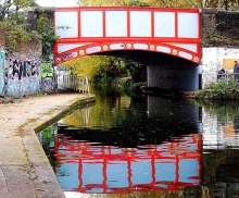
The first bridge we walked beneath is that carrying the Great Western Road over the canal. This is a cast-iron, single-arched bridge with the Union Tavern at its northern end. It looks like a Victorian design. Heading east, after walking beneath the sweeping curve of the Westway, an elevated motorway (the A40), the first bridge we encountered was that which carries the Harrow Road over the canal. This iron bridge with brick abutments is shorter than the previous one because the canal narrows temporarily as it passes beneath it.  A few yards east of this, there is another bridge that crosses the canal to reach an old, derelict building that must have been a factory in the past. The bridge, known as the ‘Pipe Bridge’, has a roof and is completely enclosed with translucent panelling. It looks as if it was built in the last few decades and leads from the factory to a solid brick wall which serves as its abutment on the south bank of the canal.

Four hundred yards east of the Pipe Bridge, after passing the green space around the Church of  St Mary Magdalene, we pass beneath a concrete footbridge with iron railings and decorative lamp posts that links Delamere Terrace and Lords Hill Road with Blomfield Road across the canal. The approach to the bridge from Delamere Terrace is an elegant helical ramp.  This fairly modern crossing is known as the ‘Ha’Penny Bridge’ (i.e. half penny).

The towpath runs south east and alongside Delamere Terrace and reaches the building that houses the Canal and River Trust, the former Toll House. This is next to another bridge, a delicate-looking cast-iron structure with masonry abutments topped with distinctive lamp stands. This carries Westbourne Terrace Road (laid out in the early 1850s) over a constricted section of the canal. East of this the canal enters a vast triangular expanse of water, the junction of three waterways: the Paddington Branch from west London, its continuation towards Paddington Station, and the Regents Canal that leads to Camden Town and further east.

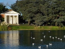
The poet Robert Browning, who lived near to this junction area, or possibly Lord Byron, is credited with christening this district as ‘Little Venice’, the name by which it is known today (https://londoncanals.uk/2010/01/17/the-history-of-the-place-name-known-as-little-venice-and-the-facts-that-are-ignored/). With its willow trees, colourful barges, a wealth of waterfowl, and some floating refreshment outlets, Little Venice is a popular place for tourists both local and from further afield. The small island in the middle of the watery space, inhabited only by birdlife, is called Browning’s Island.

We leave Little Venice by walking south east along the next section of the Paddington Branch canal. Soon, we reach another bridge, an undistinguished structure that carries the Harrow Road over us and another short, constricted section of the canal. The next 450 yards of the towpath on the west side of the canal has been redeveloped recently and is lined with eateries both on the shore and on boats moored  alongside the shore.

After walking beneath a concrete bridge, the Westway Viaduct, carrying the Westway high above us, we soon reach a fascinating footbridge over the canal. The span across the water is approached by both curving staircases and spiral ramps. This suspension bridge is supported by cables fanning out from a tall pole on the eastern side of the canal. It is known as the ‘Harrow Road’ footbridge. Despite an extensive search of the Internet, I have not yet discovered who designed this structure, which is a visual delight in comparison with the next bridge we reach, an inelegant concrete span, which carries Bishops Bridge Road.

Shortly before the direction of the canal turns from south east to due east, we need to cross it over a curious looking modern footbridge that runs beneath what looks like a double wall of glass panels. This, the Station Bridge (Paddington Basin), leads from the east side of Paddington Station to a footpath leading to North Wharf Road. It was completed in 2004 by the Langlands and Bell partnership (www.langlandsandbell.com/work/).

Having crossed this distinctive bridge, we are now on the final stretch of this blind ending branch of the Paddington Arm of the canal. Next, we encounter another suspension footbridge with perforated metal panels along both sides of its footway over the water. This bridge leads to a car park next to a twentieth century block, part of St Mary’s Hospital. This is the Paddington Basin Footbridge designed by Sidell Gibson Architects.

A few yards further east, we cross a short blind-ended inlet by means of a short bridge known as The Rolling Bridge. Designed by the Thomas Heatherwick Studio and completed in 2005, this bridge curls up into a circle to allow boats to enter or leave the inlet. Routinely, this pointlessly complex yet interesting bridge is opened briefly at noon on Wednesdays and Fridays and at 2pm on Saturdays.

On Fridays at noon, or when necessary, the last bridge over the Paddington Arm, a few feet away from its eastern terminus, can be seen in action. At rest, the Fan Bridge (aka Merchant Square Bridge) looks unexceptional. However, when it is raised to allow passage of vessels it is extraordinary. As the bridge rises, it splits into sections resembling five blades of a pen knife when they are all opened, or a lady’s fan.  The bridge is twenty feet long, was designed by Knight Architects, and completed in 2014. We were lucky enough to see this bridge open and then to watch it closing. You can watch this happening on my video at https://youtu.be/UGQERbGo_jU .

Beyond the Fan Bridge, the canal ends abruptly. Trellick Tower, where we began our perambulation was a landmark in modern architecture when it was built. The Fan Bridge, constructed 42 years later, is another exciting development in design. In between the tower block and the unusual bridge, we passed beneath or over several canal crossings representing various points in the history of bridge design, many of them adding beauty to a lovely waterway that provides pleasure for many people.

A lovely surprise in west London

DRIVING ALONG THE NORTH Circular Road, I noticed a long wall over the top of which I could see what looked like the pinnacles of a Gothic revival garden folly. We were driving past Gunnersbury Park in West London and did not have time to stop. So, the next day, we drove back to the park and spent some time exploring it. What we found was a fascinating estate consisting of beautiful park land and a series of architectural delights. This is hardly far from where we live, but it was the first time that we had visited it.  Had I not noticed what I did when on the North Circular Road, I am not sure that we would not have considered making a trip to find out what lies behind the wall next to which queues of slow moving traffic can often be seen.

The first impression one gets on entering Gunnersbury Park with its wealth of trees including many Cedars of Lebanon is that you are inside the grounds of a great house such as you can find at, for example, Ham House and Osterley Park. That impression is justified because Gunnersbury Park is basically what is left of the grounds of a mansion built in the Palladian style for the lawyer and politician Sir John Maynard (1604-1690) between 1658 and 1663. It was designed by the architect John Webb (1611-1672). Maynard died at Gunnersbury Park.

Between 1762 and 1786, Gunnersbury Park was used as a summer residence by Princess Amelia (1711-1786), who was King George III’s aunt (https://historicengland.org.uk/listing/the-list/list-entry/1000808).  In 1761, she had bought the estate from George Furness (after 1688-1756). His father had been a ‘factor’ in the East India Company. George was a British merchant and politician as well as being an art collector. He was a Member of Parliament between 1720 and 1756 and had bought the property in 1739 from John Hobart (1693-1756), 1st Earl of Buckinghamshire, a British politician. Furness improved the grounds by employing the famous gardener William Kent (1685-1748). I am not sure how much of his original design has survived the passage of time.

Princess Amelia, the second daughter of King George II, did much to improve the grounds, by landscaping, arranging planting, and by adding ornamental buildings, which still add to the charm of the place. These buildings include the bath house and a neo-classical temple, which overlooks a circular pond.

The princess held fabulous parties at Gunnersbury. In “Handbook to The Environs of London” by James Thorne, which was published in 1876, the politician and intellectual Horace Walpole (1717-1797), author of the Gothick novel “The Castle of Otranto”, who attended some of these parties, is quoted thus:

“Ever since the late king’s death, I have made Princess Amelia’s parties once or twice a week … I was sent for again to dine at Gunnersbury on Friday, and forced to send to town for a dress-coat and a sword. There were the Prince of Wales, the Prince of Mecklenburg, the Duke of Portland, Lord Clanbrassil … The Princess, Lady Barrymore, and the rest of us, played three pools at Commerce till ten … While we were at the Dairy, the Princess insisted on my making some verses on Gunnersbury. I pleaded being superannuated. She would not excuse me. I promised she should have an Ode on her next birthday, which diverted the Prince; but all would not do.”

The next morning, Walpole composed three verses for the Princess. One of them (quoted in a letter from Walpole to HS Conway dated 18th of June 1786) reads as follows:

“Oh! Why is Flaccus not alive,

Your favourite scene to sing?

To Gunnersbury’s charms could give

His lyre immortal spring.”

Walpole admitted in his letter to Conway that his poem was not one of his best. He wrote:

“If they are but poor verses, consider I am sixty-nine, and was half asleep, and made them ex-tempore – and by command!”

Following the death of the Princess, the Palladian mansion was demolished in 1801. Its contents were sold by auction and the 205 acres of its grounds were divided into lots and sold at the same time. Most of their area was bought by Alexander Copland (1774-1834), who built a new house, which forms the basis for the present building, which now houses a museum, which is currently closed because of the covid19 pandemic. Copland, a builder and business partner of the architect Henry Holland (1745-1806), was a son of Alexander Copland and his wife Barbara (née Smirke). The Alexander, who bought Gunnersbury was a cousin of the architect Robert Smirke (1780-1867), whose brother, also an architect, Sydney Smirke (1797-1877) designed the Orangery, which was built at Gunnersbury Park in 1836, and has been restored beautifully.

Copland built The Large Mansion (now the museum). Either Stephen Cosser or Major Alexander Morrison, a retired East India Company officer who bought the plot from him, built the so-called ‘Small Mansion’ to the east of the Large Mansion, which is currently in a poor state of repair. A gardener explained to us that it was supposed to be cared for by one London borough whereas the Large Mansion was under the care of another. In 1828, the part of the estate with the Small Mansion was bought by Thomas Farmer, who lived there as Copland’s neighbour until 1835.

In 1835, Copland’s Large Mansion was bought by the banker Nathan Mayer Rothschild (1777-1836). After his death a year later, his widow Hannah (née Barent-Cohen; 1783-1850) used Gunnersbury Park as her second home and employed the architect Sidney Smirke to make alterations to it (https://family.rothschildarchive.org/estates/37-gunnersbury).  Following Hannah’s death, her oldest son Lionel Rothschild (1808-1879), the first ever practising Jew to become a Member of Parliament, took over the property and enlarged its park as well as improving the house’s facilities. After his death and that of his widow Charlotte, the estate moved into the possession of their youngest son Leopold de Rothschild (1845-1917).

In 1889, Leopold purchased the Small Mansion and thereby reunited the two parts of the original Gunnersbury estate. Under the ownership of the Rothschild family, many improvements were made to the grounds, some of which I will mention soon. After Leopold died in 1917, the estate was broken up and parts were sold off. In 1925, both mansions and about 185 acres of attached grounds were purchased for public use by the then Boroughs of Acton and Ealing. Now, the park and its mansions are maintained by the boroughs of Ealing and Hounslow.

The Large Mansion is elegant but not as attractive as the one which was demolished long ago and can be seen in old drawings. Nearby, the temple that overlooks a pond is delightful and reminded me of some of the garden architecture at Stourhead (in Wiltshire). Wandering around the garden, you will come across the Gothic revival architectural features I saw when driving past Gunnersbury Park on the North Circular Road. These are built around ‘Princess Amelia’s Bath House’, a garden folly built in the 1780s. Not far from this, there are very picturesque ‘Gothick’ ruins near to the estate’s farm buildings. These might be the remains of the dairy mentioned above in the quote from Horace Walpole or possibly later additions to the grounds constructed by an owner who bought the Princess’s estate. One source (https://brentfordandchiswicklhs.org.uk/publications/the-journal/journal-10-2000/princess-amelias-bath-house/) suggests that what is now called the ‘Bath House’ might have been the dairy in Amelia’s time at Gunnersbury. Whatever its history, lovers of romantic Gothic revival ruins will get great pleasure from what can be seen at Gunnersbury Park.

The Orangery stands next to a large pond. This structure was built whilst the Rothschilds owned the estate. It was constructed in 1836, designed by Sidney Smirke. The family were responsible for another water feature on their estate. It has a name that intrigued us: the Potomac Pond. This almost circular water body is surrounded by a fence and almost hidden by the trees and other vegetation growing around its perimeter. It is only accessible to members of a local angling club. The Rothschilds had purchased a former clay pit and converted it into the pond. One of the claypit’s kilns was rebuilt to create a Gothic revival tower on its shore. This lovely folly, which would look at home in a painting by the German Caspar David Friedrich (1774-1840), might have once been used as a boathouse.

I have described a few of the features that make it well worthwhile to visit Gunnersbury Park, whose history is not exactly simple. The place is so near to London and the M4 motorway, yet it feels so far away. If it were not the background roar of the traffic and the low flying aeroplanes descending towards Heathrow Airport, fewer than usual these days, it would be hard to believe you were not deep in the countryside.

Strolling around the Serpentine

THE RIVER WESTBOURNE may be known by few, but seen by many, living in, or visiting, London. Much of this tributary of the River Thames is hidden from view; it runs underground. The river rises in West Hampstead, passes through Kilburn and beneath Bayswater Road, flows through Kensington Gardens and Hyde Park, then runs into the Thames near the gardens of The Royal Hospital Chelsea, home of the annual Chelsea Flower Show, (close to the Bull Ring Gate bus stop).

Italian Gardens with 3 arched pump house and behind it on the right, the Queen Anne Alcove

What I will refer to as ‘The Serpentine’ is really the combination of the Long Water (in Kensington Gardens) and the contiguous Serpentine (in Hyde Park). It occupies part of the valley of the River Westbourne and is thus the only part of this river that most people can see. The Serpentine was created between 1730 and 1733 for Queen Caroline (1683-1737), wife of King George II. The body of water was formed by linking several existing ponds fed by the River Westbourne and by water pumped from the Thames. Today, some of the water is supplied from borewells in Hyde Park. Prior to the creation of the Serpentine, two of the ponds were separated by a building called ‘Price’s Lodge’. The “Daily Post” dated 20th of April 1733 reported that:

“The old Lodge in Hyde Park, together with part of the grove, is to be taken down in order to compleat the Serpentine River.”

Price’s Lodge, formerly known as ‘the Cheesecake House’ was a place where the nobility riding around Hyde Park could purchase refreshments (https://georgianera.wordpress.com/tag/prices-lodge/). The newspaper quoted above refers to ‘The old Lodge’, which might possibly been a separate building from Price’s Lodge, which might have still been in existence and being used as a boat house in 1801, but it was no longer standing later that century.

We begin our stroll at the end of the Serpentine just across Bayswater Road close to Lancaster Gate Underground Station. It was here that after flowing beneath Bayswater Road that the River Westbourne flowed into the Long Water section of the Serpentine. The so-called Italian Gardens consists of four large basins or reservoirs, each with eight sides. There is a fountain in the centre of each of them and another in the middle of them. The reservoirs are set on a platform adorned with sculptures and a statue of Edward Jenner, of vaccination fame. The platform is about eight feet above the water level of the rest of the Serpentine. At the north end of the platform with the reservoirs and fountains, there is a decorative building with a central single chimney and roofed with Italianate tiles. Facing the fountains, the building has a loggia, a convenient shelter during a rain shower. Behind the loggia there is a large room housing machinery to pump the water that shoots out of the fountains.

Between the Italian Gardens and Bayswater Road, there is a relatively new café, The Italian Gardens Café, which overlooks the fountains. The café is next to a neo-classical structure which contains a concavity lined with wood panelling. Made in 1705, designed by Christopher Wren (of St Pauls Cathedral fame) and bearing the crest of Queen Anne (reigned 1702-1714), this is the Queen Anne Alcove. This decorative building was moved to its present site from near Kensington Palace in 1868.

The four reservoirs, which make the Italian Gardens delightful, were built in 1861 and were intended to act as filter beds for the Serpentine. The loggia-cum-engine house was designed by Robert Richardson Banks (1812-1872) and Charles Barry (1823-1900). The sculptural features, including urns and nymphs, through which water flows from the Gardens into the Serpentine, were designed by John Thomas (1813-1862).

Moving on from the Italian Gardens southwards along the east side of the Long Water, you can, if you are lucky, spot birds such as herons and cormorants standing in the water near the opposite shore.  After a short stretch along which the lake is well hidden from the path by vegetation you reach an open space in the centre of which there is a huge sculpture made of travertine stone, “The Arch”, presented to the park by its creator, Henry Moore (1898-1986), in 1980. Looking through the arch and across the Serpentine you can see the equestrian sculpture “Physical Energy” by the Victorian sculptor GF Watts. The two sculptures are in line with Kensington Palace, of which there is an unobstructed view from the Moore artwork. “The Arch” is irregularly shaped because it is based on the for of an animal bone that the sculptor had in his possession. A path leads away from the Serpentine to the  Serpentine Sackler art gallery, which is often worth visiting. However, we will ignore that and continue to follow the Long Water in a south easterly direction.

Soon, we reach an elegant masonry bridge with five arches spanning the water. This was built in the 1820s to the designs of John Rennie junior (1794-1874), son of John Rennie, who designed the first Waterloo Bridge. The foot path around the Serpentine passes under each end of the bridge through semi-circular stone lined tunnels. The bridge marks the boundary not only between Kensington Gardens and Hyde Park but also between the Long Water and the Serpentine.

Walking along what has become the north shore of the water because of the bend in the Serpentine, you will pass numerous waterfowl of various shapes and sizes, including swans, gulls, ducks, coots, moorhens, geese, and cormorants. Step carefully to avoid their squidgy droppings along the footway. As you approach the modernistic Serpentine Bar and Kitchen (designed as ‘The Dell’ by Patrick Gwynne [1913-2003] and built in 1964) at the eastern end of the lake, you will pass two boat houses and a shed where in normal times, small pedal-operated boats may be hired by visitors. Look away from these boat houses towards the parkland north of the water and you will spot a roughly hewn monumental stone, a granite boulder. This is the Norwegian War Memorial, presented by the Norwegian Navy and Merchant Fleet in 1978. On one side it bears the words:

“You gave us a safe haven in our common struggle for freedom and peace”,

and on another:

“Worked and shaped by forces of nature for thousands of years”, which refers to the stone itself.

The Serpentine Bar and Kitchen is at one end of the Serpentine. Walking around the back of it, you will notice a small monument that marks the spot from which a supply of water to the Abbey of Westminster was granted by King Edward the Confessor (reigned 1042-1066). Further along the path, heading south, we cross a balustraded bridge with arches facing the Serpentine. Water from the lake flows under the path and emerges from beneath it just before it falls over a cascade (made in 1820) into the luxuriantly vegetated ‘Dingley Dell’.  South of the bridge, there is an ornamental urn, the Queen Caroline Memorial, beneath which there is the following inscription:

“To the memory of Queen Caroline wife of George II for whom the Long Water and the Serpentine were created between 1727 . 1731.”

The path around the Serpentine begins heading west along the south shore of the lake. It is flanked by many trees including weeping willows. Eventually, we reach the Lido. The Lido includes a café and an outdoor bathing area, where bold swimmers, who are not averse to pondweed and sharing the water with waterfowl, can swim in the unheated water of the Serpentine. The front of the café is supported by a row of pillars with Doric capitals. A plaque attached to the wall facing the water commemorates the once leader of the Labour Party George Lansbury (1859-1940), who created the bathing area in about 1930. When the situation is normal, when there is no covid19 pandemic, swimmers use the bathing area throughout the year whatever the temperature of the water.

After enjoying a refreshment at the Lido, we move towards Rennie’s mighty bridge, passing first the Diana Memorial Fountain, opened by the Princess’s mother-in-law, Queen Elizabeth II, in 2004. This curiously designed water feature consists of two streams of water that flow down curved slopes and meet each other at the lower end of the fountain closest to the Serpentine. Near this, there is a huge, rather unattractive, sculpture of a bird with a long beak. Titled “Isis”, this artwork was created by Simon Gudgeon in 2009. Its circular base has bands of metal inscribed with the names of supporters of the Look Out Hyde Park appeal.

A short stretch of foot path takes one from Isis to the beautiful bridge across the Serpentine. After emerging from the tunnel under the bridge, we find ourselves back in Kensington Gardens and alongside the Long Water section of the Serpentine, walking in a north-westerly direction. Looking away from the water, you will spot a single storey building with three arches each topped with triangular pediments. Built in 1734-35, this is Queen Caroline’s Temple, which might have been designed by William Kent (1685-1748). Opposite it and across the water you get a fine view of Henry Moore’s sculptural arch.

Further on, the pathway runs alongside the water, affording a good view of the distant Italian Gardens and many waterfowl perched on a series of wooden posts crossing the water. Looking away from the water, you will see a statue of Peter Pan standing above a collection of children and animals. Peter Pan is a character created by the author James Barrie (1860-1937), who lived on Bayswater. The statue was created in 1912 by the artist George Frampton (1860-1928).

A few yards further, and we come alongside the western edge of the Italian Gardens. Looking west, you can see a distant obelisk, a memorial to the explorer John Hanning Speke (1827-1864). Near the north west corner of the Gardens, there is a cute sculpture of two bears embracing each other. This metal artwork is placed upon a disused stone drinking fountain. A plaque attached to it notes that it commemorates the 80th anniversary of The Metropolitan Drinking Fountain & Cattle Trough Association, which was founded in 1859. If you get thirsty reading this plaque, then help is close at hand at the lovely Italian Gardens Café.

Finally, one more brief note about Queen Caroline, for whom the Serpentine was created, and which now provides much joy to many Londoners and others. When she inquired of Sir Robert Walpole (1676-1745) the cost of enclosing the publicly owned St James Park to secure it for her exclusive use, he replied:

“Only three crowns”

By this, Walpole, the Prime Minister, meant the Crowns of England, Scotland, and Ireland because what she was asking was politically impossible.

Burgers and the Parthenon

THE HARD ROCK CAFÉ at 150 Old Park Lane in central London opened its doors to customers in June 1971. It has been a popular eatery and tourist attraction ever since then. Often, a queue of hungry customers can be seen at its doors. I ate an enjoyable meal there once soon after it opened. I was then an undergraduate at University College London. Since then, I have not entered this place again. Some years ago, when the Hard Rock Café opened a branch in what had been the Tract and Bible Society bookstore in St Marks Road in Bangalore (India) in 2007, we had an indifferent meal there under the watchful eyes of a huge poster portrait of the singer Tina Turner.

Few of the customers of the Old Park Lane branch of this American-style diner in Old Park Lane are likely to have raised their heads to see what is above the eatery. It is worth doing so to see the:

“Bracketed cornice over 5th floor, shaped gable end to attic storeys finished off by giant broken segmental pediment with green brick banding and figure sculpture crowned by ornamental obelisk-finial.” (https://historicengland.org.uk/listing/the-list/list-entry/1266274).

This green (and white brick) banding gives the building an eye-catching appearance. There is a crest between the two large bow windows on the fourth (American fifth) floor. This shield with three chevrons and ten circles bears the date ‘1907’.

The building, 149-150 Old Park Lane, was built in 1904 to the designs of the architects Thomas Edward Colcutt (1840-1924) and Stanley Hamp (1877-1968), who worked together as a partnership.  So far, so good, but what was the building used for when it was built and why did it deserve such an elaborate and unusual pediment? Various descriptions of its architecture describe that it consists of ‘flats and chambers’ above ‘a former showroom, now restaurant’. One source (www.foodepedia.co.uk/restaurant-reviews/2010/nov/hard_rock_cafe.htm) states that the Hard Rock is situated inside a former Rolls Royce showroom. This is confirmed by Anthony Knight, who wrote (on a restaurant development website):

“Two shaggy-haired Americans living in London were fed up with the fact they couldn’t find US-style burgers in the capital so they started a small burger joint in a Rolls-Royce dealership. In 1973 they hosted their first live gig, with the singer none other than Paul McCartney” (www.elliottsagency.com/opinion/greateststories/).

The brand name ‘Rolls Royce’ has been used since 1906. The building at 150 Old Park Lane was constructed two years earlier. I have not been able to ascertain when the luxury car company first opened their show room in the current premises of Hard Rock Café.

Looking up at the pediment, there is a sculpture of a kneeling muscular man supporting a sort of obelisk on which there are interlinked letters, which look like ‘D’, ‘J’, and lower-case ‘l’. What this stands for remains a mystery to me. However, the crest mentioned above, is identical to that on the coat-of-arms of the city of Gloucester (www.british-history.ac.uk/vch/glos/vol4/pp368-371). This is appropriate as the building is known as ‘Gloucester House’.

The building housing the Hard Rock Café is not the first edifice on this plot to have been named ‘Gloucester House’. According to the authoritative book edited by Ben Weinreb and Christopher Hibbert, “The London Encyclopaedia”, the first Gloucester House, which like the present burger joint was located on the west corner of Old Park Lane and Piccadilly, was constructed in the early years of the reign of King George III (he was on the throne from 1760 to 1820). It was in this building that Lord Elgin (1766-1841) first exhibited the marble fragments that he had removed from the Parthenon in Athens. They were displayed here, where today burgers and milkshakes are consumed, before he sold the marbles to the nation in 1816. That year, Gloucester House was purchased by William Frederick, Duke of Gloucester (1776-1834), who despite being nicknamed ‘Silly Billy’ became Chancellor of Cambridge University. The last owner of the house was George, 2nd Duke of Cambridge, who died in 1904. Soon after his death, the old house was demolished. It seems that its successor, the present Gloucester House, was built almost as soon as the old one was demolished.

In 1850, when the old Gloucester House was still in existence, Peter Cunningham wrote in his “Handbook of London” (published in 1850):

“At the Duchess of Gloucester’s, at the corner of Park-Lane, once Lord Elgin’s, and where the Elgin Marbles were placed on their first arrival in this country, is a very beautiful carpet in sixty squares, worked by sixty of the principal ladies among the aristocracy.”

At that time, William Frederick’s widow, Princess Mary, Duchess of Gloucester and Edinburgh (1776-1857), who was born in Buckingham Palace, was residing at the house. After her death, the house was sold to its last owner.

It occurred to me that quite accidentally the Hard Rock Café with its main entrance on Piccadilly is aptly named given that it is located where some ‘rocks’ that occasionally give the British Government a hard time, The Elgin Marbles, were once housed.  What gives the precious ancient marbles a sort of hardness is that from time to time the Greek Government wants to have them back in Athens. So, next time you bite into a burger at Hard Rock in Gloucester House, spare a thought for the Greeks who have lost their marbles.

A walk in the West End

The largest gallery in the Wallace Collection

BRAVING THE INCLEMENT weather, we walked from Kensington to the Wallace Collection in London’s West End. After walking along the north side of Hyde Park, we crossed Bayswater Road (actually ‘Hyde Park Place’) and walked along the short Albion Street. The novelist William Makepeace Thackeray (1811-1863), who was born in India (Calcutta) and the author of “Vanity Fair” lived at number 18. His home was close to the still extant Tyburn Convent (located near the famous spot where criminals were hanged). He wrote of the area where he lived (‘Tyburnia’):

“The elegant, the prosperous, the polite Tyburnia, the most respectable district of the habitable globe.” (www.stjohns-hydepark.com/moreaboutus/2016/4/21/history-of-st-johns)

From Albion Street, we turned right to walk east along Connaught Street, named after George III’s nephew and son-in-law Prince William Frederick, Earl of Connaught (d. 1834), and laid out in the King’s reign (1760-1820). Archery Close leads off the street to a cobbled mews. It is so named because it was next to the former cemetery (now a housing estate called ‘St George’s Fields’) of St George’s Church in Hannover Square, which used to be used as a practice ground for archers. A few yards east of the close, we reach Connaught Square.

The square, whose brick-built elegant terraced houses surround a private garden, began to be developed in 1821. Near to the north east corner of the square, number 14 was home to the Italian ballet dancer Marie Taglioni, Comtesse de Voisins (1804 –1884), who was born the daughter of an Italian choreographer, Filippo Taglioni and his Swedish wife the ballerina Sophie Karsten, in Stockholm. In England, Marie taught social dancing to society ladies and children. The former British Prime Minister, Tony Blair, has also owned a house in this pleasant square.

Number 1 Connaught Street, which is on the corner of Edgware Road is now a branch of the Maroush Lebanese Restaurant chain. It is housed in an attractive building whose facades are topped with balustrades. On a map surveyed in the 1930s, which also shows St Georges Fields still as a disused cemetery, marks this building as a bank (Westminster Bank).  After traversing the busy Edgware Road, formerly the Roman Watling Street, the continuation of Connaught Street becomes Upper Berkeley Street, named after Henry William Berkeley (1709-1761), who was part of the Portman family who developed the area.

Number 33 Upper Berkeley Street has a distinctive neo-Byzantine frontage and looks like the entrance to a religious building. It is an entrance to the West London Synagogue whose main entrance is nearby on Seymour Street. This synagogue was established on its present site in 1870. Its congregation is allied to Reform Judaism. Its architects were Messrs Davis and Emmanuel (https://archiseek.com/2013/the-new-west-london-synagogue/). Rabbis, who have served at this synagogue have included a Holocaust survivor, Hugo Gryn, and Julia Neuburger.

Number 20 Upper Berkely Street was home to the first British woman to qualify as a medical practitioner, Elizabeth Garrett Anderson (1836-1917). She lived (and practised briefly) at number 20 from 1860 to 1874. She established her practice around the corner at 69 Seymour Place, which opened as the ‘St Mary’s Dispensary for Women and Children’. Nearby at number 24 (‘Henry’s Townhouse’), we reach the house where the banker and clergyman, Henry Thomas Austen (1771-1850), brother of the novelist Jane Austen, lived between 1800 and 1804 (http://jasna.org/persuasions/printed/number20/caplan.pdf).

After passing Great Cumberland Place and Wallenberg Place (created in the 1780s and badly damaged during WW2), an elegant crescent on the east side of the road, we pass Montagu Street that leads north to Montagu Square where my father’s colleague and co-author, the Hungarian born Peter Bauer (1915-2002), used to live.  Further east, Upper Berkeley reaches the northwest corner of Portman Square.

Opposite this corner is Home House, once the home of the Courtauld Institute (for history of art), now the home of a private club. It was built in 1773-76 for Elizabeth, Countess of Home (c1703-1784), a Jamaican born English slave-owner, and designed mainly by Robert Adam, who also created its beautifully decorated interiors and a fantastic helical staircase. A block of flats called ‘Fifteen’ with art deco front doors is next door to Home House and opposite an entrance to the square’s private gardens. This gate, normally locked, happened to be open. So, we snuck into the garden to take a brief look. As we emerged, and slammed shut the gate, a man emerging from Fifteen, noticed us and told us that it was good that we had closed the gate, because he said:

“It’s good to keep the riff-raff out of our square.”

I replied:

“We are the riff-raff.”

He laughed and we began conversing. He lives in Fifteen, which was built in the 1930s, and told us that its interior is decorated like the original ‘Queen Mary’ liner, in art deco style. He confirmed my memory that the store front that houses Air Algerie  and the National Bank of Kuwait on the east side of the square used to be part of the shop front of the Daniel Neal children’s clothing store, which closed in 1977. My late mother always pointed it out when we drove past it in the 1960s, but I cannot recall ever having entered it.

Continuing east from the square along Fitzhardinge Street, we pass Seymour Mews. A plaque on the corner of these two roads commemorates the site of the birthplace of Captain Thomas Riversdale Cloyes-Fergusson who was awarded a Victoria Cross medal posthumously after dying, aged 21, at the Battle of Paschendaele on the 31st of July 1917 during WW1. His medal is currently on display at Ightham Mote in Kent, the former home of his parents. Incidentally, the well-preserved Tudor Ightham Mote house is a lovely place to visit.

Walking another 200 feet eastwards brings us to our destination Manchester Square. Before describing its main attraction, let us look at number 14, now called ‘Milner House’. This was the home of Alfred Milner (1854-1925), who was an important colonial official in southern Africa. He was Governor of the Cape Colony from 1897 to 1901, a period that included the 2nd Anglo-Boer War. Then, he was successively Administrator of the Transvaal and Orange River Colony (1901-1902), Governor of the Transvaal and Orange River Colony (1902-1905), and then Secretary of State for the Colonies (1919-1921). Milner was in no little way responsible for the outbreak of the conflict between the British and the Boers that began in 1899, one of whose aims was to establish an unbroken British corridor that ran from Cairo to The Cape. Another of its aims was to have the gold mines of the Rand and other parts of the Transvaal under British rule.

One of Milner’s neighbours on the square was Sir Richard Wallace (1818-1890), who, unlike his neighbour Milner, did much good for mankind. He was the illegitimate son of the 4th Marquess of Hertford and educated in Paris, where he also worked. In 1870, when his father died, Richard inherited his collection of European art. Wallace added greatly to the collection, often purchasing fine works of art. During the Siege of Paris (September 1870-January 1871), Wallace, who was living in the city, performed many acts of charity including contributing much money to the needy of Paris and organising two ambulances. In 1872, he paid for the erection of fifty public drinking fountains, which are now known as ‘Wallace Fountains’ and can be found all over Paris. One of these distinctive fountains stands outside the entrance to Hertford House, his London home on Manchester Square where his art collection is now housed in what is called ‘The Wallace Collection’.

From the outside, Hertford House is imposing rather than attractive. It was built between 1776 and 1778 for the 4th Duke of Manchester. In 1797, the 2nd Marquess of Hertford acquired the building and modified it considerably. Richard Wallace and his wife, Julie Amélie Charlotte (daughter of Bernard Castelnau, a French officer), lived there whenever they were in London from 1870 onwards. The Wallace Collection contains over 5500 works of art collected by the first four Marquesses of Hertford and Richard Wallace. These include more than 6 paintings by Rembrandt, and others by great names including Vermeer, Bols, Poussin, Frans Hals, Canaletto, Velasquez, Boucher, Watteau, Fragonard, Lawrence, Hobbema, Cuyp, Maes, and many others equally well-known.  Richard’s widow bequeathed it to the nation in 1897.

I first visited the Wallace Collection with my father when I was less than ten years old. I remember being extremely bored by the huge numbers of Paintings on display but fascinated by the large collection of weapons and armour that occupies several rooms. Now, many years later, I am thrilled by the wealth of paintings that can be enjoyed in the beautifully decorated rooms of the house. The splendour of the interior décor of the rooms contrasts greatly with the exterior of the building that gives no hint of the treasures within.  Along with the collection of artworks at Kenwood House in Highgate, the Wallace Collection is one of the finest (formerly) private art collections open to the public in London.

After seeing the collection and having coffee in Hertford House’s vast covered internal courtyard, we retraced our steps by walking back to Kensington. We felt satisfied that we had had a good walk along streets and through parkland after having enjoyed an enriching artistic experience at the Wallace Collection.

In the shadow of the Hilton Hotel

BBC RADIO ONE began broadcasting on the 30th of September 1967. Before then, if you wanted to listen to popular music on the radio in the UK, you would have to tune your radio to pick up Radio Luxembourg, whose broadcasts from Luxembourg came over the airwaves loud and clear. Some of its presenters, for example Dave Cash, Noel Edmonds, and Kenny Everett, later hosted programmes on the new radio stations that began to broadcast after Radio One and various new commercial stations began transmitting. Unlike the BBC, Radio Luxembourg was commercial and broadcast advertisements relevant to British listeners. Several programmes were sponsored by two football pools companies, Littlewoods and Vernons. The station continued transmitting for UK audiences until December 1992.

I had not thought about Radio Luxembourg much until mid-September 2020 when we were walking along Hertford Street in a part of London’s Mayfair under the shadow of the tall Hilton Hotel on Park Lane. This short street runs east from Park Lane (just next to the Hilton) for about 630 feet and then makes a right angle turn and heads north through Shepherd Market and ends up at Curzon Street, which I have written about elsewhere (https://londonadam.travellerspoint.com/20/). Next to the front door of number 38 Hertford Street, a tall narrow house built in the 18th century (or not much later), a commemorative plaque informs:

“This was the HQ of Radio Luxembourg, Broadcasting from the Grand Duchy 1933-1991”

This building was not only the headquarters of the extra-territorial radio station but also contained recording studios where seemingly ‘live’ programmes could be recorded for broadcasting later from Luxembourg. Listeners were not informed where programmes had been recorded and were left with the impression that everything was being produced in the Grand Duchy.

Number 10 Hertford Street is just across the road from the former Radio Luxembourg HQ. This elegant terraced building, whose front entrance is flanked by two metal lampstands complete with inverted cones for extinguishing flaming torches, was home to two famous people, as recorded by plaques affixed to the house.  One of its former occupants was General John Burgoyne (1722-1792), who lived and died here and Richard Brinsley Sheridan (1751-1816), who lived here from 1795-1802. Prior to these celebrated occupants, the house was occupied by John Montagu, 4th  Earl of Sandwich (1718-1792), who was famous for his musical parties (www.british-history.ac.uk/old-new-london/vol4/pp345-359) and for giving his name to a popular food item.

General Burgoyne was, according to Wikipedia:

“… a British army officer, dramatist and politician who sat in the House of Commons from 1761 to 1792.”

His military achievements during the American War of Independence were dismal. His attempt to disrupt the American forces came to nought and ended with him surrendering his army of over 6000 men in October 1777 at Saratoga. His dramatic works were popular and included “The Maid of the Oaks” (1774) and “The Heiress” (1786). He assisted in the writing and production of “The Camp: A musical Entertainment” (1778), principally written by another occupant of Number 10 Hertford Street, Richard Sheridan. The General also worked on the libretti of several operas. Had he stuck to the stage, and kept away from the battlefield, Burgoyne might have been remembered as a dramatist rather than a failed military man. Politically, he began by supporting the Tories, but later switched to the Whigs. Near the end of his political career, he was involved in Parliament’s attempted impeachment of Warren Hastings at the end of the 18th century. Hastings, the first Governor General of Bengal had been accused of misconduct in Calcutta but was eventually acquitted.

Another occupant of number 10 was also involved in the theatre but to a greater extent than Burgoyne. Richard Sheridan, born in Dublin, was a playwright and poet as well as being the owner of the London Theatre Royal in Drury Lane.  He is best known for his still popular plays “School for Scandal” (1777) and “The Rivals” (1775).What I did not know until I began writing this was that Sheridan had been a Member of Parliament (a Whig supporter). In 1777 during a Parliamentary session, he had demanded the impeachment of Warren Hastings. His speech on the subject made on the 7th of February 1787 lasted five and three-quarters hours. His oration:

“… commanded the most profound attention and admiration of the House. His matchless oration united the most solid argument with the most persuasive eloquence. His sound reasoning giving additional  energy to truth, and his logical perspicuity, and unerring judgment, throwing a light upon, and pervading the obscurity, of the most involved and complicated subject.” (https://quod.lib.umich.edu/e/ecco/004858403.0001.000/1:3?rgn=div1;view=fulltext).

Clearly, Sheridan was eloquent both in life and creatively on the stage.

This home of playwrights was built between 1768 and 1770 by the builder Henry Holland the elder (1745-1806). On arrival at this address in 1769, Burgoyne commissioned his friend, the architect Robert Adam (1728-1792), to design and execute some of the interior decoration (http://collections.soane.org/SCHEME1106).  After the General’s death in 1792, Sheridan purchased it.

Moving on, we enter the short Down Street that leads south from Hertford Street to Piccadilly. Although the street slopes downwards to Piccadilly, I am not sure that this is the reason for its name. “The London Encyclopaedia” (edited by B Weinreb and C Hibbert) noted that it was was laid out in the 1720s by the bricklayer John Downes, who was involved in much building work in Westminster (www.british-history.ac.uk/survey-london/vols29-30/pt1/pp77-83). Maybe, that is the origin of its name.

Two buildings caught my attention on Down Street. Nearer Hertford Street, on the corner of Brick and Down Streets, stands a Victorian gothic church, Christ Church Mayfair. Constructed in 1865, this protestant church was designed by F & H Francis (they were brothers) and enlarged in 1868. After a fire in 1906, it was rebuilt considerably. It was closed when we passed it, but I have read that it contains some art nouveau features.

South of the church on the west side of Down Street, there is a terracotta coloured tiled façade that looks like a typical Underground station, which is what it was between 1907 and 1932, when it was closed. This now disused station was ‘Down Street’ station on the Piccadilly Line. It lies between Hyde Park Corner and Green Park Stations, no more than about 500 yards from each of them. It was closed because it was never busy enough to keep open. Most of the inhabitants around it were and still are wealthy enough not to need or use public transport. During WW2, it was used as a bunker by Winston Churchill and his staff before the Cabinet War Rooms were ready for use.

By retracing our steps, we can return to Shepherds Market for refreshment, be it a drink or something more substantial. After passing the former Radio Luxembourg HQ and entering the section of Hertford Street that runs towards Curzon Street, you will come face to face with a pub (currently closed) called ‘Shepherds Tavern’. This hostelry was first built in 1735 as part of the development of the area by the developer and architect Edward Shepherd (died 1747). Its customers are said to have included the actress Elizabeth Taylor and Antony Armstrong Jones, who was once married to Princess Margaret.  The actress Wendy Richard (1943-2009) lived in the pub from 1948 to 1953, when her parents were its publicans.

As you enjoy a pint of beer or a glass of sherry or maybe a cortado or a ‘latte’ in Shepherds Market, you can marvel at how much history is packed into two short streets overshadowed by the 331 foot high, 28 storey Hilton Hotel on Park Lane, which first opened in 1963. And fully refreshed, you can resume exploring Mayfair sure in the knowledge that you will be treading in the steps of many now famous people who have haunted the area since it was laid out in the early 18th century.

Near the shops: a chapel in Kensington

HIGH STREET KENSINGTON is not amongst my favourite London thoroughfares, but streets leading off it take one to places of considerable interest. One of these, Allen Street, offers a view of a building that outshines many of its close neighbours. But, before we reach this short side street, here are a few words about High Street Ken.

Even before the covid19 pandemic, High Street Kensington has been declining in importance as a centre of retailing activity. The retailing boom that made the street into a rival of, for example Oxford and Regents Streets, began in the mid-1860s. Prior to that:

“…most trading and manufacturing activity around Kensington High Street was on a small and local scale. An exception must be made of the Catholic candle-making business owned successively by the Wheble, Kendall, Tucker and Smith families from about 1765 until 1908. Its founder was James Wheble (1729–1801), scion of a prominent recusant family in Winchester. By 1766 at the latest Wheble was based in Kensington, and within a few years occupied miscellaneous properties on the present Barkers site, both in the High Street and on the west side of Young Street, where a warehouse was rated in his name from 1772 onwards.” (https://www.british-history.ac.uk/survey-london/vol42/pp77-98).

This mention of candle making interested me because my great grandfather Franz Ginsberg (1862-1936) established a factory making candles in King Williams Town in South Africa in the 1880s.

From the late 19th century until a few years ago, High Street Ken was a healthily flourishing retail centre. In its heyday, it boasted of three large department stores, Pontings, Barkers, and Derry & Toms. The impressive buildings that housed the latter two still stand and are fine examples of art deco architecture. They are located close to the Underground station, which has been in service since the late 1860s.

In recent years, the advent of on-line shopping, high rents, and the proximity of the Westfield mall at Shepherds Bush (opened 2008), which has good parking, have all conspired to make High Street Ken less appealing to shoppers. Consequently, at any one time a large proportion of shops remain empty awaiting new tenants. Sadly, what was once (especially in the 1960s and ‘70s) a bustling high street with trendy shops like Biba and the ‘funky’ Kensington Market, has become slightly dreary.

Various short streets lead off the south side of the high street. One of them, Young Street, leads to Kensington Square, which is well worth visiting to explore its exciting range of houses dating back to the 18th century and earlier (see https://londonadam.travellerspoint.com/41/). Another road, Allan Street, west of the station, leads south from the high street. This street was a quiet cul-de-sac until 1852 when it was extended southwards. After that date, many more buildings were erected along it including the extensive Wynnstay Gardens, luxurious mansion flats, which was constructed between 1883 and 1885 on a site previously owned by Thomas Newland Allen (1811-1899), who was born at Chalfont St Giles (https://www.captaincooksociety.com/home/detail/chalfont-st-giles-buckinghamshire). A monument to Captain Cook, the explorer, stands on the estate where Allen was born.

Wynnstay Gardens is not a particularly attractive set of buildings. However, south of it and on the other side of Allen Street, there is a lovely neo-classical building just south of Adam and Eve Mews, which runs along its northern boundary. For many years, I had noticed it from a distance when wandering along High Street Ken, but it was only yesterday that I decided to take a closer look at this church.

Currently called the ‘Kensington United Reformed Church’, it was originally named ‘The Kensington Chapel’. Built in 1854-55 and designed by Andrew Trimen (1810-1868), it replaced the Hornton Street Chapel (north of the High Street), which was built 1794-95 (https://www.british-history.ac.uk/survey-london/vol42/pp386-394#h2-0005). Trimen was a prolific architect and also published a book in 1849, “Church and Chapel Architecture with an account of the Hebrew Church. 1,000 authenticated mouldings”, which was (https://manchestervictorianarchitects.org.uk/architects/andrew-trimen):

“… the first major publication to consider non-conformist architecture.”

The church, clad in ochre coloured Bath stone, and its impressive pillared portico,  is an elegant addition to an otherwise undistinguished street.  Its corner stone recalls that the church replaced the one in Hornton Street and that it was laid by the Reverend John Stoughton on the 26th of June 1854. If you walk along Adam and Eve Mews, you will notice a pair of doors at the east end of the north wall of the church. Above them are the words ‘Lecture Hall’. According to a plan of the original building, this led into a ‘schoolroom’ (built 1856) attached to the east of the church. This was used to accommodate ‘British’ and ‘Sunday’ schools.

John Stoughton officiated first at the Hornton Street Chapel, starting in 1843, and then in the new building in Allen Street until he retired in 1875. His congregation was far from uninteresting as this quote from John Stoughton’s book “Congregationalism in the Court Suburb” (published in 1883) reveals:

“It may be mentioned that Kensington, on many accounts, has long been a favourite place of residence for artists and literary men, and a few of these became some occasional, others regular hearers [i.e. members of the congregation]  … Curious characters at different periods, it may be added would come into the vestry to have a little chat; a gentleman during the Crimean War gravely proposed to the preacher of peace a clever scheme for blowing up Sebastopol; and at another time one of clerical appearance repeated, with extraordinary rapidity, long passages out of the Greek Testament.”

Stoughton was such a popular preacher that by 1871, none of the 1000 sitting places in the chapel would be left unoccupied.

The chapel was damaged by bombing in 1940 and only repaired in 1952-53. Today, the building stands in all its glory and hosts regular religious services for its Congregationalist congregation (it is an autonomous protestant church, which governs its own affairs), but parts of it are now used for non-ecclesiastical purposes. Next time you wander along High Street Ken, make the short detour to see what I consider one of the finer buildings in the area alongside the unusual looking Armenian Church in nearby Iverna Gardens.

A hero of Chile in Richmond-upon-Thames

BETWEEN OUR FRIENDS’ house in Richmond and Richmond Bridge, which crosses the River Thames, is but a short walk, taking not more than five minutes at a leisurely pace. Yet, during this brief walk that I took yesterday, on the day that my mother would have been one hundred years old, I spotted three old things that were new to me.

The first thing I noticed for the first time is a small single-storeyed building on Church Terrace close to the Wakefield Road bus station. What attracted me to it was a stone plaque set within its stuccoed façade that stated:

“The Bethlehem Chapel built in the year 1797.”

It is still in regular use. I picked up an information leaflet from a plastic container next to its locked door, and this provided me with some information about the place, whose façade looks original but has otherwise been substantially updated.  The interior of this non-Conformist place of worship appears to be similar to what it was when it was first built but considerably restored and modernised a bit (see images of the interior on the video: https://youtu.be/kIYuxaMyZsA).

John Chapman, market gardener of Petersham, where currently the fashionable, upmarket Petersham Nursery flourishes, built the chapel for an independent Calvinist congregation. It was opened by William Huntingdon (1745-1813), a widely known self-educated Calvinist preacher, who began life as a ‘coal heaver’ (https://chestofbooks.com/reference/A-Library-Of-Wonders-And-Curiosities/William-Huntingdon.html). Because of this, the chapel, which is the oldest independent Free Church in the West of London, is also known as the ‘Huntingdon Chapel’. By Free Church, the leaflet explains:

“We do not belong to any denomination. We are an Independent Free Church, which means that we are not affiliated to any organised body like the Church of England, Methodists or Baptists etc.”

More can be discovered about the congregation and its beliefs on the chapel’s informative website (http://bethlehem-chapel.org/index.html).

Between the chapel and the bridge, there is an Odeon cinema with a wonderful art deco façade. This was designed by the architects Julian Leathart (1891-1967) and W F Granger and was opened in 1930. It was originally named the ‘Richmond Kinema’, but this was changed to the ‘Premier Cinema’ on the 29th of June 1940:

“… to enable the removal of the Richmond name on the cinema, in case German parachutists landed nearby.” (http://cinematreasures.org/theaters/6260)

In May 1944, the cinema’s name was changed to the ‘Odeon’. Before it was converted to a triple screen cinema in 1972, its huge auditorium was able to accommodate 1553 seated viewers.

Crossing the main road in front of the cinema, we descend Bridge Street towards Richmond Bridge, but before stepping onto the bridge, we turn left and enter Bridge House Gardens. This open space was the site of the now demolished Bridge House, which was the sometime home of a Jewish family:

“Moses Medina (nephew of Solomon Medina and three times treasurer of Bevis Marks) lived at Bridge House from the 1720s to 1734, having lived previously at Moses Hart’s old house. Abraham Levy lived there from 1737-1753. Levy was a wealthy merchant of Houndsditch.” (www.richmondsociety.org.uk/bridge-house-gardens/).

Solomon Medina (c1650-1730) followed the future William III to England and became “…the leading Jew of his day” according to Albert Hyamson in his “History of The Jews in England” (publ. in 1928), a book I found in the second-hand department of Blossom Book House in Bangalore. Medina became the great army bread contractor in the wars that followed his arrival in England. He was knighted for his services, thus becoming the first professing Jew to receive that honour. His reputation was called into question because it was alleged that he had bribed John Churchill (1650-1722), the First Duke of Marlborough (see “Marlborough” by Richard Holmes, publ. 2008). Moses, his nephew, was a rabbi at the Bevis Marks synagogue in London and thrice its treasurer and also involved in his uncle’s bread contracting, supplying this food to Marlborough’s forces in Flanders (https://forumnews.wordpress.com/about/bank-of-england-nominees/).

Bridge House was demolished in 1930 to create the present area of parkland. Well, I did not know about the Medina connection with Richmond when we visited the Bridge House Gardens. What attracted my attention as soon as I set foot in the small park was the bust of a man looking across a flight of steps and out towards the river below it.

The bust depicts a man wearing a heavily decorated military uniform with tasselled epaulettes. It is a representation of General Bernado O Higgins  (Bernado O’Higgins Riquelme), who was born in Chile in 1778 and died in Peru in 1842. Bernado was an illegitimate son of Ambrosio O’ Higgins (c1720-1801), who was born in Sligo (Ireland) then became a Spanish officer. He became Governor of Chile and later Viceroy of Peru. Bernado’s claim to fame is that he was a Chilean independence leader who freed Chile from Spanish rule after the Chilean War of Independence (1812-1826). He is rightfully regarded as a great national hero in the country he helped ‘liberate’.  But, what, you might be wondering, is his connection with Richmond?

O Higgins studied in Richmond from 1795 to 1798 and while doing so, lived in Clarence House, which is at 2 The Vineyard, Richmond. Whilst in Richmond, he studied history, law, the arts, and music (https://www.davidcpearson.co.uk/blog.cfm?blogID=632) and met  Francisco de Miranda, who was active amongst a London based group of Latin Americans, who opposed the Spanish crown and its rule of colonies in South America. The bust was inaugurated in 1998 to celebrate the 200th anniversary of the departure of O’ Higgins from Richmond. Our friends told us that once a year, a delegation of Chileans arrives by boat at Bridge House Park to celebrate joyously in front of the bust of their national hero. As they arrive, another boatload of people arrives to join the celebration: members of the administration of the Borough of Richmond.

No far from the memorial to the great O’ Higgins, there is another remarkable sight close to the river: a tree with a small notice by its roots. To me, it did not look exceptional, but the notice explains that this example of Platanus x hispanica (aka ‘London plane’):

 “… is the Richmond Riverside Plane, the tallest of its kind in the capital, and is a great tree of London.” First discovered in the 17th century, this hybrid of American sycamore and Oriental plane, was planted a great deal in the 18th century. The plane growing near to the bust of O’ Higgins has a record-breaking height. What I cannot discover is the date on which the notice was placed. So, being the sceptic that I am, I wonder if any other plane trees in London have exceeded the height of this one since the notice was installed.

All of what I have described can be seen in less than ten minutes, but as I hope I have demonstrated, a great deal of history is encapsulated in that tiny part of Richmond.

A short stroll in Kensington

BEDFORD GARDENS IN Kensington is a short street connecting Kensington Church Street at its eastern end and Campden Hill Road up the hill at its western end. The facades of many of the buildings along this thoroughfare are at least partly hidden behind foliage that can be very luxuriant in the warmer seasons of the year. We have walked along this street frequently, but it was only recently that we noticed two commemorative blue plaques, which record that someone famous lived in the buildings to which they are affixed.  Also, we looked at one building, which has no commemorative plaque, but does merit at least one.

77 Bedford Gardens

A rich network of leafy wisteria branches covers the façade of number 4 Bedford Gardens on the north side of the road. Partly hidden by this vegetation, there is a circular blue commemorative plaque that informs the viewer that the composer Frank Bridge (1879-1941) lived there. He did so for many years in this house that was built in the late 1830s (www.rbkc.gov.uk/virtualmuseum/general/default.asp). What little I have heard of his compositions has not appealed to me.

Further along the road and on its south side, there is a blue plaque on number 27. It tells us that William Beveridge (1879-1963), “architect of the Welfare State”, lived in this elegant brick house from 1914 to 1921. During this period of his life, this Liberal politician left the Board of Trade in 1919 to become Director of the London School of Economics, a post he held until 1937, a year or so before my father arrived at that institution as a post-graduate student from Cape Town.

Many years ago, if my memory serves me correctly, a friend of mine, who was studying history of art at the Courtauld Institute, spent several weeks as a lodger in the home of the art historian John Pope-Hennessy (1913-1994). I remember visiting my friend there once back in the 1970s. The famous art historian, whom I did not meet, lived for some years in Bedford Gardens (www.kensingtonsociety.org/wp-content/uploads/Annual-Report-1994.pdf) at number 41 ( according to a letter published in the “Times Literary Supplement” of October 29 1976). If there is a commemorative plaque for Pope-Hennessy on Bedford Gardens, I have not yet found it.

One house in Bedford Gardens that deserves a commemorative indication is a tall brick building with large studio windows on several of its five storeys. Built in 1882, it bears the numbers 77 and 79.  A sculpted head, looking like a classical Greek or Roman carving, is mounted centrally in the façade above the first-floor windows. This building was once used as artists’ studios; it might still be used by artists. According to an incomplete list (https://en.wikipedia.org/wiki/Bedford_Gardens,_London) of notable people who resided in Bedford Gardens, number 77 was used by the artists Robert Colquhoun (1914-1962), Robert MacBryde (1913–1966), Jankel Adler (1895–1949), and John Minton (1917-1957). Ronald Searle (1920-2011) also had a studio there but lived in nearby Bayswater and then Notting Hill (http://ronaldsearle.blogspot.com/2012/07/at-home-with-searles.html).

Minton lived at number 77 from 1943 to 1946 along with Colquhoun and his partner MacBryde (https://artuk.org/discover/artists/minton-john-19171957#). Colquhoun served as an ambulance driver in the Royal Army Medical Corps during WW2, but after suffering injuries in 1941, he moved to London where he shared studio space and his life with MacBride. The pair, who met at Glasgow School of Art in the 1930s, where their lifelong romantic relationship began, shared a house with Minton and after 1943 also with Jankel Adler ( http://www.blondesfineart.com/robert-colquhoun-artist). The parties these artists held at 77 Bedford Gardens were well-known in the artistic circles of London in the 1940s.

Kensington became a popular place with artists from all over Britain from the end of the nineteenth century onwards as this quote from a website (https://historicengland.org.uk/listing/the-list/list-entry/1442898) illustrates:

“The late C19 saw a sharp rise in the number of artists’ studios in London, particularly in Camden, Hampstead, St Johns Wood and Kensington and Chelsea … Speculative studio development … started in the late 1860s in Camden, moving to Kensington in the 1870s, with the Avenue, Fulham Road built by Charles Freake (Grade II), and reaching a peak in the 1880s and 90s. By 1914, when the market virtually dried up, there were some 150 properties of this type in London ranging from pairs to groups of as many as thirty. Of these, approximately sixty multiple studios in Kensington and Chelsea contained 293 individual units. Consequently the number of artists recorded in these studios is extraordinarily high, counting many artists of great merit.”

77 Bedford Gardens was one of these developments. Today, few artists apart from the most successful of them could either afford a studio in this street or to live there. The accommodation in this short thoroughfare is now at the higher end of the property market. However, it costs nothing to stroll along this attractive little road, along which quite a few famous people have lived, and it is a pleasant thing to do.

Ulysses and the underground

THE IRISH AUTHOR James Joyce (1882-1941), author of “Ulysses”, “The Dubliners” etc., lived at number 28B Campden Grove in Kensington in 1931. While living in this flat, he worked on his novel “Finnegans Wake” (published in 1939) and married his long-term companion and muse Nora Barnacle (1884-1951). A blue plaque, which I had never noticed before during the 28 years I have lived in the area, on the house records his stay in Kensington. Joyce was not keen on this dwelling. In 1932, he wrote to Harriet Weaver Shaw:

“’I never liked the flat much though I liked the gardens nearby. That grove is inhabited by mummies. Campden Grave, it should be called. London is not made for divided houses. The little sooty dwellings with their backs to the railway line etc etc are genuine; so is Portland Place. But houses like that were never built to be run on the continental system and as flats they are fakes.” (quoted in http://peterchrisp.blogspot.com/2019/05/campden-grave-james-joyce-in-london.html

A few yards further west of Joyce’s temporary home, I spotted something else that I had not seen before and is relevant to what Joyce wrote.

The rear outer wall of number 1 Gordon Place is best viewed from near the end of Campden Grove just before it meets the northern end of Gordon Place. That rear wall is unusually shaped. Its windows are set into a concavely curved brickwork wall rather than the normal flat wall.

Today Gordon Place extends southwards, then briefly joins Pitt Street to run east for a few feet before making a right angle to continue southwards, crossing Holland Street and then ending in a picturesque cul-de-sac lined with luxuriant gardens. This has not always been its course. A map surveyed in 1865 shows Gordon Place as running between Campden Grove and Pitt Street. The section of today’s Gordon Place that runs south from Pitt Street to Holland Street was called ‘Vicarage Street’ and the cul-de-sac running south from Holland Street was then called ‘Orchard Street’. A map complied in 1896 reveals that Gordon Place was by then running along its present course. Vicarage Street had become renamed as part of ‘Gordon Place’.

Aerial views of the curved building, number 1 Gordon Place, show that its curved rear wall forms part of a deep opening that extends below the ground. Maps compiled from 1865 onwards show the presence of this hole and within it short stretches of railway tracks. The hole is a ventilation shaft for the Underground tracks, currently the Circle and District lines, that run just below the surface. Standing on Campden Grove close to the back of number 1 Gordon Place, one can hear trains clearly as they travel below the hole in the ground. How deep is the hole? The corner of Gordon Place and Campden Grove is 86 feet above sea level and High Street Kensington Station is at 43 feet above sea level.  The railway lines do not slope too much between the ventilation shaft and the station. According to Transport for London, between Notting Hill Gate and High Street Kensington, they descend by 12 feet (www.whatdotheyknow.com/request/70389/response/179967/attach/html/2/Station%20depths.xlsx.html). Using the information that we have, we can estimate the depth of the shaft to be at least 43 feet (i.e. 86-43 plus a little more because the rails are several feet below the surface).

The Metropolitan Railway that included the stretch of track between Notting Hill Gate and High Street Kensington stations was laid before 1868, and from the 1865 map, it was already present before the date when the map was surveyed. According to a detailed history of the area (https://www.british-history.ac.uk/survey-london/vol37/pp49-57), houses near the corner of Camden Grove and Gordon Place (and in other locations nearby) had to be rebuilt after the railway was constructed between 1865 and 1868.  The 1865 map shows no house at the site of the present number 1 Gordon Place. This building with its concave curved rear wall appears on a map surveyed in 1896. It would seem that the developer who constructed number 1 did not want to waste any of his valuable plot; he constructed the rear of the building right up to the circular edge of the ventilation shaft.

So, now we have an explanation for the curiously curved wall and for Joyce’s comments about houses with their backs to railway lines. Some friends of ours own a house with an outer wall that forms part of another ventilation hole on the District and Circle lines. They told us that should they need to make repairs to the outside of the wall that overlooks the tracks, they would need to get special permission from the company that runs the Underground and that many precautions would be needed to protect the workmen and the trains running beneath them.

Life is often far from straightforward, but London is endlessly fascinating. James Joyce preferred Paris to London, where most of his books were published. I hope that it was not his experience with trains running close to where he lived in Campden Grove that influenced his preference.

A brief video that I made gives another view of the ventilation shaft described above: https://youtu.be/js87XIWn1gU