Hotel Oslo

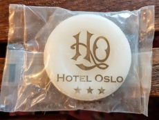
A BAR OF SOAP reminded me of our first visit to Portugal. I am looking at a small, round piece of soap sealed in a transparent package labelled “Hotel Oslo”, which we would never have acquired had I not been a victim of pick pocketers on a tram in Lisbon. We had only been in Portugal for about four hours when we took a ride on a picturesque old-fashioned tram (route 28) in the Portuguese capital. I was on the point of taking a picture of a sign that told passengers to beware of pick pocket thieves when I became one of their victims. Amongst the valuables that were stolen from me was my driving licence.

Losing the licence was a disaster as we were planning to hire a car to visit several country places in Portugal. Without the licence, the car hire company was unwilling and unable to lend me a vehicle, but it was good about refunding the money we had paid. We decided that we would attempt to carry out our plans using public transport.   

The first place on our itinerary was to have been a farmhouse in small rural place, whose name I do not remember, east of Coimbra. We travelled by train from Lisbon to Coimbra, which has two railway stations in the centre of the city. We discovered that there was a railway line from Coimbra to a spot near our planned destination. When I say “near”, it was really about half an hour’s taxi drive from where we were to stay. After lugging our baggage through the rain about 1000 yards from the station, where the Lisbon train arrived, to the other station from which we were about to depart, we ‘phoned the accommodation to which we were heading. They told us that they did not provide food, not even breakfast, and that the nearest restaurant was about half an hour’s drive from them. As we had no car and were planning to spend three days there, we began to worry how we would survive so far away from any supply of food.

Our next train was not due to depart for another two hours. I decided to walk back to the centre of Coimbra to see whether there was a hotel where we could stay instead of heading out into the ‘wild’. I rushed through the rain and found the Hotel Oslo, which had space for us and did not seem unreasonably priced. After reserving a room, I dashed back through the rain to the rest of the family, who were waiting on the platform. These were the days before we had more than one mobile ‘phone in the family, so I had to reach them to tell them about the Oslo instead of phoning them. Using our one ‘phone, we rang the rural accommodation and explained our plight. They were helpful in that they cancelled our booking gracefully and without cost.

Although not a de-luxe hotel, the Hotel Oslo was solidly built and extremely comfortable. It was located close to most of the sights in Coimbra, a place that had not been on our original itinerary. We spent four pleasant days in this delightful university city, and we were fortunate that, by chance, we were in the city at the time when the university students were starting a new academic year. By day and by night, we encountered groups of boisterous, happy students wandering about the city dressed in traditional  capes.

Had my driving licence not been stolen, I know that we would never have stayed in Coimbra and that we would have missed seeing one of the loveliest places that we have so far visited in Portugal.  As people say, every cloud has a silver lining. Although I was deprived of a lot of cash, I gained the pleasure of spending time in a wonderful place and witnessing some age-old traditions that added to our fondness of a country that we have grown to love.

The Hotel Oslo was, when we visited it, an old-fashioned style of hotel even though the 20th century building that housed it did not look archaic. Some years after staying there, we spent a couple of nights in the Hotel Mandovi in Panjim, Goa (India). This hotel had been built in 1952 by the Portuguese while they ruled Goa as a colony. It was built to coincide with the Pope’s visit to the Tenth Exposition of the relics of St Francis Xavier, which are kept in Goa. They are ceremoniously displayed once every ten years, subject to the discretion of the authorities who keep them in the Basilica of Bom Jesus in Old Goa. Although the Mandovi looks much older than the Oslo, they both have high standards of service and comfort that are old-fashioned in the best sense of the term. I am not sure whether we have kept any soap from the Mandovi as a souvenir, but you never know, one day we might find we have one lurking about somewhere in our home.

Hidden in Hyde Park

WE OFTEN CIRCUMNAVIGATE the Serpentine. Usually, when we stroll around this large body of water shared between London’s Hyde Park and Kensington Gardens, we tend to look mainly towards the water with its busy groups of waterfowl, rather than inland away from the water. Today, in the last week of February 2021, we walked around the Serpentine yet again but this time as we rounded its westernmost end and began heading back along the northern shore, we noticed for the first time a clump of trees within which there is a group of buildings.

Sheep trough in Hyde Park

A wide path leads north from the water towards these buildings, first passing the small single storey Serpentine Lodge, which being close to the lakeshore footpath, I had noticed many times before. It was built in 1839 and was home to various officials connected with the park including the Head Park Constable Joseph Smith (1811-late 1880s), who was living there by 1871 and remained there until his death (https://ifthosewallscouldtalk.wordpress.com/2016/05/31/hidden-histories-serpentine-lodge-hyde-park-london/).  The lodge is now a private residence.  

Moving inland past the lodge, we soon reach an elegant brick-built two storey house with a triple bay on each side of the centrally located front door. This is the Ranger’s Lodge, which was built in 1831/2. It houses the park’s administrative offices. Attractive because of its age and lovely setting, it is not distinguished architecturally.  It stands next to a newer and far more elegant building, The Old Police Station. When I saw the chimney stacks which are built with layers of brick alternating with layers of white stone and the windows framed with white masonry, I was immediately reminded of the former police station and courthouse that stands on Rosslyn Hill in Hampstead. Both police stations, the one in the park (built 1900-02) and that in Hampstead (1912), were designed by the same architect, John Dixon Butler (1860-1920), who designed almost 200 police stations. Two police officers on horses told us that in the yard behind the station, there are stables for the horses of the Park Police.  The police station bears a memorial to Jack William Avery (1911-1940), a war reserve Metropolitan Police Constable, who was murdered near the station on the 5th of July 1940. He was stabbed to death by a homeless labourer named Frank Cobbett (https://en.wikipedia.org/wiki/Death_of_Jack_Avery). It was only in 2007 that the memorial plaque was placed in the park.

New Lodge, a large Victorian villa with at least three storeys, built in 1876, now a private residence, stands a few yards north of the police station. This lodge as well as others in the park, like Serpentine Lodge, can be leased from the Royal Parks as dwellings by private individuals and their families.  A footpath leads northwest from between the police station and New Lodge and soon passes a disused water pump enclosed within a square area delineated by iron railings. A few feet north of the pump, there is what looks like a large bath next to a vertical pipe that might have once provided water. The map of the park describes these two items as “old sheep trough and water pump”. The bath-like object was the trough and is marked as such on a detailed map surveyed in 1862-6. This map also marks a small “fire engine house”, which no longer exists.

Another structure that no longer stands is a few yards west of Serpentine Lodge. It is commemorated by a stone lying in the grass. The stone bears an inscription that says that it marks the spot where there once stood the ‘Receiving House of the Royal Humane Society’. It had been erected on land granted by The Crown in 1774 and was severely damaged by a bomb during WW2. Its story and that of other receiving houses is related in an interesting article I found on the Internet (https://ifthosewallscouldtalk.wordpress.com/2016/05/31/hidden-histories-serpentine-lodge-hyde-park-london/):

“In 1774 two London doctors, William Hawes and Thomas Cogan, formed the ‘Society for the Recovery of Persons Apparently Drowned’ which later grew into The Royal Humane Society. The society was founded based on the doctors’ fears that people could be mistakenly taken for dead and thereby accidentally buried alive.

To combat this, a number of Receiving Houses were built along waterways in Westminster in the early nineteenth century. The Receiving Houses were designed as places where people could be taken into if they had gotten into difficulty in the water. A Receiving House was built in 1794 on the edge of the Serpentine…”

Judging by what is marked on a detailed map surveyed in 1914, the receiving house covered a considerably larger area than its neighbour, Serpentine Lodge.

Near to the marker for the former receiving house, there is an ugly black metal drinking fountain, marked on the park map as “Lutyens drinking fountain”. This was one of several similar fountains designed in 1950 by “Messrs Lutyens & Greenwood” (http://mdfcta.co.uk/fountains_lutyens.html). As the architect of New Delhi and Hampstead Garden Suburb, Edwin Lutyens, died in 1944, I imagine that the Lutyens who designed this ugly object might well have been his son Robert Lutyens (1901-1972), who published a book with his co-author Harold Greenwood in 1948.

The ugly drinking fountain no longer works. So, if you are thirsty having searched the hidden items that were new to us as described above, help is at hand a little further west, where there is an attractive modern wood-clad café kiosk, one of several of these designed trecently by the Mizzi Studio’s architects (www.floornature.com/).

Marx and Mozart … in Soho

‘SEEDY’ IS A WORD that often springs to mind when the London district of Soho is mentioned. Yet, I was unaware of this when I used to visit the area with my mother during the early 1960s. In those days, she was working in the sculpture studios of the St Martins School of Art, which were then located in nearby Charing Cross Road. My mother, a disciple of the cookery writer Elizabeth David, who helped introduce the Mediterranean cuisine into British kitchens, did much of her food shopping in Soho’s Old Compton Street and Brewer Street. It was with these shops, rather than with ‘adult entertainment’, that I associated the district called ‘Soho’.

Soho Square, which contains a statue of King Charles II (reigned 1660-1685) that stands in front of a half-timbered structure, was laid out in 1681 during the King’s reign. The area around it had acquired the name ‘Soho’ by 1632. Until the streets in Soho began being developed in the late 17th century, Soho was mostly open fields. Both the gentry and working people began living in the houses built in the area. From the very start of its development, the area attracted refugees from continental Europe:

“The first were Greeks escaping the Ottoman invasion of their homeland in the 1670s. Led by their priest Joseph Georgirenes, they began building a chapel from 1677 in Hog Lane. … It continues to be remembered in the name of Greek Street which ran behind the chapel.

The next group of refugees were Huguenots from France who arrived in the district … By 1711 the population of the parish of St.Anne’s, covering the Soho area, was slightly over eight thousand, of which between a quarter and a half were French. The strong cosmopolitan nature of the area continued well into the 19th century.” (https://www.thehistoryoflondon.co.uk/the-development-of-soho/2/.)

The area continues to be cosmopolitan, as has much of the rest of London now become.

From about 1780 until the 1980s, Soho was the heart of London’s ‘sex industry’. The district’s first brothel opened in 1778 (https://en.wikipedia.org/wiki/Soho_walk-up). From then onwards, the profession of prostitution flourished in Soho. In recent years, the police have been closing some of the places that offered the services of prostitutes. Despite this decrease in the ‘industry’, there is still no shortage of shops selling ‘ adult goods’ related to sexual pursuits in Soho.

Frith Street and Dean Street, two roads that connect Soho Square with Old Compton Street, one of Soho’s main thoroughfares, have had several famous residents. Before you ask, I have no idea whether any of them ever visited any of their neighbours who offered sexual services professionally.

The health care reformer Dr Joseph Rogers (1821-1889) lived and worked at 33 Dean Street from 1851 to 1885. He was living in Soho during the outbreak of cholera in 1854, which led to the ground-breaking epidemiological discoveries of Dr John Snow, who established that cholera was spread through infected water. Rogers helped with the local parish’s response to the disease. When Dr Rogers moved into Dean Street, so also did the better-known, indeed world famous, father of Communism as we know it, Karl Marx (1818-1883), who resided in the street until 1856.

Karl Marx lived above what is now the Quo Vadis restaurant (founded in 1926 by the Italian Peppino Leoni). I am certain that my parents must have eaten there at least once because every year they received a Christmas card from the restaurant. Marx, who arrived in London in 1849, worked on the first volume of his “Das Kapital” whilst living in Soho. His accommodation there was far from comfortable. At first, he:

“… had only two rooms on the second floor of the house – a bedroom at the back used by the whole family and a front room which served as a kitchen and living room – but he later rented a third room for use as a study. The whole ensemble was described by Jenny Marx as ‘the evil frightful rooms which encompassed all our joy and all our pain’.” (www.english-heritage.org.uk/visit/blue-plaques/karl-marx/)

I wonder if members of the Marx family crossed the road to buy goods at the shop with a rococo shopfront (constructed 1791: http://www.british-history.ac.uk/survey-london/vols33-4/pp128-141#h3-0025). Currently, it bears the name ‘Rippon’, and is now a stationer and newsagent.

Carlile Street links Dean Street to Soho Square. The Toucan is a bar that celebrates the association of the drink known as ‘Guinness’ with the toucan. It was the writer Dorothy L Sayers (1893-1957), who when working with SH Benson, an advertising agency, dreamt up the use of the toucan to promote the drink. She composed the following lines in 1946:

“If he can say as you can

‘Guinness is good for you’

How grand to be a Toucan

Just think what Toucan do.” (https://historyhouse.co.uk/articles/guinness_toucan.html)

The half-timbered octagonal hut in the middle of Soho Square looks as if it has been there since the late 17th century. At least, that is what I believed until I began writing this today. Described by the architectural historian Nikolaus Pevsner as “… a silly half-timbered summer house …”, it dates from 1875-76 and was probably built by SJ Thacker.

Frith Street, parallel to Dean Street, leads south from the square to Old Compton Street. One of my favourite writers, the essayist William Hazlitt (1778-1830) died at number 6 Frith Street, now a hotel, which was built in about 1718. Hazlitt moved into two rooms on the second floor at the back of the house early in January1830 (see “The Quarrel of the Age: The Life and Times of William Hazlitt”, by AC Grayling). After a brief incarceration in connection with a debt, he returned to Frith Street, where, by now he was suffering from a stomach disorder that was progressing from bad to worse.  It was here in Soho that he wrote one of his last pieces “Emancipation of the Jews”, which argued that restrictions and civil disabilities should be lifted from the Jews. This piece was published after his death in mid-September 1830. Hazlitt was buried in the nearby churchyard of St Anne’s. In his essay, he wrote:

“The emancipation of the Jews is but a natural step in the progress of civilisation … We and modern Europe derived from them the whole germ of our civilisation, our ideas on the unity of the Deity, on marriage, on morals. . . The great founder of the Christian religion was himself born among that people, and if the Jewish Nation are still to be branded with his death, it might be asked on what principle of justice ought we to punish men for crimes committed by their co-religionist near two thousand years ago?” (www.victorianweb.org/religion/judaism/gossman10.html).

Further south along Frith Street, we reach the stage entrance of the London Casino theatre (opened in 1930, with its main entrance on Old Compton Street). There is a commemorative plaque above the stage door, which reads:

“In a house on this site, in 1764-5 Wolfgang Amadeus Mozart 1756-1791 lived, played, and composed.”

The young Wolfgang stayed here with his father Leopold and his sister Nannerl. They were lodgers of Thomas Williamson, who made corsets. They had moved to Soho from Ebury Street near Victoria.  It is possible that the composer Johann Christian Bach (1735-1782), son of Johann Sebastian Bach, visited the Mozarts whilst they were living in Frith Street. Wolfgang composed several works in London including his First Symphony, which was premiered in London (https://blogs.bl.uk/music/2018/05/mozartinlondon.html). While this was written at bury Street, the Mozarts held concerts, for which the public were charged, at Williamson’s house in Frith Street.

They lived in a time when all entertainment was ‘live’ rather than recorded or transmitted from one location to another. I feel sure that the greatly inventive Wolfgang Amadeus Mozart would have embraced the performance and publicity possibilities of television with great gusto. Back in Dean Street, a few yards from the Mozart’s Soho lodgings, we find the Bar Italia, currently closed. When it is open, it is usually full of mainly Italians watching matches between Italian football teams on a huge TV screen at the back of the café. This seems particularly apt because the Bar Italia is located on the ground floor of the building where John Logie Baird (1888-1946) gave the first public demonstration of his invention, television, in 1926.

As the Bar Italia is currently closed and you will probably be in need of a good coffee after absorbing so much history in such a small part of Soho, head into Old Compton Street and make a beeline for The Algerian Coffee Stores, where you can buy a brilliant inexpensive espresso, macchiato, cortado, cappuccino, or whatever you want.

Coffee al fresco

THE COVID19 PANDEMIC has, for the time being, made drinking inside cafés a thing of the past. If you wish to enjoy a beverage, be it a cappuccino, cortado, americano, a hot chocolate, or even a humble cup of tea, you can buy it at a counter and then enjoy it outdoors, come rain, snow, or shine. In the absence of restaurants and pubs, with the exception of take-away foods, this has become one of the few little treats, apart from the joys of nature, available to those who wish to enjoy a bit of life out in the open air.

Not long ago, whilst exercising in London’s Hampstead district, we came across a particularly lovely place to obtain hot drinks and a selection of snacks, both sweet and savoury. They are being served under a canopy illuminated by strings of ‘fairy lights’ on a terrace overlooking the sloping garden of Burgh House.

Built in 1704 during the reign of Queen Anne, Burgh House was, according to the historian of Hampstead, Thomas Barratt, first owned by a Quaker couple, Henry and Hannah Sewell. Barratt remarked:

“…the house gives the idea of Quaker severity of style combined with a good quality of work.”

The house acquired its present name in 1822, when it was the residence of the Reverend Allatson Burgh (1769-1856), who was for a time vicar of St Lawrence Jewry (http://www.burghhouse.org.uk/about-us/history-of-the-residents-of-burgh-house#revburgh). He was also the author of a book about church music. Prior to the cleric, the house was occupied, between 1776 and 1820, by the upholsterer Israel Lewis (1748-1820) and his wife Sarah, both known for their good deeds. Lewis was a supporter of the non-Conformist Rosslyn Hill Chapel in Hampstead. The family also provided assistance to the poet John Keats (1795-1821) and his brothers. On the 16th of October 1818, the poet wrote to his brother, who was living in the USA, George Keats (1797-1841):

“Mr Lewis has been very kind to Tom all the summer. There has scarce a day passed but he has visited him, and not one day without bringing him or sending some fruit of the nicest kind.”  (“The Letters of John Keats: Volume 1, 1814-1818”)

Burgh House is close to the former chalybeate wells of Hampstead, which were famed for their alleged curative properties. Before the Lewis’s lived there, it was the home of the chief physician of the Wells and a promoter of the benefits of its water, Dr William Gibbons (1649-1728) and his wife Elizabeth. They lived in the house between 1720 and 1743, Elizabeth continuing to live there as a widow.

After Burgh’s death in 1856, the house named after him became the officers’ mess and headquarters of the Royal East Middlesex Militia between 1858 and 1881. The house was then privately owned by several other people, the last of whom were Captain George Louis St Clair Bambridge (1892-1943) and his wife Elsie (1896-1976). Mrs Bambridge’s father was the writer Rudyard Kipling, who was born in Bombay (India). The Bambridges lived at Burgh House between 1933 and 1937. During that time, the ageing Rudyard was a regular visitor.

After the Bambridges left Burgh House for Wimpole Hall in Cambridgeshire, the venerable building faced dilapidation until it was taken over by Hampstead Borough Council in 1946. It was then used for social functions such as wedding receptions.

After a long campaign and much fund-raising, the house was opened to the public as a museum in 2006. In addition to displaying items of historical interest, concerts, talks, and other cultural events are also held there. The concerts are held in a music room that the Reverend Burgh added on to the building when he occupied it.  All these life-enhancing activities have come to a halt during the covid19 pandemic. The pleasant and attractive outdoor café is helping to keep the community spirit alive until rates of infection decrease sufficiently to allow at least some return of the cultural activities that we used to enjoy.

The Burgh House café is open from Wednesday to Sunday. Should you visit Hampstead when the café at this place is closed, there are another three Hampstead places, from which we enjoy collecting hot beverages:

Ginger and White in Perrins Court

The Coffee Cup in Hampstead High Street

Matchbox Café in South End Green

There are also a couple of telephone kiosks that have been converted to tiny cafés both in Hampstead High Street and Pond Square, but we have never sampled their wares.  

Now you see it, now you don’t and Samuel Johnson

THE GROUNDS OF KENWOOD House in north London are delightful at any time of the year. Here you can enjoy the marvels of a fine country house in magnificently landscaped grounds, rivalling rural spots like, for example, Stourhead, Blenhheim, and Compton Verney, without leaving the metropolis. Amongst Kenwood’s many horticultural attractions are the superb flowering bushes such as camellias, azaleas, and rhododendrons.

Kenwood House

Kenwood was within about half an hour’s brisk walk from my family home in Hampstead Garden Suburb and even nearer Highgate School, which I attended between 1965 and 1970. In amongst the flowering bushes, I remember that there used to be an open-fronted, small round hut with a conical roof.  Inside it, there were benches that served as seats. This edifice was labelled ‘Dr Johnson’s Summerhouse’. The Dr Johnson to which this referred was one of Britain’s greatest literary figures, the writer and lexicographer Samuel Johnson (1709-1784). When I used to see this hut during visits to Kenwood in the late 1960s and the 1970s, I used to try to imagine the great Johnson sitting, resting and enjoying the view of the lawns and trees, some of which we can still see today. But, in those days, I was unaware that he never did enjoy these views from this spot.

It turns out that Dr Johnson used his summerhouse not in Kenwood but far away at Streatham Place in what used to be countryside south of London during Johnson’s lifetime. Shaun Traynor wrote:

“Streatham Place, the grand country house of the brewer Henry Thrale and his wife Hester, became for a time in the mid to late 18th century a setting for some very distinguished literary and artistic company. To this house, then sitting amid extensive grounds in the countryside south of London, came leading figures of the day: Edmund Burke, David Garrick, Sir Joshua Reynolds (who was to paint the Thrales), Oliver Goldsmith and – most significantly – Dr Johnson.” (https://www.johnsonsocietyoflondon.org/resources/Documents/Dr%20J’s%20Summerhouse%20-%20Shaun%20Traynor/Sam%20J%20summerhouse%20Shaun%20Traynor.pdf).

He added that the grounds of Thrale’s home contained a secluded summerhouse in which Johnson used to read and write. When Henry Thrale (born between 1724 and 1730) died in 1781, his widow Hester remarried, and the Streatham Place with its summerhouse were sold. Thrale’s daughter Susannah, who had been fond of Johnson, moved the hut to her home in Knockholt, Kent in 1826.  According to Traynor:

“She erected it on rising ground in the very centre of the grove making all paths lead to it, and making the grove a kind of shrine to Dr Johnson’s memory.”

The years passed, and the summerhouse fell into disrepair. In 1962, a local man, who had great feelings for its historical significance, bought it and then presented it to London County Council (‘LCC’) so that it could be displayed to the public. After restoring it, it was placed in Kenwood at the spot where I recall seeing it, in 1968 (http://www.thrale.com/samuel_johnsons_summer_house). Although it is not inconceivable that Johnson might have visited Kenwood, it is not at all likely that he passed much if any of his spare time in a summerhouse in that garden.

In about 2017, after not having visited Kenwood for two or more decades, I paid it a visit. One of the first things I looked for was Dr Johnson’s summerhouse. I knew exactly where to look, but it was no longer there. After peering in amongst the large clumps of bushes in the spot where I remember that it used to stand, I found an octagonal concrete base. I wondered whether the summerhouse had once stood there. On enquiring at the information desk within Kenwood House, I learnt that the base was all that remained of what I had remembered seeing. I was told that the summerhouse had been destroyed by fire. This fire occurred sometime after 1984, probably 1991 (www.moruslondinium.org/research/dr-johnsons-streatham-park-mulberries). I was saddened to learn of this.

However, all is not lost. Alan Byrne, an artist who used to love sitting in the original Johnsonian summerhouse in Kenwood, has created an accurate replica of the refuge that the great writer used to enjoy. Using detailed plans of the original and other records, he produced an accurate reconstruction during the years 1997 to 1999 (https://www.johnsonsocietyoflondon.org/Dr-Johnson-summerhouse-photos-and-narrative). It stands in his garden in Islington.

Even without Dr Johnson’s summerhouse, Kenwood is well-worth visiting. The gardens alone are splendid, but when it is open, Kenwood House is a ‘must-see’. It contains some fine rooms decorated by Dr Johnson’s contemporary, the architect Robert Adam (1728-1792) as well as a collection of fine-art paintings that is, after the National Gallery, one of the best in London. When you feel that you have seen enough of Kenwood, then treat yourself to a stroll through its grounds and the contiguous Hampstead Heath to historic Hampstead, a place which offers a great range of eateries and pubs. And, incidentally, Samuel Johnson was no stranger to the place as the historian Thomas Barratt revealed:

“‘Mrs. Johnson for the sake of the country air,’ writes Boswell, ‘had lodgings at Hampstead, to which Johnson occasionally resorted. ‘For his own part, Johnson would doubtless have preferred Fleet Street; but he was fond of his wife, and felt in duty bound to minister to her pleasures as far as his limited means admitted.”

I can sympathise with Mrs Samuel Johnson. I much prefer Hampstead to Fleet Street, even if the former has less countrified air than it did in the 18th century.

A London square lacking a soul and New Delhi

THE HIGHEST PLACE in north London’s Hampstead Garden Suburb (‘HGS’) is Central Square. Designed to be a focal point for people living in the Suburb, this often-windswept square is a dismal failure. Apart from the occasional communal fetes held on this large open space, this area is somewhere that people walk cross usually without stopping to linger. I was brought up in a house not far from the Square and rarely during the 30 or more years I lived in the area could this heart of the Suburb be described as a lively meeting place. Visits since leaving the area over 30 years ago, have never revealed much, if anything, going on in what might have been a wonderful heart for the local community.

Free Church, Central Square

HGS was created by Dame Henrietta Barnett (1851-1936), who was married to a cleric, Canon Samuel Augustus Barnett (1844-1913). The Barnetts lived close to the Spaniards Inn near Hampstead. The architect Raymond Unwin (1863-1940) was important in conceiving the layout and design for the Suburb. Another architect involved with the creation of HGS, especially the environs of Central Square was Edwin Lutyens (1869-1944).  Building commenced in about 1904/5. The plan for Central Square was finalised in 1911 after several changes in its design. These changes have been summarised as follows (https://londongardenstrust.org/conservation/inventory/site-record/?ID=BAR011):

“Raymond Unwin’s first design for the suburb (February 1905) had communal buildings including a church, chapel, hall, library and shops; the site of the square was to be levelled and extended to the north. Unwin and Edwin Lutyens, appointed architect in May 1906, proposed a more formal plan in 1906-7; this and a third scheme by Lutyens did not meet with Mrs Barnett’s approval. The final plan of 1911 of Central Square as built is a variant on Lutyens’ plan for a rectangle broken up into four clearly articulated spaces each defined by a double row of trees and a lily pond.” 

It was a shame that the shops and library never materialised. Had they been included in the final plan, the Square would have had a chance of becoming a vibrant communal centre and maybe the Suburb would not have developed into the staid and rather precious district that it has become. The architectural historian Nikolaus Pevsner, who lived close to HGS in Hampstead’s North End, did not differ from my assessment of the Square:

“The omission of shops from Central Square has proved a disadvantage; the square has never become a real social centre. Not only shops, but also cinemas, pubs, and cafés have been refused admission. Institute education and divine worship have not proved to be as much of a lively attraction as the social reformers hoped for.” (“Buildings of England. London 4: North” by Bridget Cherry and Nikolaus Pevsner, published 1998)

As for the lily pond, if that ever existed, it had disappeared by the time I was a young child in the 1950s.

Apart from the four lawns separated by footpaths, the Square has the following notable features: a church on its south side; a church on its north side; tennis courts on its eastern edge and near them, a monument to the memory of Dame Henrietta Barnett; and on its east side a large building called ‘The Institute’, which houses Henrietta Barnett School. Central Square is flanked by two equally sterile rectangular open spaces: North and South Squares.

Lutyens was responsible for the design of many of the structures standing around Central Square: St Jude Church with its tall spire, constructed 1909-1911; the Free Church with its dome, begun 1911, but only competed in the 1960s; the Henrietta Barnett Memorial, completed about 1938; and the Institute’s design has some input from Lutyens. And that is not all. Lutyens also designed some of the houses in North Square and in Erskine Hill that leads north from it. Friends of mine lived in a pair of semi-detached houses designed by Lutyens on Erskine Hill. Externally, they were not unattractive buildings, but inside I was not impressed; the ground floor rooms were small and not well fed with daylight. Taken in isolation, one might forgive Lutyens for this defect in his design, but since first seeing my friends’ homes, I have discovered that Lutyens was prone to creating designs that were less than ideal.

When visiting Runnymede, where Magna Carta was signed in the 13th century, we saw a couple of lodges that had been designed by Lutyens. A friend pointed out that he had omitted guttering in their design, which is a strange thing to miss out in a country where rain is not infrequent. The result is that over the years water running off the lodges’ roofs have damaged the brickwork of their external walls. The latest “National Trust Magazine” (Spring 2021) highlights a design failure at Castle Drogo near Dartmoor in Devon, designed by Lutyens and constructed between 1911 and 1930 for the founder of Home and Colonial Stores, Julius Drewe (1856-1931). Designed to look like a mediaeval fortress, the place was equipped with the latest of 20th century features including electricity generated by a ‘hydro-turbine’. Despite all of its up-to-date furnishings, it is prone to old-fashioned water leaks. This was largely due to Lutyens’ choice of asphalt, a relatively new material as far as roofing was concerned. In addition, the article in the magazine reveals:

“The windows were designed without windowsills …this leaves little protection from the Dartmoor elements…”

In 1897, Lutyens married Lady Emily Bulwer-Lytton (1874–1964), who was daughter of Edward Robert Lytton Bulwer-Lytton, 1st Earl of Lytton (1831-1891), Viceroy of India between 1876 and 1880. In 1911, the capital of British India shifted from Calcutta to Delhi. And with this move, Lutyens was chosen to head an architectural team to design a new administrative complex in Delhi. His views on the kind of architecture that he considered suitable were disdainful of Indian architecture:

“Lutyens regarded Indian architectural interventions as mere ‘spurts by various mushroom dynasties with as much intellect as there is in any art nouveau’. Indian buildings, according to him, reflected a childish ignorance of even the basic principle of architecture. He also firmly believed that in countries outside of Europe ‘without a great architectural tradition of their own, it was even more essential to adhere strictly to the canons of the architectural style’.” (https://thewire.in/history/friendship-faltered-raisina-hill).

This patronising and denigrating view of traditional Indian architecture that includes treasures like the Taj Mahal and the great stepwells in Gujarat and elsewhere, along with his dogged adherence to certain aspects of European classical architecture, are a poor reflection of Lutyens’ own aesthetic sensibilities and help to explain why I do not rate him amongst the best of 20th century architects. However, many might disagree with my judgement: chacun à son gout, as they say across The English Channel.

Although Lutyens’ creations in New Delhi are much admired, one part of his design showed lack of planning. This is evident in the Viceroy’s House, which he designed. It stands in a complex of buildings on Raisina Hill. Lutyens had wanted the House to stand prominently, like St Judes in HGS, so that it could be seen from all around. Unfortunately, Lutyens:

“…had seen the perspective plan of the buildings earlier but had failed to take adequate notice of the gradient. When he discovered it finally, it was perhaps too late. Lutyens wrote to his wife Emily: ‘I am having difficulty with Baker. You remember the perspective showing the secretariats with Government House. Well, he has designed his levels so that you will never see Government House at all from the Great Place. You will [only] see the top of the dome.’” (https://thewire.in/history/friendship-faltered-raisina-hill)

Well, in my humble opinion, a top-rate architect should never have made such an error and even worse blamed it on his colleague, the eminent architect Herbert Baker (1862-1946). To some outcry in India, there are plans to replace some of Lutyens’ creations in Delhi (www.thehindu.com/news/national/what-is-the-project-to-redevelop-lutyens-delhi-all-about/article29865323.ece)

I have never visited Delhi, New or Old, but I hope that what Lutyens created there is more joyous than the sombre atmosphere that reigns in and around the soulless Central Square in the Hampstead Garden Suburb.

A local working-class heroine

COLVILLE SQUARE GARDEN in North Kensington is seventy-two yards east of a section of Portobello Road, where stalls with various foods do business most days of the week. The square was laid out in the1870s by the local developer George Frederick John Tippett (1828 – 1899). By the 1950s, the area around Colville had a large proportion of the local ‘black’ community, numbering about 7,000 (https://citylivinglocallife.files.wordpress.com/2017/04/colville-community-history-newsletter-issue-18.pdf), living there.  Conditions in the locality became particularly bad not least because of the activities (www.rbkc.gov.uk/vmpeople/infamous/peterrachman.asp) of the notoriously unscrupulous local Polish-born landlord Peter Rachman (1919-1962). Unfortunately, in addition t0 Rachman’s poor behaviour with his mostly impecunious tenants, the area became seedy and crime ridden. Since those days, things have looked up and the area has become a far more pleasant place to live and visit.

Colville Square Gardens is a typical London square surrounded by residential buildings. Long and thin. it runs parallel to Portobello Road between Colville Terrace and Talbot Road. Much of the garden is used for recreational activity and includes a play area for young children. At the south-eastern corner of the square, there is a decorative iron gate leading to a nursery and pre-school. The gates bear the words:

“In memory of Pat McDonald”, and her dates:

“1940 – 1986”

A small, rather indistinct plaque next to the gate records:

“Pat McDonald. Working-class heroine. Lived and worked in North Kensington from the 1960s until her death in 1986. She was the driving force behind the campaigns for better housing, more play-space, and new nurseries. May her fighting spirit live on.”

There is no mention of who placed this memorial.

Pat’s endeavours to improve the care of children under the age of five began in about 1967 when she:

“… and a mothers group ‘commandeered’ a local vicar and started a playgroup in the vestry of a local church … The booklet to commemorate Pat McDonald’s life tells through reminiscences how this became Powis Playgroup in All Saints Church Hall, which gained a grant for equipment from the Pre-school Playgroups Association.” (www.academia.edu/28663809/Activism_and_organisation_Creating_a_community_nursery_in_1970s_Notting_Hill).

And this is almost all that I have managed to discover about North Kensington’s local heroine. It seems that the poor lady’s life ended tragically. Two websites allude to her tragic, premature end. From one of them (www.theundergroundmap.com/article.html?id=34069), we learn:

“The Colville Nursery Pat McDonald gates are dedicated to the People’s Association community activist play worker, who was murdered by her husband.”

The association was most likely the ‘Notting Hill People’s Association’, which was set up in 1966 to:

“… to widen access topeople with grievances and problems and to resolve them with legal advice – to resolve the individual problems but also to campaign on more general issues.” (www.unionhistory.info/britainatwork/emuweb/objects/common/webmedia.php%3Firn%3D1618+&cd=8&hl=en&ct=clnk&gl=uk).

Once again, whilst walking along a street which I have used hundreds of times, I came across something I had never noticed before. This time it was the quite conspicuous gate in memory of a social reformer and the far less conspicuous memorial plaque close to it. I pride myself on being reasonably observant, but clearly, I have not been nearly as aware of my surroundings as I believed.

Where judges might have walked

A SHORT STEEP STAIRCASE leads upwards from Hampstead’s Branch Hill to a tree-lined avenue called Judges Walk. This overlooks a steep northwest facing declivity or valley that falls away sharply from Whitestone Pond. This was once the head of a tributary of the River Brent, whose mouth is at the River Thames at Brentford. Today, apart from much mud, there is little obvious evidence of the tributary. Judges Walk has not always had that name. It has also been known as Prospect Walk on account of the views that may be obtained from it, which must have been better in the past than now because the vegetation lining the path might have been less dense.

In days gone by, Judges Walk was a popular place for promenading. The historian of Hampstead, Thomas Barratt (1841-1914), writing in 1912 noted:

“Judges’ Walk is naturally much resorted to for the beauty of its view and its splendid grove of limes and elms.”

Until 1745, when Church Row became a street lined with better-class houses and the parish church was being rebuilt, it became a more fashionable place to promenade than Judges Walk.

How did Judges Walk get its name? William Howitt, author of “The Northern Heights of London” (published in 1869) wrote:

“This avenue derives its name from the tradition that during the great plague of London the judges removed from Westminster, and held their courts in this very airy spot.”

This derivation has been questioned both by GE Mitton in “Hampstead and Marylebone” (published in 1902), who commented that:

“… derivations of this sort are very easy to make up and entirely unreliable”,

 and by Barratt, who wrote:

“If, as tradition asserts, the judges held their courts here in the time of the Plague, that is good enough ground for the title; but as no actual proof of this has hitherto been brought forward it is at least open to doubt.”

However, he did not totally discount a connection of the path’s name with the judiciary. He suggested that:

“…since so many judges have lived in this charming locality and been accustomed to take their walks up and down its famous avenue, it is only natural and in the fitness of things that it should be called Judges’ Walk.”

A more recent historian of Hampstead, Christopher Wade (1920-2015), noted in his book “The Streets of Hampstead” (published 1984) that Judges Walk acquired its present name in the early 20th century, having previously had a variety of names including ‘Prospect walk’, ‘King’s Bench Avenue’, and ‘Upper Terrace Avenue’.  Like others before him, he was doubtful about the Great Plague theory. He seemed to favour an idea that the pathway was named after the nearby Branch Hill Lodge (at the bottom of the staircase mentioned above), which was once known as ‘Judges’ Bench House’. A house, long-since demolished, on the site of the present Branch Hill Lodge, the former home of the founder of the store chain John Lewis, was redesigned in 1745 by the architect Henry Flitcroft (1697-1769) for the Master of the Rolls Sir Thomas Clarke (1703-1764). It was later occupied by at least other two senior members of the English justice system, Sir Thomas Parker (1695-1784) and then Alexander Wedderburn the Earl of Rosslyn (1733-1805) before he moved into his estate next to the present Rosslyn Hill.

Apart from the view from Judges Walk, which has been painted by the famous John Constable (1776-1837), who lived in Hampstead’s Well Walk, there is a building covered with wood cladding that can be seen be looking away from the declivity.  Entered from Windmill Hill, this house, whose foundations were laid in the late 18th century (https://historicengland.org.uk/listing/the-list/list-entry/1379199), is currently named ‘Capo di Monte’, having previously been known as ‘Upper Terrace Cottage’ and ‘Siddons Cottage’. The actress Sarah Siddons (1755-1831) stayed there between 1804 and 1805. Barratt noted that the house:

“…was occupied by Woodburn the printseller ; also, in succession, by Copley Fielding the artist, and Edward Magrath, the first secretary of the Athenaeum Club.”

Years later it was home to the art historian Kenneth Clark (1903-1983) and even later of the broadcaster Marghanita Laski (1915-1988).  No doubt some of these residents of Capo di Monte strolled along Judges Walk to take the air and enjoy the view.

This vista, which we found to be somewhat obscured by the trees and bushes lining Judges Walk, even during winter when foliage is sparse, was described in a novel, “Interplay” (published 1908), written by the suffragette Beatrice Harraden (1864-1936), who was born in Hampstead:

“She sat in Judges’ Walk, and surveyed from there the stretches of wood and copse with their varying shades of green, relieved by delicate tones of red and enhanced in beauty by the sombreness of many trees which, even as ball-room belles, preferred to make a later and more consequential entrance into the scenes of splendour.”

The eastern end of Judges Walk is close to the reservoir on the top of which perches the small Hampstead observatory. Just east of this, and running along the west side of Heath Street, there is a small garden called Whitestone Garden.  I am do not know when this leafy spot, which contains a few benches and did not exist when I was a child in the 1960s, was created, but it is a welcome addition to Hampstead Heath.

In my retirement, I visit Hampstead frequently, and there is never a visit during which I fail to find something new (to me) of interest.  Judges Walk, along which I had never ventured until this year, is one of those many ‘discoveries’ that increase my fascination with this former village that has become surrounded by the relentless spreading of London.  

The gate that has disappeared

NOTTING HILL GATE is a stretch of roadway, 670 yards long, that runs west from Bayswater Road to Holland Park Avenue. It is part of what was once a Roman Road that ran from London to places west and southwest of the city, passing through what is now Staines. The ‘gate’ in the street name refers to a tollgate that stood along it until about 1860. The gates of this barrier were placed so that there was no way of bypassing them via the few side roads that existed prior to the development of the area during the 19th century. I have no idea of how much was charged at this turnpike, but one might get a rough idea from a list of charges levied in early 18th century Wiltshire:

“1s. for a coach or wagon, 6d. for a cart, 1d. for a ridden or led horse, 10d. a score for cattle, and 5d. a score for sheep.” (www.british-history.ac.uk/vch/wilts/vol4/pp254-271).

I became curious to learn where the Notting Hill gate was located. I found the answer in a book that I bought whilst browsing the shelves of a local charity shop.

According to Florence Gladstone and Ashley Barker, authors of “Notting Hill in bygone days” (published in 1924), a detailed history of the area, the tollgate known as ‘Notting Hill Gate’:

“… was the first of three successive turnpikes at this spot and crossed the road east of the site of the Metropolitan Station. It seems possible that the toll-keeper’s house occupied the corner where that station is set back from the road. The very interesting view of this gate by Paul Sandby, R.A., dated 1793 … faces west and apparently shows the end of Portobello Lane and the Coach and Horses Inn.”

This gives a clear description of where the turnpike (tollgate) was located, but today, the appearance of the area described has changed considerably.

To begin with, Portobello Lane no longer exists, at least not with that name. It most likely followed the course of the present Portobello Road and connected with Notting Hill Gate along the southern stretch of what is now Pembridge Road. On a map surveyed in 1863-65, Portobello Road is marked in its present position but the northern stretch of it that led through what were then open fields to Portobello Farm was then still called ‘Portobello Lane’.

Today, the Underground station, formerly the ‘Metropolitan Station, is not visible on the road as it can only be accessed by staircases leading down from the pavements to a subterranean ticket hall. The platforms of the Circle and District Lines are housed in what was part of the original station, which is set back from the road. These platforms were opened in 1868 and were accessed through a building set back from the road as can be seen on an extremely detailed (1:1056) map surveyed in 1895.

During the 18th century, The Coach and Horses Inn stood at number 108 Notting Hill Gate, a few feet west of Pembridge Road (formerly ‘Portobello Lane’), where today a recently opened branch of Marks and Spencer is doing good business.

The tollgate disappeared long ago, and so did much of Notting Hill Gate that would have been recognisable to the two authors of the book mentioned above. The most prominent survivor of pre-WW2 days is the Coronet, currently the home of the Print Room theatre organisation. Near it but clothed in a dull, modern (1960s) exterior is The Gate Cinema, whose well-conserved auditorium was constructed in 1911 within a building that had been a restaurant since 1861 (https://historicengland.org.uk/listing/the-list/list-entry/1385016). Most of the rest of the architecture lining Notting Hill Gate is mostly 20th century and/or aesthetically unpleasing.  

I am not sure that what preceded the buildings that we see today was necessarily much better aesthetically, but we can get an idea from a short stretch of buildings, currently numbered 26 to 70, opposite the northern end of Church Street. These are mostly shops, whose ground floors stretch away from the road to join buildings with two or three storeys set back from the road. Judging by the architecture of the buildings above and behind these shops, they were probably already built by the end of the 19th century. A drawing created in 1912 by William Cleverley Alexander (1840-1916), who resided near Notting Hill Gate, shows some of these buildings looking remarkably like how they appear today. However, since he created his picture, the row of buildings has been changed by the construction of two banks, each with a neo-classical façade.

While I would not recommend visiting Notting Hill Gate for its own sake, it is the gateway to far more attractive sights such as Portobello Road, Kensington Gardens, Holland Park, and Notting Hill of movie fame. And if you are thirsty, there are at least nine cafés within a paper cup’s throw away from the Underground station, and the number continues to increase.

A new arrival above the theatre

I HAVE NEVER SMOKED. Therefore, when smoking was banned in cinemas, I was not upset by this ruling. The Coronet cinema in Notting Hill Gate was one of the last cinemas in London to enforce the ban. Smokers sat upstairs in the circle and non-smokers sat downstairs in the stalls. Despite the smoking, it was a delight seeing films at the Coronet because the cinema was housed in what was once a theatre that first opened in 1898. The original interior décor, though in need of some restoration had been preserved.

The theatre was designed by the theatre architect William George Robert Sprague (1863 – 1933), who also designed the Novello and Aldwych theatres in London. Audiences at the Coronet were able to see famous actors such as Ellen Terry and Sarah Bernhardt on its stage. From 1923, the Coronet became used as a cinema, the screen being positioned in the theatre’s proscenium arch. In 2004, the Coronet was bought by Kensington Temple, who used it for prayer meetings. When not being used for religious purposes, films were screened there for public audiences as before.

In 2014, a fringe theatre group, The Print Room, which left its original premises in nearby Hereford Road, acquired the Coronet and began using it as a theatre once more. A new stage was constructed. It covers the area of the theatre where the stalls seats used to be. The audience sits in the steeply raked seats of the former circle seating area. Where the stalls used to be, has been converted to a quirkily decorated bar area. Because the bar is just beneath the stage, the bar is closed during performances to prevent noise from it being heard in the auditorium during a show. All of this has been done without changing what has been left of the place’s old internal décor.

The Coronet occupies a corner plot. Its exterior has neo-classical decorative features with pilasters, pediments etc. There is a dome high above the main entrance, which is located at the corner of Notting Hill Gate and Hillgate Street. For as long as I can remember (about 30 years), the lead-covered dome was unadorned.

The covid19 pandemic began closing London in about March 2020. The Print Room, like all other theatres in the country, closed. As it is close to shops that we use, we passed it regularly. During the summer, the theatre was covered with scaffolding whilst builders redecorated its exterior. By the end of summer, the scaffolding was removed.

Several weeks later, I could not believe my eyes. A statue had been placed on the top of the dome. The figure on the dome appears to be bound by ropes or cables and his or her face is covered by the sort of mask one might wear if one was a beekeeper. The figure is holding what looks like a large open book or an artist’s palette in its left hand, whilst pointing a pen or artist’s paintbrush into the distance with the right hand. Close examination of the sculpture reveals that at present the ropes are holding down a protective covering. I look forward to seeing what is being concealed.

I was curious about the sudden appearance of a statue on the dome. It turns out that when the Coronet was built, the dome did bear a statue (www.arthurlloyd.co.uk/CoronetTheatreNottingHillGate.htm). When it was taken down, I cannot discover, but it was more than 30 years ago. Planning to replace it began in September 2018 (www.rbkc.gov.uk/idoxWAM/doc/Revision%20Content-2133806.pdf?extension=.pdf&id=2133806&location=VOLUME2&contentType=application/pdf&pageCount=1). The planning document submitted by the Studio Indigo architectural practice reveals:

“Historical images and photos of the Coronet show that there was at some point a statue on top of the dome roof. The statue appeared to be of a life size human figure, the details of which were difficult to precise.

The proposals include for a life size bronze sculpture of the artist Gavin Turk as the famous English portrait artist [posing as] Sir Joshua Reynolds. The statue is based on the Alfred Drury sculpture which stands in the Anneberg Courtyard of Burlington House in the grounds of the Royal Academy, and is a design by contemporary artist Gavin Turk. The new statue celebrates the notional idea of a theatrical/cultural building which had a figure calling the people into the venue.”

Looking at old pictures of the Coronet, it seems that the new sculpture will not resemble the original. If the sculpture that now perches on the dome is by Gavin Turk, a leading British sculptor, it will be in good company. Not far away, there is an abstract sculpture by Antony Gormley on the roof of Holland Park school.  

Noticing that a statue had arrived on the dome of the Coronet hit me dramatically. I was very pleased to see it as it will enhance a theatre which is already remarkable for the high quality of its productions. Furthermore, it is heartening that the only remaining elegant edifice on Notting Hill Gate’s main thoroughfare, mostly ruined architecturally in the 1960s and 1970s, is being well-maintained and tastefully improved.