The watermelon line and other boundaries

Sometime in the mid-1970s, I travelled from London to Platamon in northern Greece by road with my PhD supervisor,  Robert, and his wife. We drove a Land Rover and towed a caravan. The trip took eight days, during which there was plenty of time to discuss a wide variety of topics.
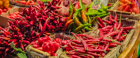
One of the subjects that Robert brought up was a series of imaginary boundaries that divide Europe in different ways. For example, there must be a watermelon line that separates parts of the continent where watermelons are grown from the parts of Europe where they are not. Similarly, there must be an olive line, north of which olives are not grown and harvested.

I read somewhere that a French author – I have never discovered which one – proposed that there must be a line south of which Brussel sprouts are not routinely consumed.

Another line proposed by Robert is one that separates the areas where church towers are topped with bulbous onion-shaped, as for example in southern Germany, from other place where church towers are not topped with these domes.


One could proposed many other examples, but you should now be seeing what I am getting at.


Another line that interested Robert a great deal was that which bounds the northern limit of an an commonly seen in hot desert conditions, Cataglyphis bicolor. Robert became an expert on this insect’s ecology and foraging behaviour.  The place he studied it was on the sandy flats near the sea at Platamon.


Drawing these notional lines might be becoming more difficult because climate change is affecting the geography of crop growing significantly.  With summer temperatures in southern Europe rivalling those in the Gulf States,  I would not be surprised if Mediterranean crops such as olives will soon be grown in northern territories such as the south of England. Robert would have been surprised if he had lived to experience the changed climate we are now experiencing.
Kutch from kingdom to district

MY WIFE’S COUSIN lives in a part of the Indian state of Gujarat called Kutch (‘Kachchh’). He and his wife have a lovely farmhouse near the port city of Mandvi, where you can watch huge wooden dhows being constructed along the riverbank. Although Kutch is now a part of the state of Gujarat, it has not always been. The people of Kutch (‘Kutchis’) speak a language quite distinct from Gujarati. The Kutchi language has closer similarity to Sindhi than to any other Indian language (Kutch is bordered to its north by Sindhi speaking people*). It is a spoken language, but not written. Even though Kutchi people can speak and write in Gujarati, they will proudly inform you that they are Kutchis and definitely not Gujaratis. During our several visits to Kutch, my wife’s cousin’s driver, who can speak good Gujarati, insists on speaking to my wife in Kutchi, which she cannot speak as well as Gujarati.

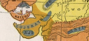
Many people with whom I have discussed my travels, look puzzled when I say that we have been to Kutch. Just in case you are wondering, it is the furthest west part of India. Most of the north of the region is bordered by Pakistan, from which it is separated by the arid Rann of Kutch. To the south and separated from it by the Gulf of Kutch (a part of the Arabian Sea) is the peninsula of Saurashtra – now also a part of Gujarat.

Until 1947, Kutch was a kingdom founded by unifying three separate kingdoms, ruled by branches of the Jadeja family, in the 16th century. In 1819, having suffered a military defeat (at The Battle of Bhuj in March 1819), the Kingdom of Kutch accepted the sovereignty of the British East India Company. Under the watchful eyes of the British, members of the Jadeja family continued to rule Kutch – it became one of India’s many ‘Princely States’. On the 16th of August 1947, one day after India became independent, Kutch voluntarily acceded to the new Indian state.

Kutch became a state of India. In November 1956, as a result of the State Reorganisation Act (1956), Kutch ceased to be a state in its own right, but became a part of the then huge Bombay State. The latter was effectively a bilingual region, most people were either speakers of Marathi or of Gujarati. The Marathis and the Gujaratis began to clash. In 1956, the Mahagujarat Movement began campaigning for a state for Gujaratis, which was separated from that for Marathis. The movement was spearheaded by Indulal Yagnik (1892-1972). His nephew, who lives in Bangalore is a family friend, whom we meet whenever we are in the city. As the Gujaratis clamoured for their own state, so did the Marathis, Blood was shed, and much property was damaged. On the 1st of May 1960, the old Bombay state was divided along linguistic grounds. The states of Maharashtra and Gujarat were formed. The latter includes the Gujarati speaking district of Saurashtra as well as the northern part of the former Bombay State, and also Kutch. And that is how it remains today.

Since 2017, we have made several enjoyable visits to Kutch, from which my wife’s maternal ancestors hail, and enjoyed many fascinating experiences there. Some of these can be found in my new book – a collection of true stories about life in India seen through my eyes. The book (also Kindle) is available from Amazon websites including https://www.amazon.co.uk/HITLER-LOCK-OTHER-TALES-INDIA/dp/B0CFM5JNX5/

*When Lord Napier conquered Sindh *which neighbours Kutch) in 1843, he is reputed to have sent a single word message to London in Latin “Peccavi”, which means ‘I have sinned’.